Severe Thunderstorm Potential in the Central Plains and Front Range
Special Stories
5 Jul 2019 8:13 AM
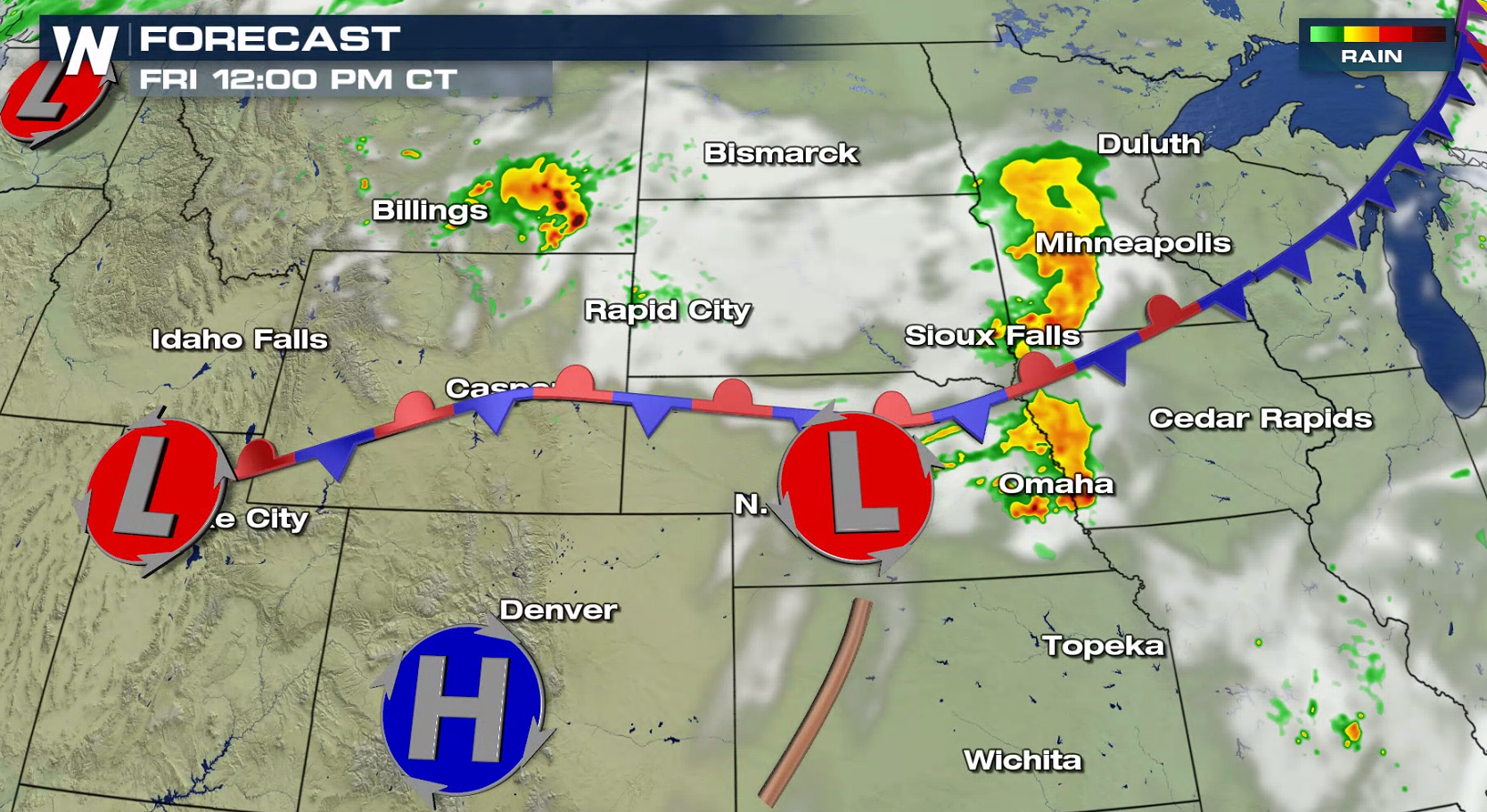
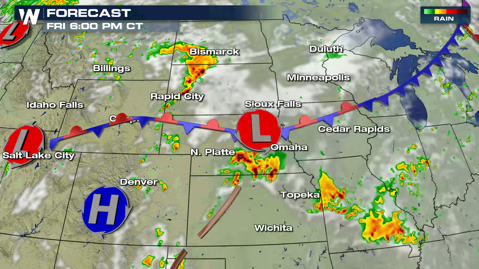
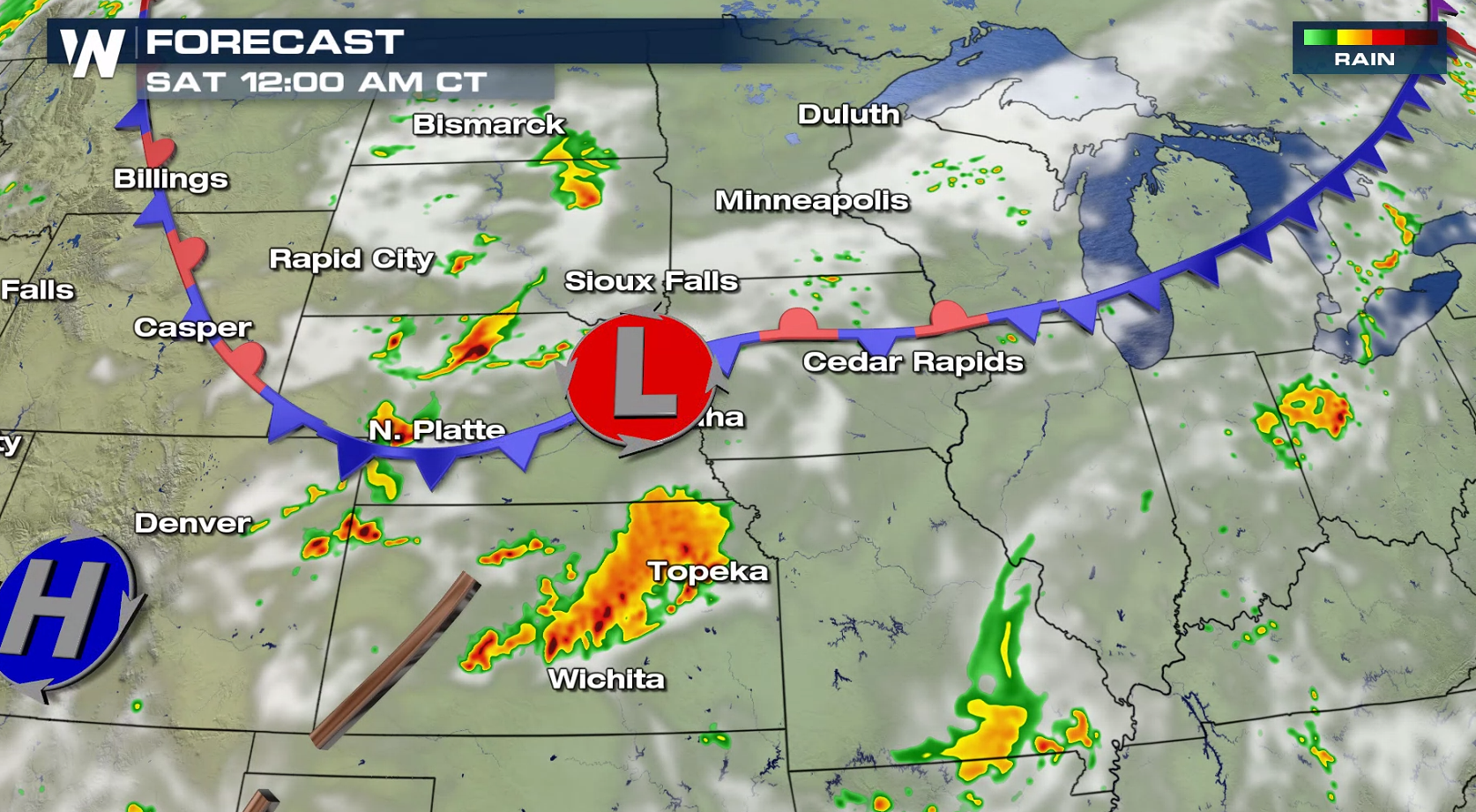
A slow moving storm system will bring the threat for severe thunderstorms in the Plains and Front Range today (Friday). A slight risk for severe weather includes parts of South Dakota, Nebraska, Kansas, Colorado and Wyoming. Damaging wind gusts and hail are the biggest concerns, with isolated tornadoes possible in the Front Range and Black Hills.
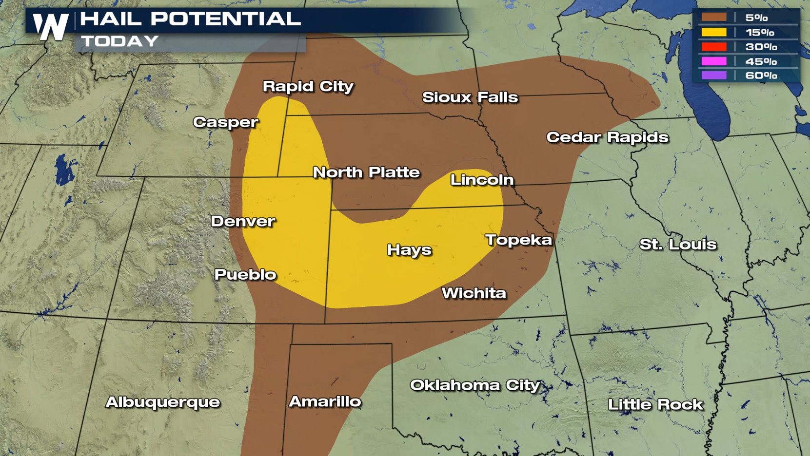
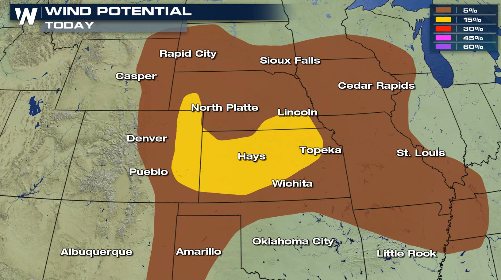
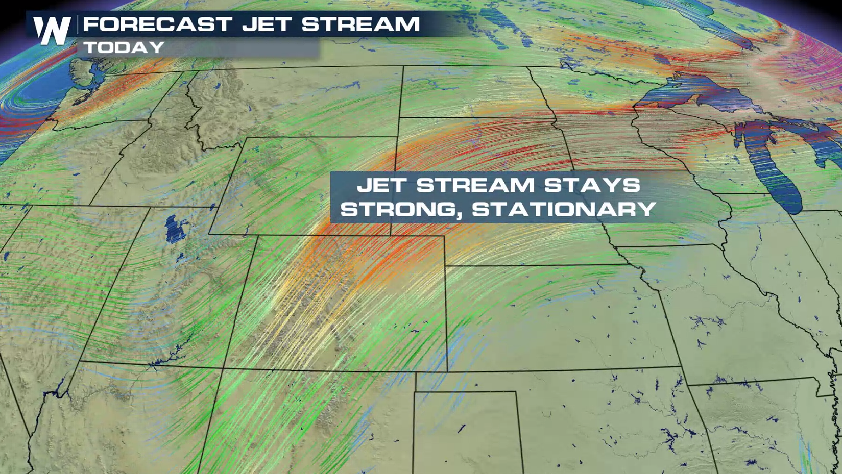
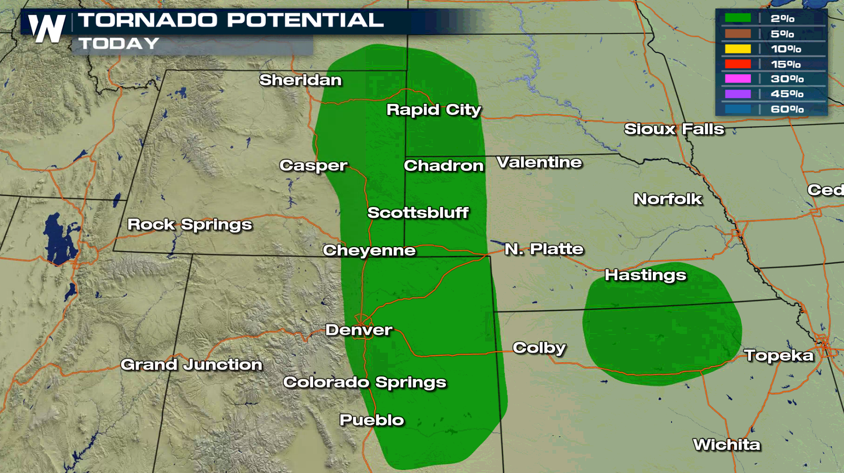 Humidity will continue to increase over the region with a well established feed of moisture from the Gulf of Mexico. As temperatures climb throughout the day, instability will be building. Robust Jet Stream energy will flow into the region, aiding thunderstorm development.
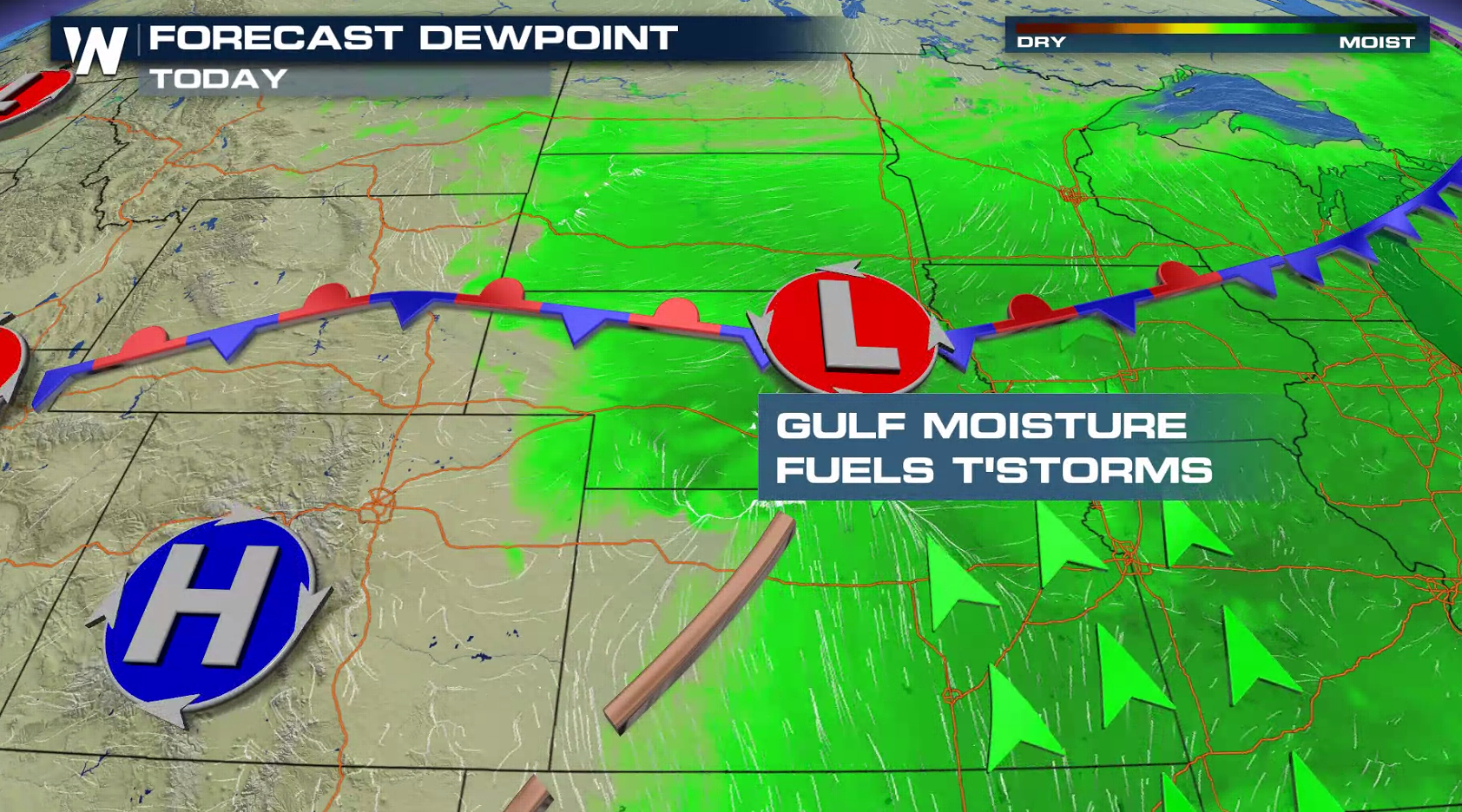
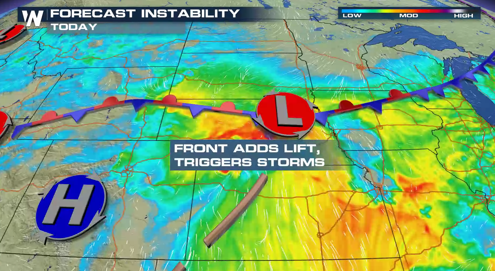
 A stationary front will be the primary focus for thunderstorms throughout the day. Clusters of storms will be ongoing from the morning, rolling along the front into the afternoon. Another wave of storms will develop into the evening in the Front Range and Central Plains.
 As always, WeatherNation will have updates on-air and online. Check back with us throughout the day for the latest severe weather updates.
For WeatherNation: Meteorologist Mace Michaels


 Humidity will continue to increase over the region with a well established feed of moisture from the Gulf of Mexico. As temperatures climb throughout the day, instability will be building. Robust Jet Stream energy will flow into the region, aiding thunderstorm development.


 A stationary front will be the primary focus for thunderstorms throughout the day. Clusters of storms will be ongoing from the morning, rolling along the front into the afternoon. Another wave of storms will develop into the evening in the Front Range and Central Plains.


 As always, WeatherNation will have updates on-air and online. Check back with us throughout the day for the latest severe weather updates.
For WeatherNation: Meteorologist Mace Michaels
As always, WeatherNation will have updates on-air and online. Check back with us throughout the day for the latest severe weather updates.
For WeatherNation: Meteorologist Mace MichaelsAll Weather News
More