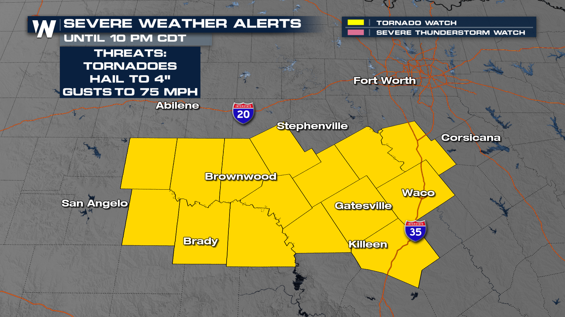
Texas and Gulf Coast Severe Weather Tonight

The severe weather threat continues into tonight, including the entire DFW metro (ABOVE) all the way to the Gulf Coast. We have multiple watches in effect, including a Tornado Watch until 10pm in Central Texas. In addition to the tornado threat there could be very large hail up to 4" in diameter, as well as 75mph wind gusts. Storms continue through the South on Tuesday and Wednesday, for more on that forecast, click here.
Texas Risk
All modes of severe weather are possible, including tornadoes through the Dallas-Fort Worth metroplex. We also have nearly the same area highlighted with the significant hail threat, meaning hailstones 2" in diameter or larger are possible. Park your car under cover! The reason these two areas overlap is because the same updrafts that support large hail will also have the potential to rotate and produce tornadoes.
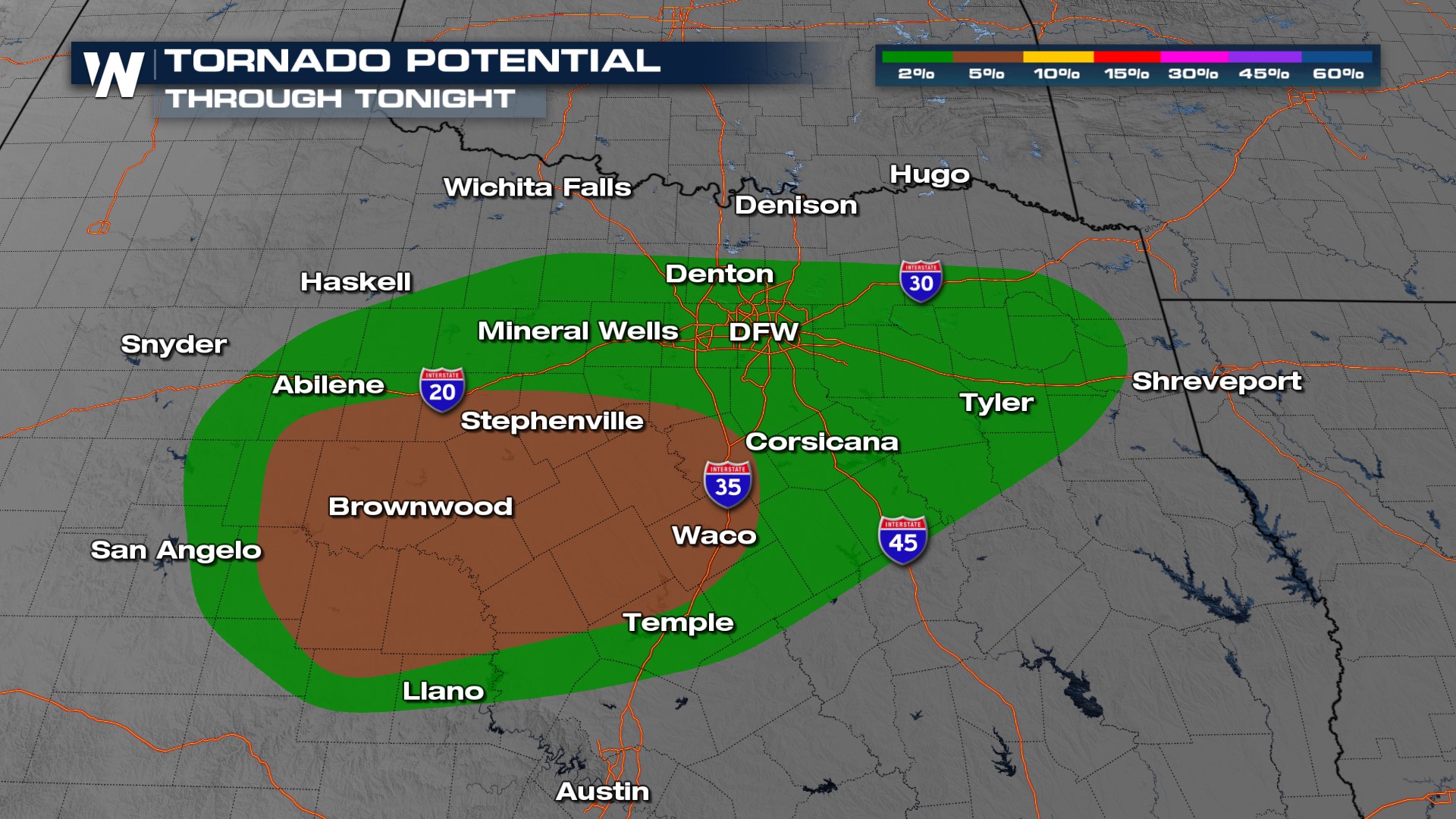 Ongoing storms near the Red River Valley will drop to the south and east tonight but development of cells around the Dallas area may not initiate until much later this evening. These will be the ones to watch for the risk of large hail and tornadoes. Storms continue overnight, pushing into the Deep South for Tuesday.
Gulf Coast
The severe weather threat captures much of the I-10 corridor in the Deep South overnight with wind and hail as the primary threats.
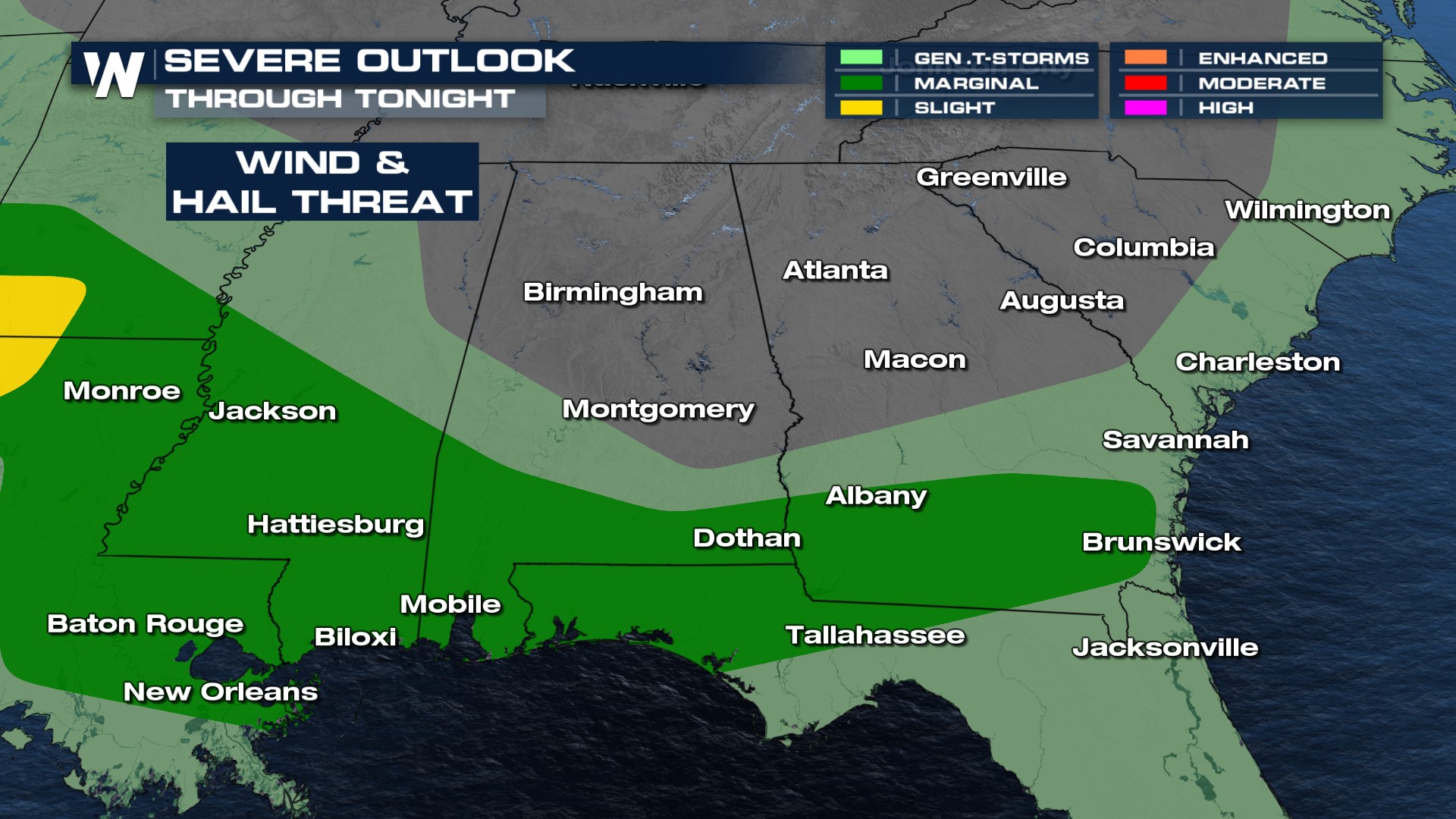
In addition to the severe weather threat, torrential downpours and frequent lightning are likely with any storm. The storms that impact the region overnight and into Tuesday morning will be the moisture that arrives from Texas storm activity.
Stay with WeatherNation for the latest in the severe weather forecast.


