Severe Storms Target Northern and High Plains Monday

Special Stories
8 Jun 2020 8:00 AM
The first weekend of June has been a stormy one across the Northern and High Plains and severe thunderstorms will again be possible in portions of the region today (Monday). Large hail and damaging winds will present the biggest threat to life and property, but isolated tornadoes will be possible as well.
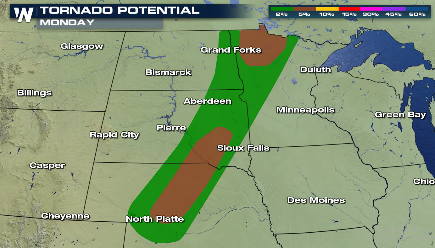
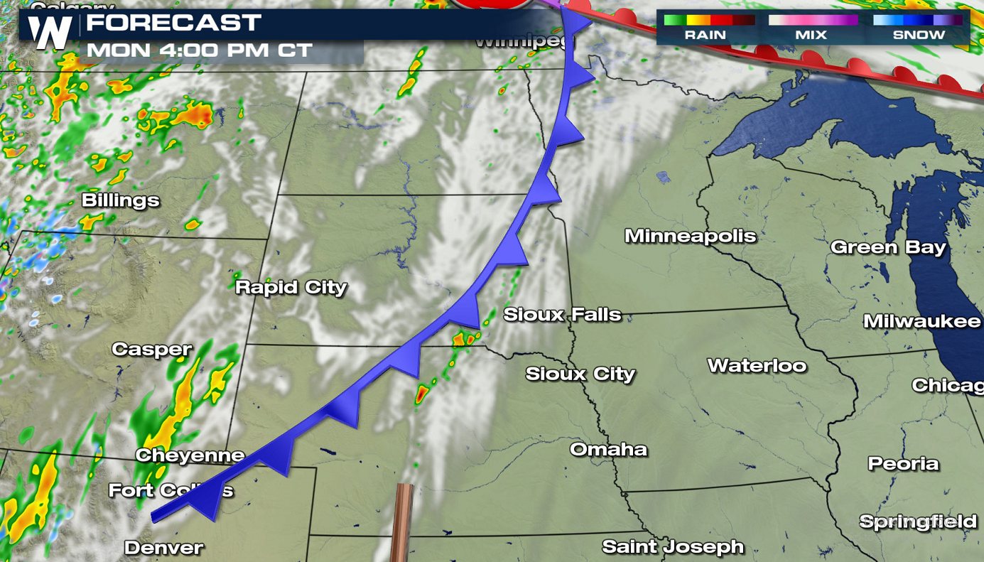
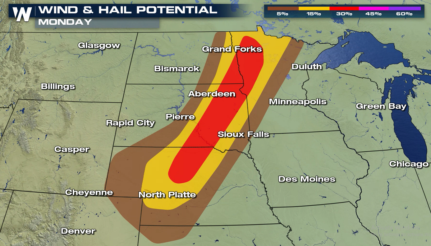 A vigorous trough will push into the western United States, creating this unsettled weather pattern. Ahead of the trough and surface cold front, temperatures are expected to be in the 80s and 90s---quite hot---across the Great Plains. Moisture transported from the Gulf of Mexico thanks to southerly winds will make it noticeably humid as well. The temperature, humidity, winds, and fronts will all come together and create an energetic environment for thunderstorm development.
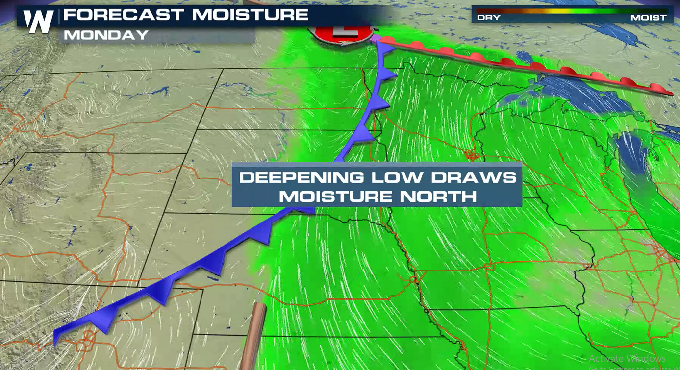
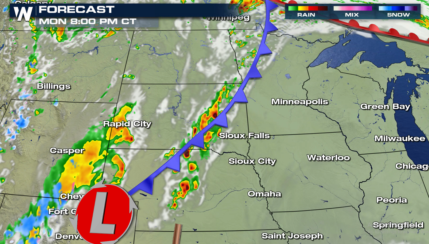
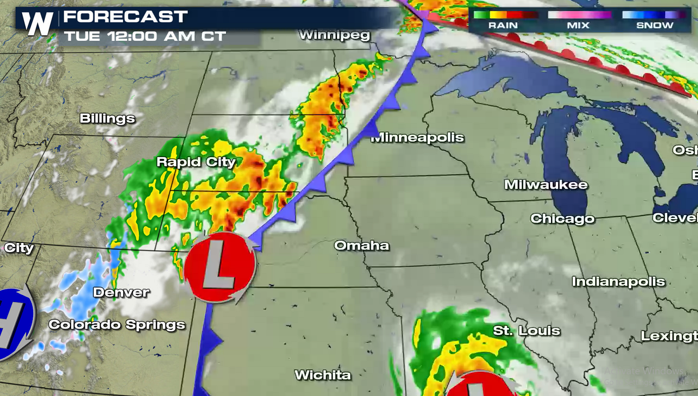
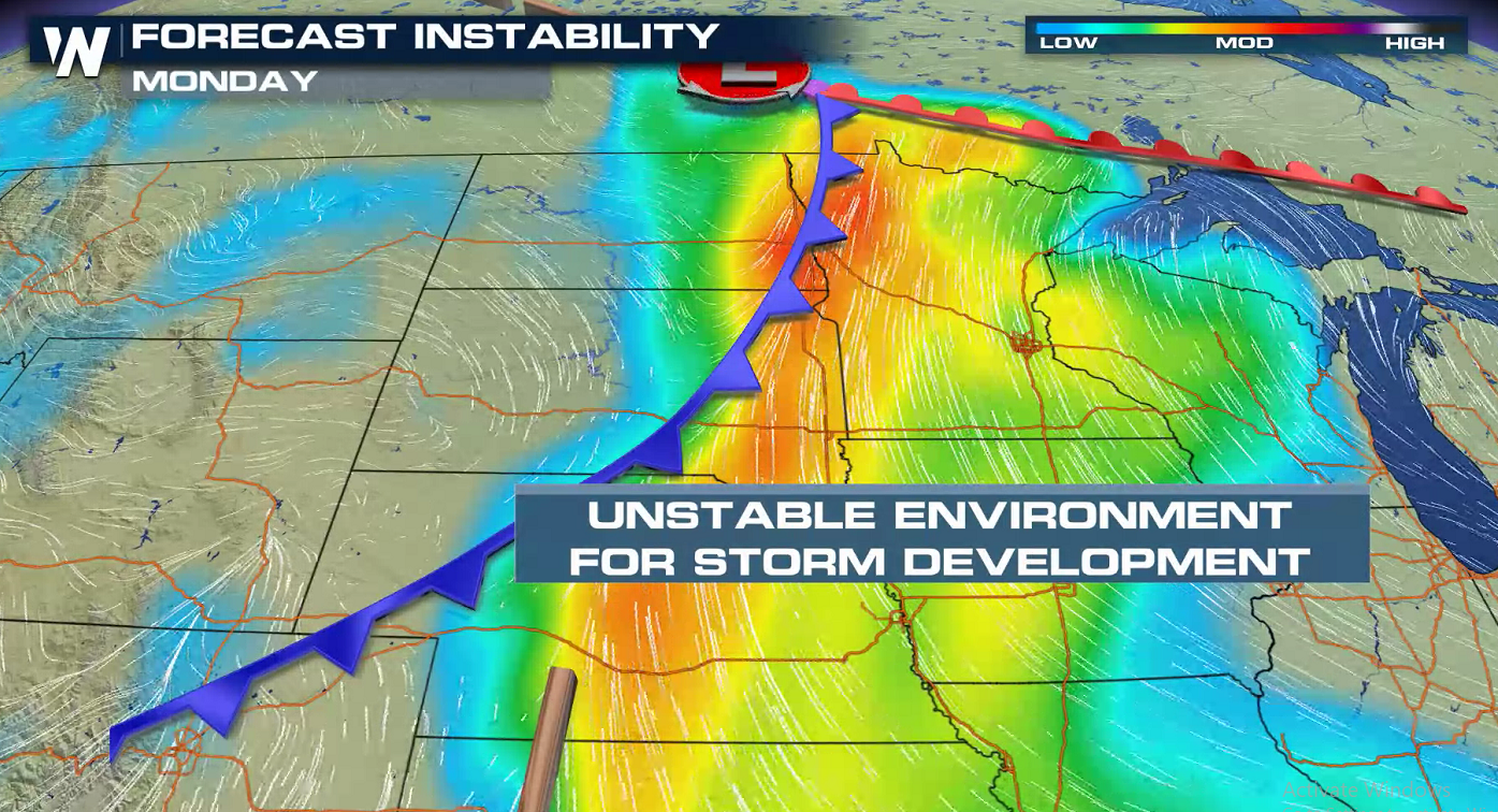 Most of the afternoon will be dry as a cold front slowly moves to the east. In the late afternoon, a few thunderstorms will develop along the front. With heat and humidity climbing ahead of the front, storm coverage and intensity will increase into the evening. Severe storms will be possible along and ahead of the cold front through the night.
 Stay Weather Aware this weekend and be sure to follow WeatherNation for the very latest forecast information.
A vigorous trough will push into the western United States, creating this unsettled weather pattern. Ahead of the trough and surface cold front, temperatures are expected to be in the 80s and 90s---quite hot---across the Great Plains. Moisture transported from the Gulf of Mexico thanks to southerly winds will make it noticeably humid as well. The temperature, humidity, winds, and fronts will all come together and create an energetic environment for thunderstorm development.
Most of the afternoon will be dry as a cold front slowly moves to the east. In the late afternoon, a few thunderstorms will develop along the front. With heat and humidity climbing ahead of the front, storm coverage and intensity will increase into the evening. Severe storms will be possible along and ahead of the cold front through the night.
Stay Weather Aware this weekend and be sure to follow WeatherNation for the very latest forecast information.All Weather News
More
Flooding Risk Increases as Heavy Rain Targets the Tri-State Area
Tuesday, heavy rainfall moved across the Nort
30 Jul 2026 12:25 AM


Genevieve Down to a Category 2 Hurricane
PacificFausto is now a post-tropical cyclone.
30 Jul 2026 12:00 AM

Severe Weather: Energy From the Midwest Now in the Southeast
UPPER MIDWEST - Through Monday, dangerous tor
29 Jul 2026 10:30 PM


Southeast Flood Risk Lingers Near Stalled Front
A stalled boundary over the Southeast will ke
25 Jul 2026 10:55 AM

Another Round of Storms Targets the Northeast
Tuesday brought severe weather again across p
23 Jul 2026 1:15 AM