Tornado Threat Targets the Northeast Sunday
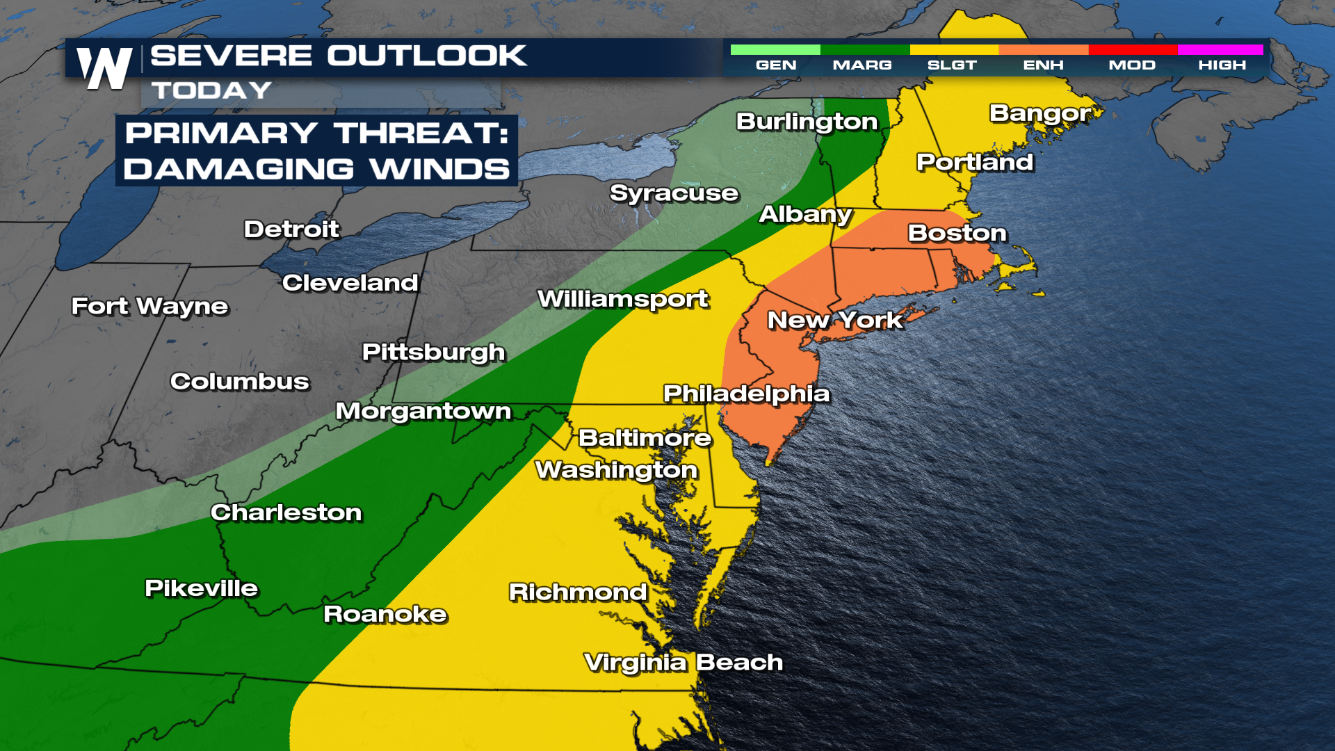
It has been very active in the Northeast this weekend as a cold front continues to move through. Severe winds (58+ mph) have topped out the storm reports, with lots of storms producing gusty, damaging winds. The front sparking these severe chances has not moved out to sea, so the threat will linger into today. Damaging winds are the biggest concern. An enhanced risk for severe storms remains in place for Sunday through Philadelphia, New York City, and Boston.

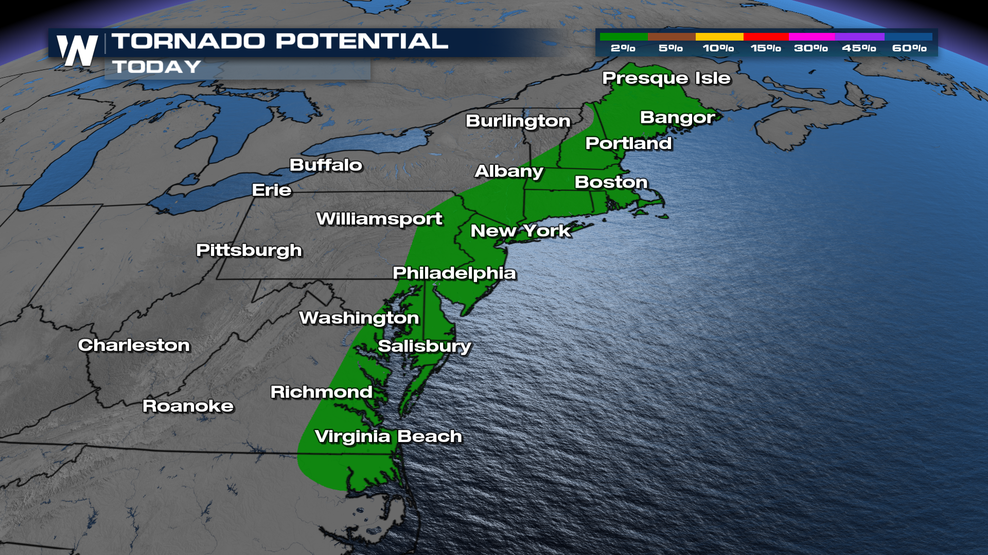
The main threat will be strong damaging winds but there will be a chance for an isolated tornado. Even if you dealt with strong storms earlier in the day, you won't want to let your guard down for the second half of the day.

Through Sunday afternoon, storms will have enough energy to form severe storms as the front pushes east. Storms look to start off as relatively isolated, but become more widespread as they take on the East Coast.
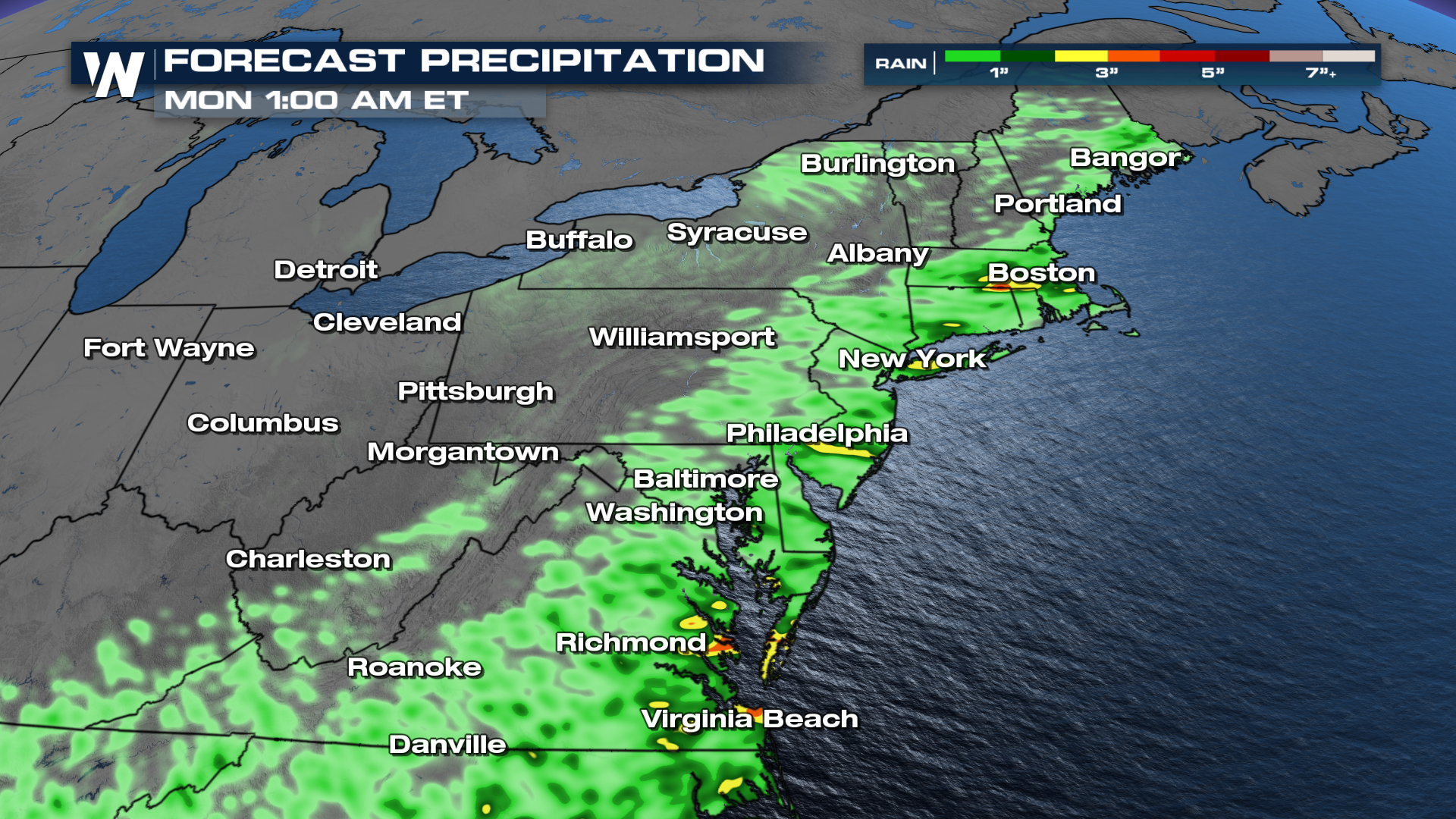
Isolated flash flooding poses a threat to certain cities along the Eastern Seaboard. On a more local level, there's the chance for 3-5"+ by early Monday morning. Pay attention to any and all weather alerts that may be issued, and remember to turn around, don't drown.

More details of your full Eastern Regional Forecast can always be found :!0 past the hour on WeatherNation.