Severe Storms Threaten the High Plains & Midwest
Special Stories
31 May 2020 6:49 AM
Energy from a strong storm system that brought severe weather to the Northwest on Saturday will head east on Sunday, bringing severe thunderstorm chances to Western Montana and portions of the High Plains on Sunday. On Monday, the energy moves into the Midwest and Great Lakes while an unstable atmosphere remains in place across the Plains. Finally, on Tuesday a frontal system is expected to cross this region to create an elevated chance for severe storms.
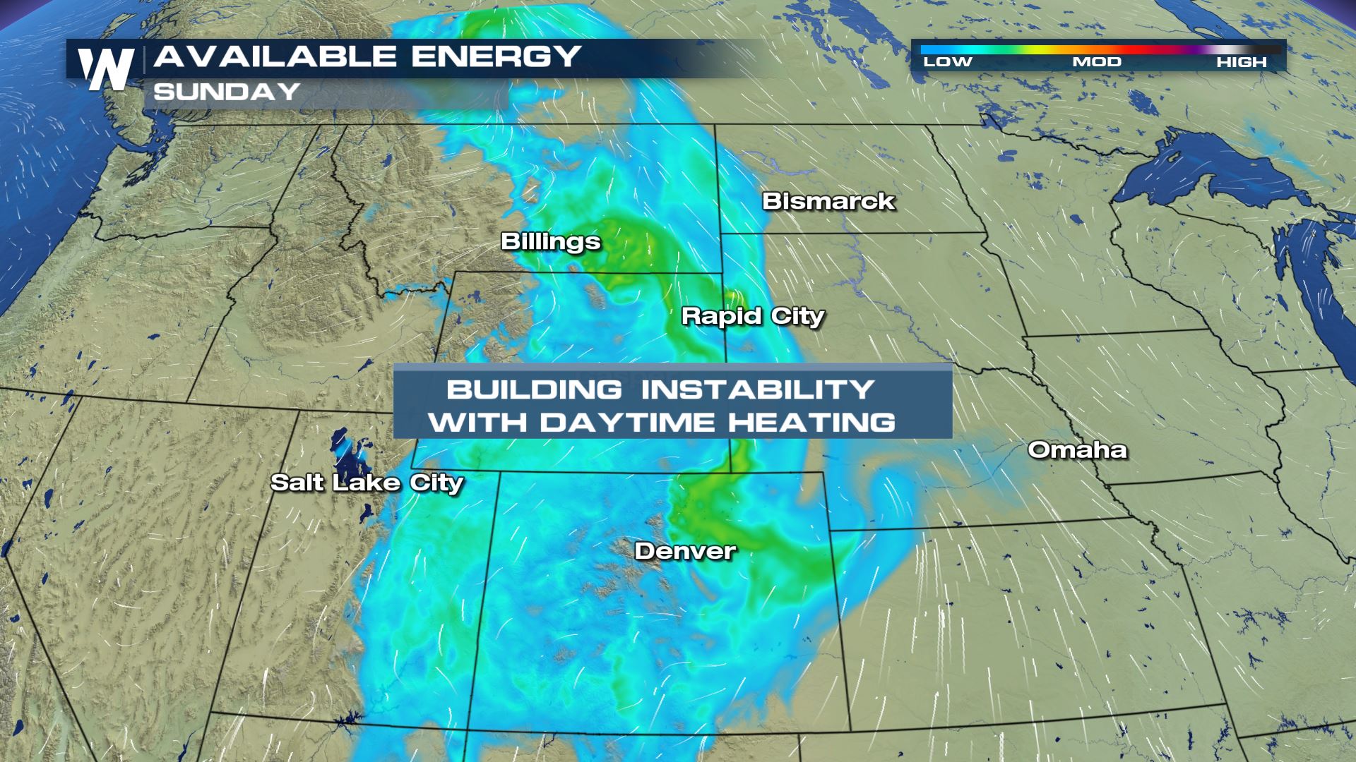 On Sunday and Monday, temperatures will be warming to the 80s and 90s across the Northern High Plains, especially along and east of the continental divide. Those warm temperatures, combined with sufficient moisture, will provide plenty of instability for storms to tap into as moderate wind shear develops over the region from a smaller scale trough of low pressure.
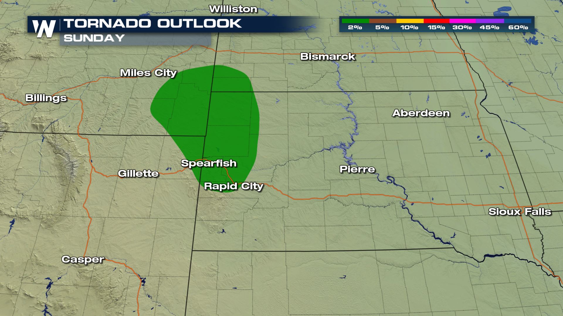
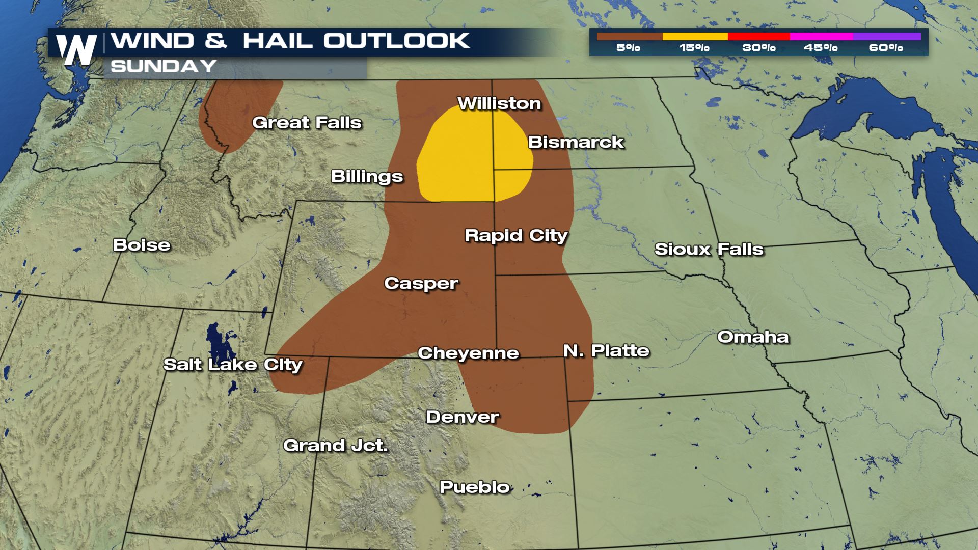 Large hail and damaging winds will be the primary concern with severe storms on Sunday and Monday, but an isolated tornado or two will be possible. The Storm Prediction Center is highlighting a small region (below) near Rapid City for that threat Sunday afternoon.
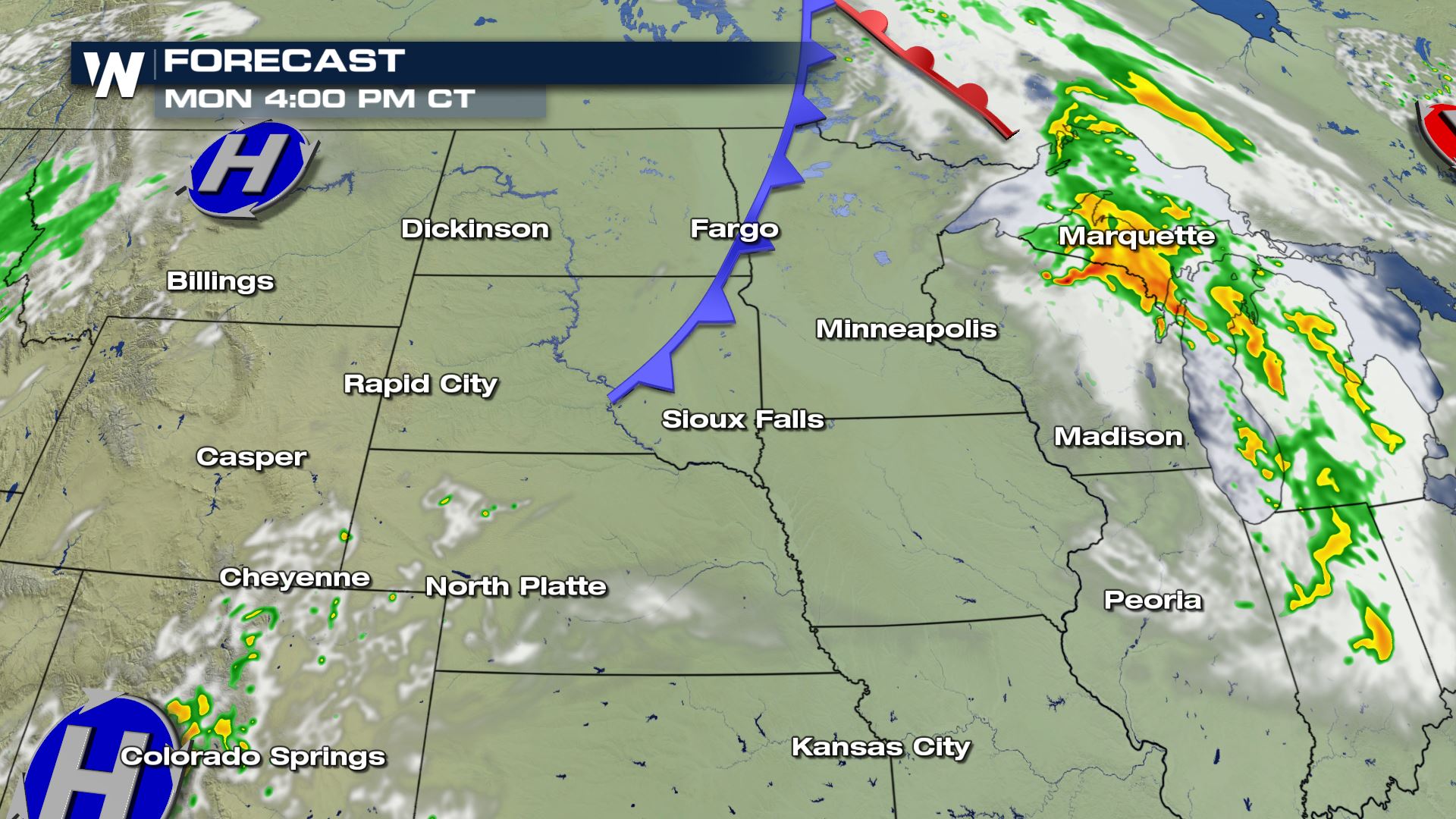
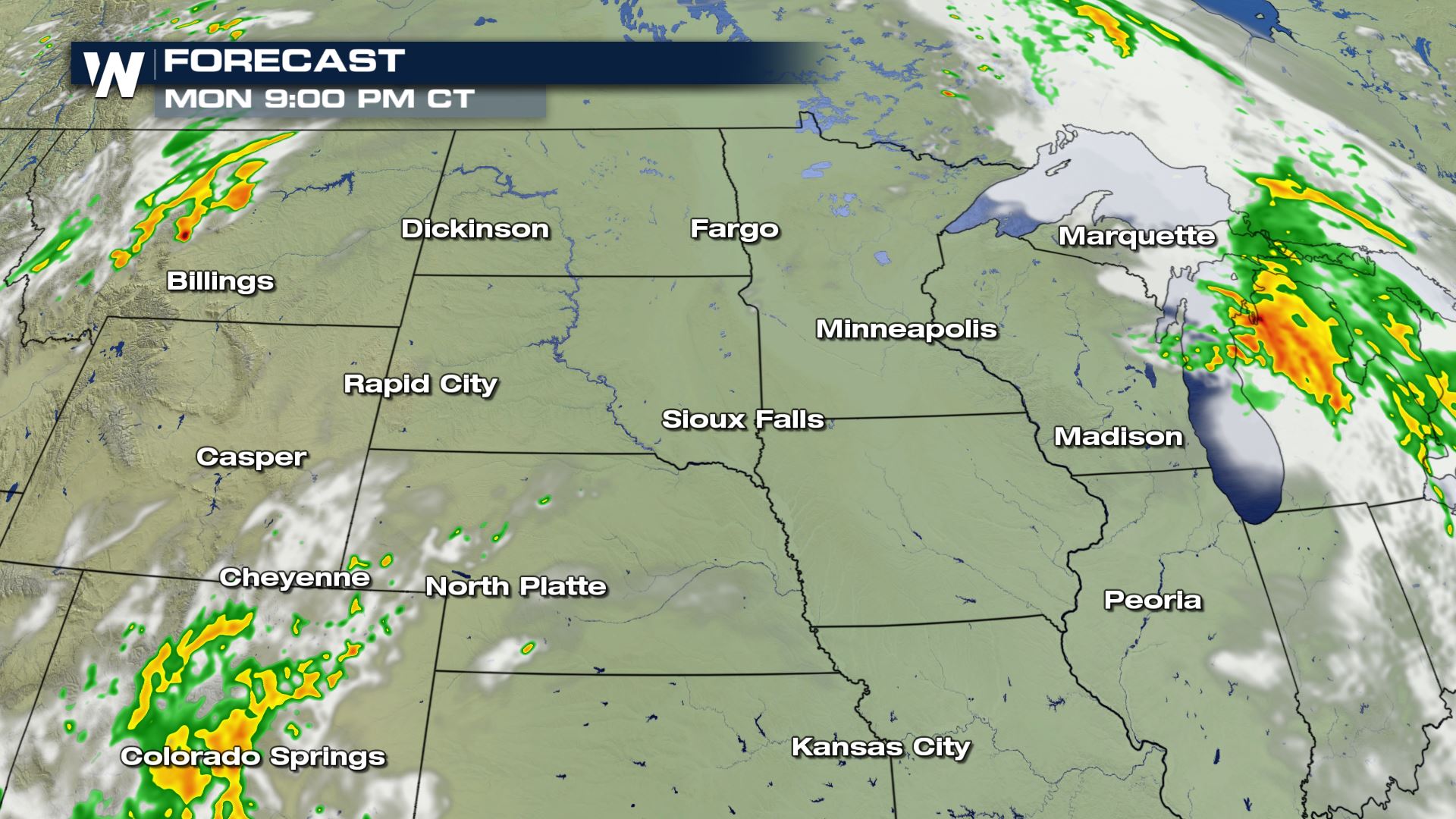
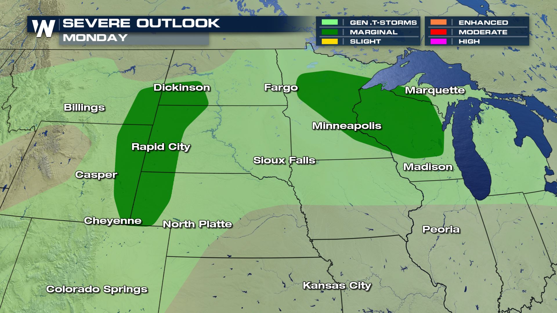 On Monday, the chance for severe storms continues over the Western High Plains but also shifts east with Sunday's energy into the Upper Midwest. Storms in Minnesota and Wisconsin could be underway Monday morning before continuing eastward across Michigan in the afternoon and evening. Storms closer to the Dakotas will be driven by afternoon heating once again, but could be limited by a "cap," or temperature inversion, which prevents updrafts from continuing into the middle and upper-levels of the atmosphere.
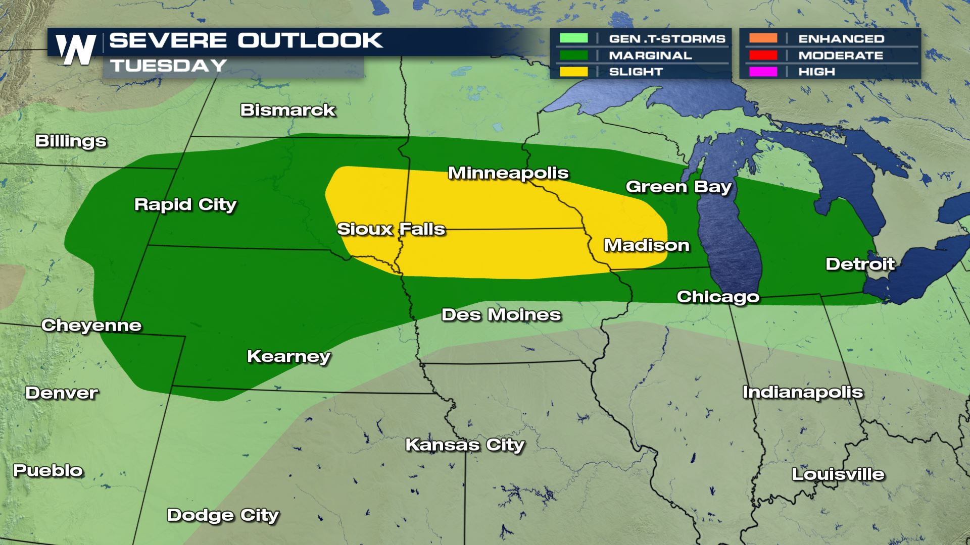 A frontal system is expected to cross the Northern Plains and Midwest on Tuesday, acting as a trigger for additional thunderstorms across most of the region. The strong ridge of high pressure will break down slightly to allow the energy of the jet stream to move over the area which could see moderate to strong instability build ahead of the front. There is an elevated risk for scattered severe storms from Eastern South Dakota through Southern Wisconsin. Wind and hail will likely remain the primary hazards but isolated tornadoes cannot be ruled out.
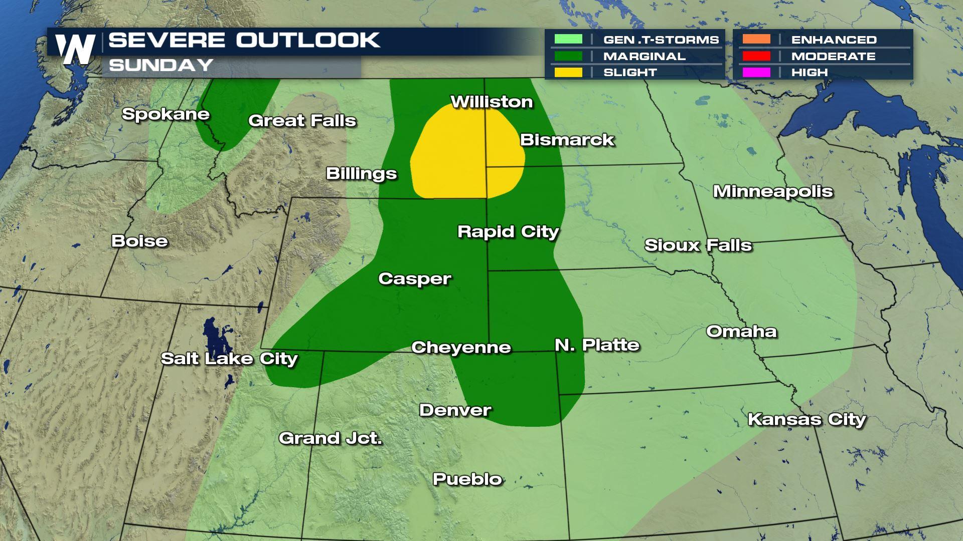
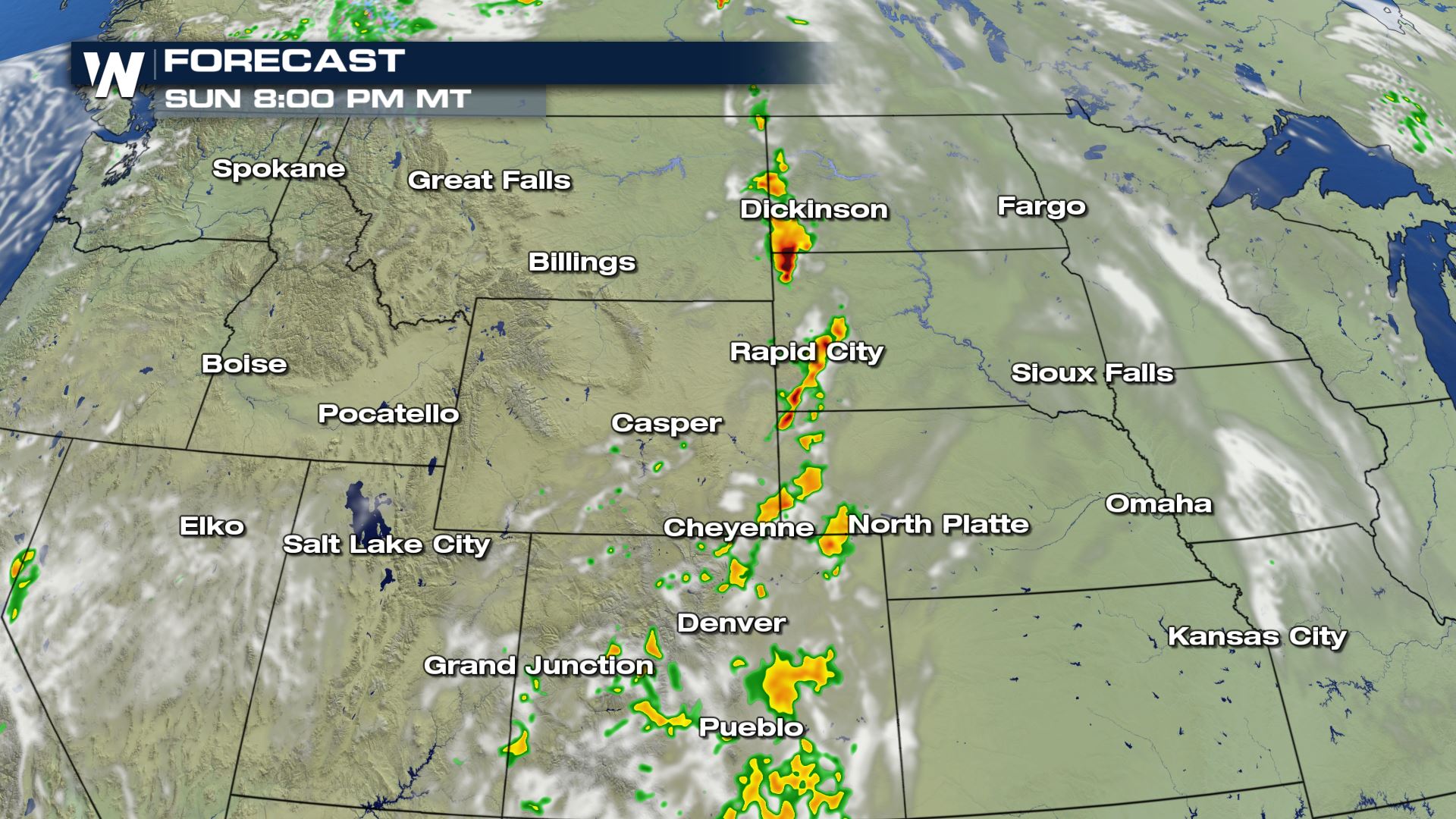
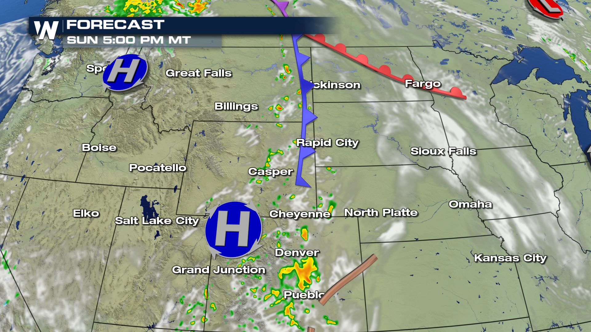 On Sunday, storms will be triggered by the sold front moving out of Central Montana in the afternoon. Expect isolated severe storms to move east into the Dakotas and off of the Rockies in the late afternoon and evening. Isolated strong or severe storms could persist overnight across the Dakotas.
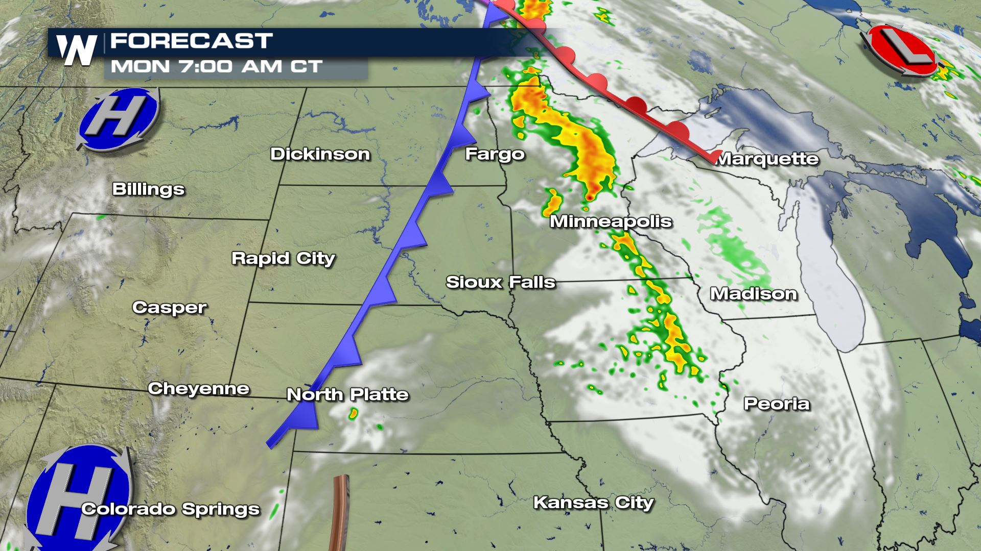 By Monday morning, the chance for isolated severe storms will move across Minnesota and Wisconsin, before pushing into Michigan later in the day.
 In the Western High Plains, isolated severe storms are possible in the afternoon and evening but storms could be held in check by capping in the atmosphere.
 We'll continue to monitor any severe storms that form as well as any changes to the forecast in the days ahead. This article will be updated with the latest information.
On Sunday and Monday, temperatures will be warming to the 80s and 90s across the Northern High Plains, especially along and east of the continental divide. Those warm temperatures, combined with sufficient moisture, will provide plenty of instability for storms to tap into as moderate wind shear develops over the region from a smaller scale trough of low pressure.
Large hail and damaging winds will be the primary concern with severe storms on Sunday and Monday, but an isolated tornado or two will be possible. The Storm Prediction Center is highlighting a small region (below) near Rapid City for that threat Sunday afternoon.
On Monday, the chance for severe storms continues over the Western High Plains but also shifts east with Sunday's energy into the Upper Midwest. Storms in Minnesota and Wisconsin could be underway Monday morning before continuing eastward across Michigan in the afternoon and evening. Storms closer to the Dakotas will be driven by afternoon heating once again, but could be limited by a "cap," or temperature inversion, which prevents updrafts from continuing into the middle and upper-levels of the atmosphere.
A frontal system is expected to cross the Northern Plains and Midwest on Tuesday, acting as a trigger for additional thunderstorms across most of the region. The strong ridge of high pressure will break down slightly to allow the energy of the jet stream to move over the area which could see moderate to strong instability build ahead of the front. There is an elevated risk for scattered severe storms from Eastern South Dakota through Southern Wisconsin. Wind and hail will likely remain the primary hazards but isolated tornadoes cannot be ruled out.
On Sunday, storms will be triggered by the sold front moving out of Central Montana in the afternoon. Expect isolated severe storms to move east into the Dakotas and off of the Rockies in the late afternoon and evening. Isolated strong or severe storms could persist overnight across the Dakotas.
By Monday morning, the chance for isolated severe storms will move across Minnesota and Wisconsin, before pushing into Michigan later in the day.
In the Western High Plains, isolated severe storms are possible in the afternoon and evening but storms could be held in check by capping in the atmosphere.
We'll continue to monitor any severe storms that form as well as any changes to the forecast in the days ahead. This article will be updated with the latest information.All Weather News
More

Tropics: Fausto Heads towards Hawaii; Genevieve Cat 4 Hurricane
PacificTropical Storm Fausto continues to tra
28 Jul 2026 10:30 AM

Severe Storms Target the Midwest to the Northeast
UPPER MIDWEST - Through Monday, dangerous tor
28 Jul 2026 10:25 AM

Southeast Flood Risk Lingers Near Stalled Front
A stalled boundary over the Southeast will ke
25 Jul 2026 10:55 AM

Another Round of Storms Targets the Northeast
Tuesday brought severe weather again across p
23 Jul 2026 1:15 AM

Another Round of Severe Weather for the Upper Midwest and Great Lakes
The upper-level low train continues to keep t
21 Jul 2026 1:45 AM

Air Quality Improvements in the Forecast
Wildfires burning in Northwestern Ontario, Ca
20 Jul 2026 7:20 PM