Severe Storm Threat Includes the Twin Cities this Weekend

Strong to locally severe thunderstorms will once again traverse much of the Plains region of the United States during this first weekend of June. The most likely time frame for these showers and thundershowers will be on Sunday and Sunday night, while an advancing cold front sweeps across the Dakotas, Nebraska, and Kansas. That same front will push into sections of the Interstate 35 corridor from the Twin Cities to Des Moines and Kansas City, before settling south of I-70 on Monday from Tulsa to Wichita and Springfield (MO).
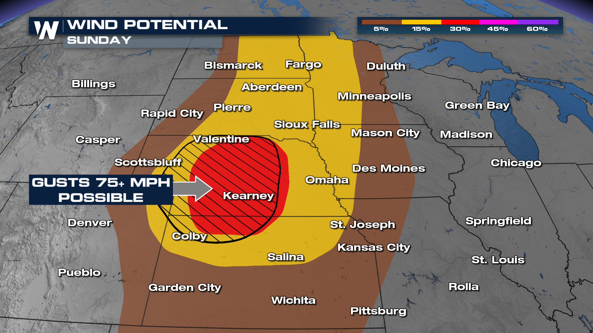
Damaging wind gusts of 75 miles per hour (or stronger) will be one of the main concerns and hazards on Sunday, June 2. The area to really watch, stay weather ready, and weather aware, will be central Nebraska and north-central Kansas where concentrated wind gusts of hurricane-force will be possible.
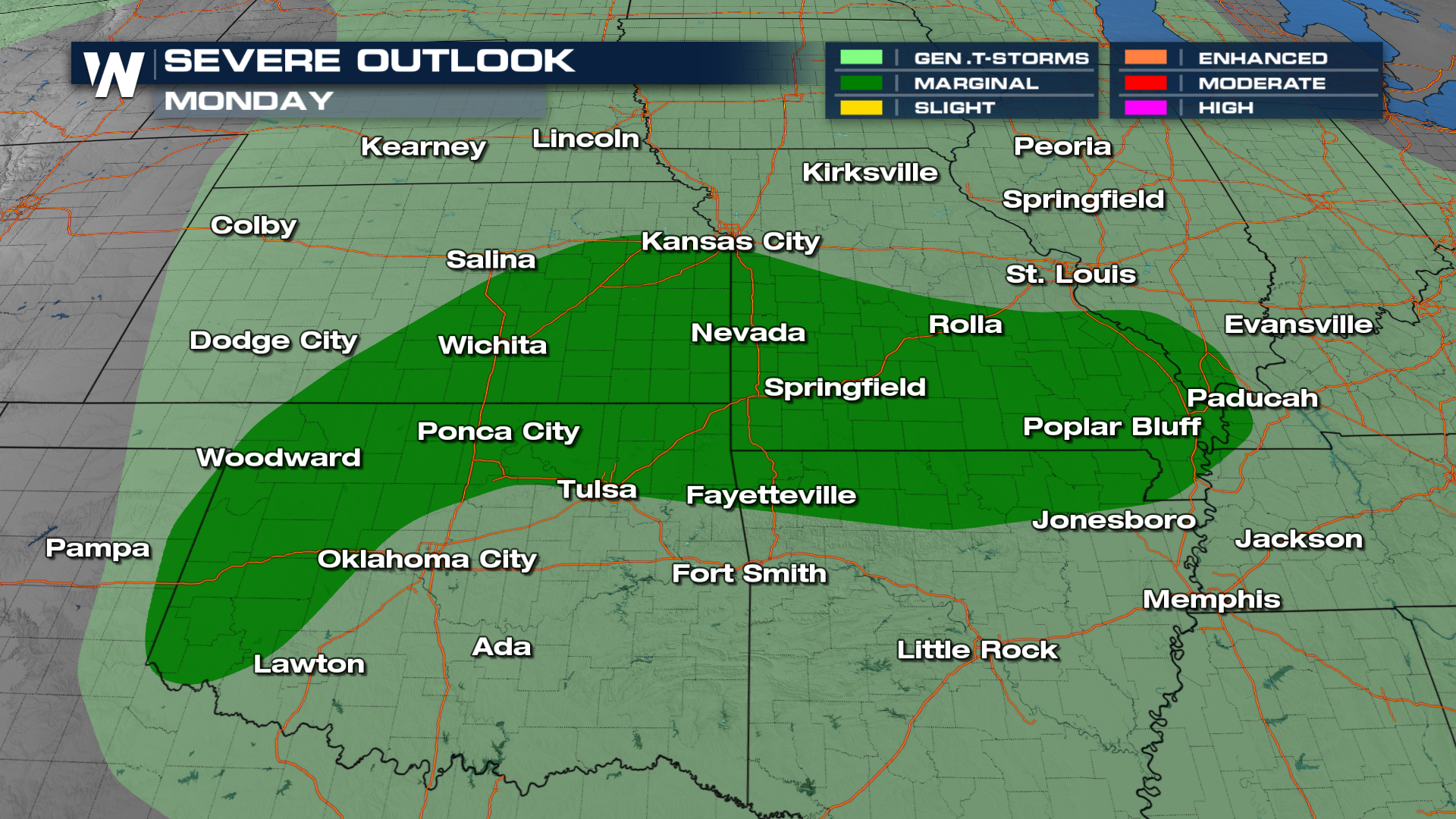
 While we can't rule out a tornado, most of these thunderstorms will produce straight line wind. Still, straight line wind can still damage property and put you at harm, thus you should still stay weather ready when it comes to these thunderstorms. Into Monday we go and cities such as Springfield, Missouri and Wichita, Kansas will have to stay on guard when it comes to severe weather.
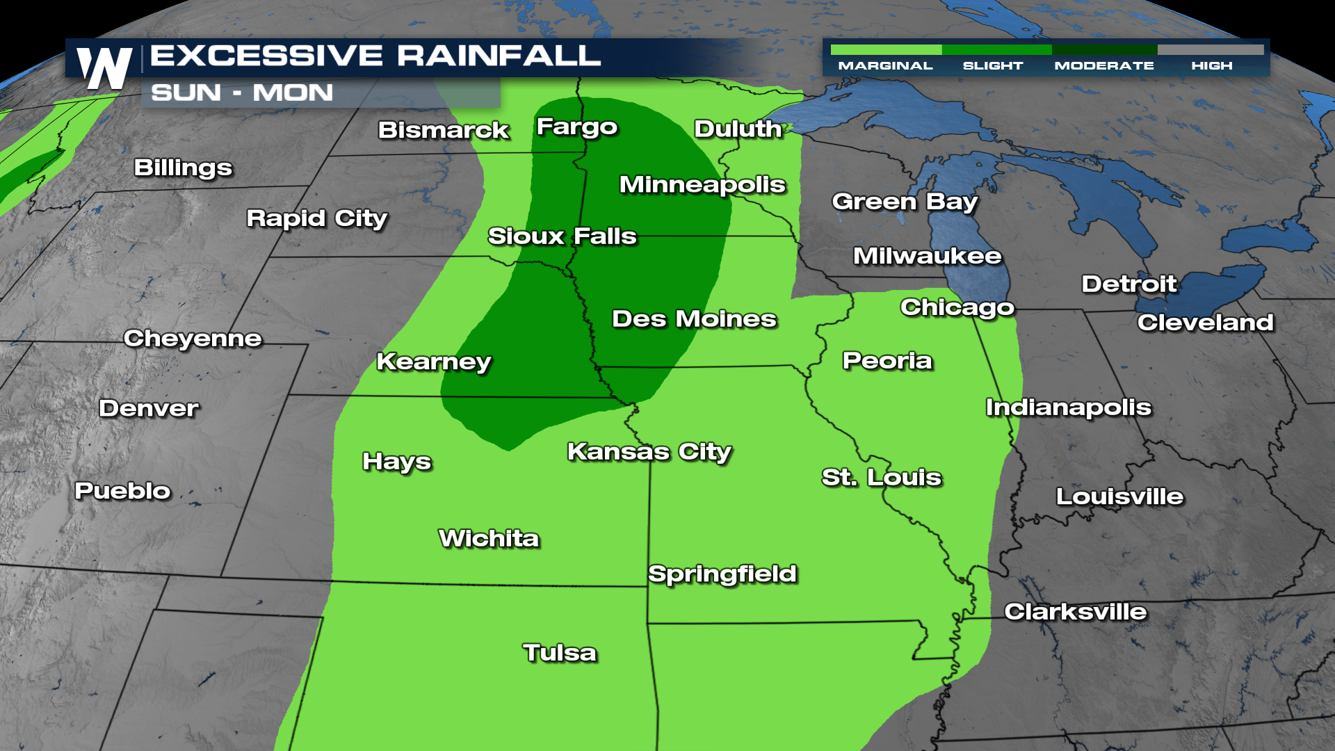
 Areas of heavy rain could cause more flooding. We have already seen flooding take place in Nebraska this week from the thunderstorms. Additional rainfall amounts of one to four inches could cause water to settle into low-lying spots.
 It's the summer travel season. If you're traveling through this part of the country, please stay up-to-date with the latest road conditions, road closures, and weather forecast so you (and your vehicle) can avoid dangerous conditions!


