Severe Threat For Denver Area into Monday Evening
Top Stories
6 Aug 2018 3:01 PM
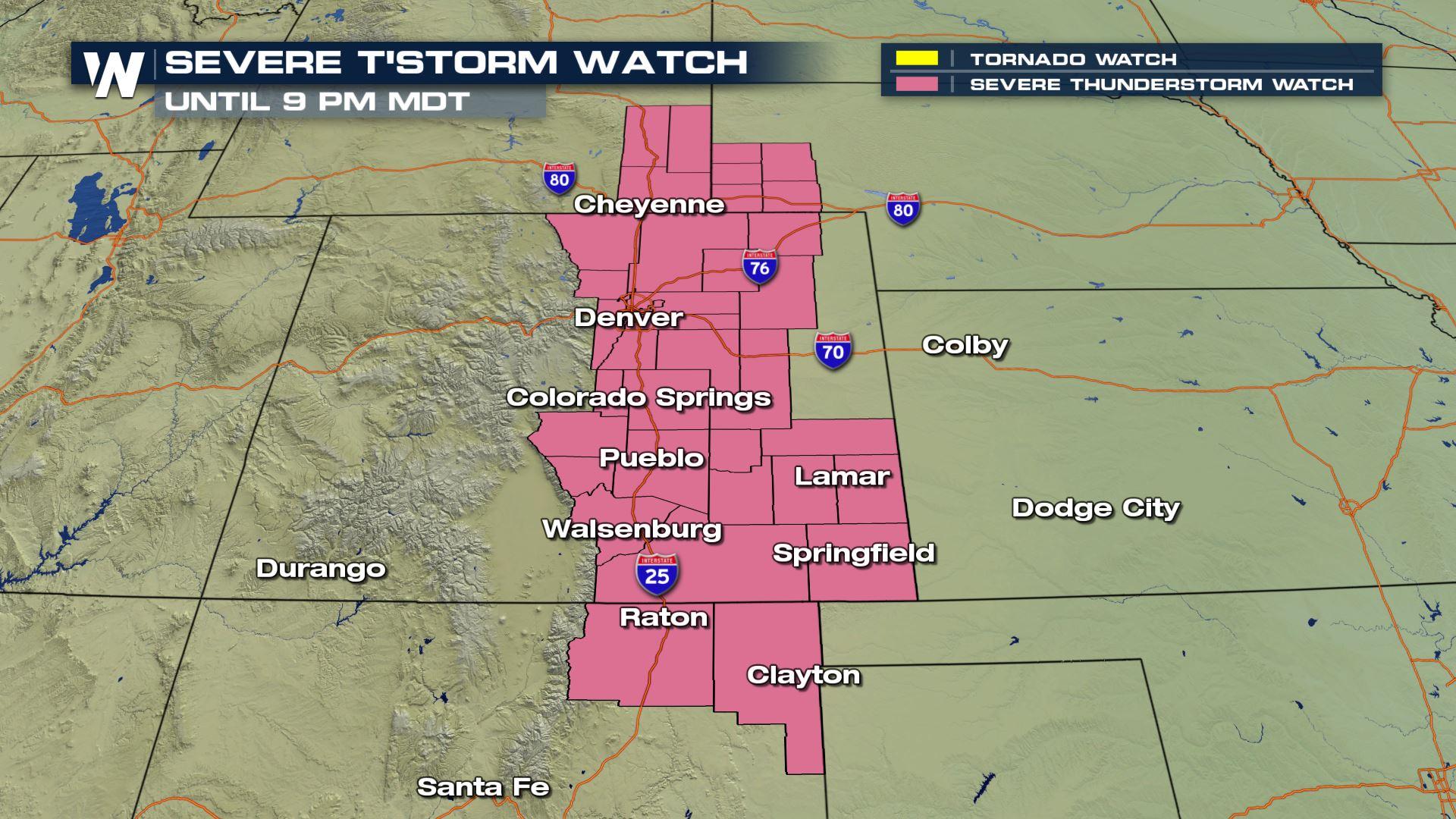
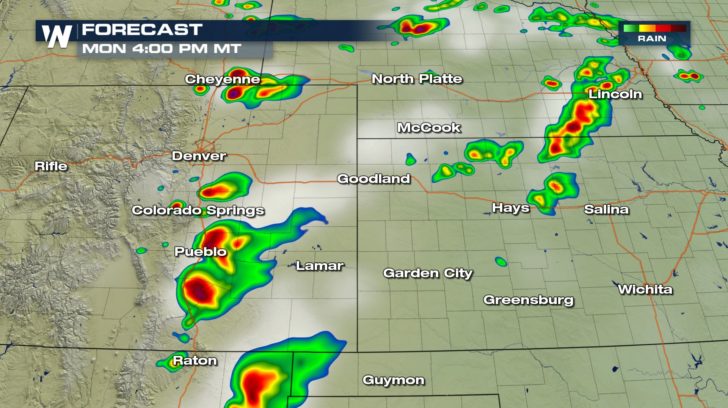
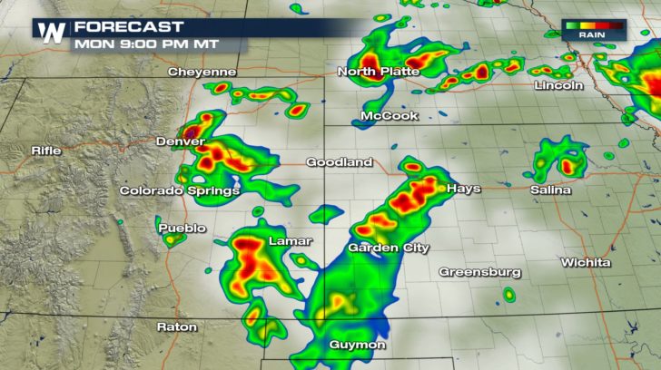
The severe threat for the Denver area is back again. It could be yet another active second-half of the day near the I-25 corridor. A Severe Thunderstorm Watch has been issued from southeast Wyoming to northeast New Mexico. Cities like Cheyenne and Denver are included within this watch that is in place until 9:00 PM MDT.
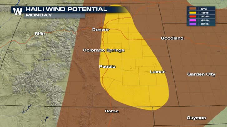
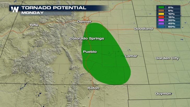
 The threats with these storms will be large, damaging hail and strong wind gusts. Spin up tornadoes can not be ruled out either.
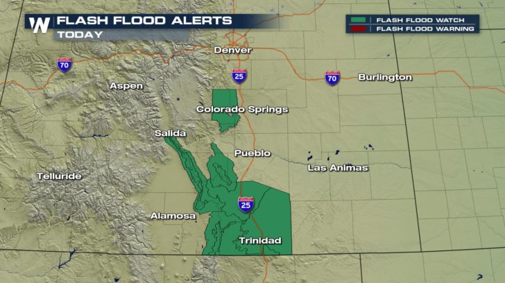
 With the potential for heavy rainfall rates on top of burn scars, flash flooding will be a possibility. Rainfall rates could be as high as 1 to 1.5 inches of rain per hour.
 As of Monday afternoon, storms were already firing off across the Front Range of Colorado. Storms will continue until the evening hours of Monday with the support of an upper level jet.
 Be sure to have your alerts turned on and stay with WeatherNation for updates.
For WeatherNation, Meteorologist Kate Mantych.
Be sure to have your alerts turned on and stay with WeatherNation for updates.
For WeatherNation, Meteorologist Kate Mantych.
The threats with these storms will be large, damaging hail and strong wind gusts. Spin up tornadoes can not be ruled out either.
With the potential for heavy rainfall rates on top of burn scars, flash flooding will be a possibility. Rainfall rates could be as high as 1 to 1.5 inches of rain per hour.
As of Monday afternoon, storms were already firing off across the Front Range of Colorado. Storms will continue until the evening hours of Monday with the support of an upper level jet.
Be sure to have your alerts turned on and stay with WeatherNation for updates.
For WeatherNation, Meteorologist Kate Mantych.All Weather News
More
Southeast Flood Risk Lingers Near Stalled Front
A stalled boundary over the Carolinas will ke
24 Jul 2026 12:35 PM

Severe Chances Return for the Midwest
The upcoming stretch of hot temperatures will
24 Jul 2026 12:25 PM

Tropics: Fausto Heads to Hawaii, Bertha Breaks Apart
BerthaBertha has dissipated after moving inla
24 Jul 2026 11:50 AM

Hot & Smoky w/ a Chance of Lightning
Conditions have been really dry out west. We'
24 Jul 2026 11:15 AM

Very Hot Temperatures For the Western and Central United States
Are you over the summer heat yet? Well, more
24 Jul 2026 9:20 AM

Another Round of Storms Targets the Northeast
Tuesday brought severe weather again across p
23 Jul 2026 1:15 AM

Another Round of Severe Weather for the Upper Midwest and Great Lakes
The upper-level low train continues to keep t
21 Jul 2026 1:45 AM