Cold Front Drives Severe Storms Through Thursday

A cold has been slowly progressing across the country, bringing rain and gusty winds along with it. The front will continue to approach the East Coast to tend the week, spurring heavy showers and a few severe storms.
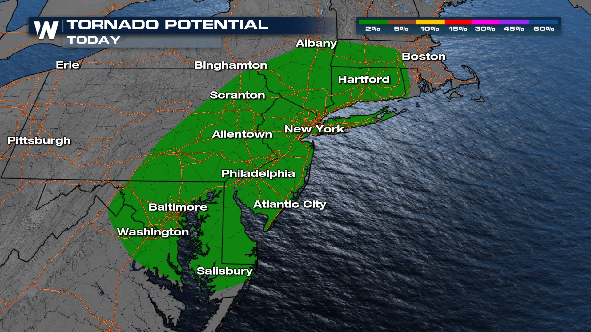
Damaging winds are the primary concern here as we head into Thursday from Connecticut through Georgia (top of page). Isolated tornadoes are also possible, primarily in the Northeast.
 Storms will follow along and ahead of the frontal boundary through the end of the work week. For now, Friday remains under a general thunderstorm risk.
The other concern is the threat of flooding. With multiple rounds of showers and storms rivers, creeks, and streams will already be swollen which could keep the risk elevated through Thursday.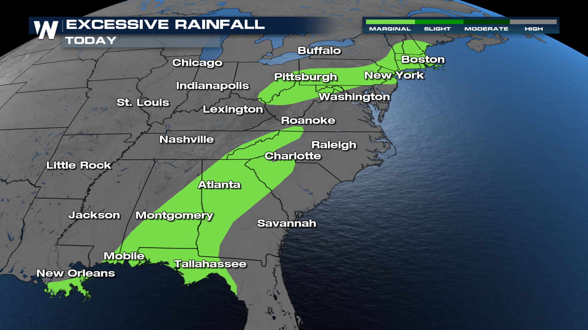
Tune in to WeatherNation live for more updates.


