Severe Threat Returns This Weekend
Top Stories
28 Feb 2019 10:26 AM
The threat for severe weather returns to parts of the south and southeast as we have again another set-up for storms that could produce damaging wind gusts, large hail, and even tornadoes.
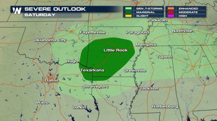
 Storms will be more isolated in nature on Saturday and with the timing, it looks like we have the best chances as we get into Saturday night.
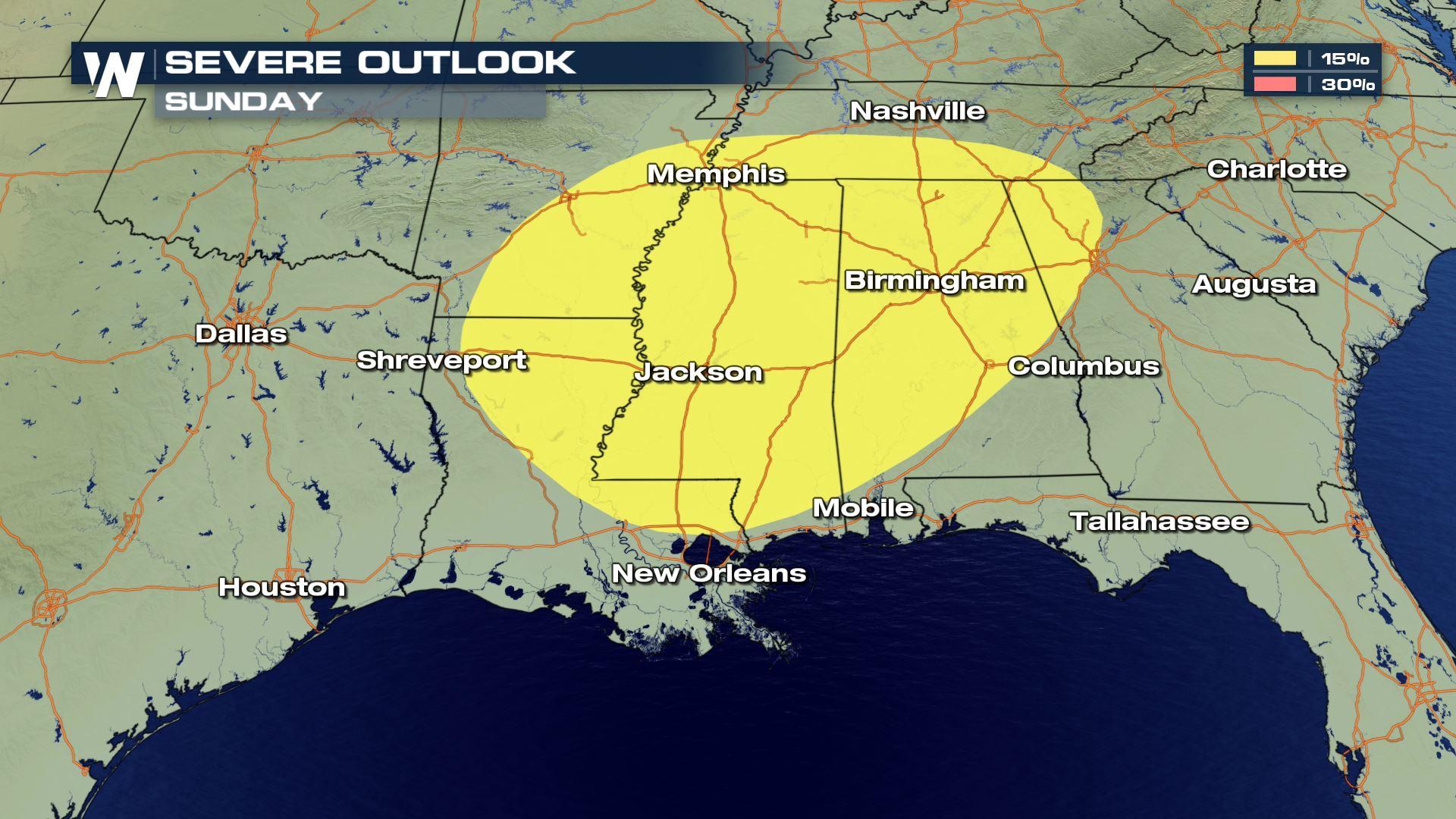
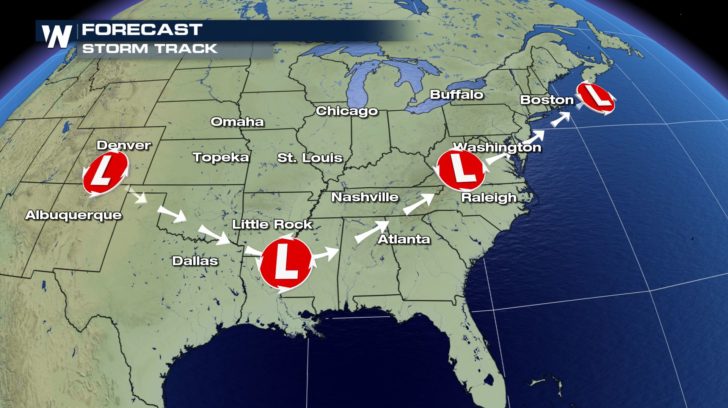
 Looking ahead to Sunday, models continue to follow the low pressure system into the lower Mississippi Valley as we get into the afternoon and evening.
Yet again the threats will be for gusty winds, hail at least 1" in diameter, and even a possibility of tornadoes.
Looking ahead to Sunday, models continue to follow the low pressure system into the lower Mississippi Valley as we get into the afternoon and evening.
Yet again the threats will be for gusty winds, hail at least 1" in diameter, and even a possibility of tornadoes.
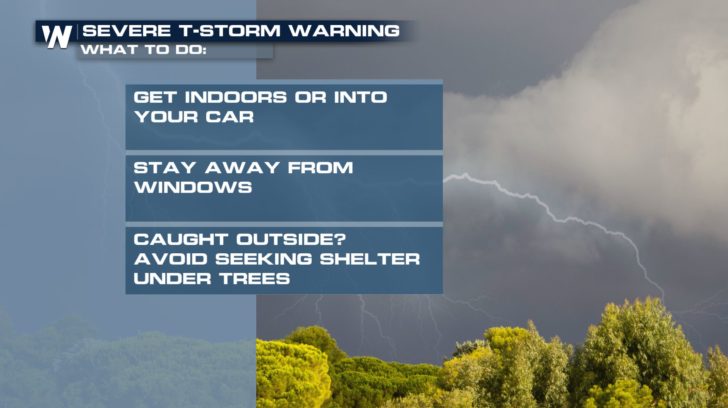
 Make sure to stay connected with WeatherNation as we follow this storm system into the weekend and beginning of the workweek.
 For WeatherNation, I'm Meteorologist Meredith Garofalo
Storms will be more isolated in nature on Saturday and with the timing, it looks like we have the best chances as we get into Saturday night.
Looking ahead to Sunday, models continue to follow the low pressure system into the lower Mississippi Valley as we get into the afternoon and evening.
Yet again the threats will be for gusty winds, hail at least 1" in diameter, and even a possibility of tornadoes.
Make sure to stay connected with WeatherNation as we follow this storm system into the weekend and beginning of the workweek.
For WeatherNation, I'm Meteorologist Meredith GarofaloAll Weather News
More
Wildfire Outbreak in the Pacific Northwest
Conditions have been incredibly dry out west.
2 Aug 2026 1:30 PM

After Reaching Category 5, Genevieve Weakens in the Pacific
PacificGenevieve formed on last Friday south
2 Aug 2026 1:25 PM

More Storms for the East Sunday and Monday
A low-pressure system crashing through the Mi
2 Aug 2026 1:25 PM


Flooding, Severe Storms Target the Midwest Again
After an active week of storms across the nor
1 Aug 2026 1:40 AM

Flooding Risk Increases as Heavy Rain Targets the Tri-State Area
Tuesday, heavy rainfall moved across the Nort
30 Jul 2026 12:25 AM

Severe Weather: Energy From the Midwest Now in the Southeast
UPPER MIDWEST - Through Monday, dangerous tor
29 Jul 2026 10:30 PM