Severe Threat Sparks Up Tuesday
Special Stories
25 Nov 2019 2:59 PM
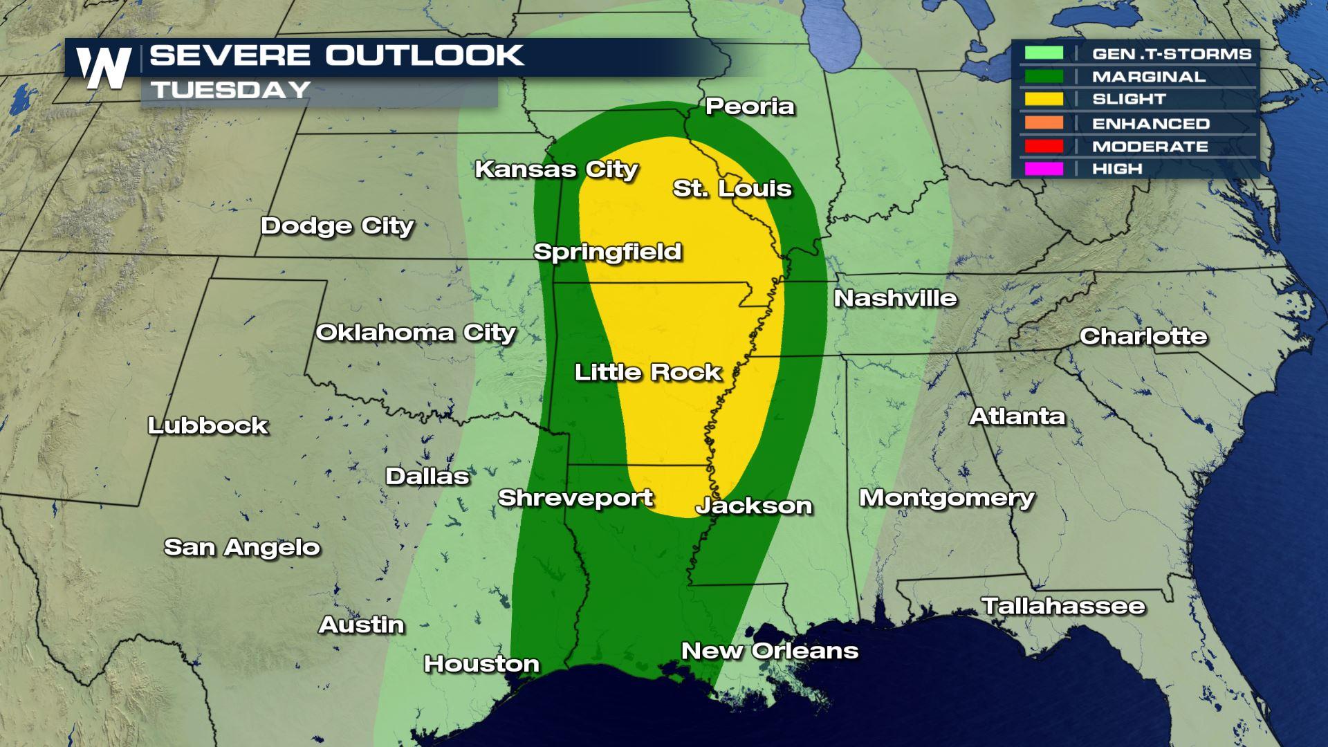
A potent low-pressure system will track through the central US on Tuesday. Conditions are conducive for severe weather development ahead of the associated cold front. The primary concern will be for damaging wind gusts from the southern Plains into the Mississippi Valley.
Rain and thunderstorms will be fed by the Gulf of Mexico. Rain chances extend into Illinois and Indiana Tuesday. Isolated strong to severe thunderstorms will be possible starting in the afternoon.
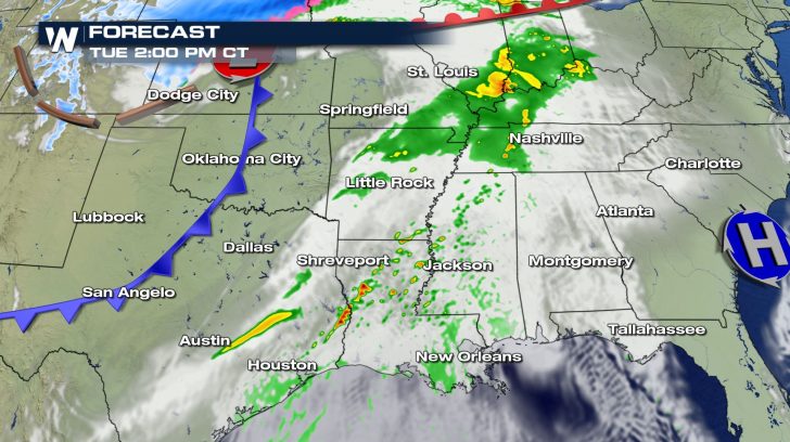 Clusters of storms look to intensify by late afternoon and into the evening. Some pockets of heavy rain are possible as well, although widespread downpours are not expected.
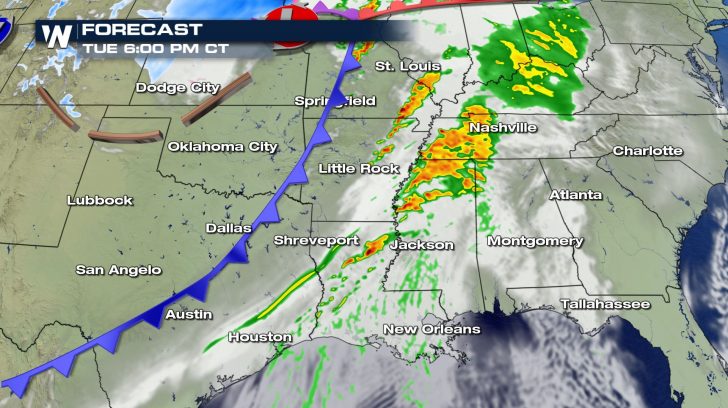 Severe chances will follow the cold front into Mississippi, Tennessee, and Kentucky late Tuesday.
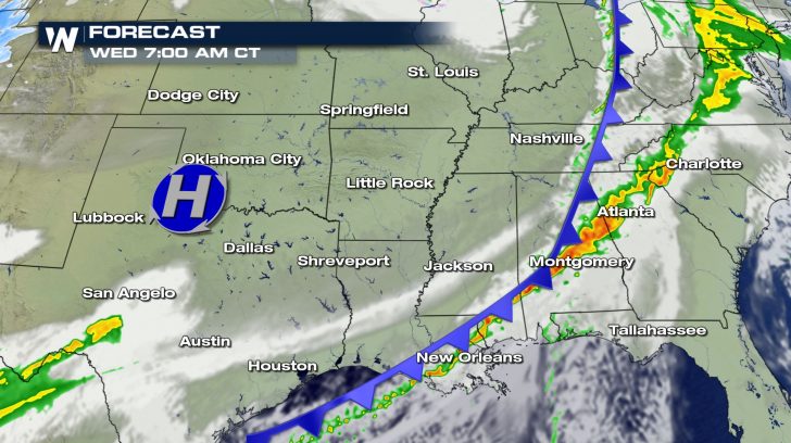
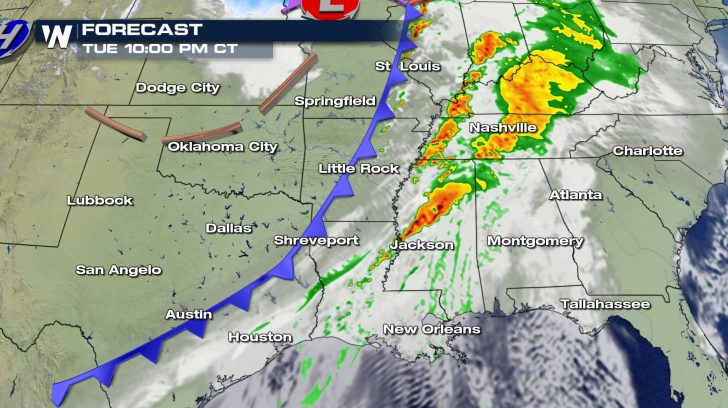 Conditions clear out behind the front, but will be cooling down as well.
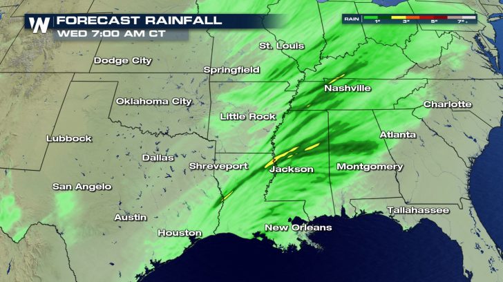
 Rainfall looks to be heaviest overnight and into Wednesday. Totals will end up between one and three inches in most cases.
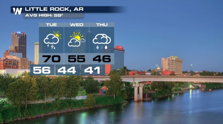
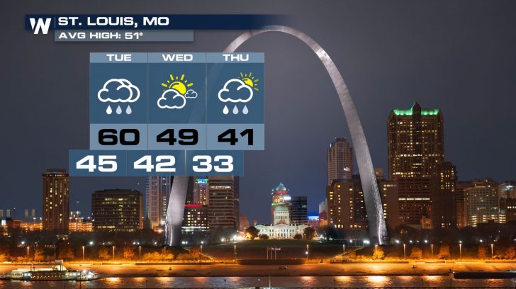
 Get the layers ready! Temperatures cool off significantly behind the front. Rain chances return just in time for Thanksgiving in Little Rock, St. Louis, and many other central US cities.
Clusters of storms look to intensify by late afternoon and into the evening. Some pockets of heavy rain are possible as well, although widespread downpours are not expected.
Severe chances will follow the cold front into Mississippi, Tennessee, and Kentucky late Tuesday.
Conditions clear out behind the front, but will be cooling down as well.
Rainfall looks to be heaviest overnight and into Wednesday. Totals will end up between one and three inches in most cases.
Get the layers ready! Temperatures cool off significantly behind the front. Rain chances return just in time for Thanksgiving in Little Rock, St. Louis, and many other central US cities.
All Weather News
More
East Gears Up for Stormy, Wet Weekend
A low pressure system crashing through the Mi
1 Aug 2026 11:35 AM


Flooding, Severe Storms Target the Midwest Again
After an active week of storms across the nor
1 Aug 2026 1:40 AM


After Reaching Category 5, Genevieve Weakens in the Pacific
PacificFausto is now a post-tropical cyclone.
31 Jul 2026 1:30 AM

Flooding Risk Increases as Heavy Rain Targets the Tri-State Area
Tuesday, heavy rainfall moved across the Nort
30 Jul 2026 12:25 AM

Severe Weather: Energy From the Midwest Now in the Southeast
UPPER MIDWEST - Through Monday, dangerous tor
29 Jul 2026 10:30 PM