Severe Thunderstorm Watch Issued in the Northeast
Top Stories
21 Sep 2018 3:57 PM
On Friday afternoon, a severe thunderstorm watch was issued for parts of the Northeast for the potential of storms bringing damaging wind gusts and isolated tornadoes.
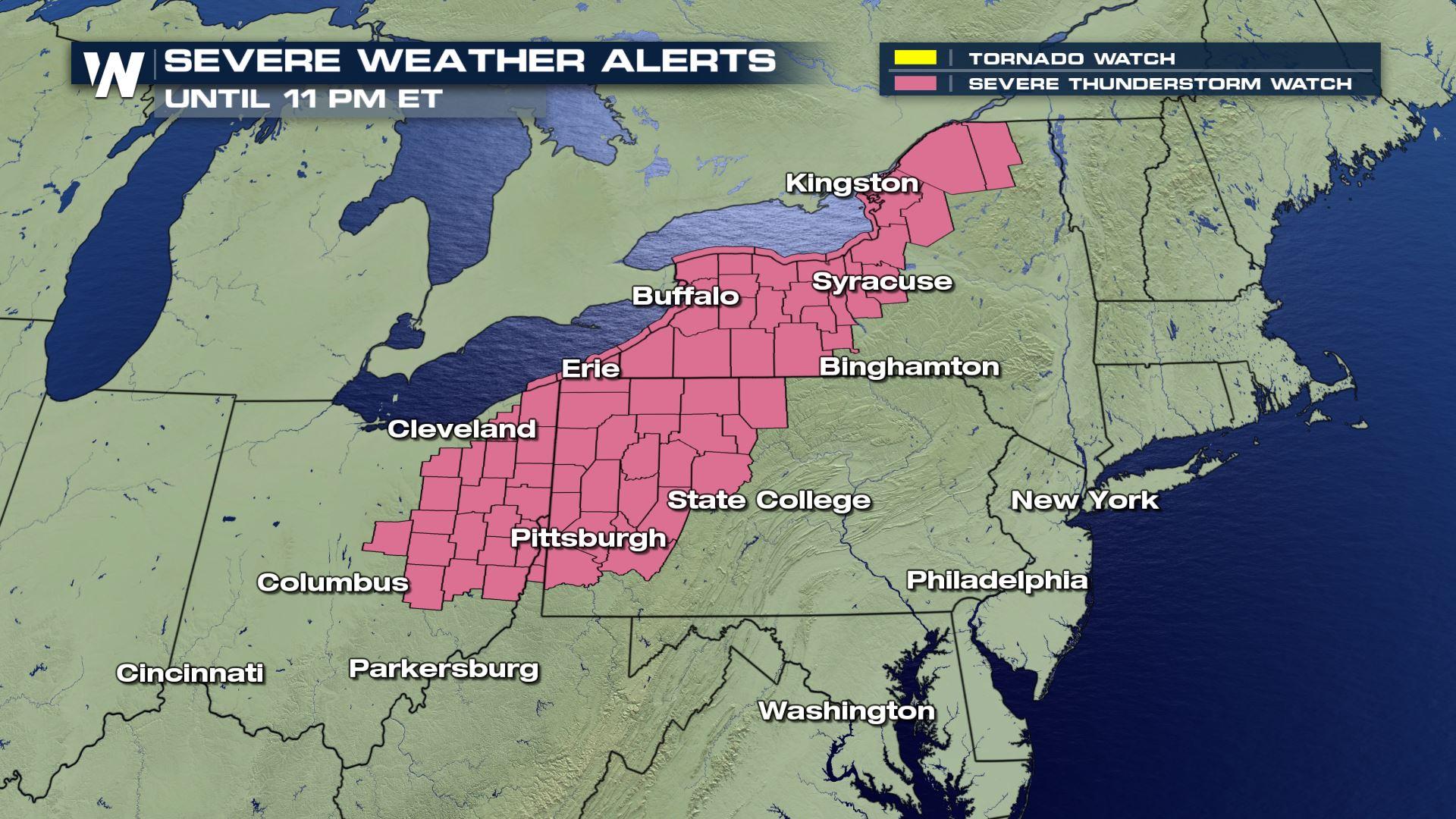
 The snapshot of the severe thunderstorm watch as of 6 p.m. Eastern Friday, valid until 11 p.m. Eastern Friday.
A severe thunderstorm watch means that severe thunderstorms are *possible* carrying damaging wind gusts of 58 miles per hour or stronger, hail 1-inch-thick or larger, and an isolated tornado. In this case Friday, the hail does not appear to be a huge threat. However, the damaging wind hazard does!
The snapshot of the severe thunderstorm watch as of 6 p.m. Eastern Friday, valid until 11 p.m. Eastern Friday.
A severe thunderstorm watch means that severe thunderstorms are *possible* carrying damaging wind gusts of 58 miles per hour or stronger, hail 1-inch-thick or larger, and an isolated tornado. In this case Friday, the hail does not appear to be a huge threat. However, the damaging wind hazard does!
 The potential for damaging wind gusts where brown is 5%, yellow is 15%, and red is 30% chance of damaging wind gusts within 25 miles of any given location.
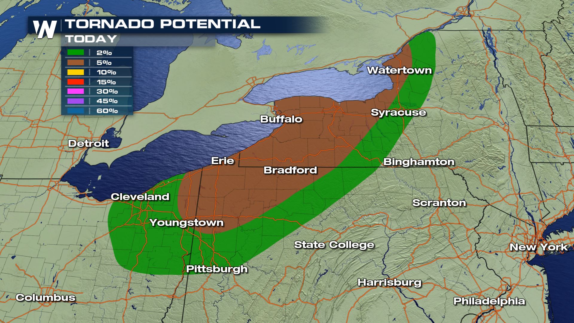 The tornado potential for Friday, September 21 where green shows 2% and brown shows 5% chance of a tornado within 25 miles of any given location.
The thunderstorms have already flared up and will continue to move steadily to the east on Friday evening. Keep an eye on the western sky for the approaching storms. Here's a snapshot around 8 o'clock eastern Friday evening.
The tornado potential for Friday, September 21 where green shows 2% and brown shows 5% chance of a tornado within 25 miles of any given location.
The thunderstorms have already flared up and will continue to move steadily to the east on Friday evening. Keep an eye on the western sky for the approaching storms. Here's a snapshot around 8 o'clock eastern Friday evening.
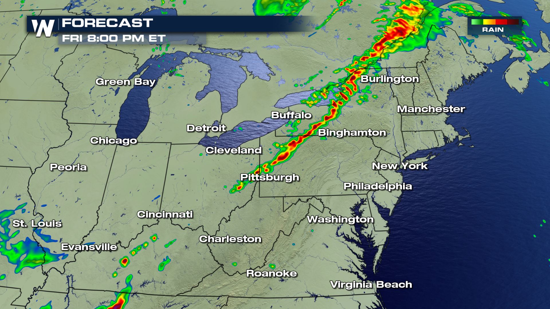 The forecast radar imagery where yellow and reds indicate the most likely area for thunderstorm activity at that time.
If a severe thunderstorm warning is issued for your location, seek shelter inside a sturdy structure. The best place to be is in the lowest, most-interior room of a sturdy structure. These thunderstorms do not appear to last too long this evening, so hopefully not impacting your plans too much!
For WeatherNation, Meteorologist Steve Glazier
The forecast radar imagery where yellow and reds indicate the most likely area for thunderstorm activity at that time.
If a severe thunderstorm warning is issued for your location, seek shelter inside a sturdy structure. The best place to be is in the lowest, most-interior room of a sturdy structure. These thunderstorms do not appear to last too long this evening, so hopefully not impacting your plans too much!
For WeatherNation, Meteorologist Steve Glazier
The snapshot of the severe thunderstorm watch as of 6 p.m. Eastern Friday, valid until 11 p.m. Eastern Friday.
A severe thunderstorm watch means that severe thunderstorms are *possible* carrying damaging wind gusts of 58 miles per hour or stronger, hail 1-inch-thick or larger, and an isolated tornado. In this case Friday, the hail does not appear to be a huge threat. However, the damaging wind hazard does!
The potential for damaging wind gusts where brown is 5%, yellow is 15%, and red is 30% chance of damaging wind gusts within 25 miles of any given location.
The tornado potential for Friday, September 21 where green shows 2% and brown shows 5% chance of a tornado within 25 miles of any given location.
The thunderstorms have already flared up and will continue to move steadily to the east on Friday evening. Keep an eye on the western sky for the approaching storms. Here's a snapshot around 8 o'clock eastern Friday evening.
The forecast radar imagery where yellow and reds indicate the most likely area for thunderstorm activity at that time.
If a severe thunderstorm warning is issued for your location, seek shelter inside a sturdy structure. The best place to be is in the lowest, most-interior room of a sturdy structure. These thunderstorms do not appear to last too long this evening, so hopefully not impacting your plans too much!
For WeatherNation, Meteorologist Steve GlazierAll Weather News
More

More Storms for the East Sunday and Monday
A low-pressure system crashing through the Mi
2 Aug 2026 2:20 AM


Flooding, Severe Storms Target the Midwest Again
After an active week of storms across the nor
1 Aug 2026 1:40 AM

After Reaching Category 5, Genevieve Weakens in the Pacific
PacificFausto is now a post-tropical cyclone.
31 Jul 2026 1:30 AM

Flooding Risk Increases as Heavy Rain Targets the Tri-State Area
Tuesday, heavy rainfall moved across the Nort
30 Jul 2026 12:25 AM

Severe Weather: Energy From the Midwest Now in the Southeast
UPPER MIDWEST - Through Monday, dangerous tor
29 Jul 2026 10:30 PM