Severe Thunderstorms Likely in Texas Monday
Special Stories
13 May 2019 7:20 AM
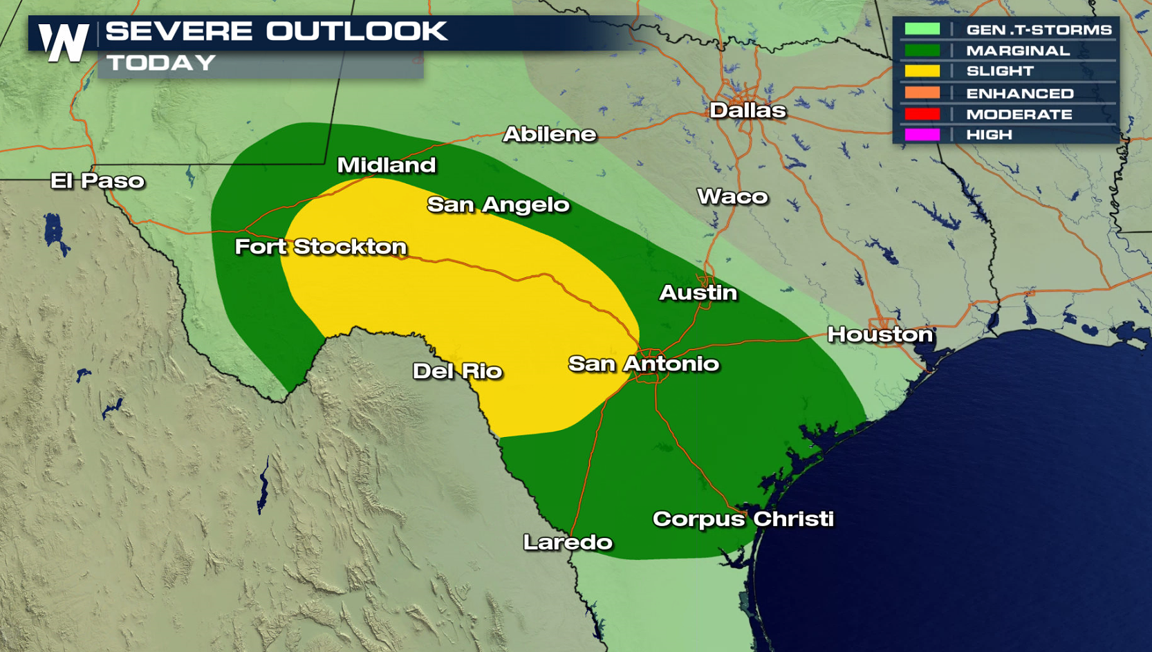
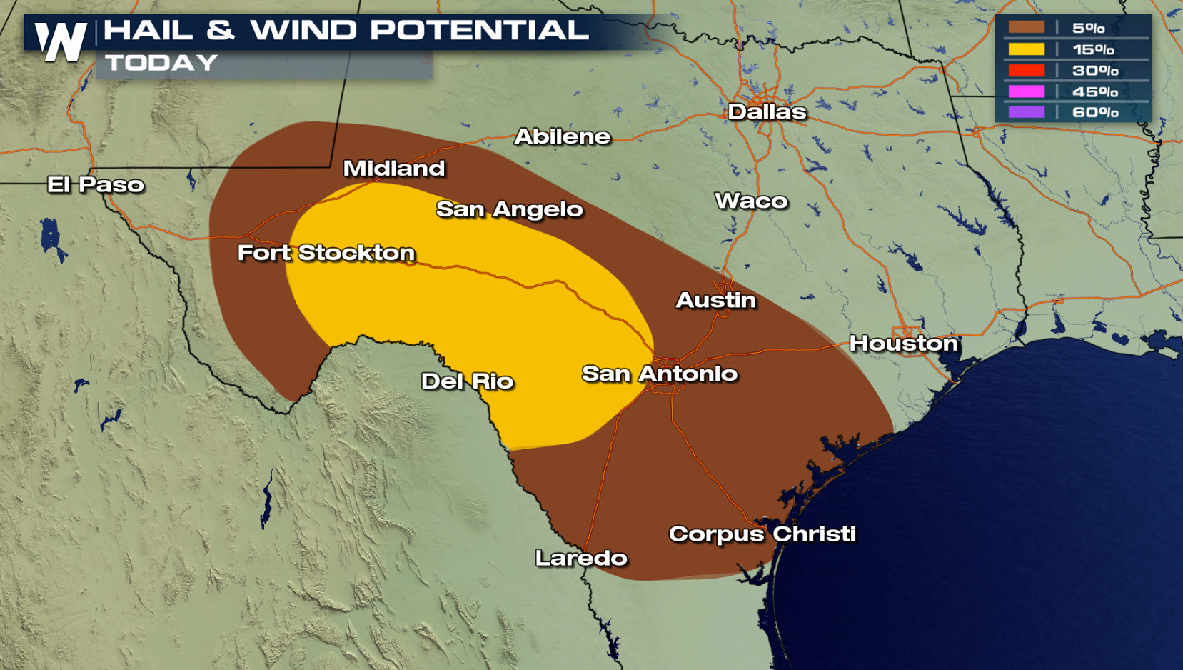
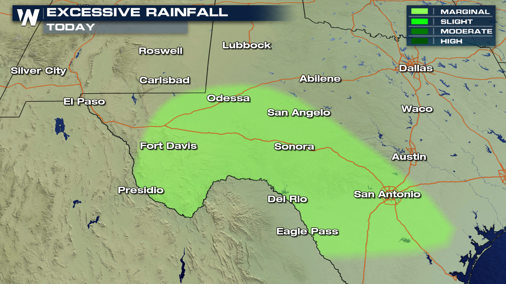
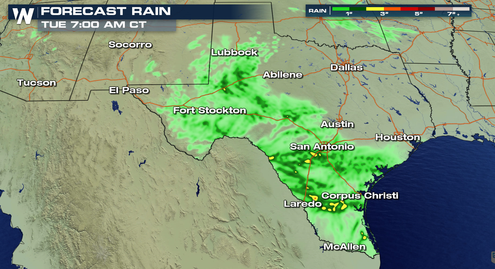
The work week starts with two areas to watch for potential severe thunderstorms: Texas and Florida. Areas along the Rio Grande River in southern and western Texas are under a risk to see large hail and strong wind gusts. You can read a more detailed outlook on the Florida severe weather threat at this link.
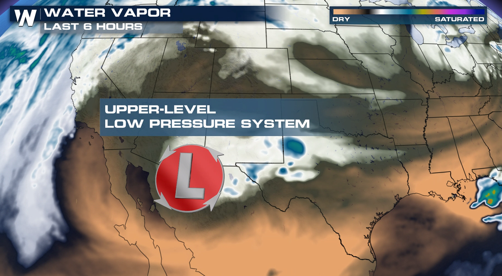
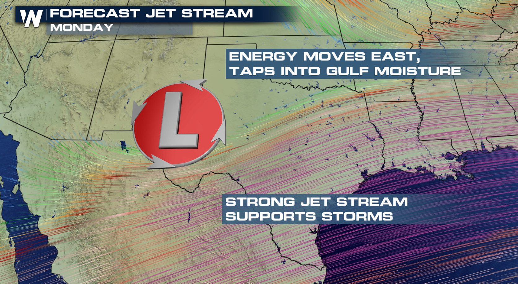
 A compact upper-level low pressure system is digging across the Southwest. The strong Jet Stream energy will interact with increasing instability to create severe storms in the late afternoon and early evening.
 A few storms will be moving through areas of western Texas around midday. Storms are expect to expand and intensify in the late afternoon, taking advantage of the heat and humidity in place over the region. Storms will remain strong to severe into the night while moving eastward.
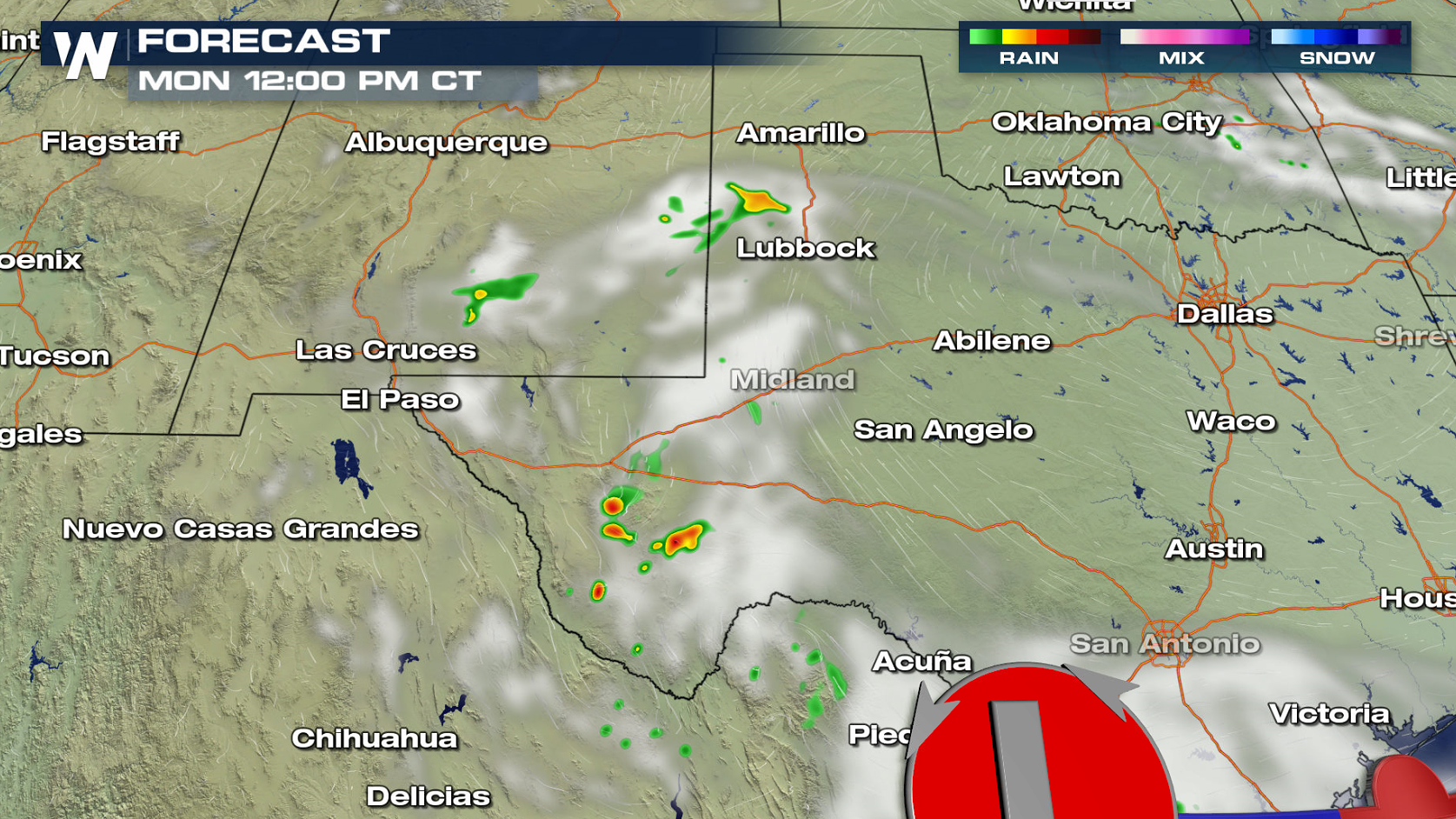
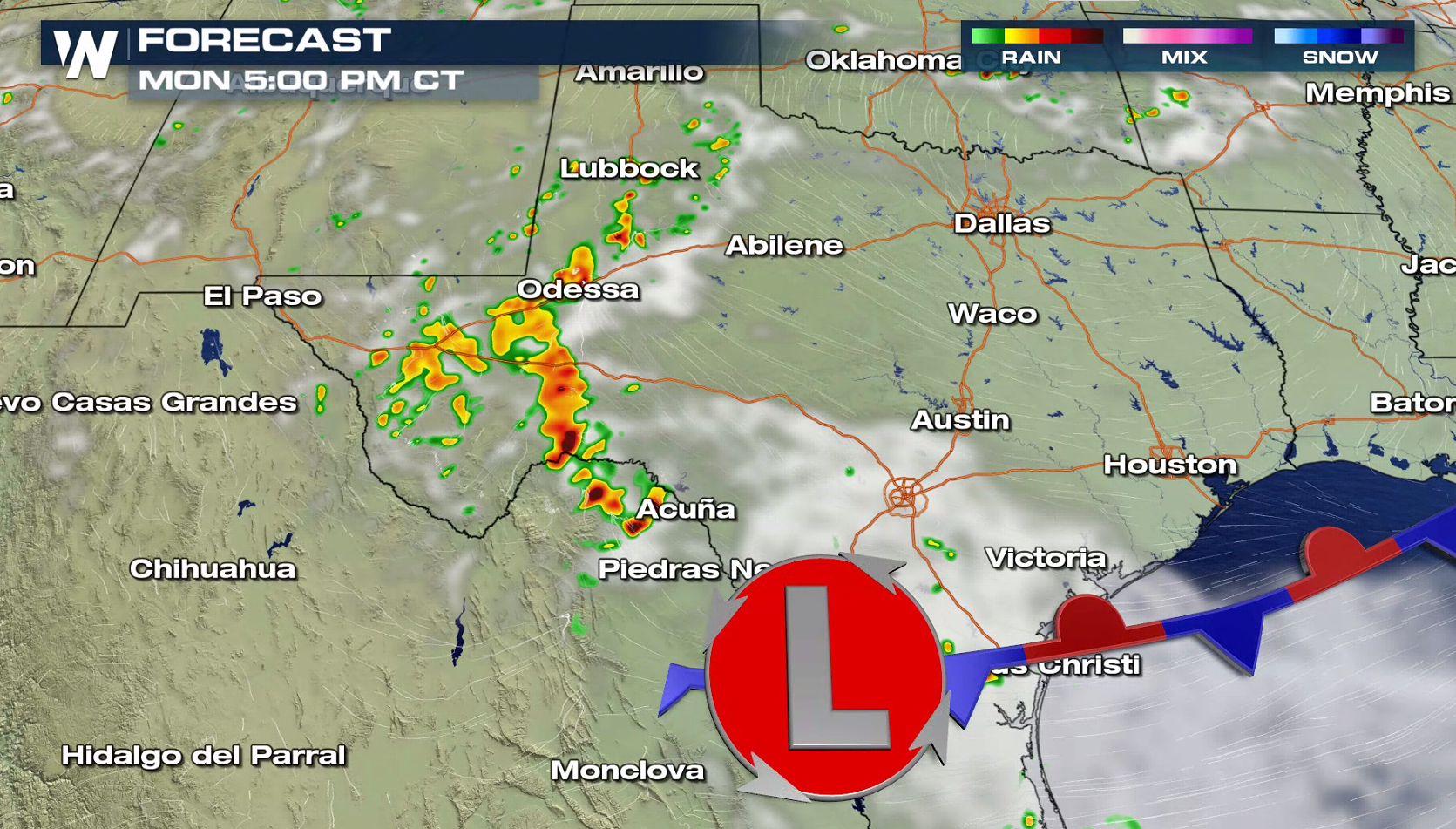
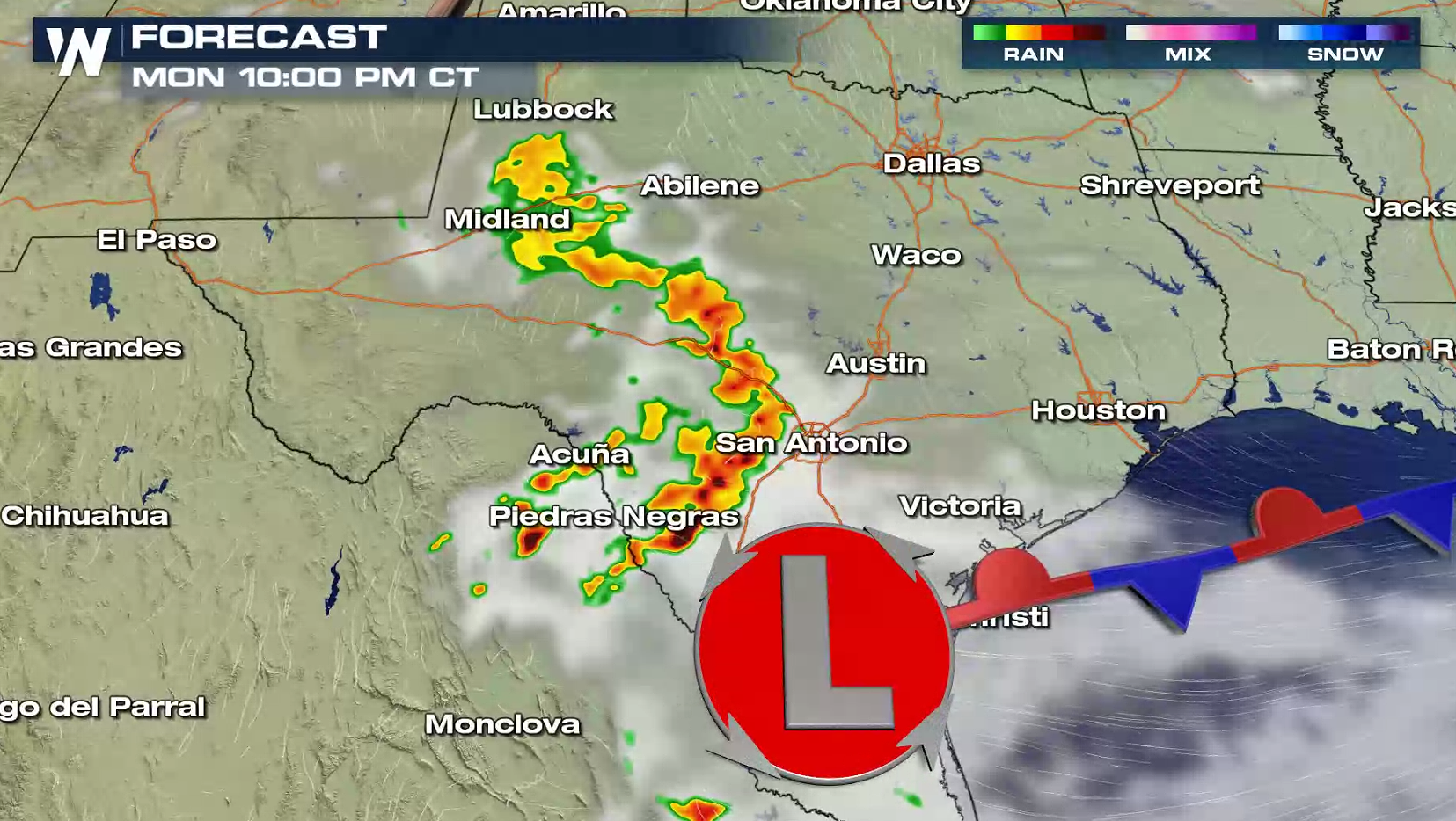 Heavy rain will also be a concern. Some areas could see more than 3" of rain, which could produce flooding in isolated areas.
 Have a severe weather plan in place, in case you need to take shelter this week if threatening storms approach your area. Be sure to check back with WeatherNation on-air and online if you are in the severe weather risk areas.
For WeatherNation: Meteorologist Mace Michaels

 A compact upper-level low pressure system is digging across the Southwest. The strong Jet Stream energy will interact with increasing instability to create severe storms in the late afternoon and early evening.

 A few storms will be moving through areas of western Texas around midday. Storms are expect to expand and intensify in the late afternoon, taking advantage of the heat and humidity in place over the region. Storms will remain strong to severe into the night while moving eastward.


 Heavy rain will also be a concern. Some areas could see more than 3" of rain, which could produce flooding in isolated areas.

 Have a severe weather plan in place, in case you need to take shelter this week if threatening storms approach your area. Be sure to check back with WeatherNation on-air and online if you are in the severe weather risk areas.
For WeatherNation: Meteorologist Mace Michaels
Have a severe weather plan in place, in case you need to take shelter this week if threatening storms approach your area. Be sure to check back with WeatherNation on-air and online if you are in the severe weather risk areas.
For WeatherNation: Meteorologist Mace MichaelsAll Weather News
More