Severe Thunderstorms Possible Across the South on Sunday

While much of the country will be impacted by wintry weather, a small portion of the south will be impacted by severe storms today! Portions of Florida and Georgia are feeling the warmth, and this warm air mass will collide with the advancing cold front, bringing severe thunderstorm risks through Sunday night. Several severe thunderstorm warnings and tornado warnings have already been issued.
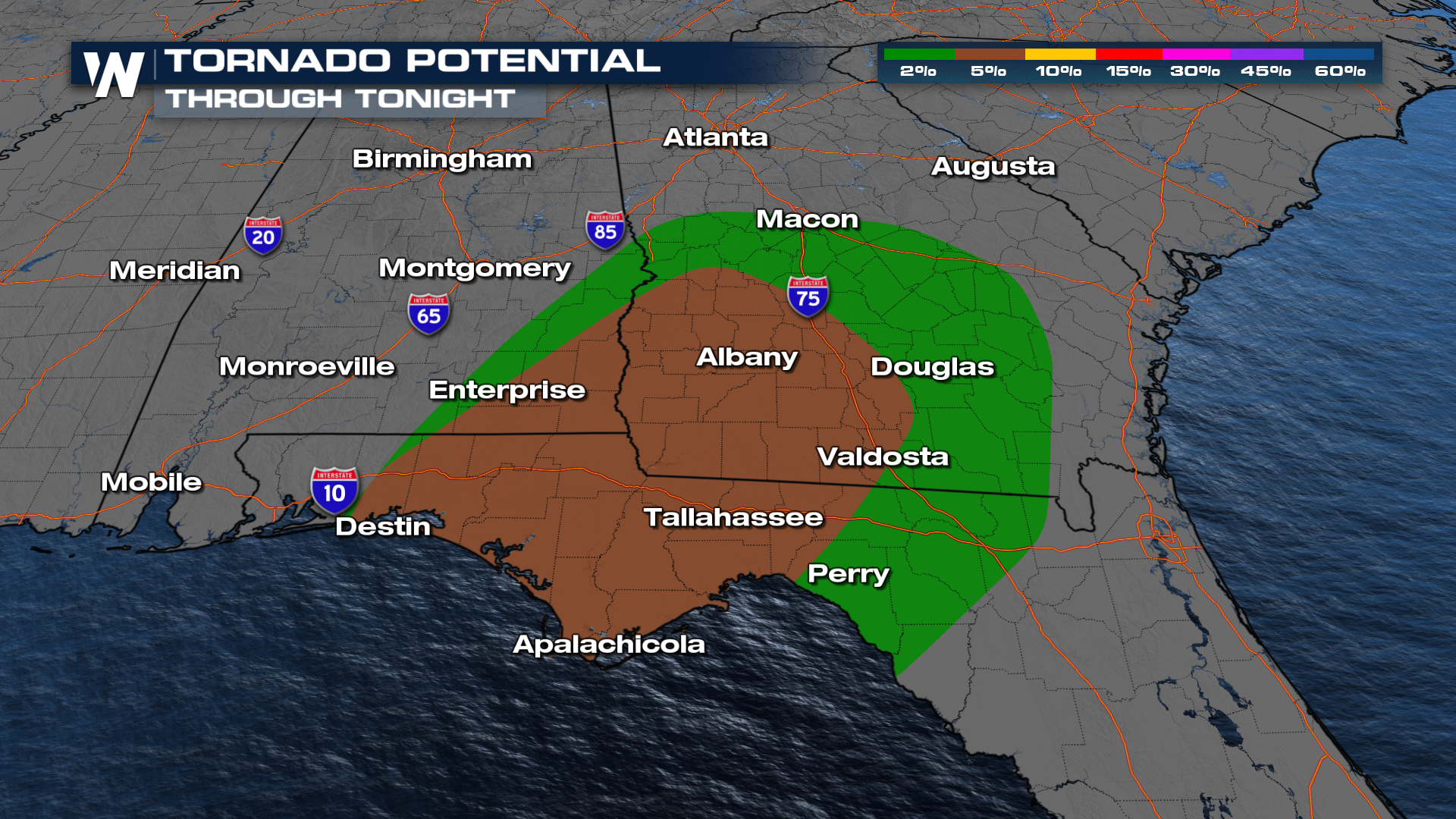
With enough instability, the Storm Prediction Center (SPC) is issuing a large Slight risk (level 2 out of 5) for severe weather through Sunday. Strong winds and tornadoes remain possible.
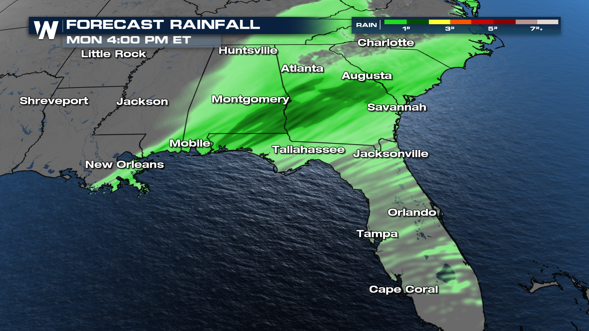
 Heavy rain will also be a factor as these storms move through. Our model data shows swaths of heavy rain across Mississippi and Alabama. There is an isolated flooding threat for portions of Alabama and northern Georgia through tonight.
 We'll continue to update this developing story in the coming hours and days. Stay with WeatherNation for the latest, and watch your Southeast Regional Forecast every 10 minutes past the hour!


