Severe Weather Forecast Through Midweek - Active in the Northern Plains
Special Stories
2 Jul 2018 11:35 AM
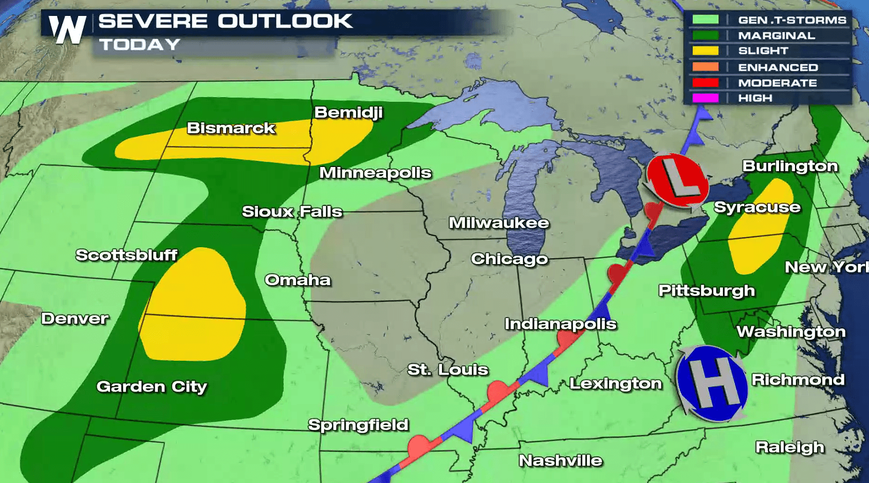
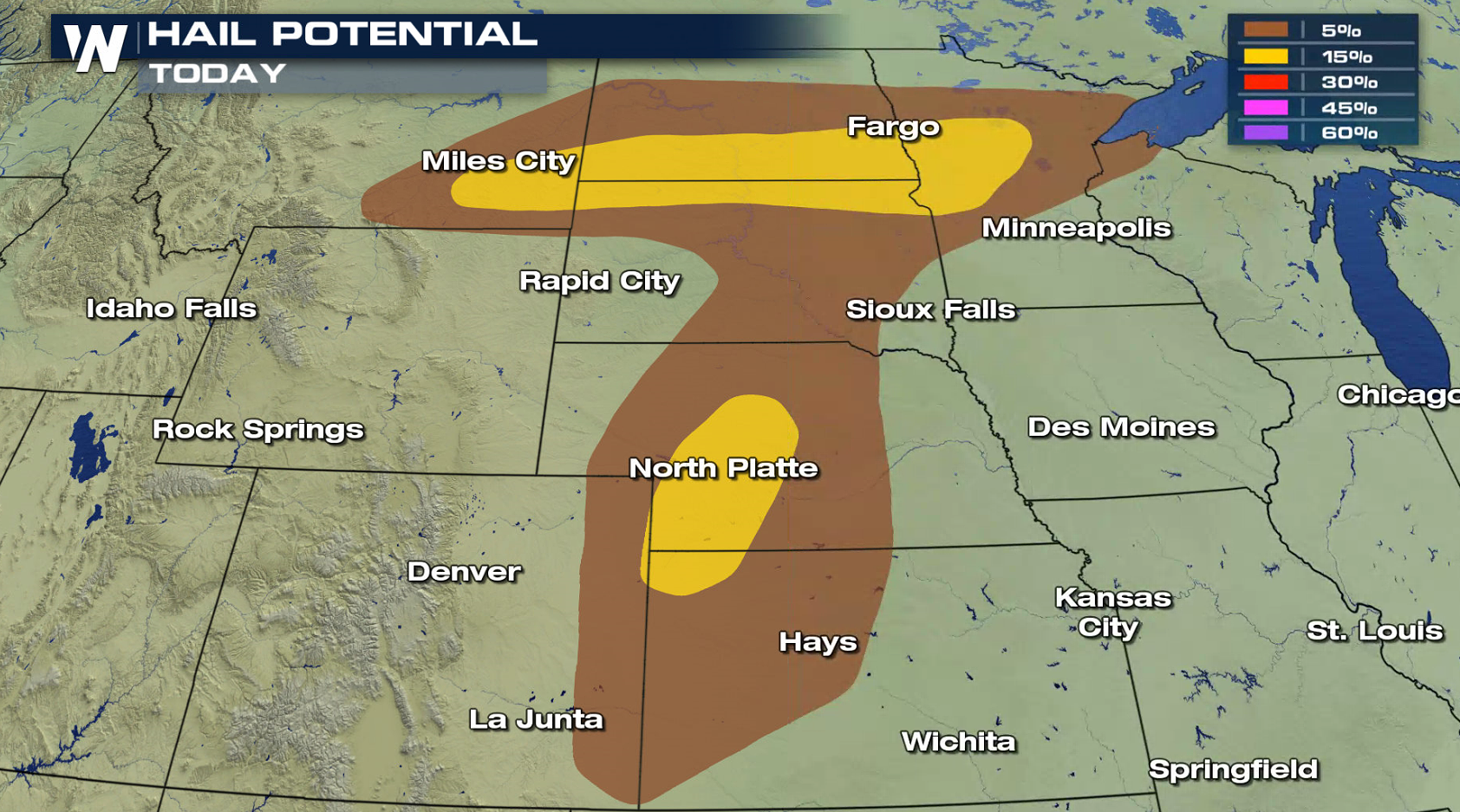
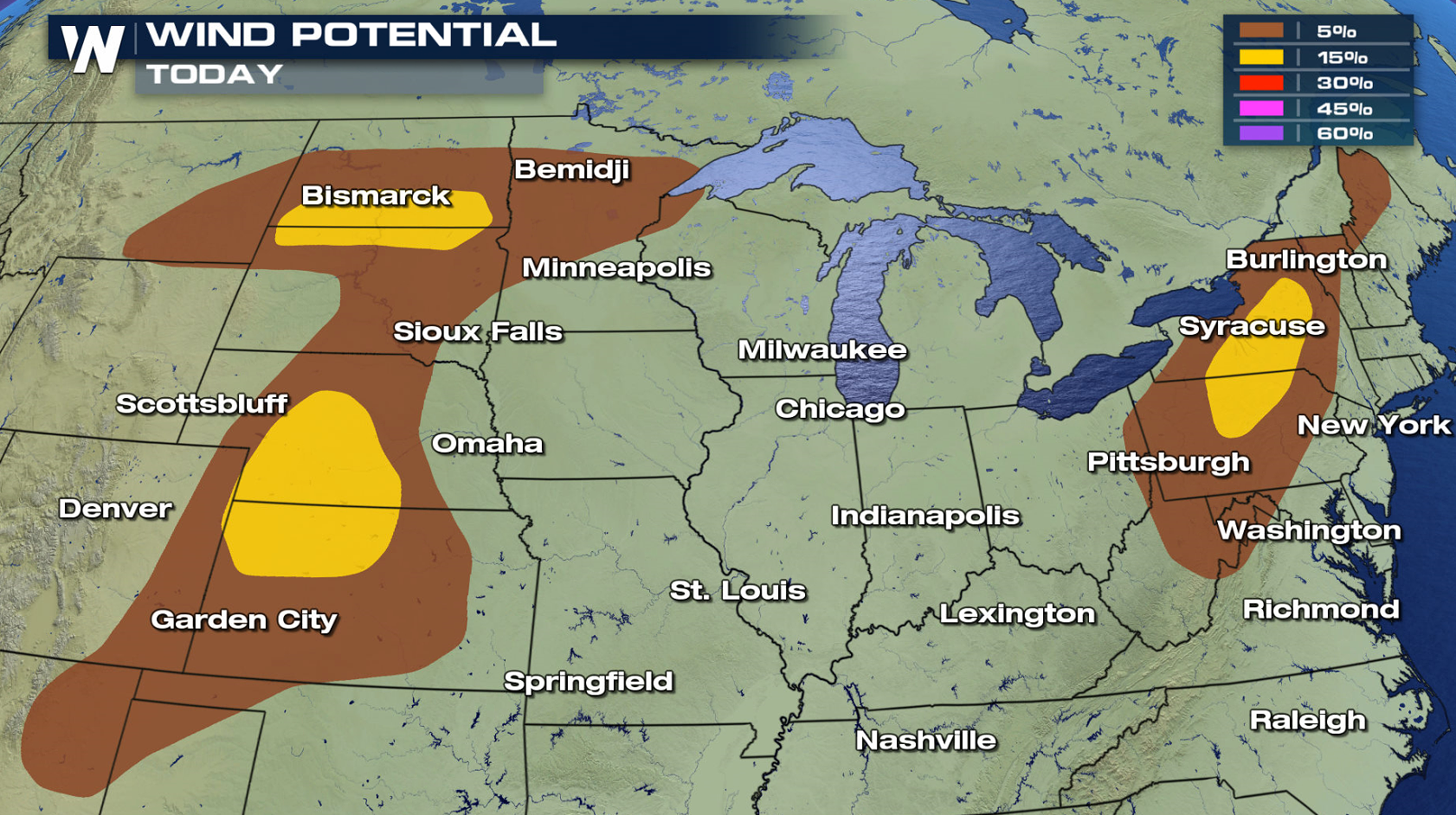
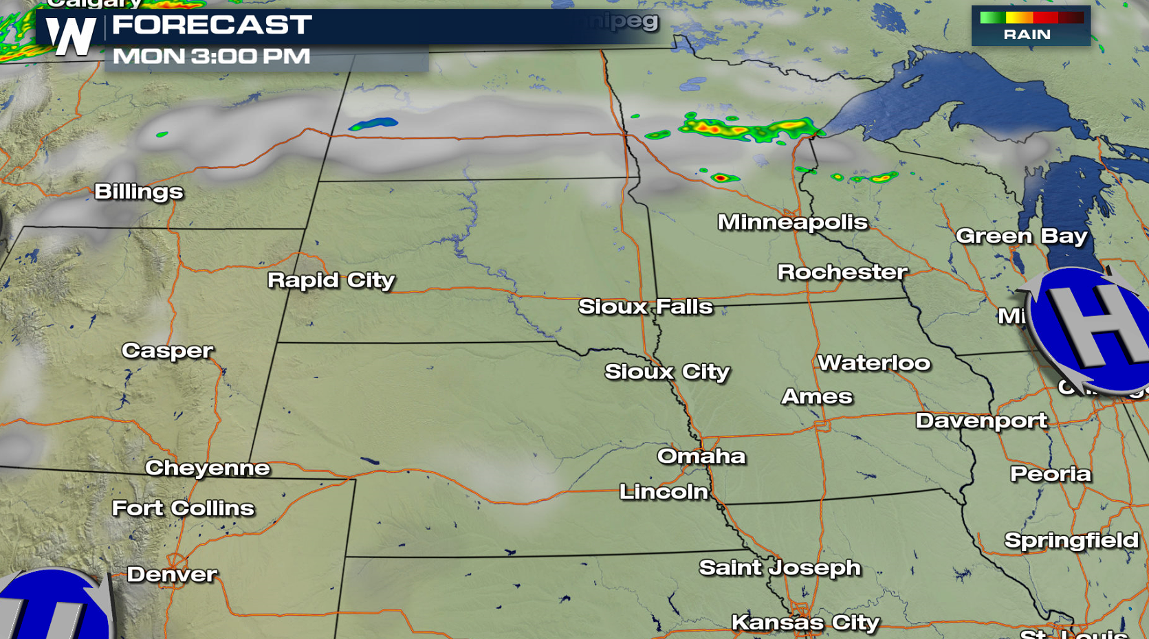
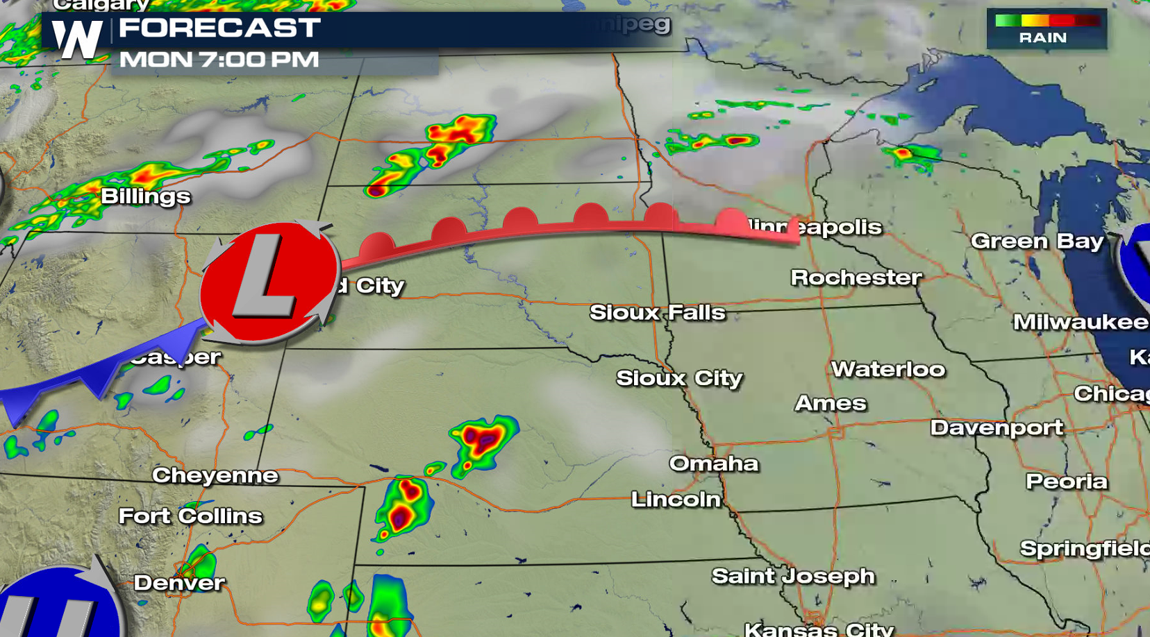
Pockets of severe weather are possible today (Monday) in the Plains and Northeast, with active weather expected to continue through Independence Day in the Upper Midwest. Hail greater than 1" in diameter and wind gusts above 60 mph are the main threats, but an isolated tornado may occur later this evening (Monday).
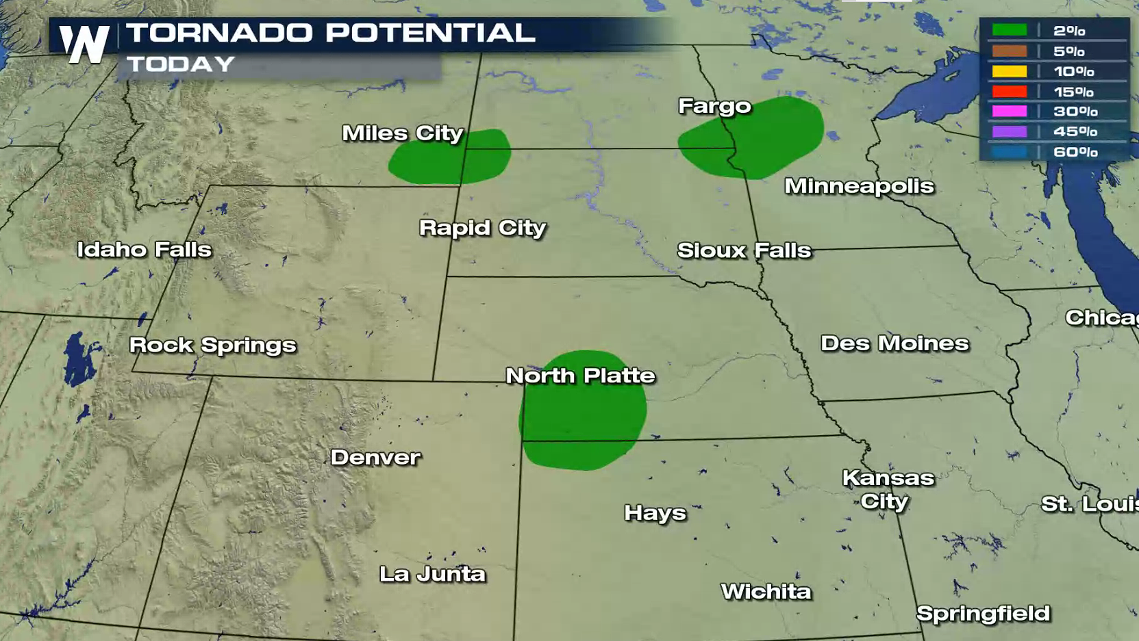 A warm front and low pressure center moving into the northern Plains will be the focus for thunderstorm development in the early evening. Storms are expected to blossom throughout the evening, taking advantage of heat, humidity, and low level wind shear.
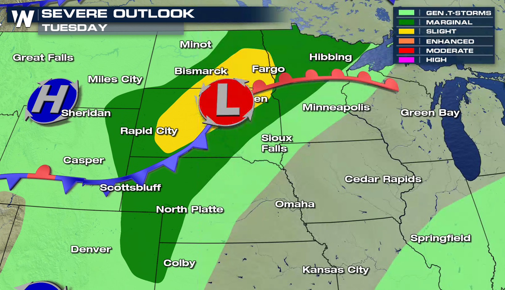
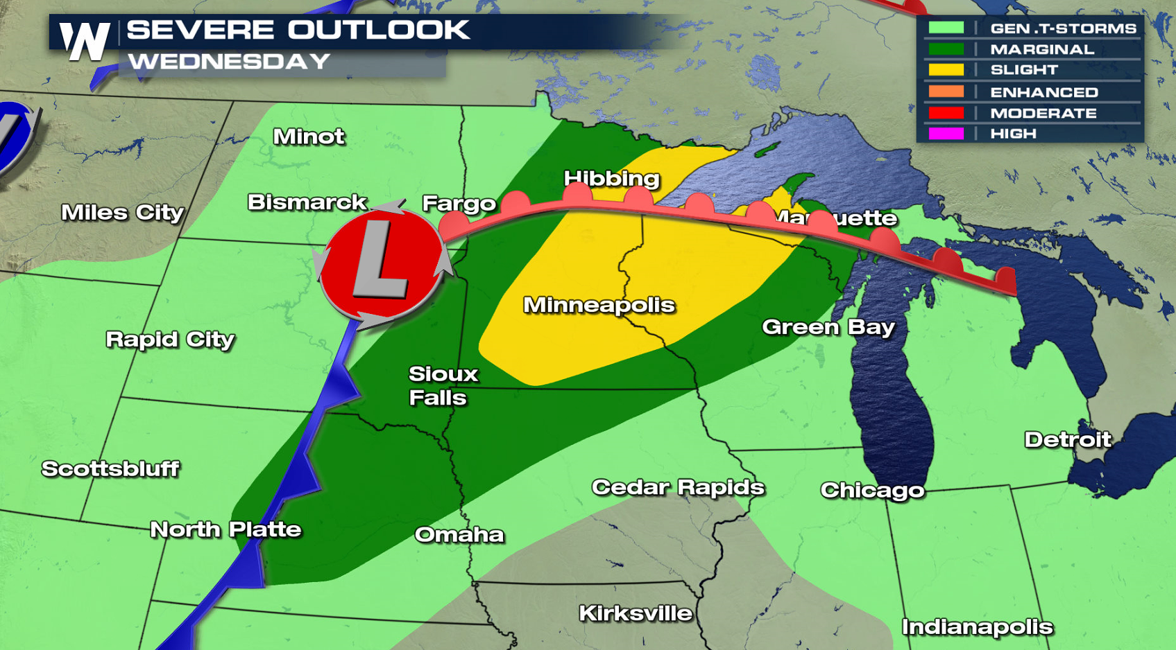
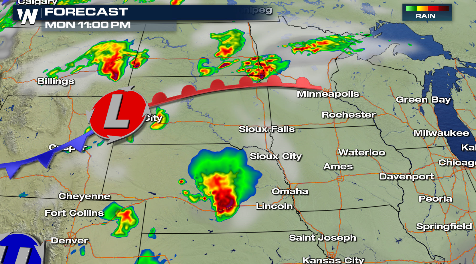 The system moves slowly through the Upper Midwest on Tuesday and Wednesday, keeping severe weather in the forecast through Independence Day.
 For WeatherNation: Meteorologist Mace Michaels
A warm front and low pressure center moving into the northern Plains will be the focus for thunderstorm development in the early evening. Storms are expected to blossom throughout the evening, taking advantage of heat, humidity, and low level wind shear.
The system moves slowly through the Upper Midwest on Tuesday and Wednesday, keeping severe weather in the forecast through Independence Day.
For WeatherNation: Meteorologist Mace MichaelsAll Weather News
More
Heavy Rain Returns to Texas This Weekend
It has been over a week since the devastating
13 Jul 2025 3:15 AM

Timeline: How Catastrophic Flooding Unfolded in Texas Hill Country
TEXAS - Catastrophic flooding devastated port
13 Jul 2025 3:10 AM

Watching the Gulf and Atlantic for Tropical Development, CSU Updates Seasonal Forecast
BREAKING: The National Hurricane Center is no
13 Jul 2025 3:00 AM

Heavy Rain, Flooding Threat Returns to Florida
Keep the rain boots handy in Florida - heavy
13 Jul 2025 2:50 AM

Building Heat for West Coast Next Week
High pressure is moving off the California co
13 Jul 2025 2:50 AM

Severe Storm Risk Pushes into the Great Lakes, Ohio Valley
Friday was another busy day with severe weath
12 Jul 2025 8:00 PM

Storms Return From the Front Range to Texas
Moisture is moving back into the Central and
12 Jul 2025 2:50 AM