Severe Weather for the Florida Panhandle and Carolinas
Special Stories
4 Dec 2020 2:00 PM
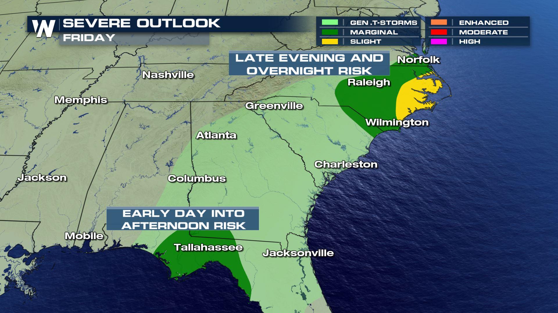
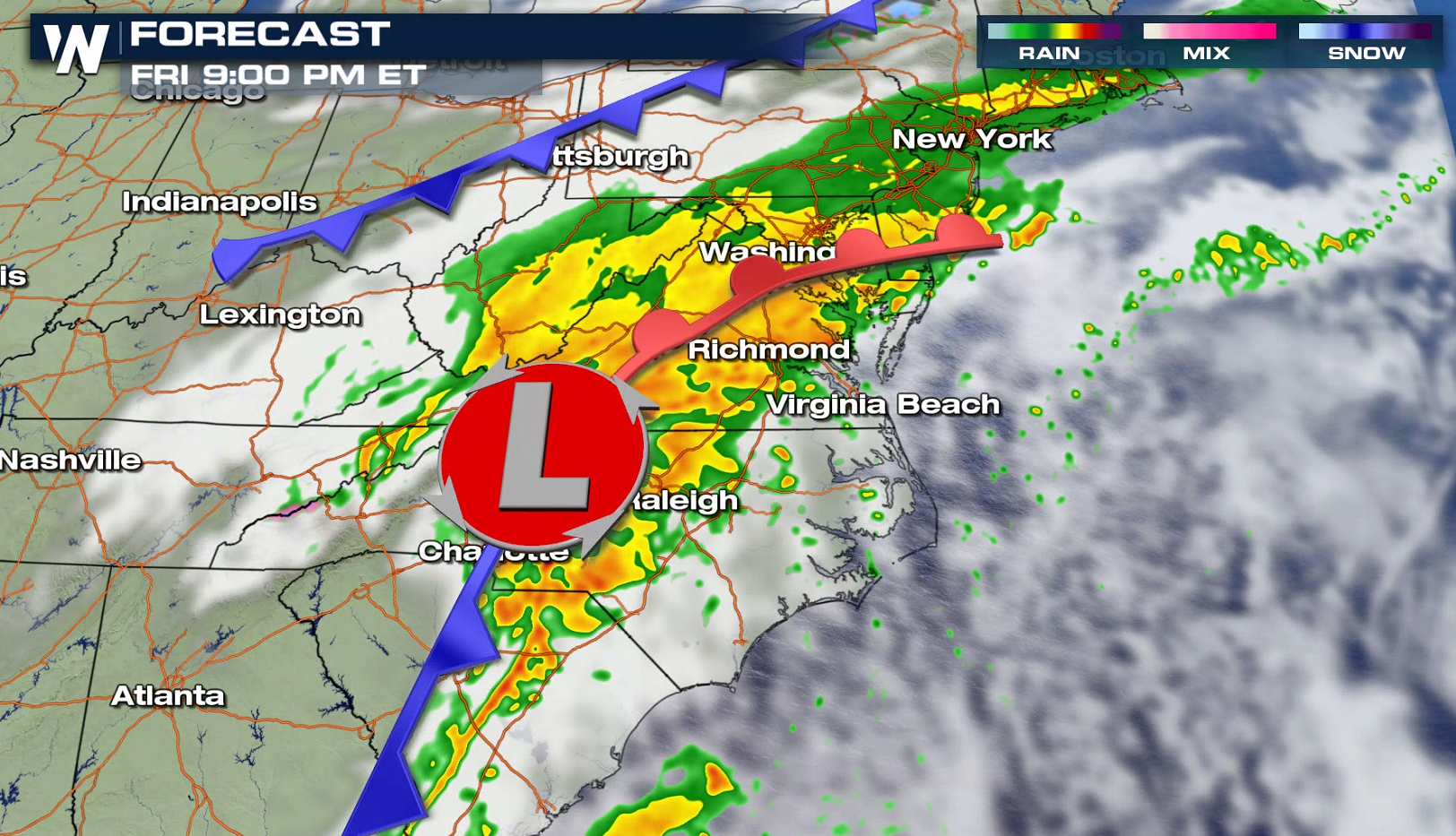
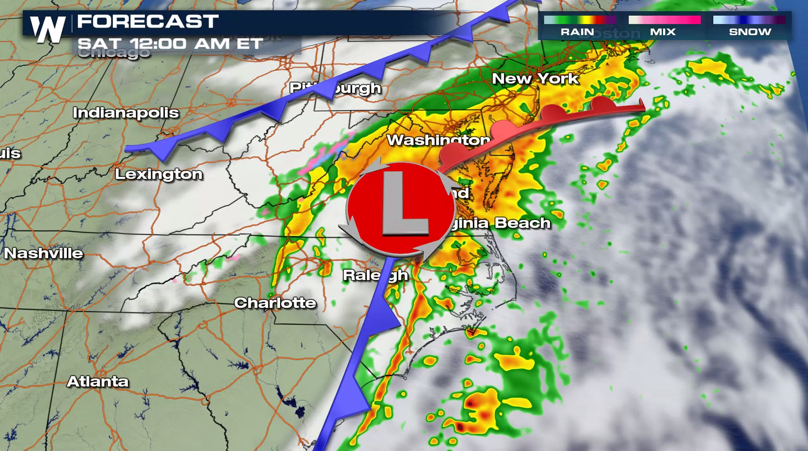
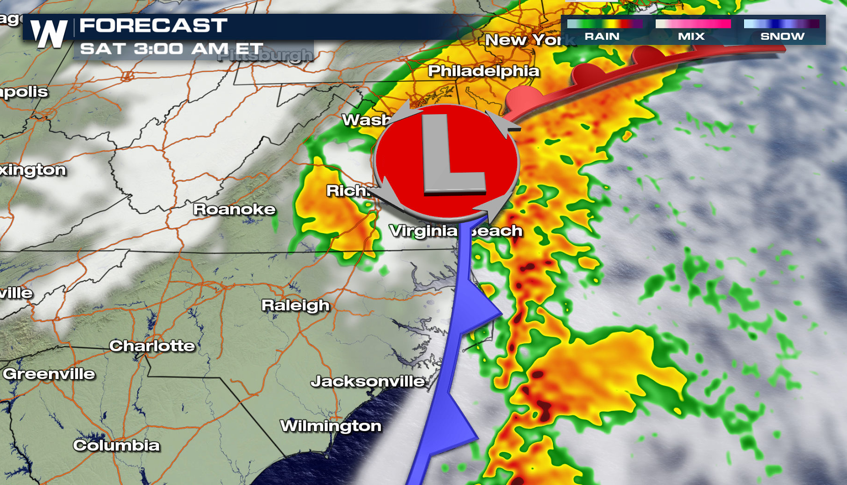
A storm system moving through the Lower Mississippi Valley will curve northward toward the Appalachians today (Friday), bringing a threat for severe thunderstorms. There is a marginal risk (level 1 on a scale from 1 to 5) for the Florida Panhandle for the first half of the day, and in eastern North and South Carolina later this evening and night.
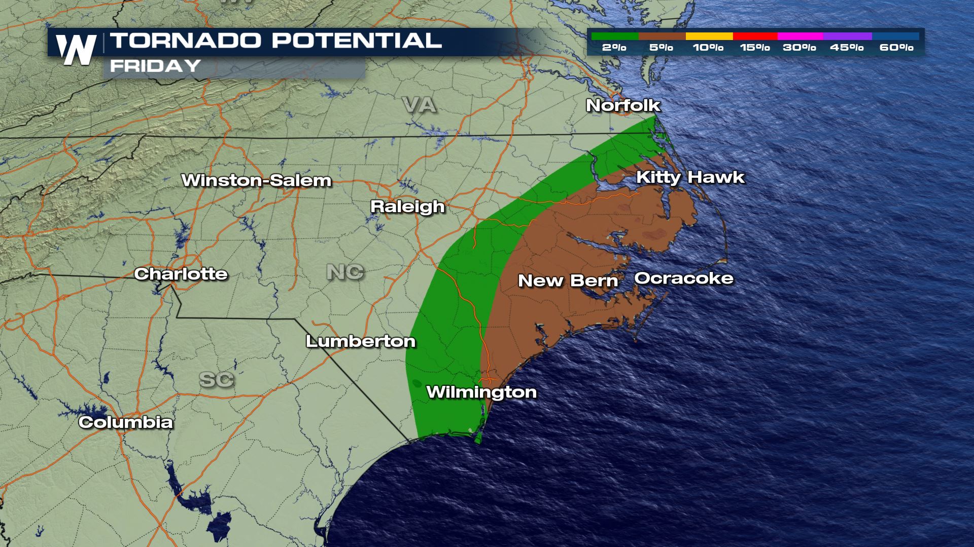
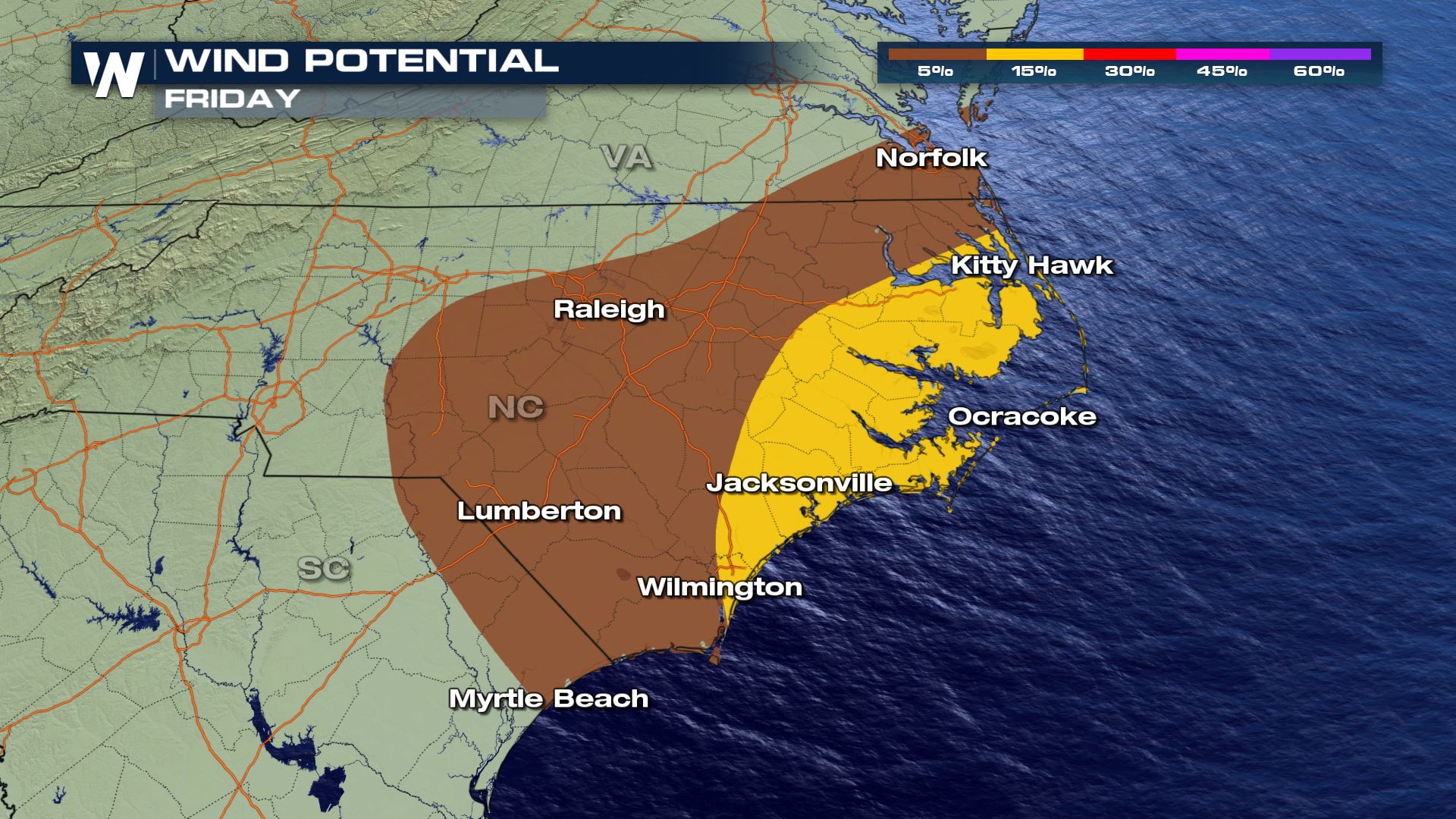 Strong wind gusts and isolated tornadoes are the main severe weather threats. Increasing humidity from the Gulf of Mexico, robust jet stream energy, and moderate instability will support severe thunderstorm development.
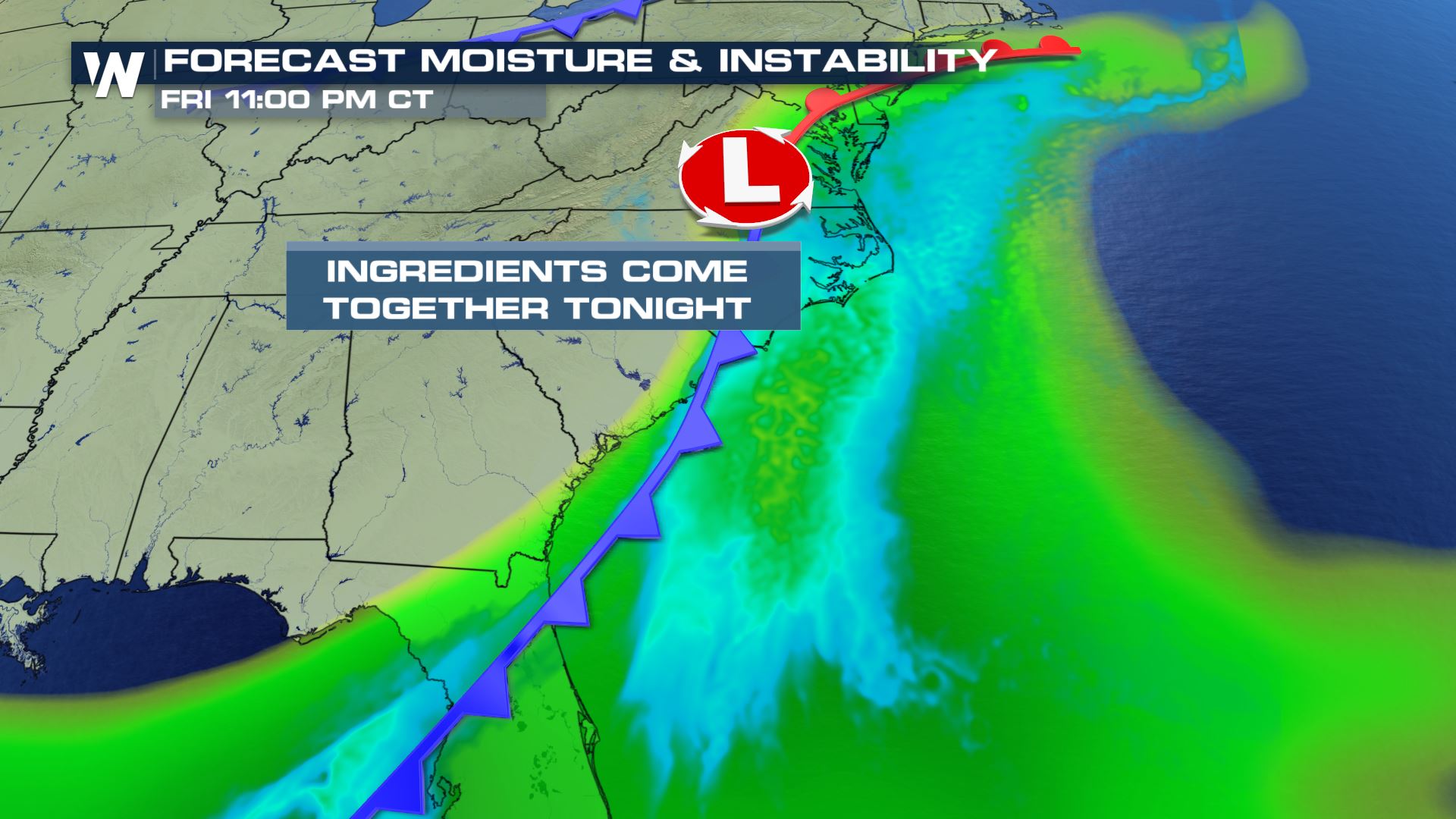 The storm will curve northward throughout the day, bringing heat, humidity and instability. This will lead to additional thunderstorm developing for tonight and again, some severe.
 Check in with WeatherNation throughout the day for updates on-air and online for the latest on severe thunderstorm development.
Strong wind gusts and isolated tornadoes are the main severe weather threats. Increasing humidity from the Gulf of Mexico, robust jet stream energy, and moderate instability will support severe thunderstorm development.
The storm will curve northward throughout the day, bringing heat, humidity and instability. This will lead to additional thunderstorm developing for tonight and again, some severe.
Check in with WeatherNation throughout the day for updates on-air and online for the latest on severe thunderstorm development.All Weather News
More
After Reaching Category 5, Genevieve Weakens in the Pacific
PacificGenevieve formed on last Friday south
2 Aug 2026 1:25 PM

More Storms for the East Sunday and Monday
A low-pressure system crashing through the Mi
2 Aug 2026 1:25 PM


Wildfire Outbreak in the Pacific Northwest
Conditions have been incredibly dry out west.
2 Aug 2026 12:20 PM

Flooding, Severe Storms Target the Midwest Again
After an active week of storms across the nor
1 Aug 2026 1:40 AM

Flooding Risk Increases as Heavy Rain Targets the Tri-State Area
Tuesday, heavy rainfall moved across the Nort
30 Jul 2026 12:25 AM

Severe Weather: Energy From the Midwest Now in the Southeast
UPPER MIDWEST - Through Monday, dangerous tor
29 Jul 2026 10:30 PM