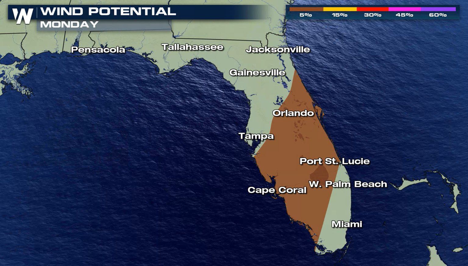
Severe Weather Likely for the Southeast and East Coast Monday
Special Stories
30 Nov 2020 9:00 AM
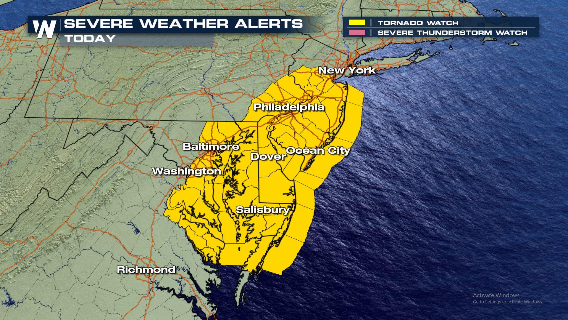
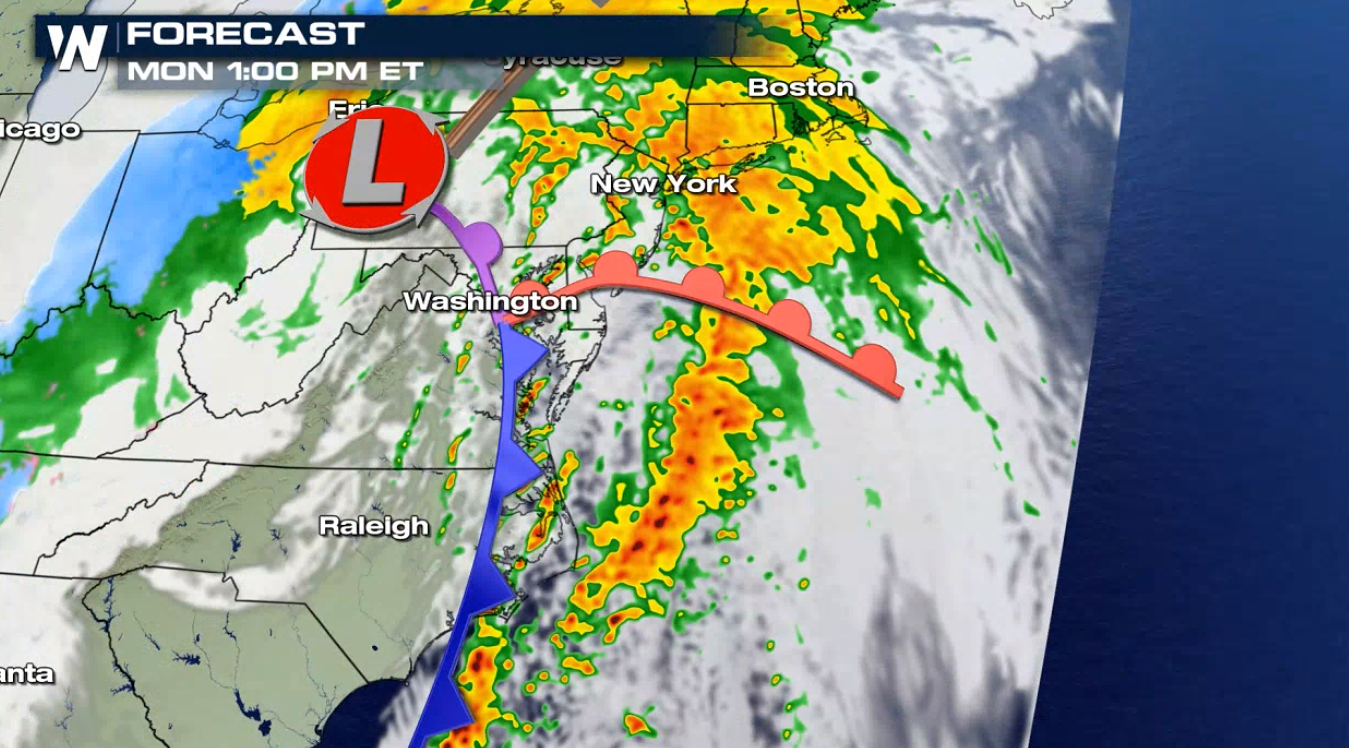
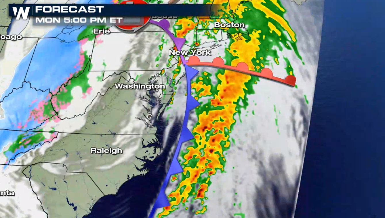
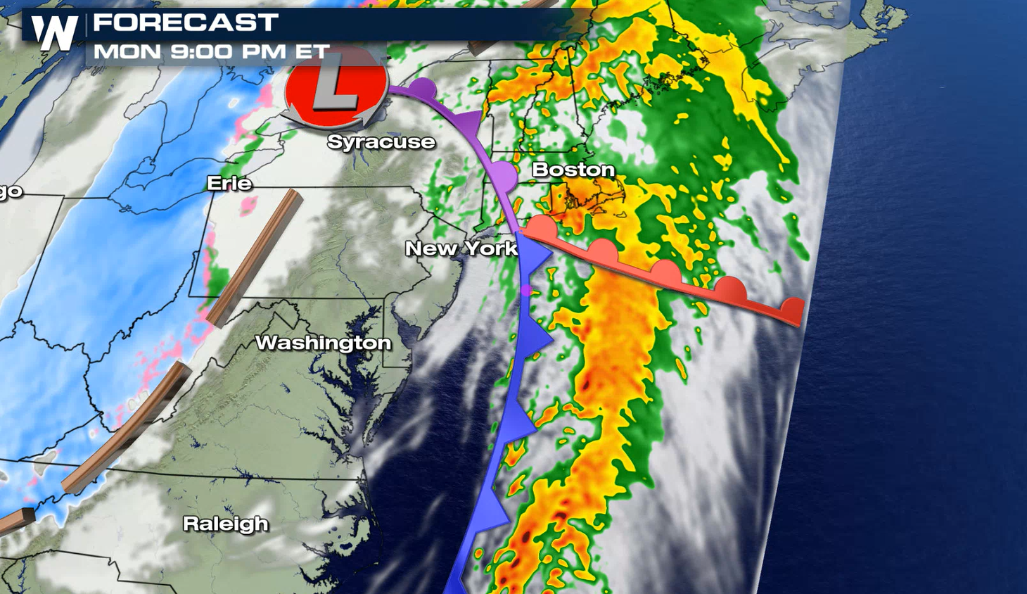
*Breaking* A tornado watch has been issued for parts of Maryland, Delaware, New Jersey and Pennsylvania through Monday evening.
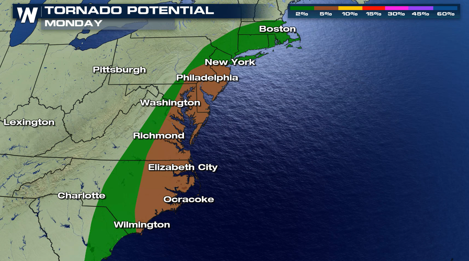
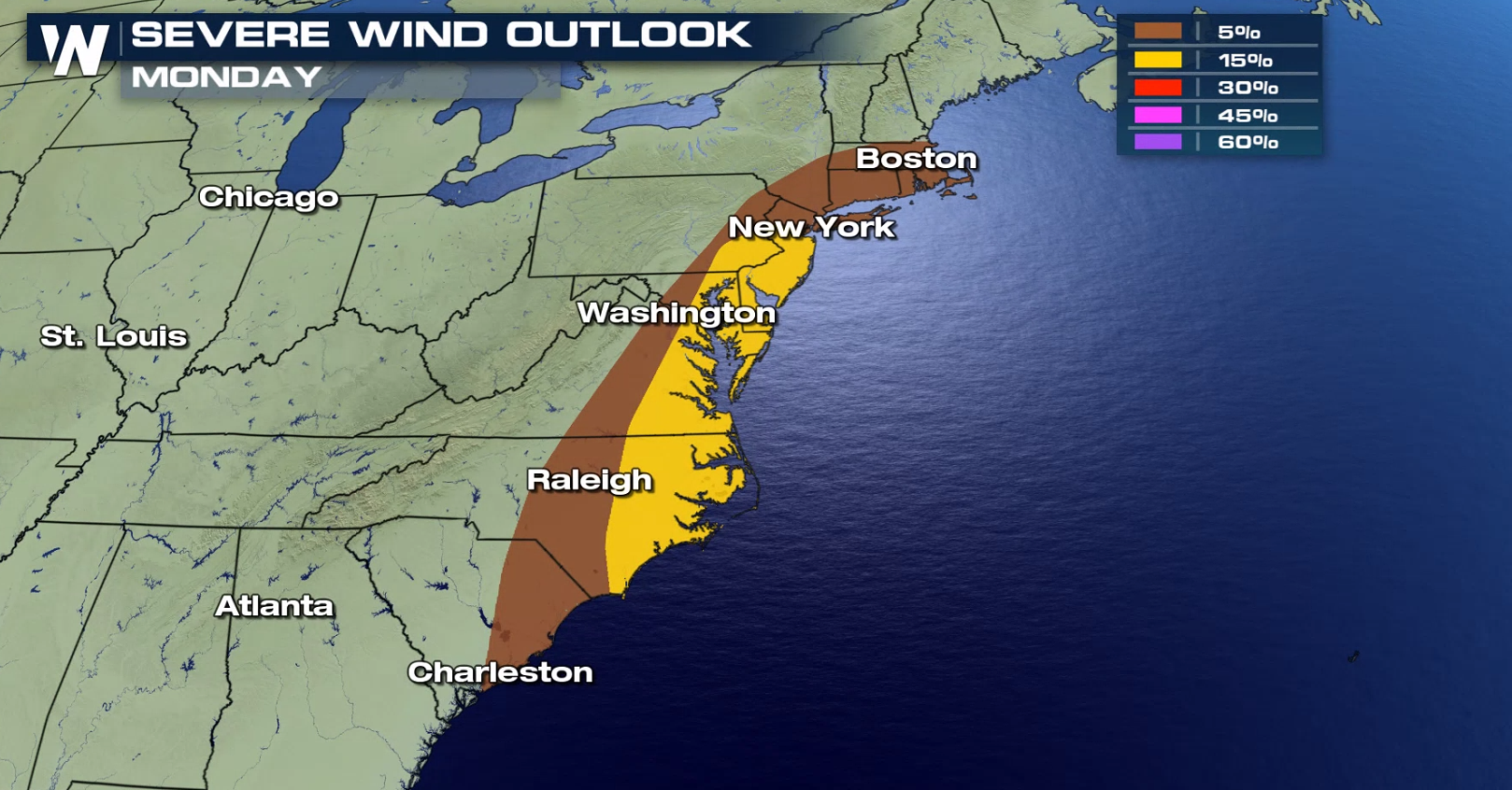
 Jet stream energy will allow for a severe set-up and create deep and strong wind shear across the Middle Atlantic, leading to the potential for storms to create damaging wind gusts and perhaps a few isolated tornadoes.
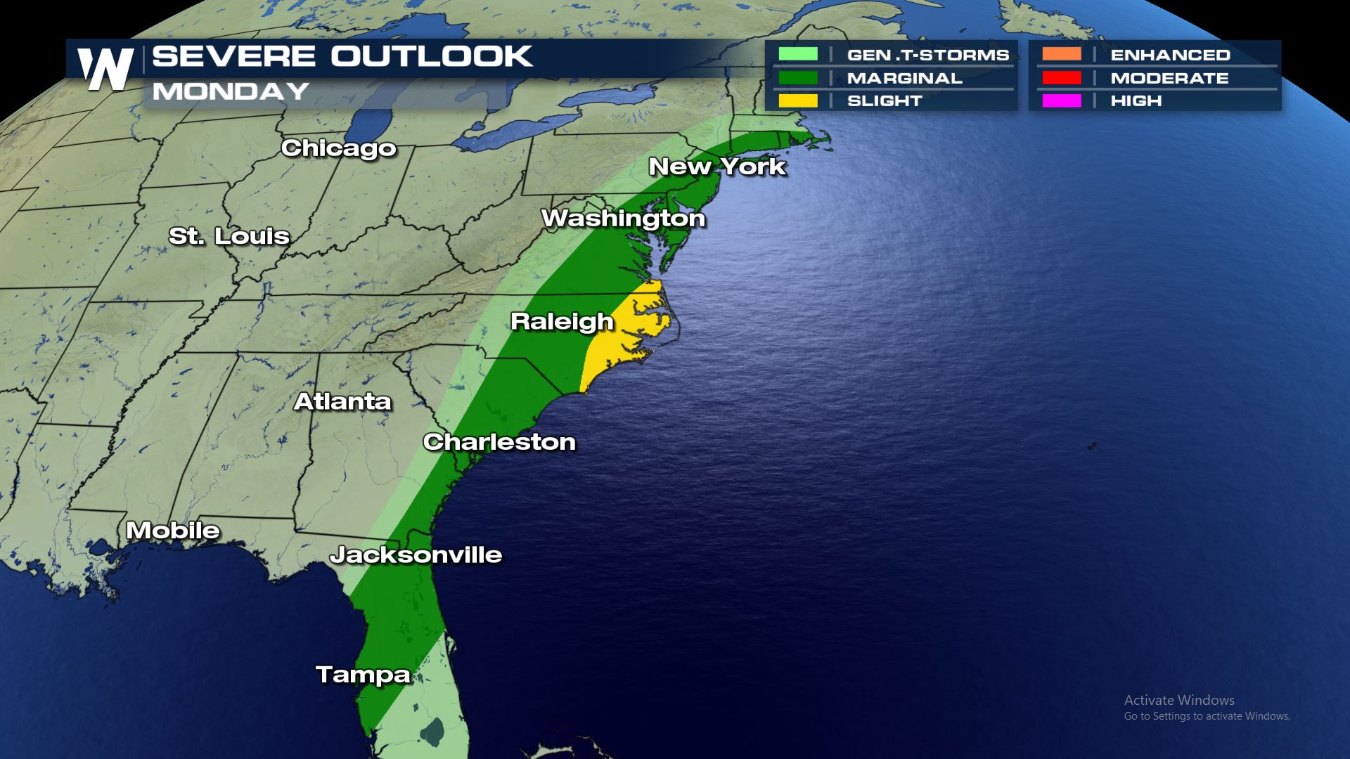 Tornadoes and damaging winds will be the primary weather risks with this severe set-up. The hail potential is low.
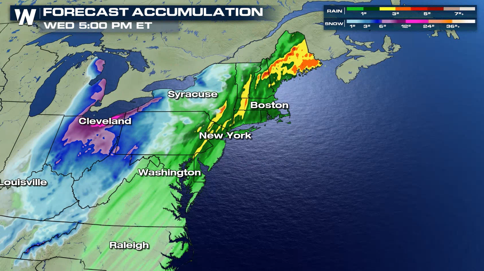
 The cold front will sweep through the Middle Atlantic during the day, bringing a few severe thunderstorms. Heavy rain and isolated severe storms into the Northeast.
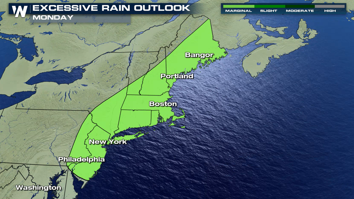
 Rain totals will be anywhere from 1-4" with locally higher amounts possible. Flooding from heavy rain will be another hazard, especially in flood prone areas.
 Stay with WeatherNation for the latest on this powerful system and other top weather headlines.
Jet stream energy will allow for a severe set-up and create deep and strong wind shear across the Middle Atlantic, leading to the potential for storms to create damaging wind gusts and perhaps a few isolated tornadoes.
Tornadoes and damaging winds will be the primary weather risks with this severe set-up. The hail potential is low.
The cold front will sweep through the Middle Atlantic during the day, bringing a few severe thunderstorms. Heavy rain and isolated severe storms into the Northeast.
Rain totals will be anywhere from 1-4" with locally higher amounts possible. Flooding from heavy rain will be another hazard, especially in flood prone areas.
Stay with WeatherNation for the latest on this powerful system and other top weather headlines.All Weather News
More

Western Heat Continues With Some Relief
A large dome of hot high pressure remains acr
1 Jul 2025 11:00 PM

NHC Monitoring Front in the Southeast Ahead of 4th of July
SOUTHEAST - A frontal boundary moving through
1 Jul 2025 10:35 PM

Severe Storms For the East Coast Through Tuesday
A cold front is tapping into a moist air mass
1 Jul 2025 10:20 PM

Where Rain Could Dampen Holiday Travel Plans
AAA is expecting over 70 million travelers to
1 Jul 2025 4:35 PM

Severe Weather Threat Continues in the Midwest
It has been an active, severe season across t
30 Jun 2025 9:00 PM

Thunderstorms Possible in the Southeast Overnight
SOUTHEAST - Strong thunderstorms have develop
28 Jun 2025 2:40 AM