Severe Weather Possible in the High Plains and Upper Midwest
Special Stories
9 Jul 2018 8:59 AM
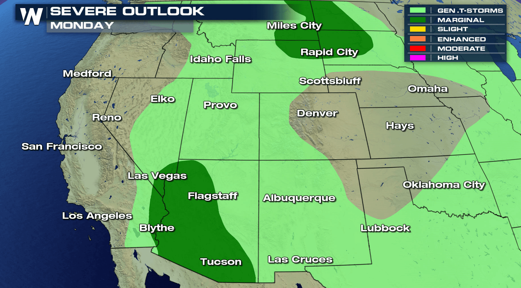
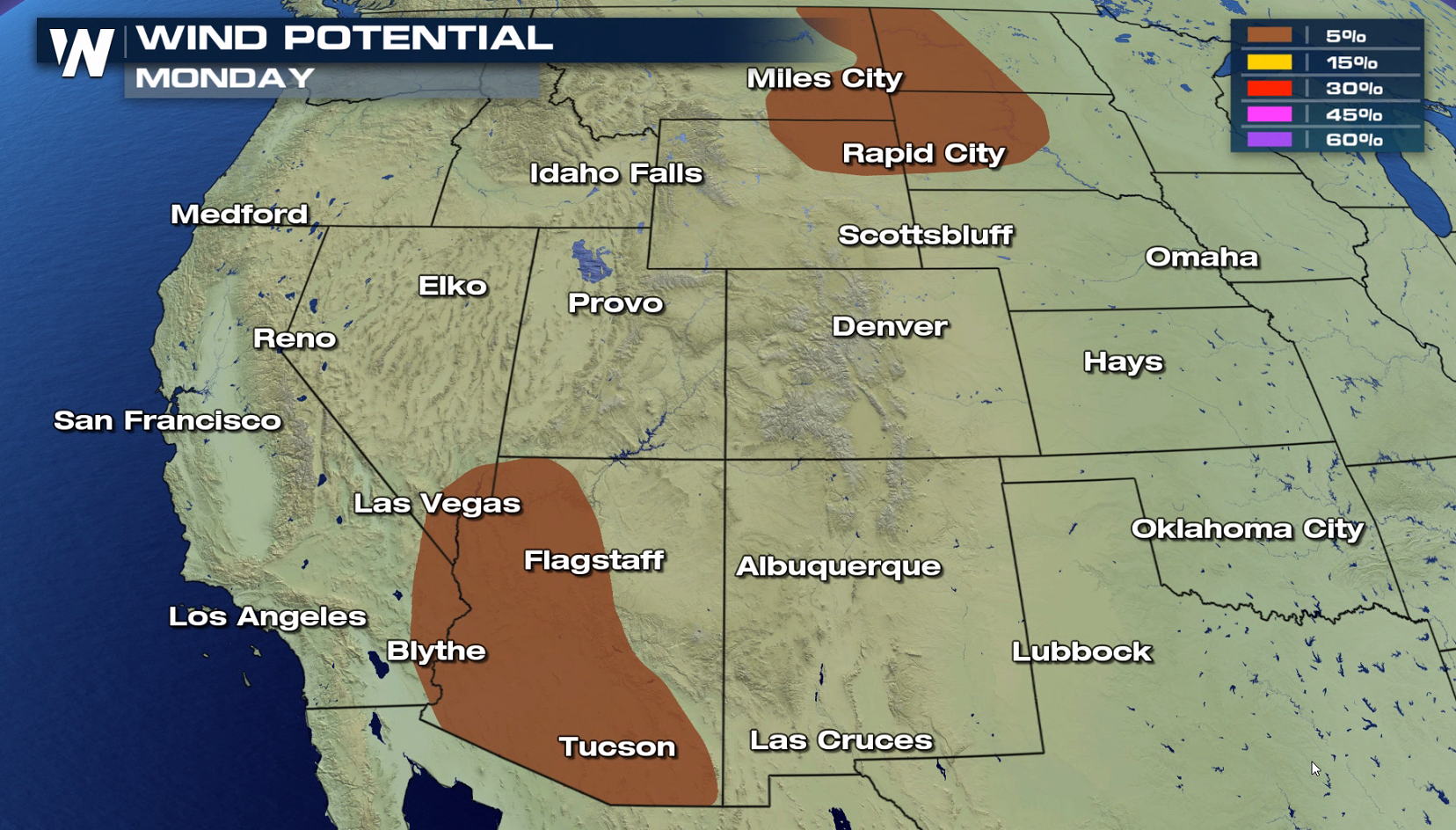
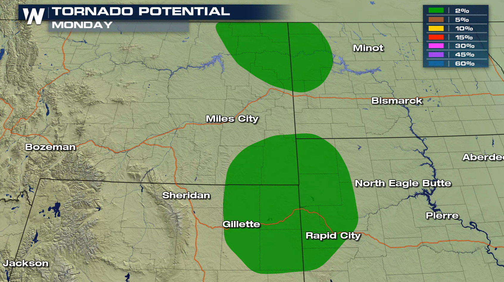
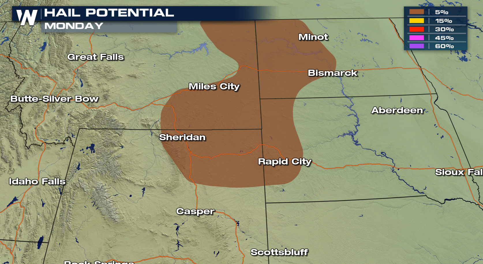
An active Jet Stream pattern across the northern tier of the nation will be the focus for severe weather this week, similar to last week. There is a marginal risk for severe thunderstorms in parts of Montana, Wyoming, North Dakota and South Dakota today (Monday), centered near a warm front and low pressure center. Monsoonal storms may also produce a few severe storms later this afternoon and evening.
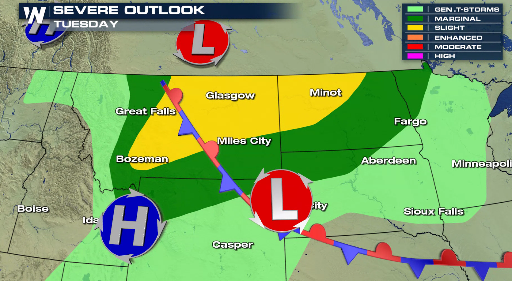
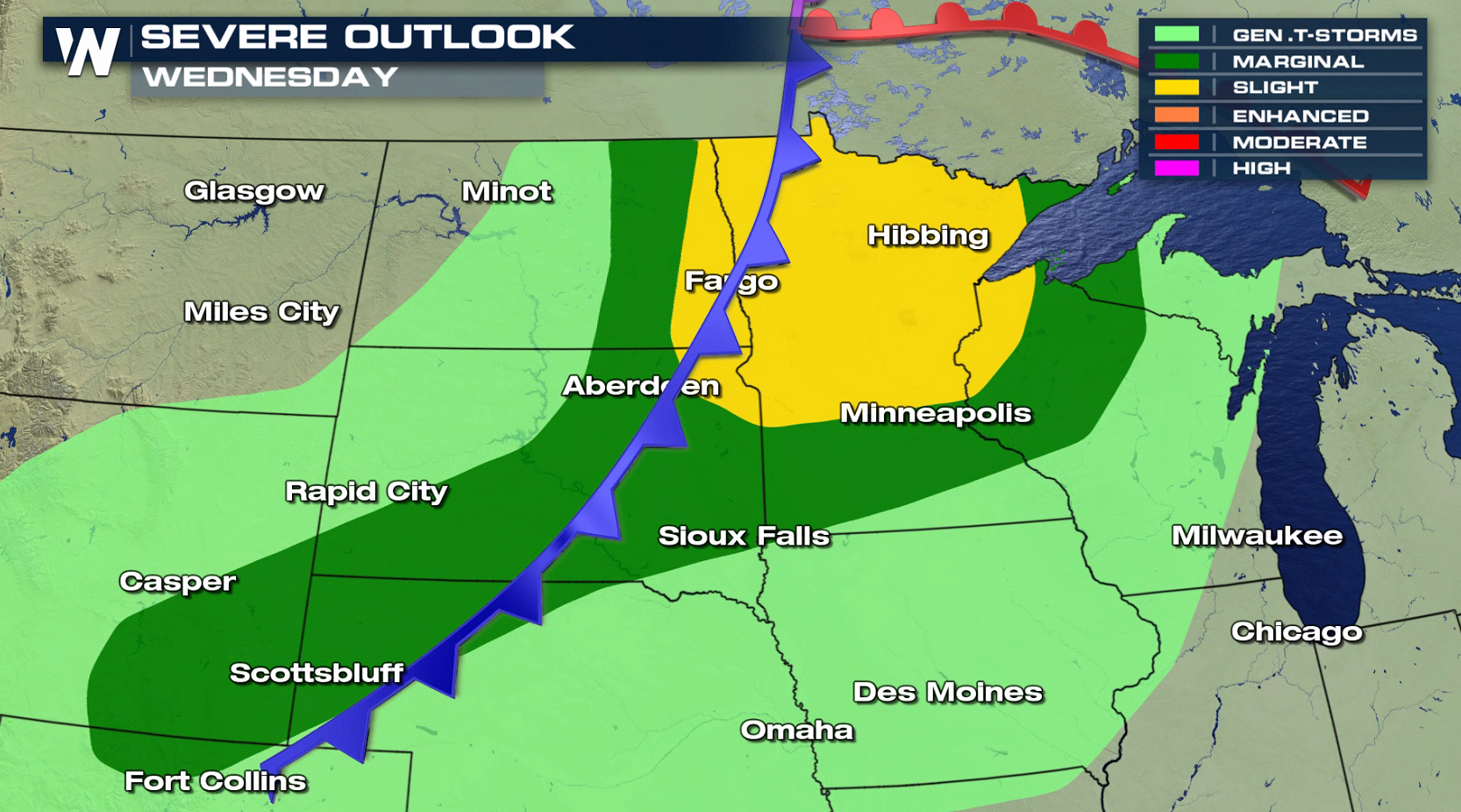
 As a stronger low develops in Canada near the front, a more organized area of severe thunderstorms is expected to develop and move through the region into the middle of the week. There is a slight risk for severe thunderstorms in Montana and North Dakota Tuesday, shifting eastward to include Minnesota and Wisconsin Wednesday.
 For WeatherNation: Meteorologist Mace Michaels
As a stronger low develops in Canada near the front, a more organized area of severe thunderstorms is expected to develop and move through the region into the middle of the week. There is a slight risk for severe thunderstorms in Montana and North Dakota Tuesday, shifting eastward to include Minnesota and Wisconsin Wednesday.
For WeatherNation: Meteorologist Mace MichaelsAll Weather News
More

Flooding, Severe Storms Target the Midwest Again
After an active week of storms across the nor
1 Aug 2026 1:40 AM


After Reaching Category 5, Genevieve Weakens in the Pacific
PacificFausto is now a post-tropical cyclone.
31 Jul 2026 1:30 AM

Flooding Risk Increases as Heavy Rain Targets the Tri-State Area
Tuesday, heavy rainfall moved across the Nort
30 Jul 2026 12:25 AM

Severe Weather: Energy From the Midwest Now in the Southeast
UPPER MIDWEST - Through Monday, dangerous tor
29 Jul 2026 10:30 PM