Severe Weather Possible in the Great Lakes and Plains
Special Stories
10 Jul 2019 10:17 AM
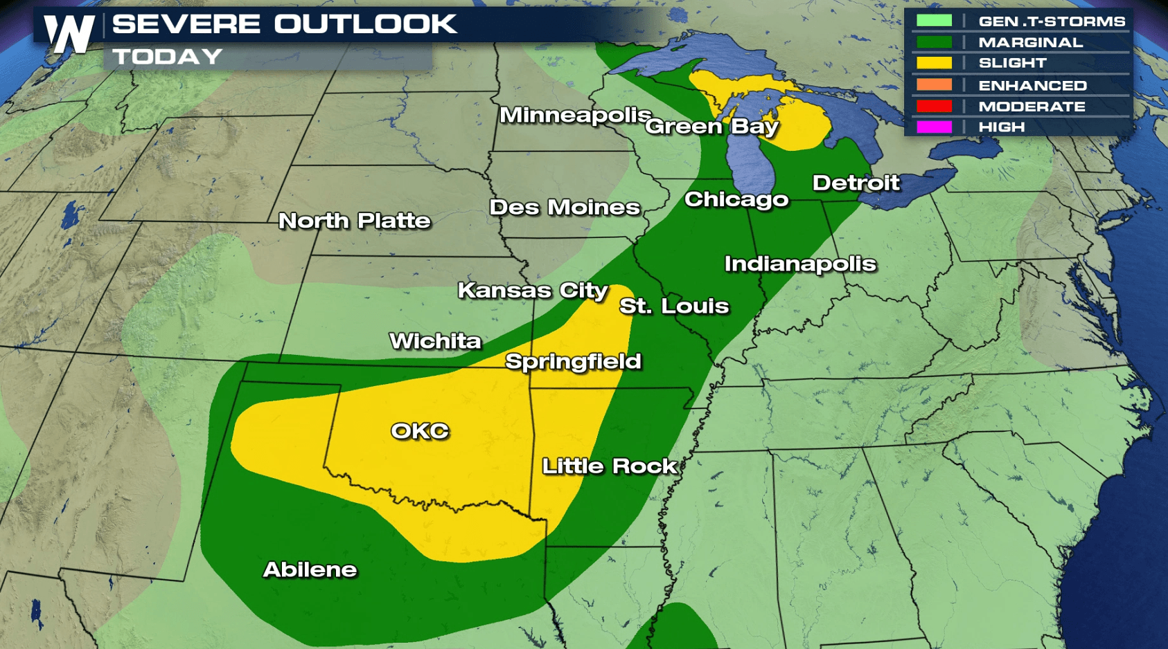
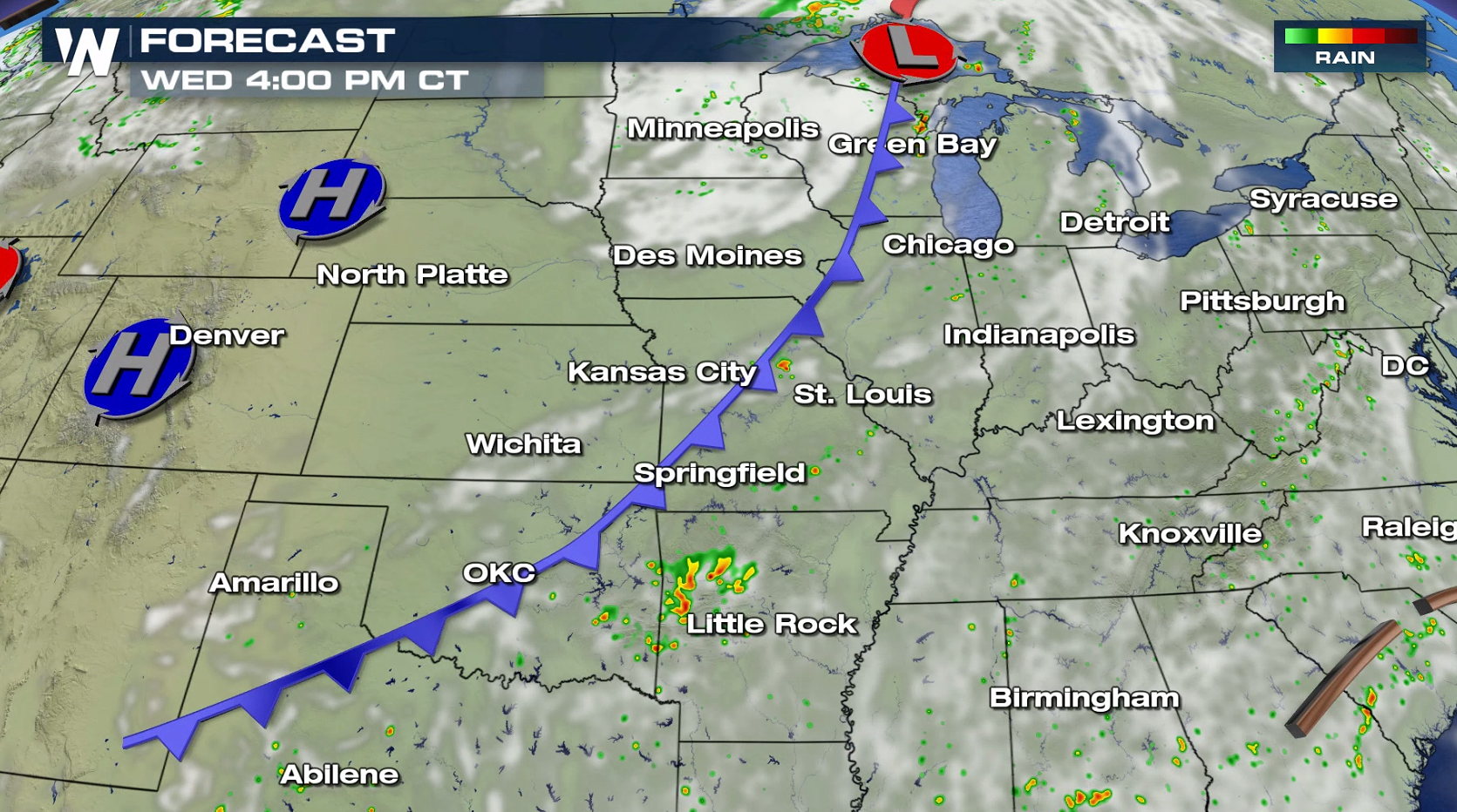
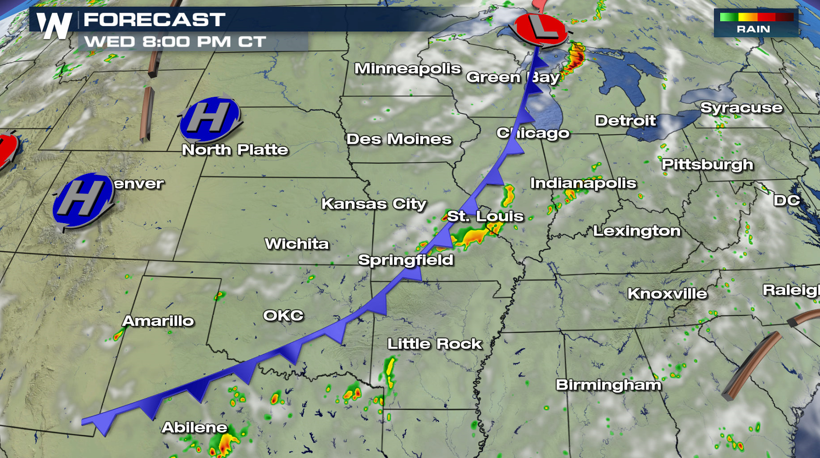
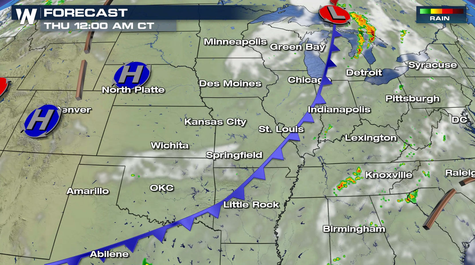
A slow moving storm system stretched out from the Great Lakes to the Southern Plains will bring the threat for severe thunderstorms late this afternoon into the evening. There is a slight risk for severe weather in Michigan near the low pressure center, and along the cold front from Missouri to Texas.
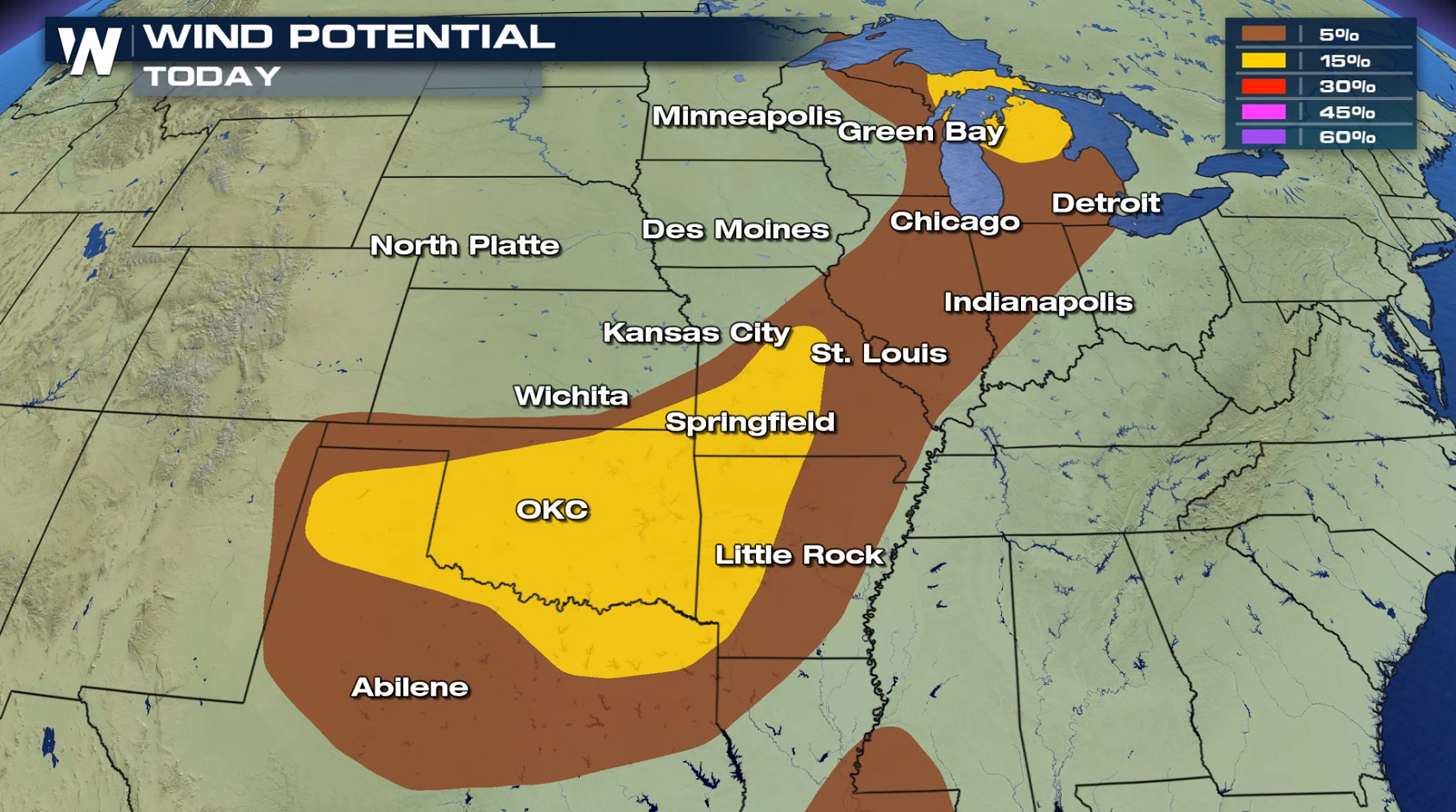
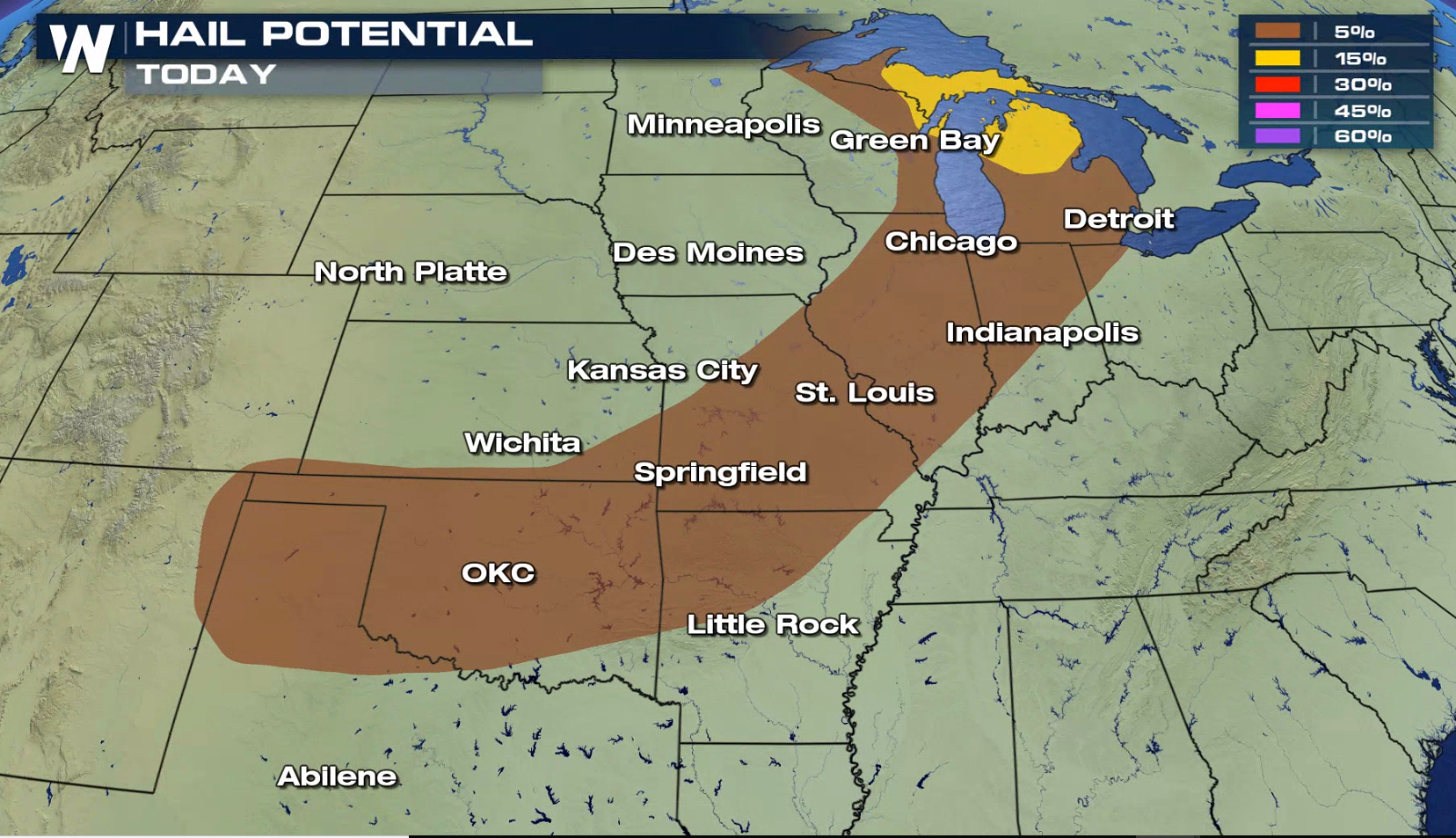
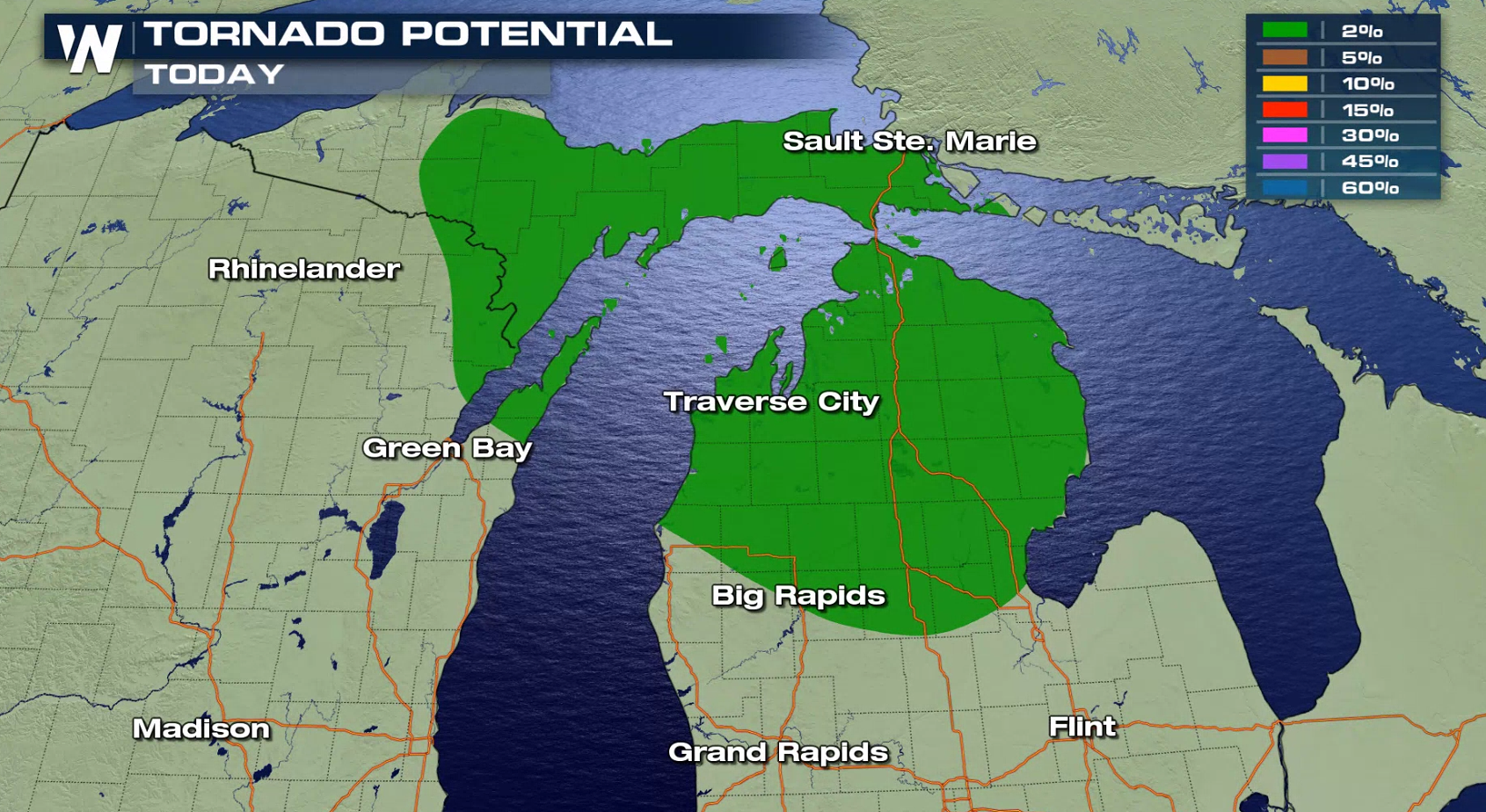 Storms will fire in the late afternoon and continue through the evening. Damaging wind gusts are the biggest threat, with isolated tornadoes possible around the low in Michigan. A few storms may produce large hail as well. By the overnight, storms are expected to diminish in intensity and overall coverage.
 If you are in the risk areas, be sure to check back with WeatherNation on-air and online for the latest severe weather information.
For WeatherNation: Meteorologist Mace Michaels
If you are in the risk areas, be sure to check back with WeatherNation on-air and online for the latest severe weather information.
For WeatherNation: Meteorologist Mace Michaels
Storms will fire in the late afternoon and continue through the evening. Damaging wind gusts are the biggest threat, with isolated tornadoes possible around the low in Michigan. A few storms may produce large hail as well. By the overnight, storms are expected to diminish in intensity and overall coverage.
If you are in the risk areas, be sure to check back with WeatherNation on-air and online for the latest severe weather information.
For WeatherNation: Meteorologist Mace MichaelsAll Weather News
More
Severe Storms Target the Midwest to the Northeast
UPPER MIDWEST - Dangerous tornadoes have alre
28 Jul 2026 1:45 AM

Tropics: Fausto Heads towards Hawaii; Genevieve Cat 4 Hurricane
PacificHurricane Fausto continues to track we
28 Jul 2026 1:45 AM


Southeast Flood Risk Lingers Near Stalled Front
A stalled boundary over the Southeast will ke
25 Jul 2026 10:55 AM

Another Round of Storms Targets the Northeast
Tuesday brought severe weather again across p
23 Jul 2026 1:15 AM

Another Round of Severe Weather for the Upper Midwest and Great Lakes
The upper-level low train continues to keep t
21 Jul 2026 1:45 AM