Severe Weather Possible in the Plains and Mississippi Valley
Special Stories
19 Jun 2019 10:31 AM
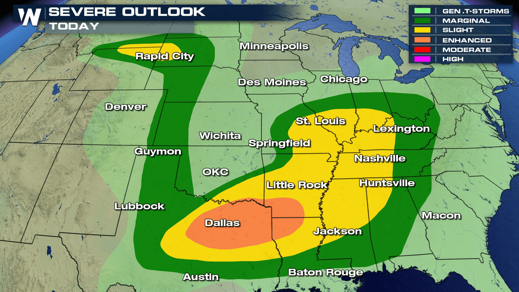
A widespread area has the potential to see severe thunderstorms today (Wednesday). The risk extends from the high Plains to the southern Plains, and also includes parts of the Ohio Valley and lower Mississippi Valley. You can read more about the enhanced risk, centered around the Arklatex, at this link.
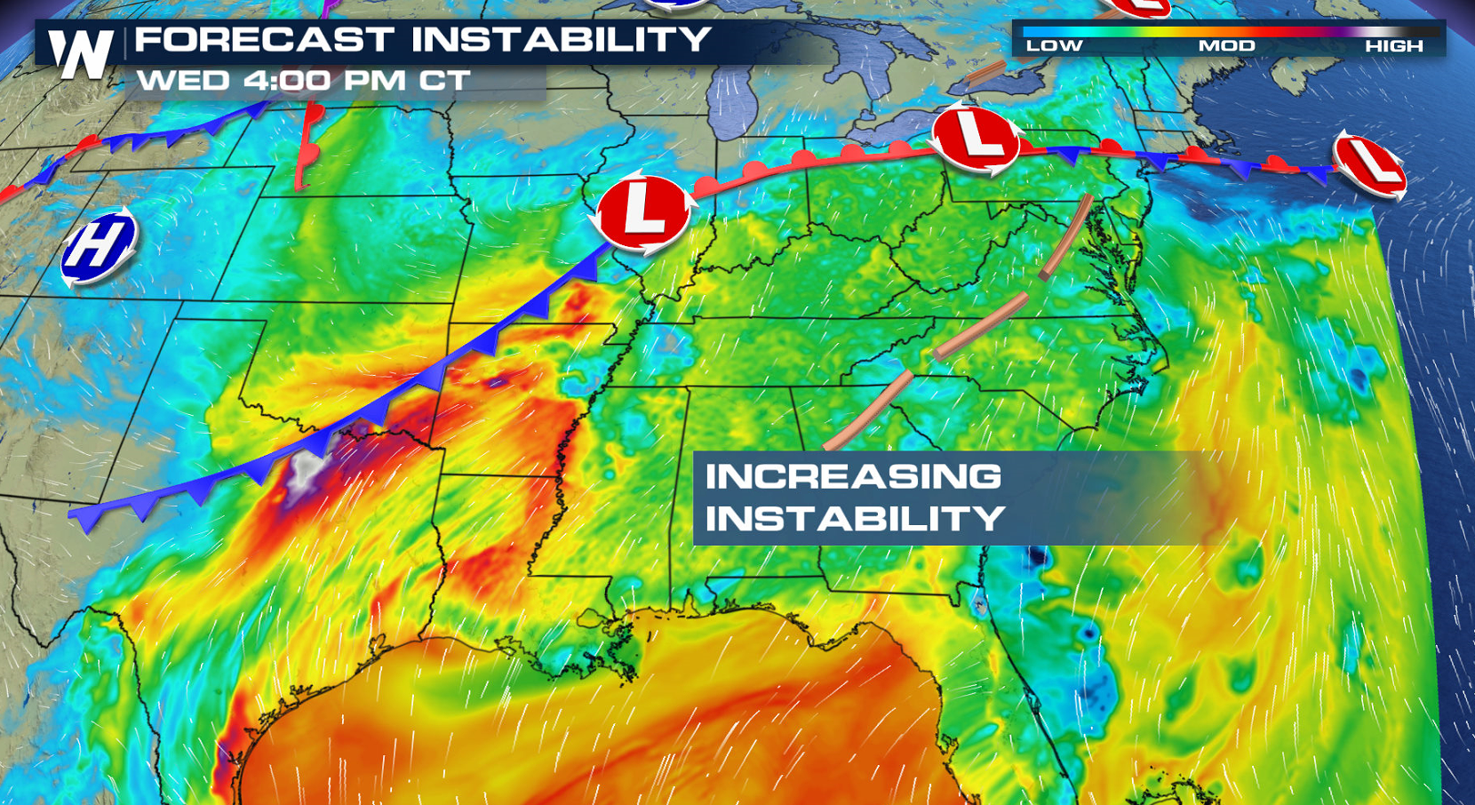
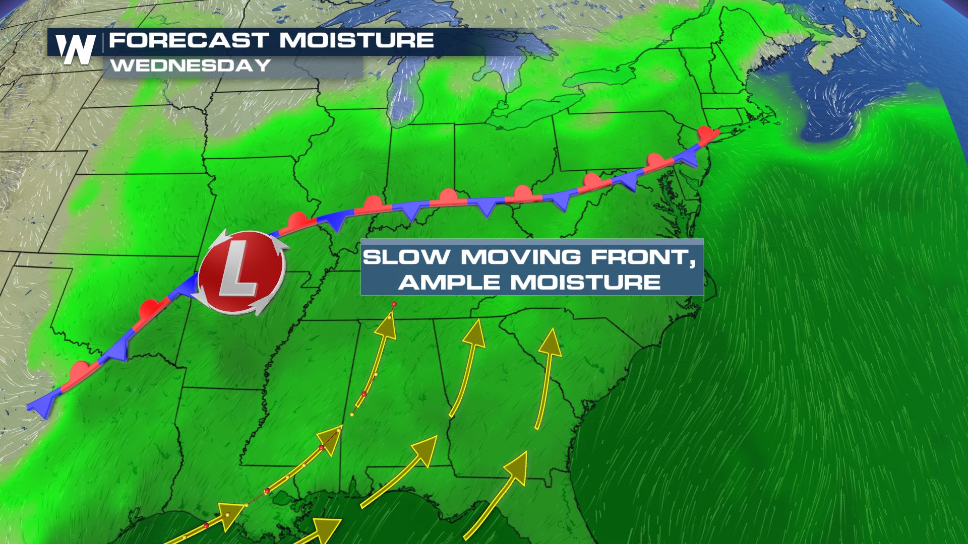
 Instability will be building ahead of two cold fronts: one stretching from the Ohio Valley to the southern Plains, and the other in the high Plains. Warm temperatures and increasing humidity will supply fuel to produce severe thunderstorms.
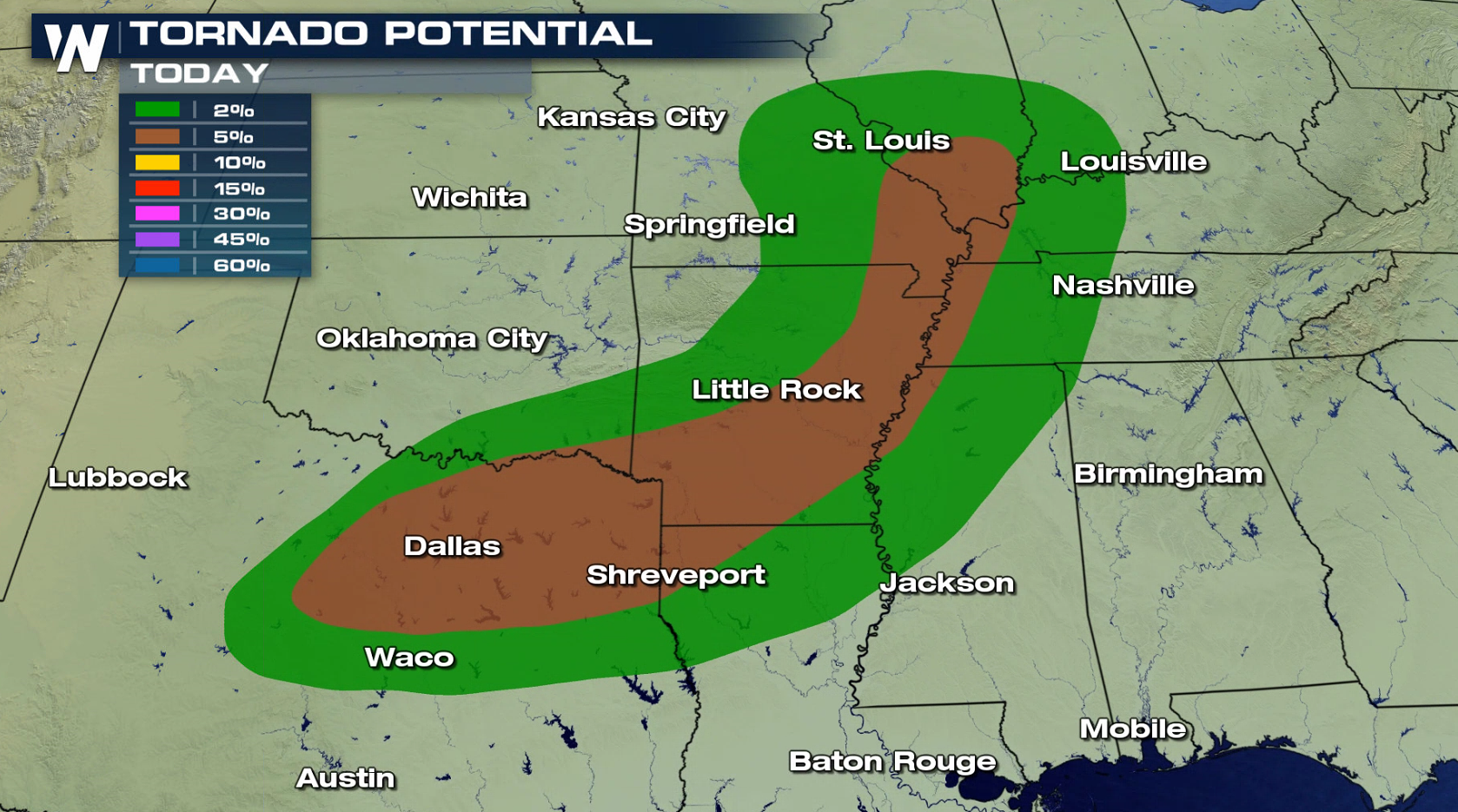
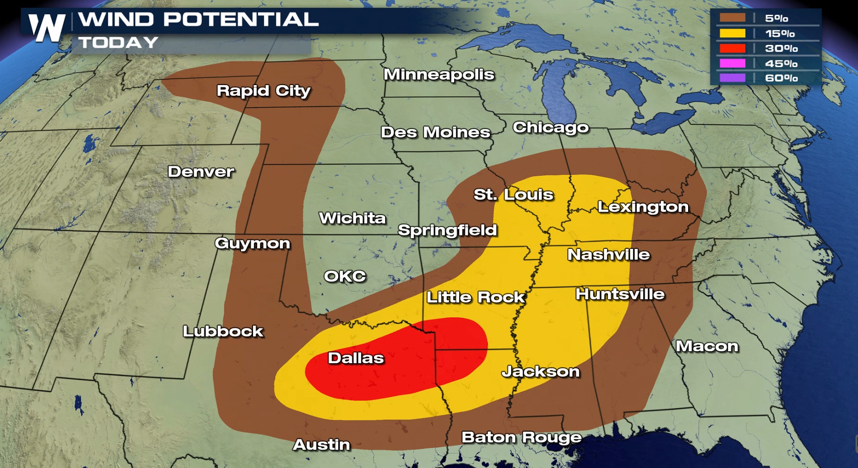
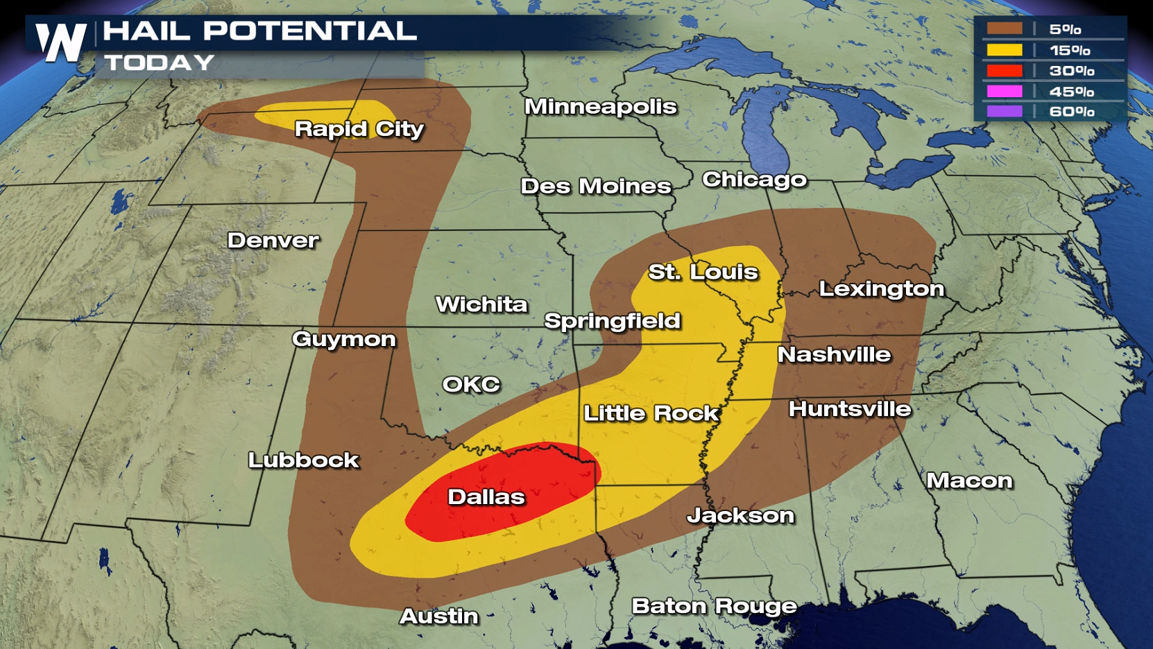
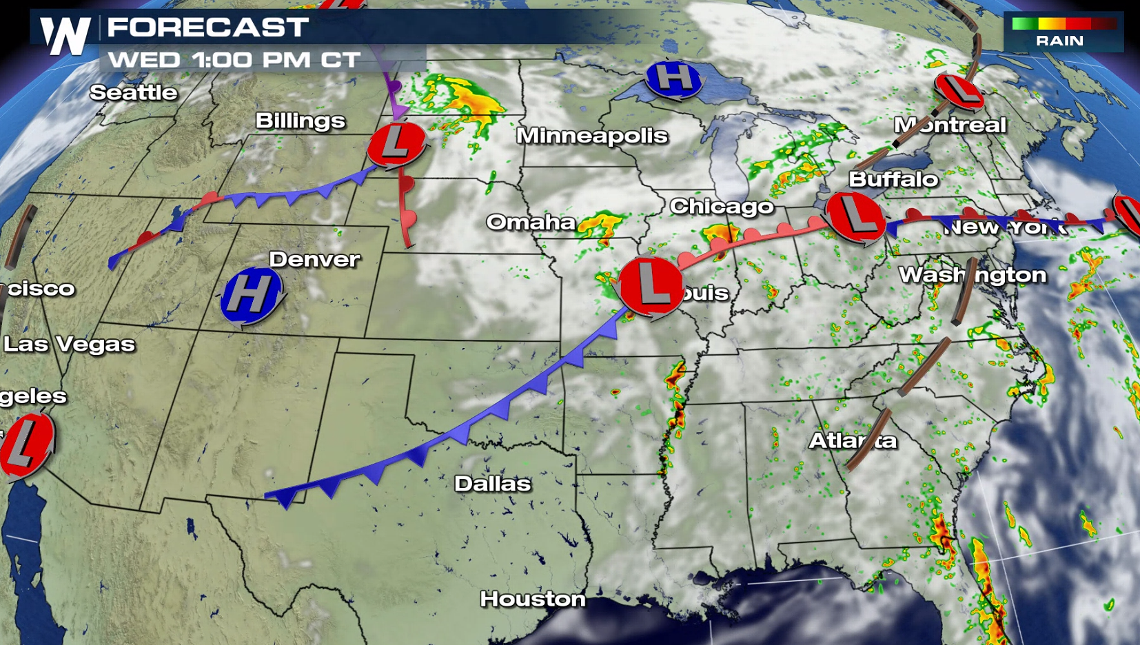
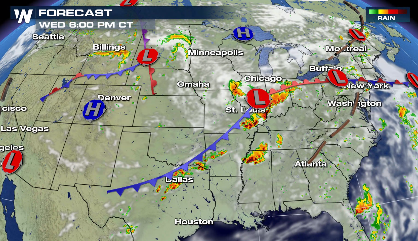
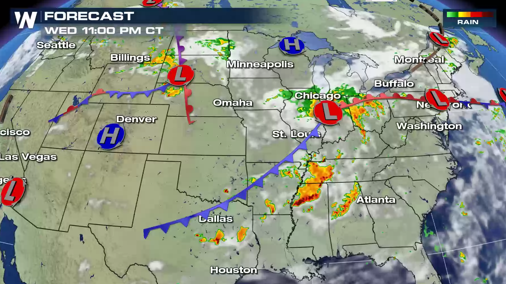
 Here's a look at the forecast throughout the afternoon and evening. Severe storms will be most likely near fronts and around the low pressure centers in the northern Plains and Ohio Valley. The most intense storms will likely be seen in northern Texas ahead of the cold front.
 Stay tuned to WeatherNation on-air and online for severe weather updates.
For WeatherNation: Meteorologist Mace Michaels
Stay tuned to WeatherNation on-air and online for severe weather updates.
For WeatherNation: Meteorologist Mace Michaels
Instability will be building ahead of two cold fronts: one stretching from the Ohio Valley to the southern Plains, and the other in the high Plains. Warm temperatures and increasing humidity will supply fuel to produce severe thunderstorms.
Here's a look at the forecast throughout the afternoon and evening. Severe storms will be most likely near fronts and around the low pressure centers in the northern Plains and Ohio Valley. The most intense storms will likely be seen in northern Texas ahead of the cold front.
Stay tuned to WeatherNation on-air and online for severe weather updates.
For WeatherNation: Meteorologist Mace MichaelsAll Weather News
More

East Gears Up for Stormy, Wet Weekend
A low pressure system crashing through the Mi
1 Aug 2026 9:15 PM


Flooding, Severe Storms Target the Midwest Again
After an active week of storms across the nor
1 Aug 2026 1:40 AM

After Reaching Category 5, Genevieve Weakens in the Pacific
PacificFausto is now a post-tropical cyclone.
31 Jul 2026 1:30 AM

Flooding Risk Increases as Heavy Rain Targets the Tri-State Area
Tuesday, heavy rainfall moved across the Nort
30 Jul 2026 12:25 AM

Severe Weather: Energy From the Midwest Now in the Southeast
UPPER MIDWEST - Through Monday, dangerous tor
29 Jul 2026 10:30 PM