Severe Weather Potential Across the Southern Mississippi Valley
Special Stories
27 Dec 2018 8:47 AM
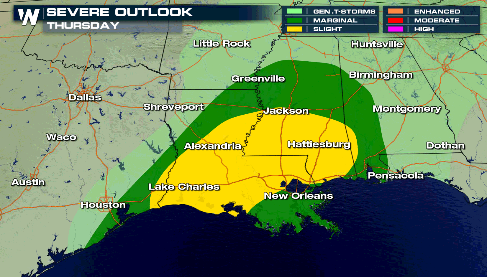
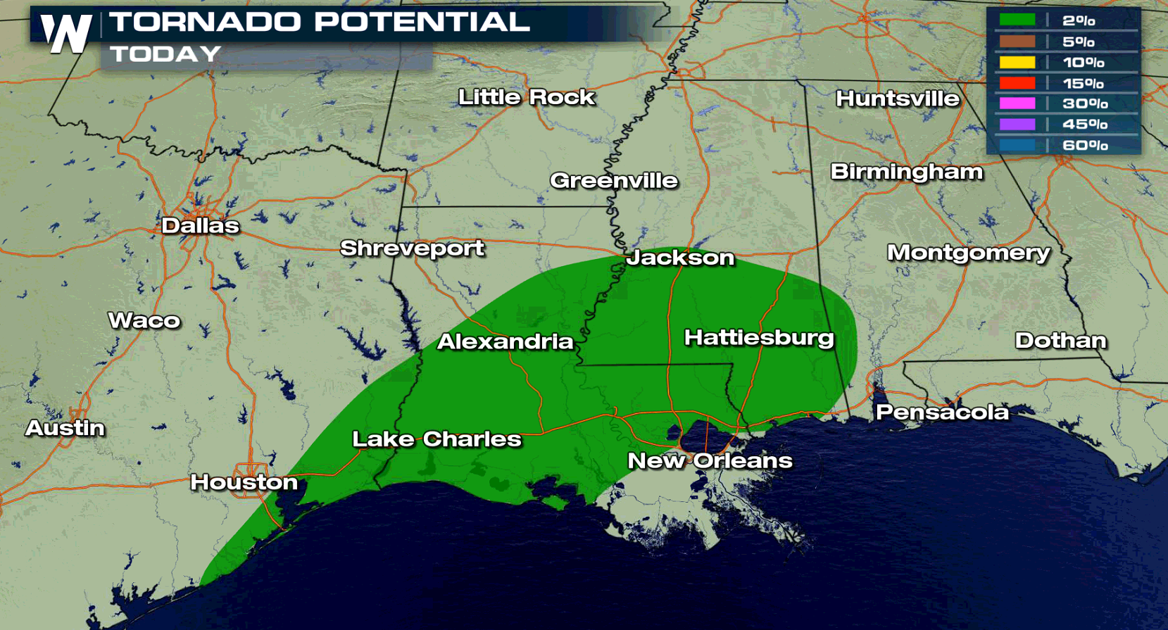
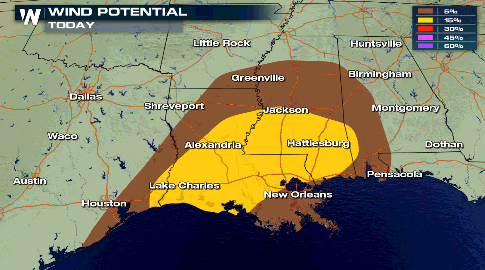
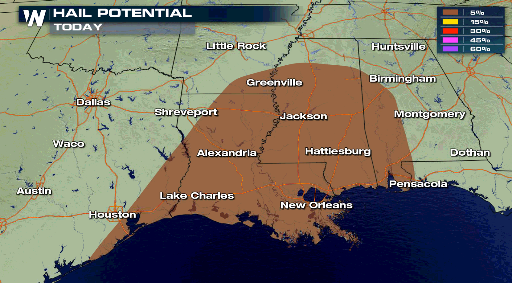
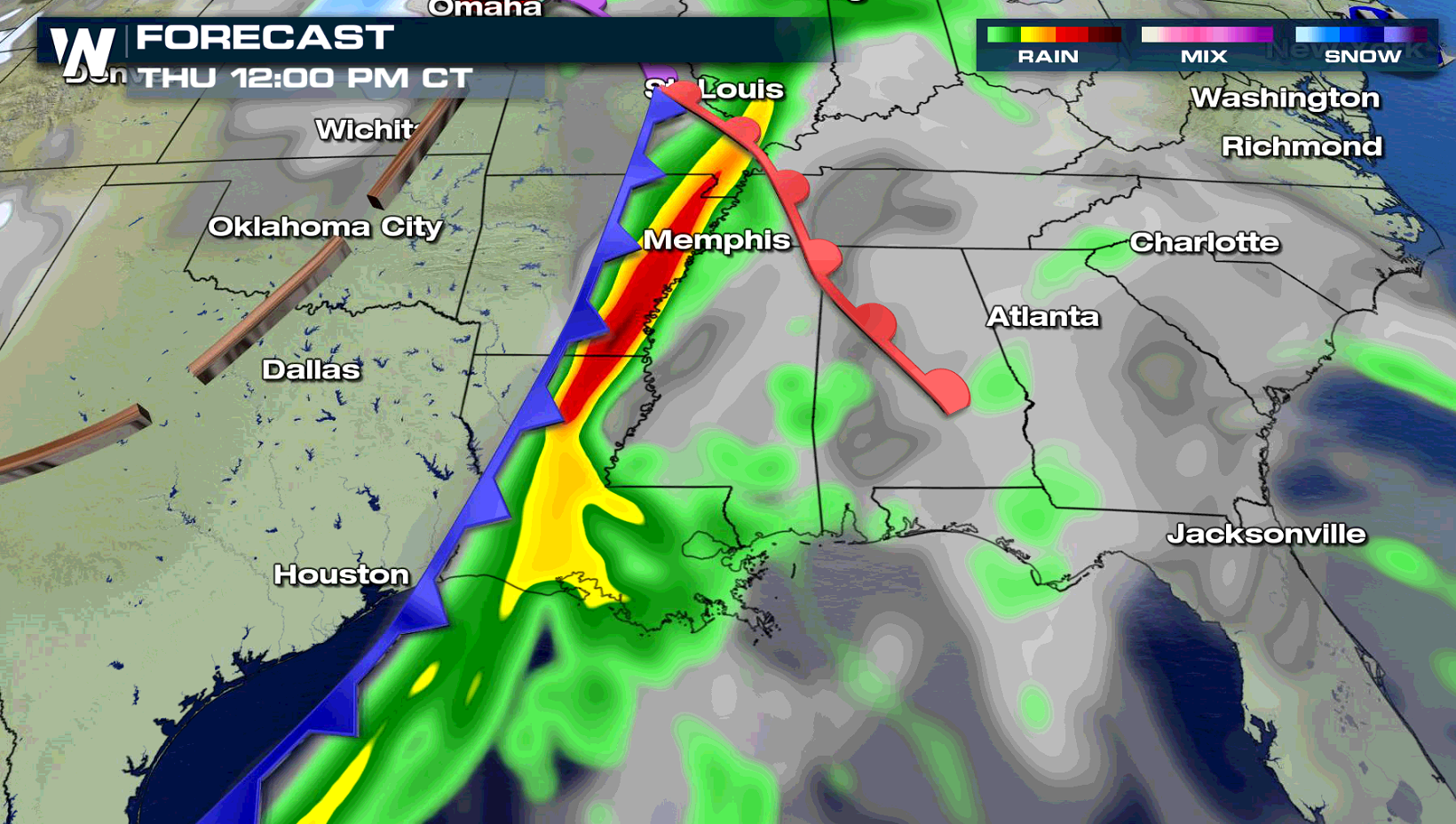
A sharp cold front will push through the southern Mississippi River Valley creating severe thunderstorms today (Thursday). Areas from east of Houston to Pensacola have the risk for intense storms through this evening. Isolated tornadoes are possible, with strong wind gusts as the biggest concern.
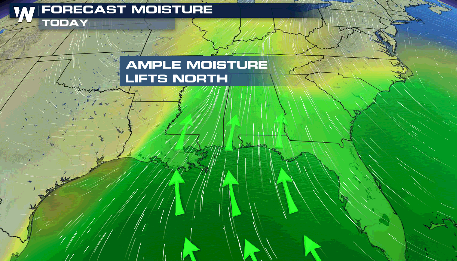
 A strong low pressure center in the Plains will keep a persistent wind flow streaming northward from the Gulf of Mexico. This will push high humidity into the region, along with warmer temperatures. Instability will build ahead of the front, giving energy to produce and sustain severe storms.
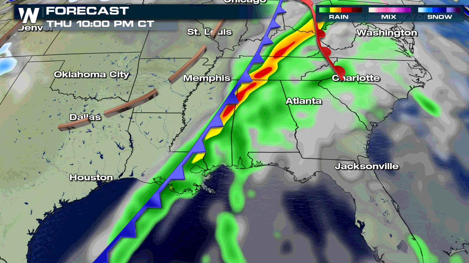
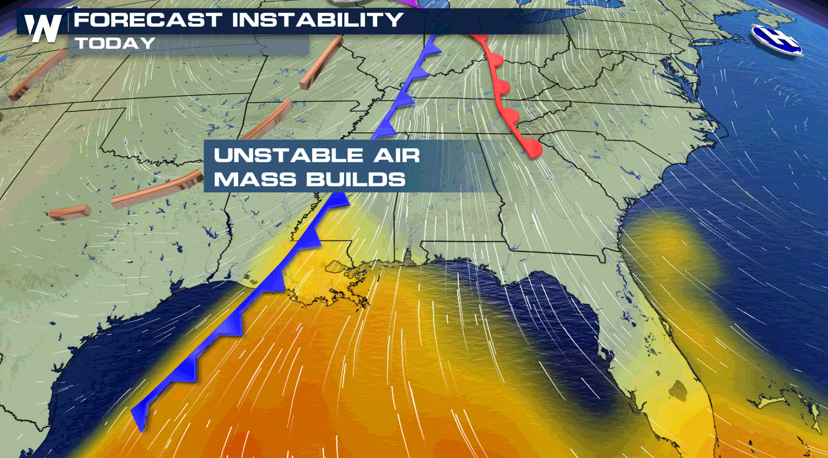 The front will sweep eastward from the Arklatex this morning (Thursday) and moves toward Mobile Bay by the end of the day. Storms will be numerous along and ahead of the cold front.
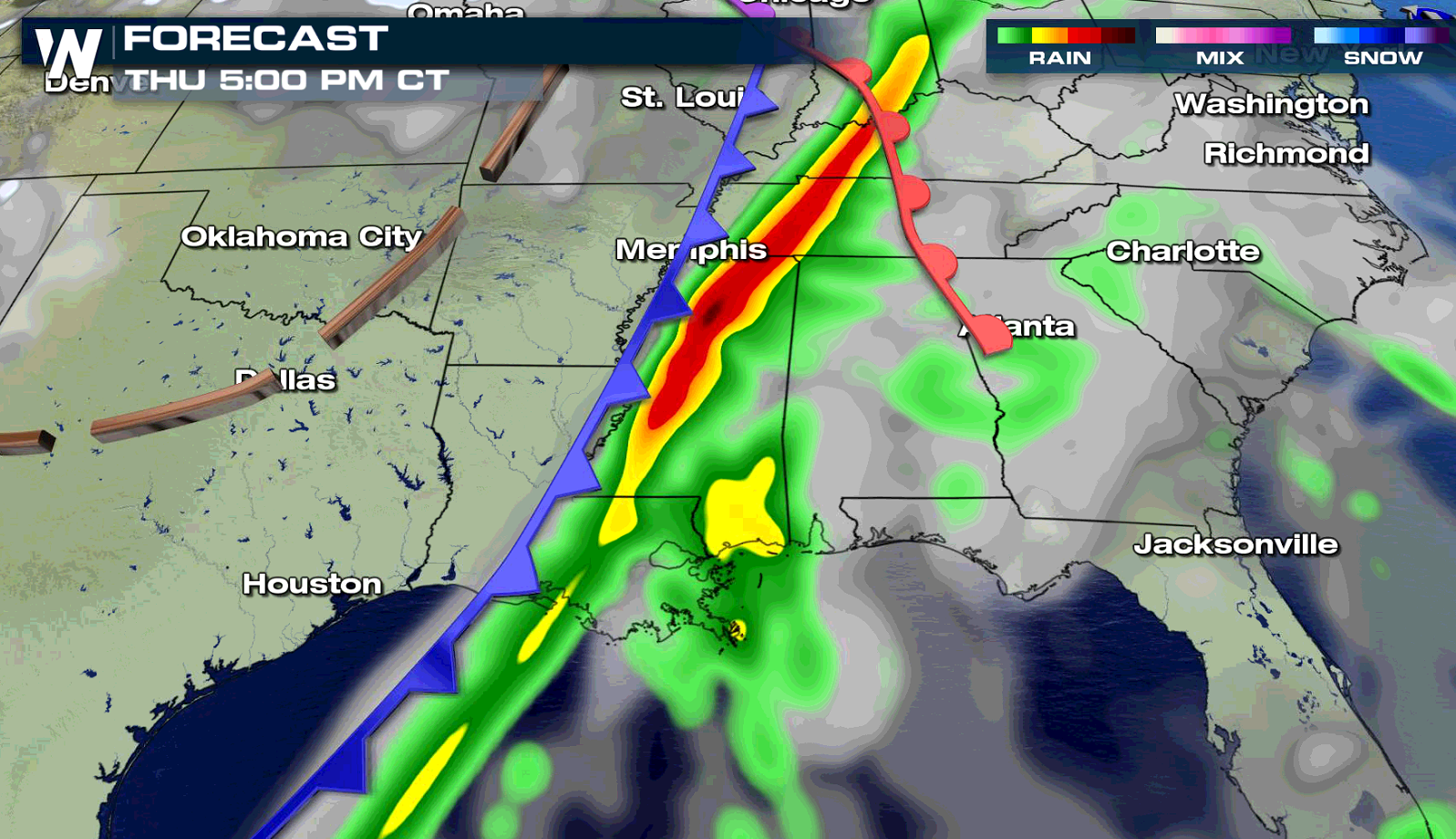
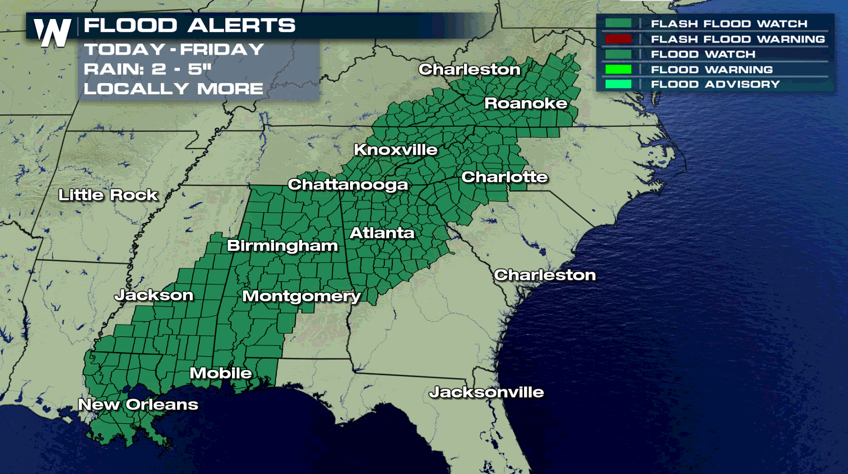
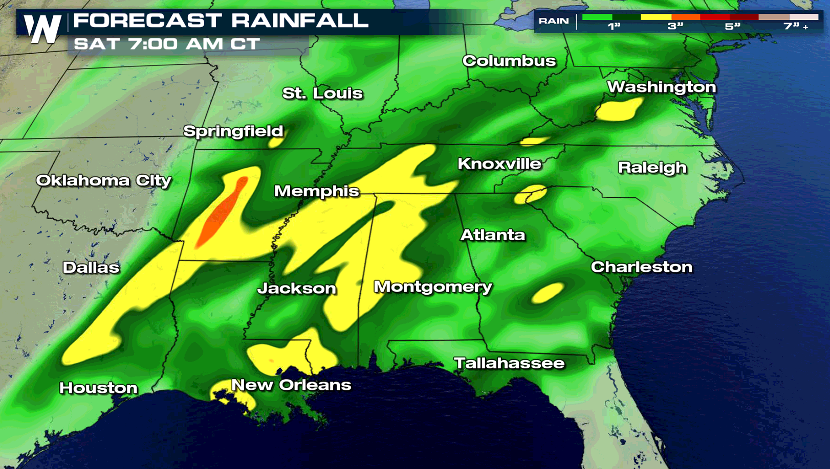
 Due to the high humidity mentioned above, heavy rain is also a concern. Flood Watches extend through the Appalachians to the Mouth of the Mississippi River. Some areas may see more than 3" of rain in a short amount of time, which could produce areas of flooding.
 For WeatherNation: Meteorologist Mace Michaels
A strong low pressure center in the Plains will keep a persistent wind flow streaming northward from the Gulf of Mexico. This will push high humidity into the region, along with warmer temperatures. Instability will build ahead of the front, giving energy to produce and sustain severe storms.
The front will sweep eastward from the Arklatex this morning (Thursday) and moves toward Mobile Bay by the end of the day. Storms will be numerous along and ahead of the cold front.
Due to the high humidity mentioned above, heavy rain is also a concern. Flood Watches extend through the Appalachians to the Mouth of the Mississippi River. Some areas may see more than 3" of rain in a short amount of time, which could produce areas of flooding.
For WeatherNation: Meteorologist Mace MichaelsAll Weather News
More


More Storms for the East Through Monday
A low-pressure system that moved through the
3 Aug 2026 1:50 AM

After Reaching Category 5, Genevieve Weakens in the Pacific
PacificGenevieve formed last Friday south of
3 Aug 2026 12:30 AM

Flooding, Severe Storms Target the Midwest Again
After an active week of storms across the nor
1 Aug 2026 1:40 AM

Flooding Risk Increases as Heavy Rain Targets the Tri-State Area
Tuesday, heavy rainfall moved across the Nort
30 Jul 2026 12:25 AM

Severe Weather: Energy From the Midwest Now in the Southeast
UPPER MIDWEST - Through Monday, dangerous tor
29 Jul 2026 10:30 PM