Severe Weather Potential in the Southeast and Northeast
Special Stories
1 Nov 2018 9:15 AM
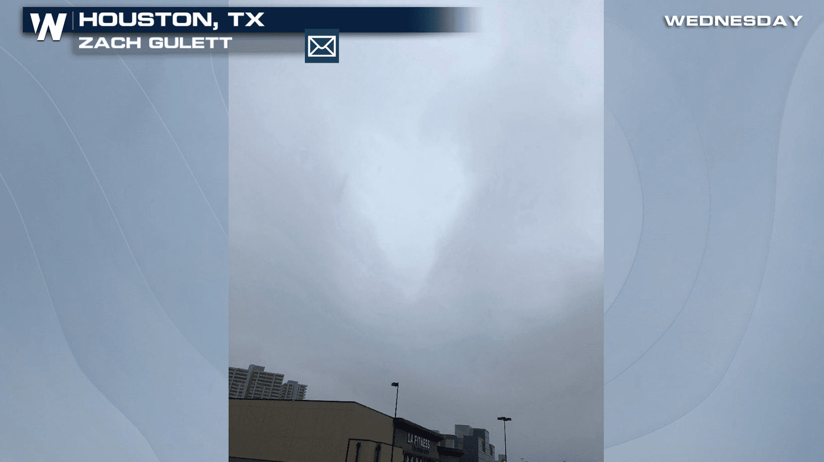
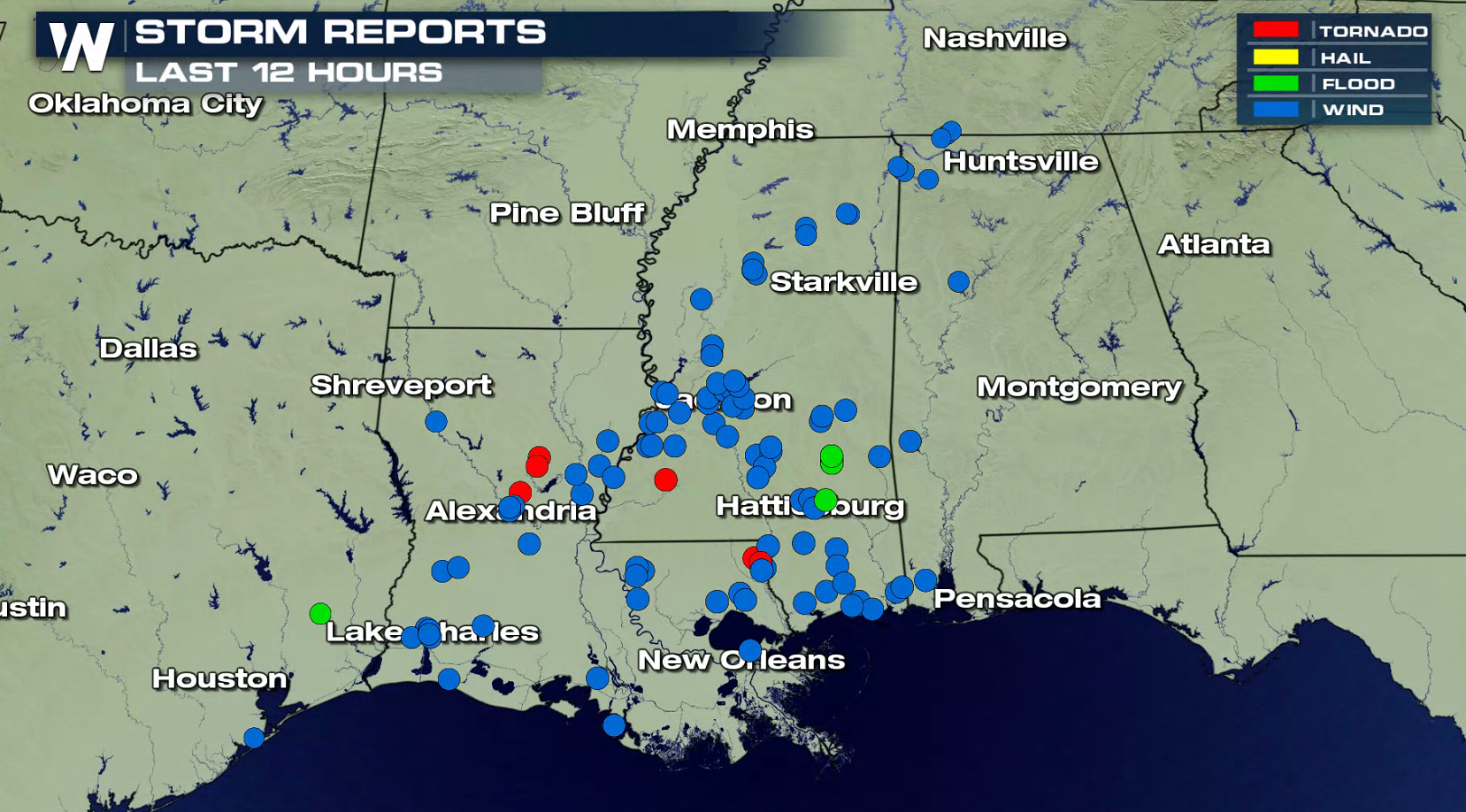
A strong cold front produced multiple severe thunderstorms on Wednesday along the Gulf of Mexico coastline from Texas to Alabama. Several tornadoes were reported, along with strong winds producing damage.
 https://twitter.com/WeatherNation/status/1058004908937404417
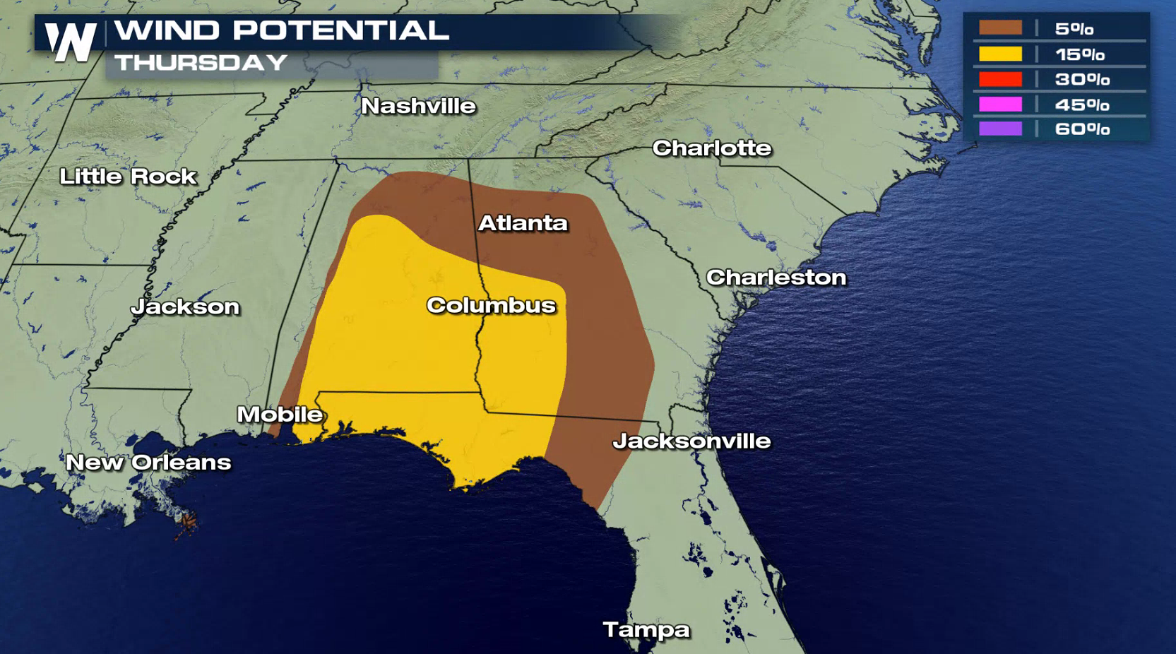
The system continues to move eastward with additional showers and thunderstorms for today (Thursday) from Alabama to North Carolina. Tornadoes are possible, along with strong winds and large hail.
https://twitter.com/WeatherNation/status/1058004908937404417
The system continues to move eastward with additional showers and thunderstorms for today (Thursday) from Alabama to North Carolina. Tornadoes are possible, along with strong winds and large hail.
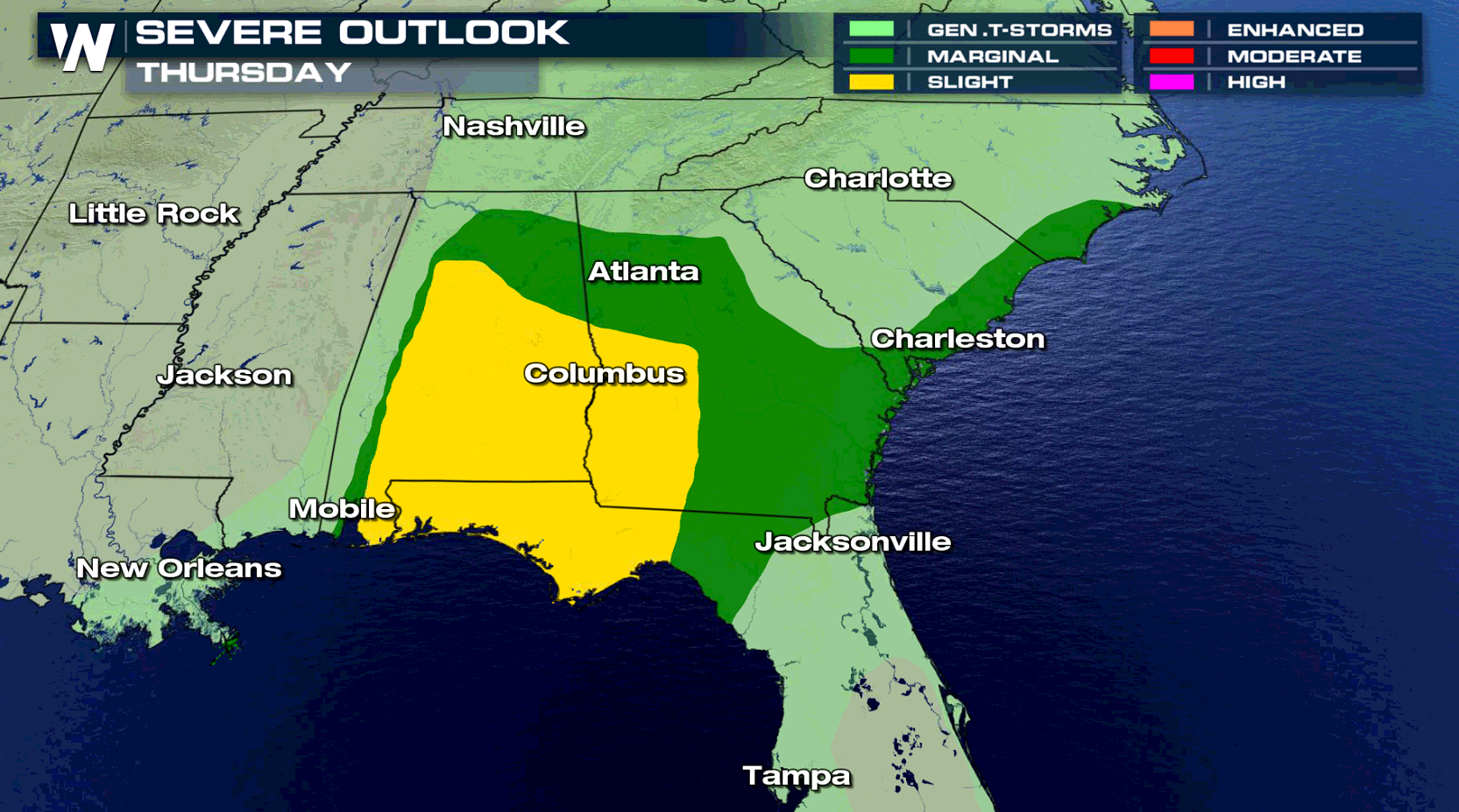
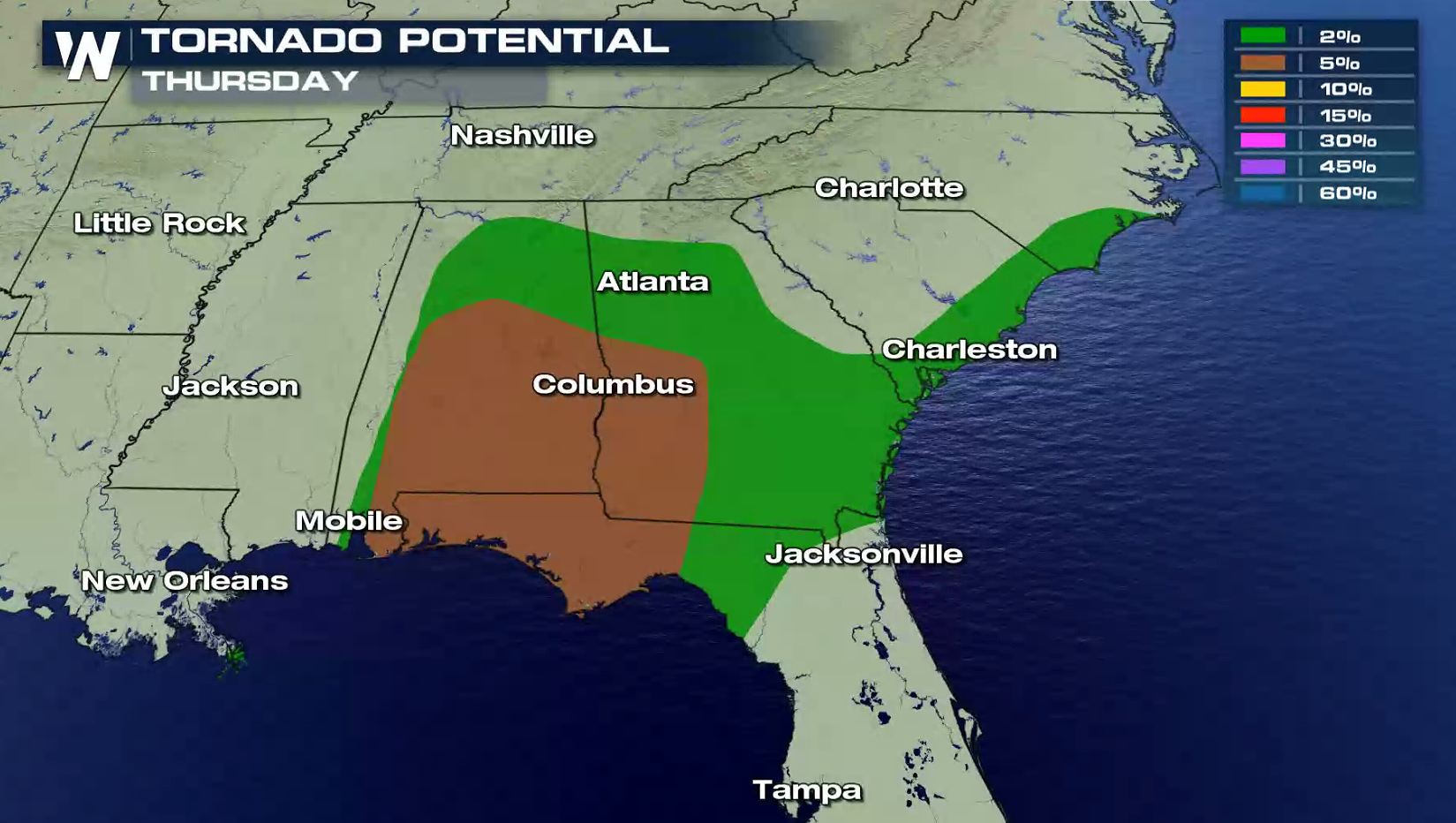
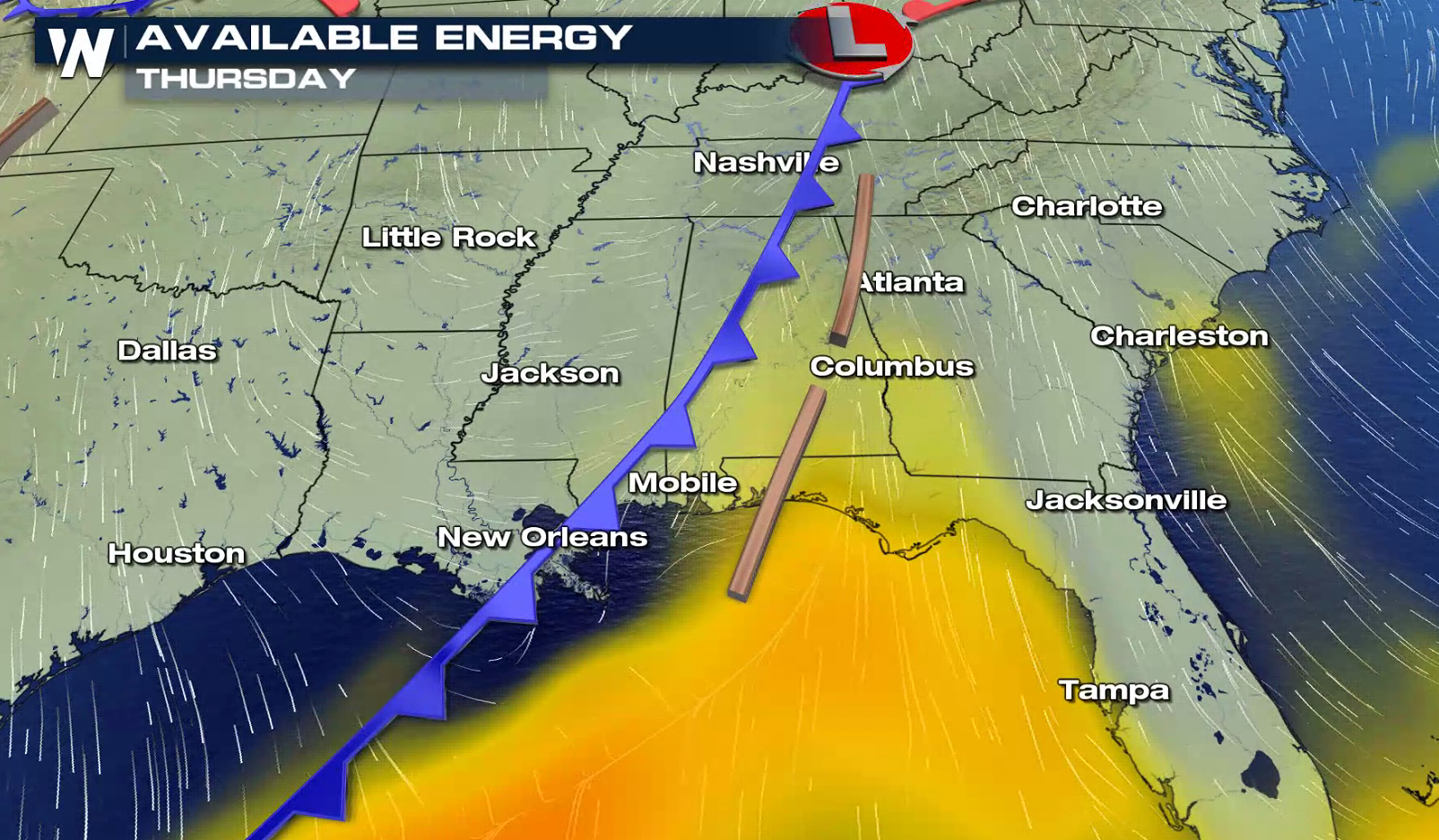
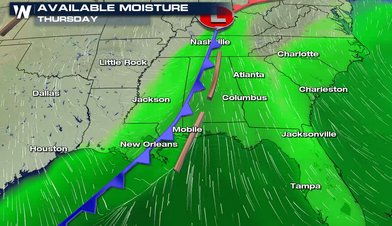
 Heat and humidity will continue to build ahead of the cold front responsible for Wednesday's severe weather. As it pushes eastward today (Thursday), more severe storms will develop.
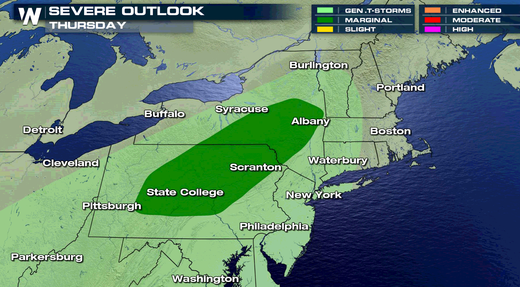
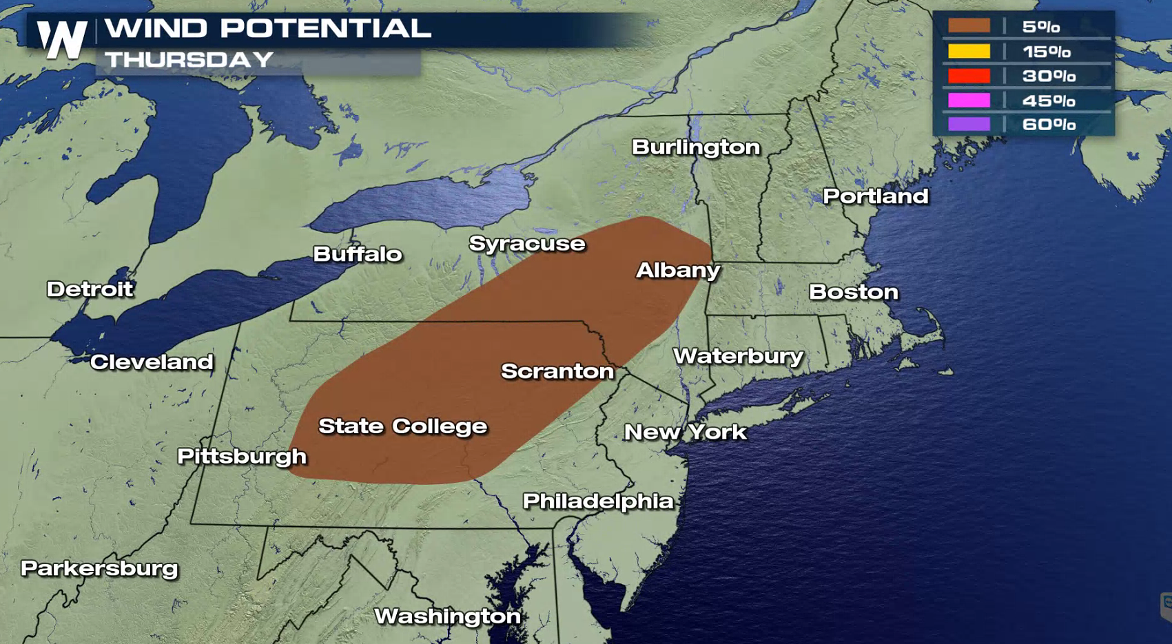
 Further north, there is a marginal severe thunderstorm risk in New York and Pennsylvania. Wind damage will be the biggest concern with strong Jet Stream energy wrapping around a low pressure center on the northern side of the storm system.
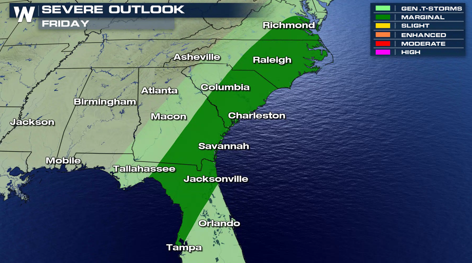
 The cold front will lose some strength for Friday, but there is still a marginal risk for severe thunderstorm. The area extends from Chesapeake Bay to the Big Bend of Florida.
 For WeatherNation: Meteorologist Mace Michaels
https://twitter.com/WeatherNation/status/1058004908937404417
The system continues to move eastward with additional showers and thunderstorms for today (Thursday) from Alabama to North Carolina. Tornadoes are possible, along with strong winds and large hail.
Heat and humidity will continue to build ahead of the cold front responsible for Wednesday's severe weather. As it pushes eastward today (Thursday), more severe storms will develop.
Further north, there is a marginal severe thunderstorm risk in New York and Pennsylvania. Wind damage will be the biggest concern with strong Jet Stream energy wrapping around a low pressure center on the northern side of the storm system.
The cold front will lose some strength for Friday, but there is still a marginal risk for severe thunderstorm. The area extends from Chesapeake Bay to the Big Bend of Florida.
For WeatherNation: Meteorologist Mace MichaelsAll Weather News
More


More Storms for the East Sunday and Monday
A low-pressure system crashing through the Mi
2 Aug 2026 2:20 AM

After Reaching Category 5, Genevieve Weakens in the Pacific
PacificGenevieve formed on last Friday south
2 Aug 2026 1:30 AM

Flooding, Severe Storms Target the Midwest Again
After an active week of storms across the nor
1 Aug 2026 1:40 AM

Flooding Risk Increases as Heavy Rain Targets the Tri-State Area
Tuesday, heavy rainfall moved across the Nort
30 Jul 2026 12:25 AM

Severe Weather: Energy From the Midwest Now in the Southeast
UPPER MIDWEST - Through Monday, dangerous tor
29 Jul 2026 10:30 PM