Severe Weather Ramps Up Late Week

We've been stuck in a pretty stagnant pattern recently. With a few cut-off lows and strong ridges of high pressure, the day-to-day pattern has struggled to change much. The trough in the Pacific Northwest will try to change that later this week.
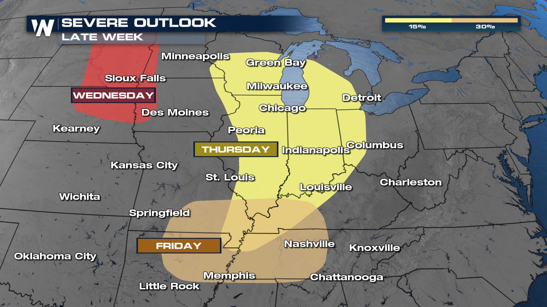 This trough will spark storms on the High Plains Wednesday before closing in on the Middle Mississippi River Valley late this week.
OVERVIEW
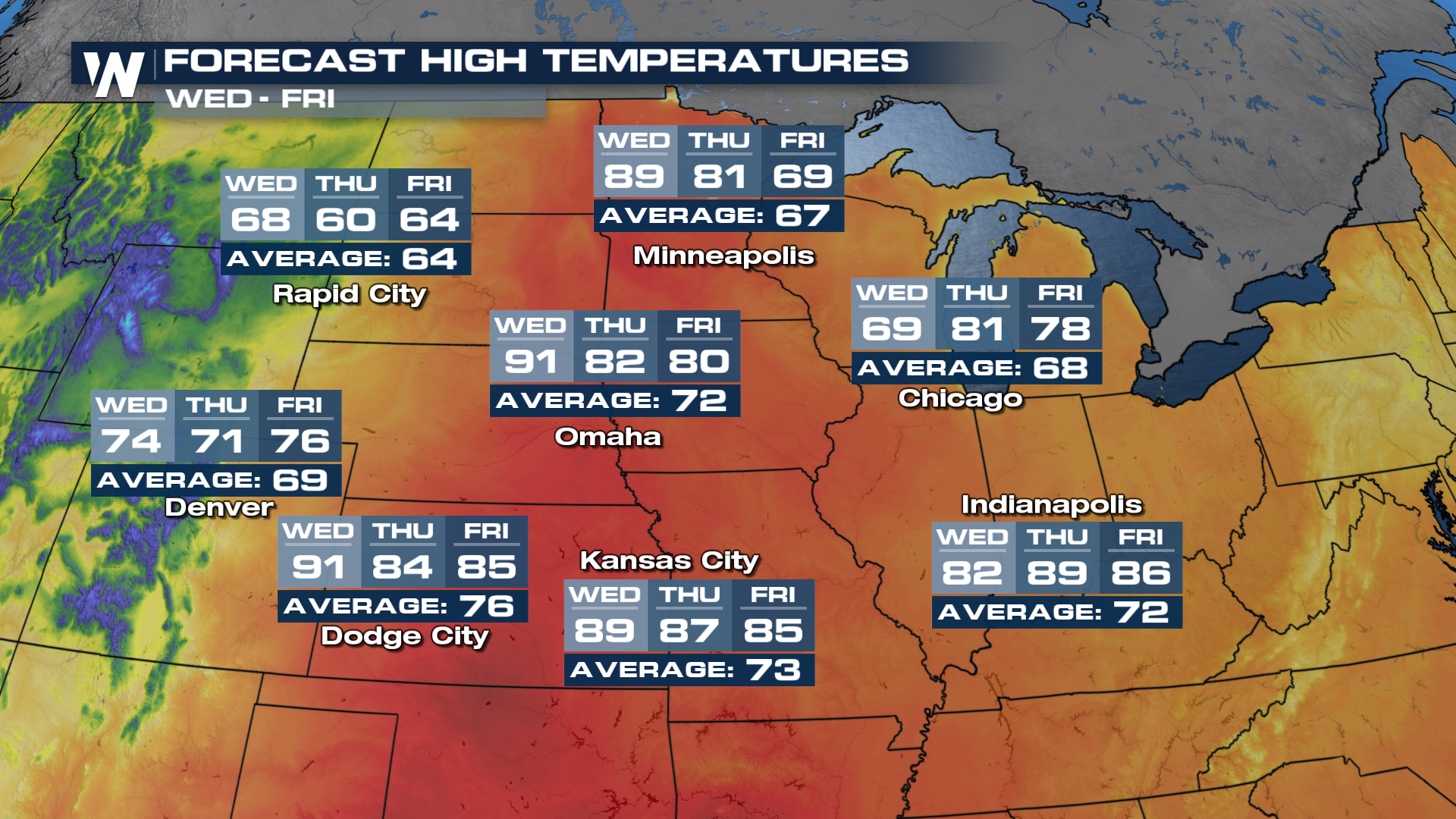
As this trough swings in, it will run into VERY warm temperatures. By Wednesday and Thursday, highs across the High Plains will get back to the 80's and 90's. The warm and humid air will more than likely help power strong to severe storms later this week.
 While a few ingredients look to come together sometime around Thursday, a lot can still change between now and then. The Storm Prediction Center has highlighted areas around Chicagoland later this week.
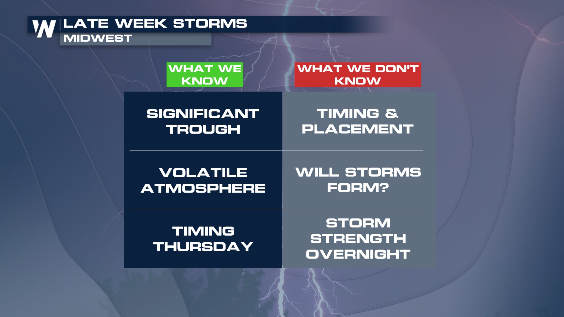 As details become a little clearer throughout the week, things like timing and storm mode will become a little clearer too.
 LONG-RANGE FORECAST


