Summertime Heat Prompts Fire Danger in the Northern Plains

NORTHERN PLAINS - The record heat continued on Monday as many cities smashed previous records. Multiple cities across the northern plains reached the upper 90s as it was another hot day. Bismarck, ND, saw a record high of 97°, beating out the old record of 92°.
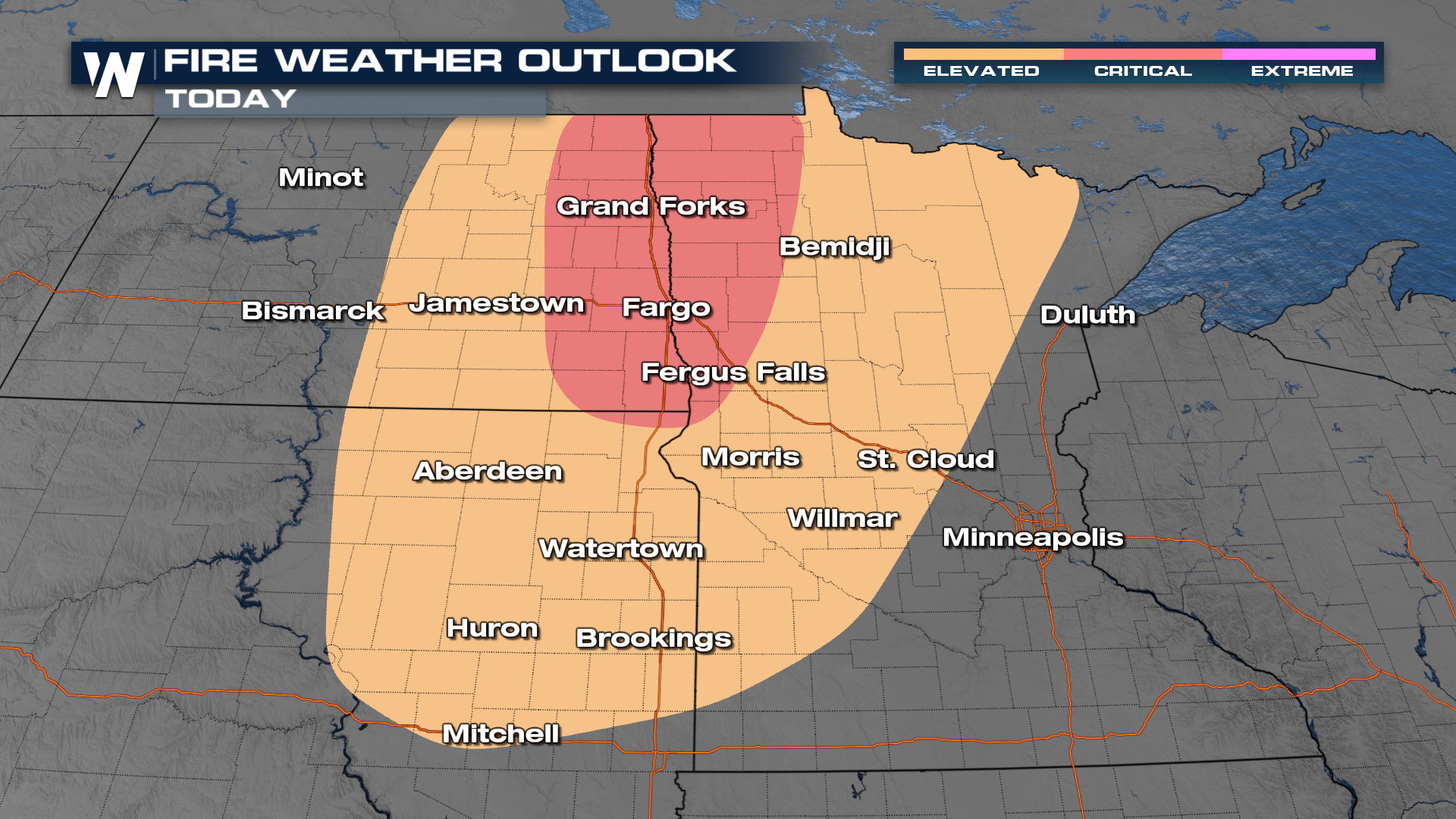
 FIRE DANGER - The Storm Prediction Center has issued a fire weather outlook for an elevated and critical fire threat. A combination of heat, winds, and dry conditions has ramped up the fire threat. This threat will diminish this week as cooler air and rain move in.
 The record heat will continue as above-average temperatures continue into Wednesday for many. Cities that normally average 60s will dig into the upper 80s and 90s. Check out the temps on Thursday. Cooler air arrives with the passing of a cold front, bringing temperatures near to below average. Bismarck will see a high of 92° on Tuesday, and by Thursday be down to only 59°. It will feel like multiple seasons this week.
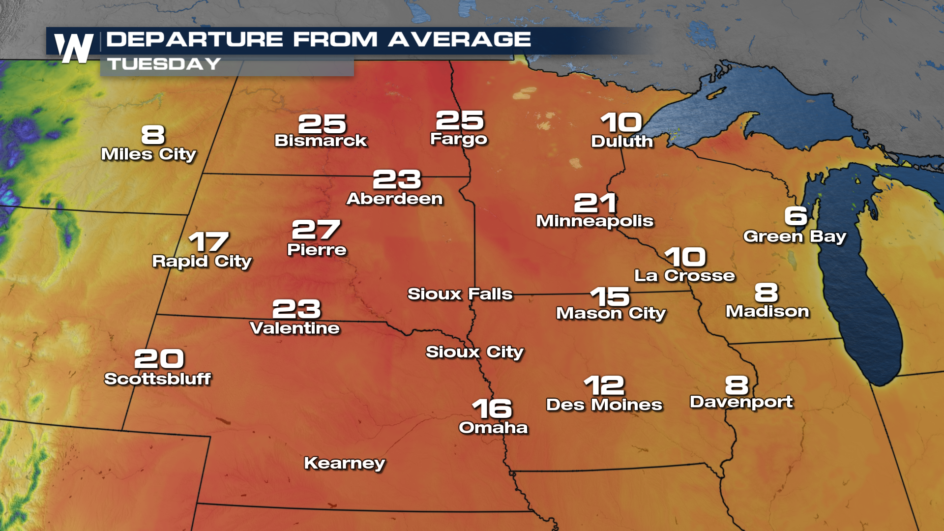
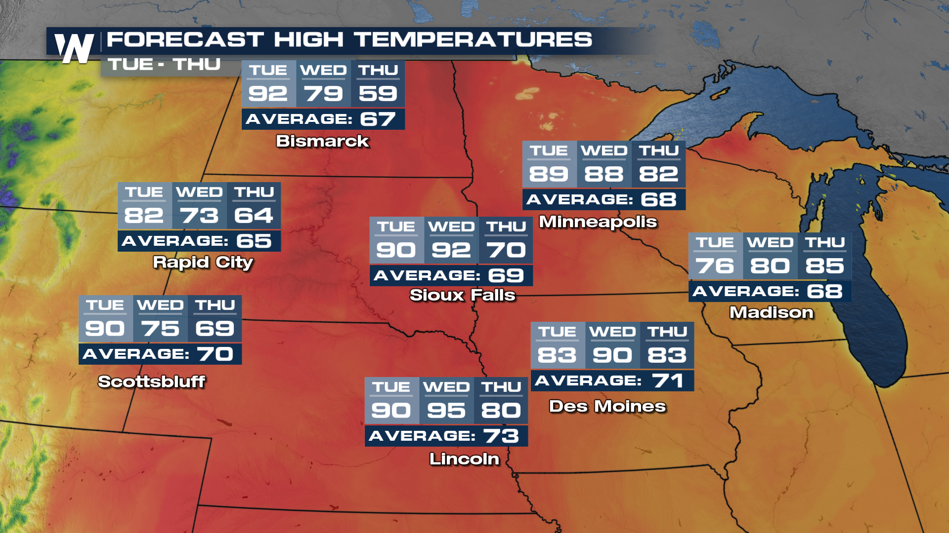 Today, temperatures will continue to run 20°- 30° above average, making it feel like summer! With these above-average temps in place, we can see another round of potential records.
 Cities like Fargo, ND, will have a significant temperature drop by the latter half of the week.
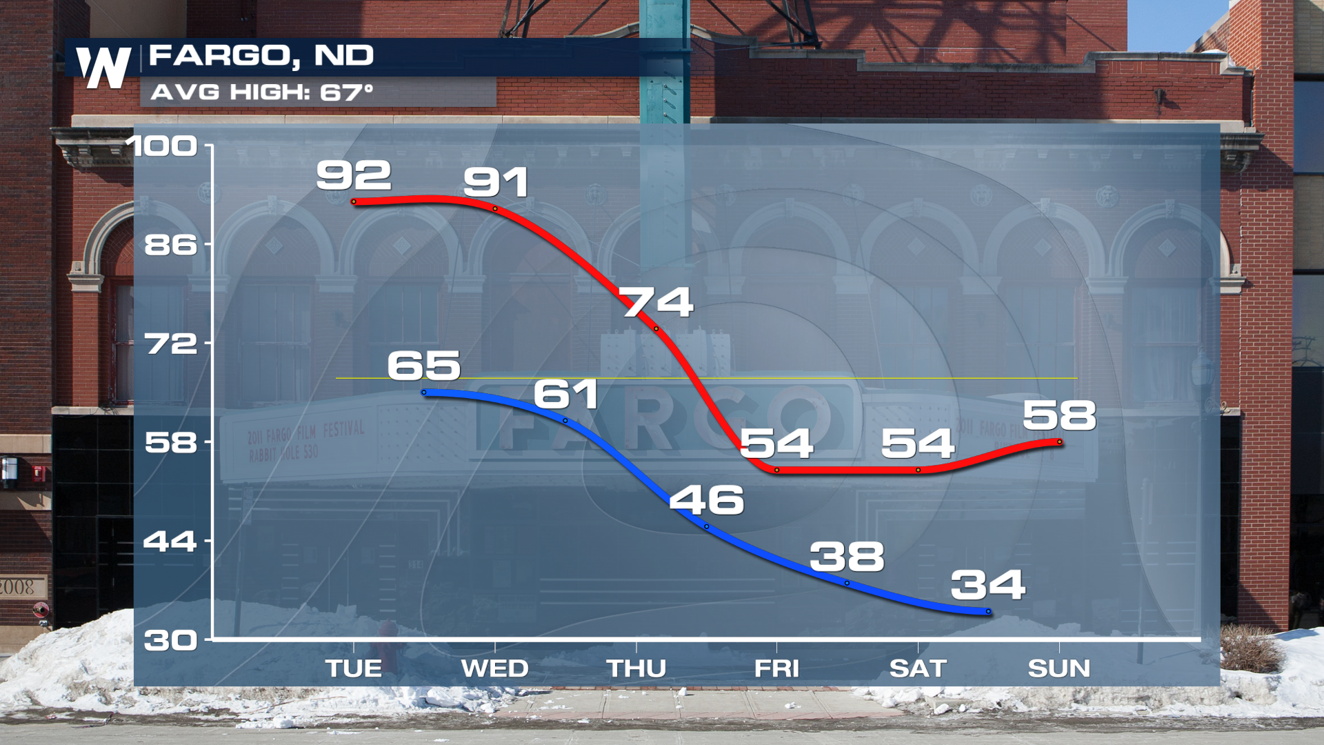 For those who aren't a fan of the heat, just wait a few days! A big pattern shift will occur, dropping temperatures to more seasonal spring-like weather. Stay tuned to Weather Nation for the latest details.


