Severe Weather Returns to the Plains Thursday
Top Stories
13 May 2021 1:00 PM
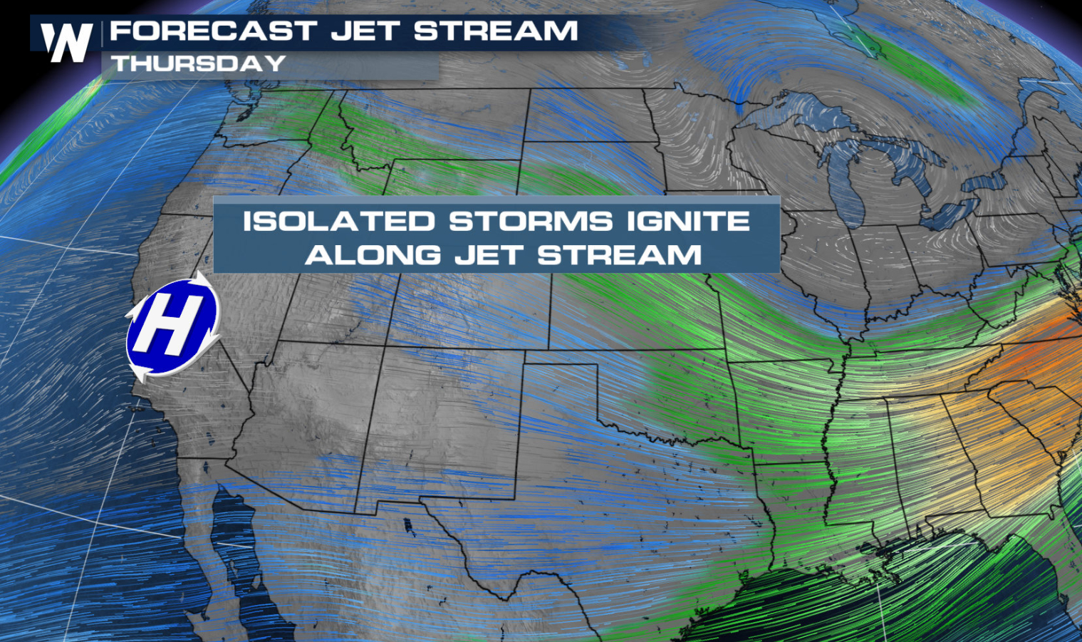
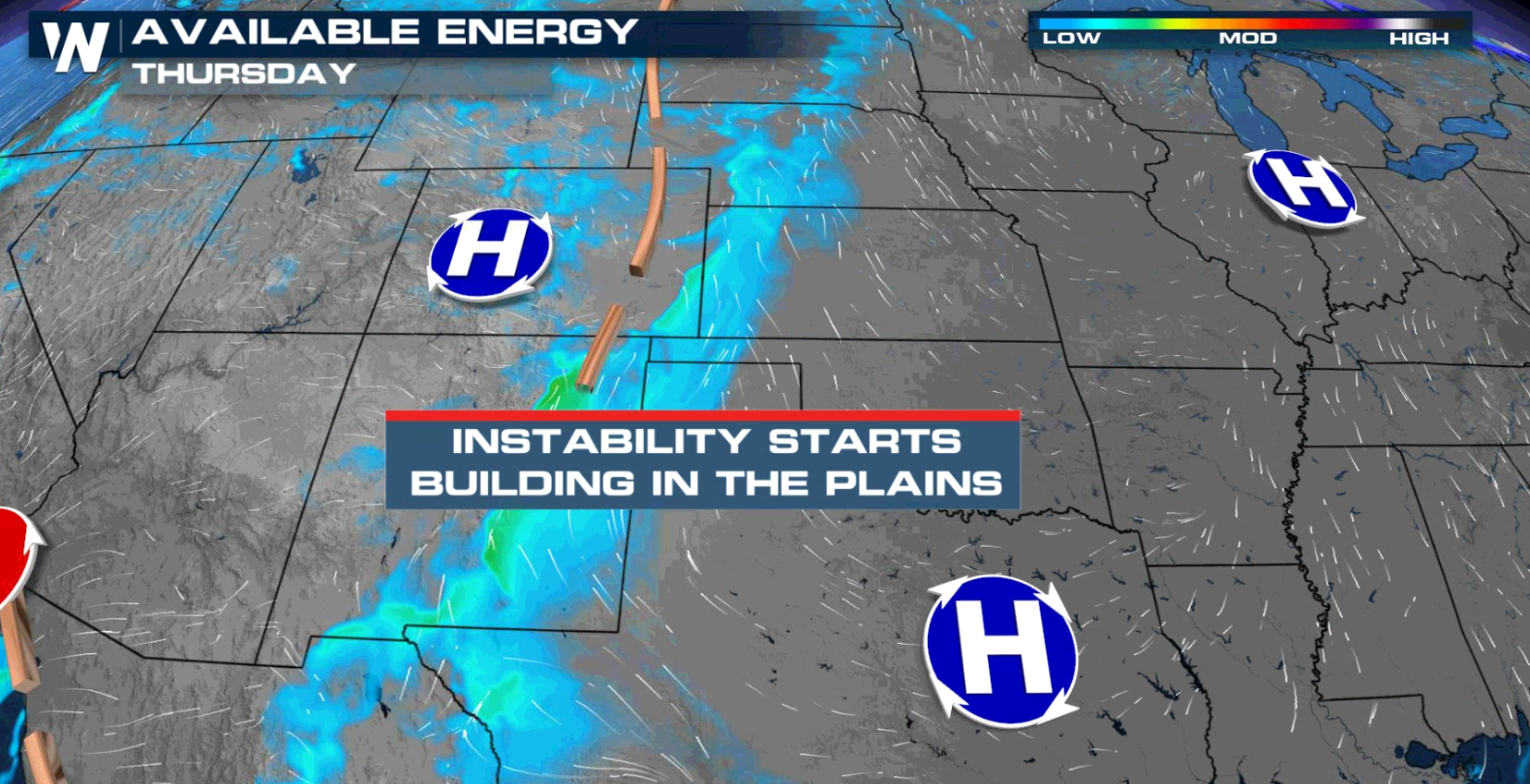
The threat for severe thunderstorms returns to the Plains for today (Thursday) into this weekend. Instability will build ahead of a storm system as jet stream energy moves into the region from the West.
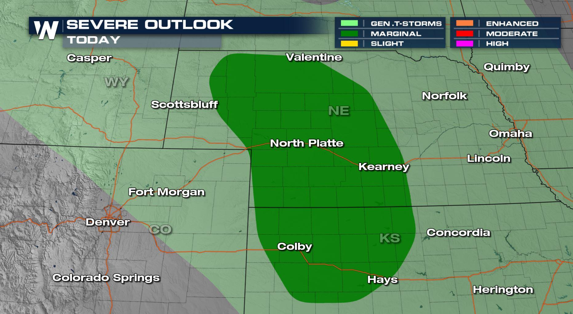
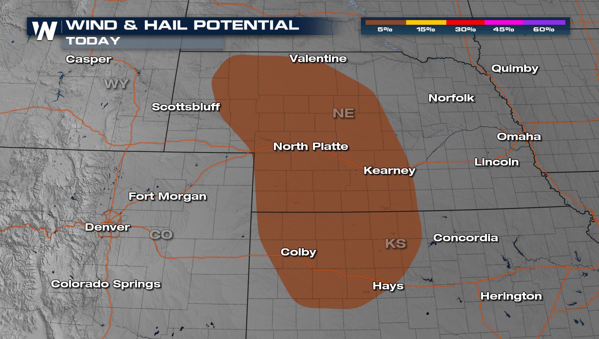
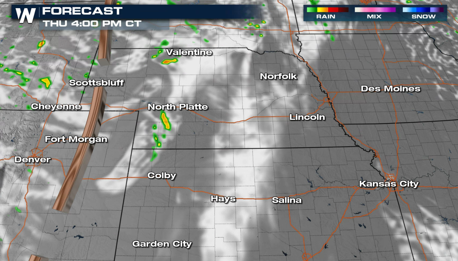
 There is a marginal risk for severe thunderstorms (level 1 on a scale from 1 to 5) in central Nebraska and northwestern Kansas today (Thursday). Strong wind gusts, greater than 58 mph, and large hail, larger than a quarter, are the main threats.

 Storms will fire ahead of a surface trough in central Nebraska in the afternoon ahead of a weak upper level disturbance. The strongest storms will occur in the late afternoon and early evening.
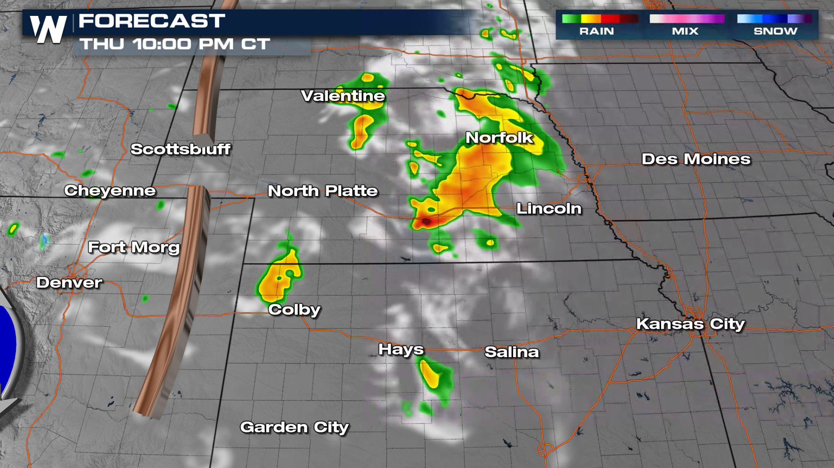
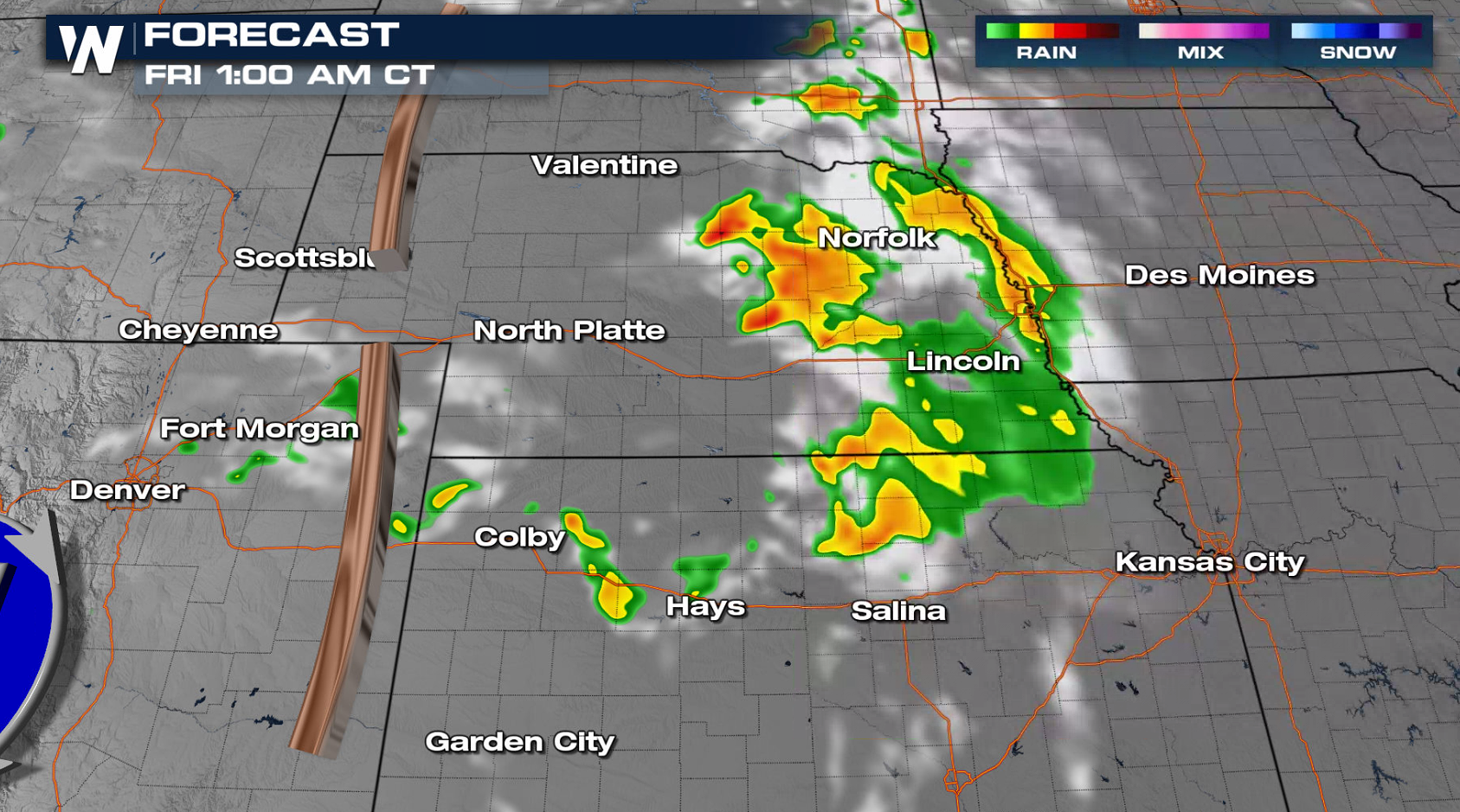
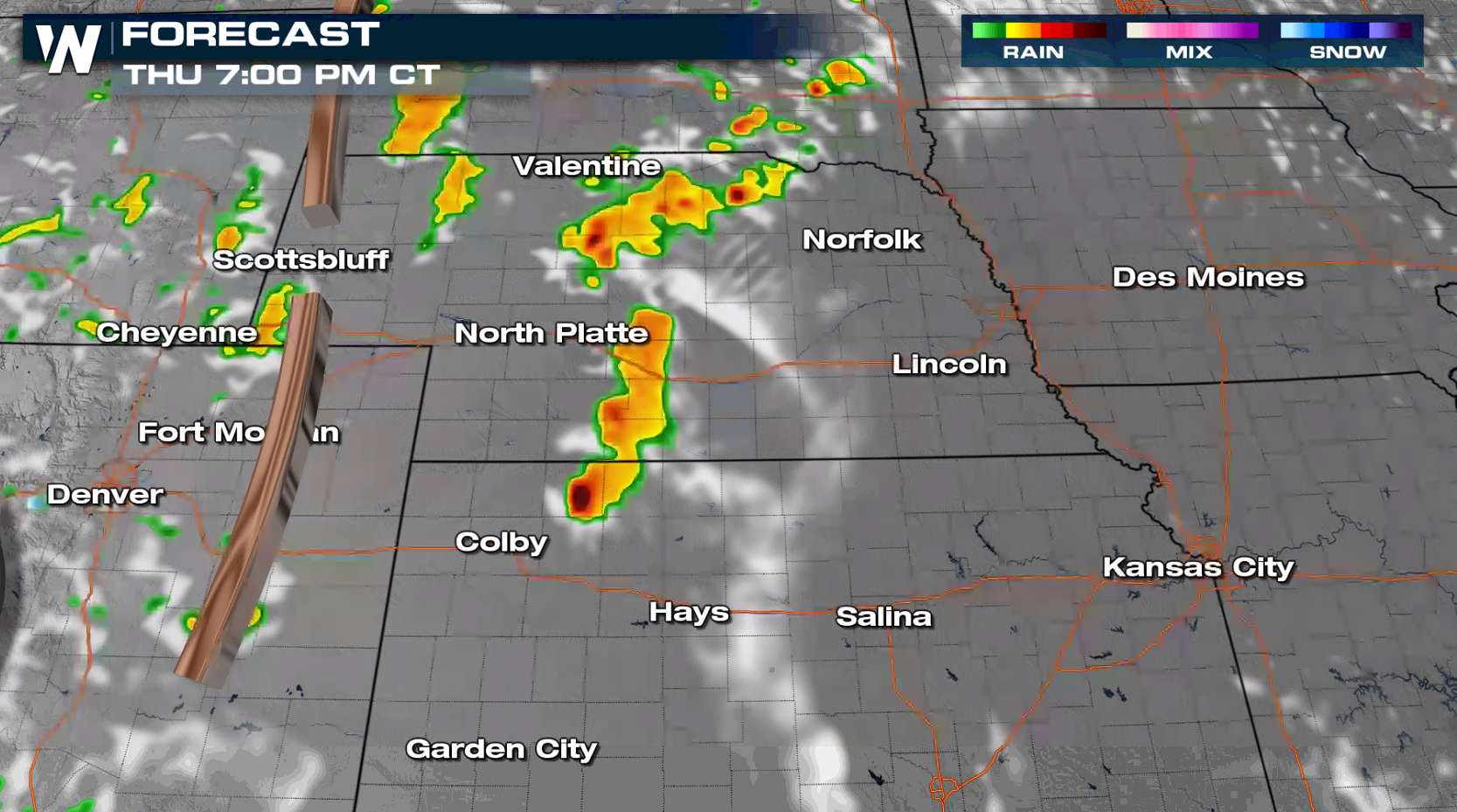 As storms moves eastward, intensity will diminish, especially after sunset. Areas of heavy rain and small hail will still be possible into the overnight.
 Check back with WeatherNation on-air and online for the latest severe weather updates.
There is a marginal risk for severe thunderstorms (level 1 on a scale from 1 to 5) in central Nebraska and northwestern Kansas today (Thursday). Strong wind gusts, greater than 58 mph, and large hail, larger than a quarter, are the main threats.
Storms will fire ahead of a surface trough in central Nebraska in the afternoon ahead of a weak upper level disturbance. The strongest storms will occur in the late afternoon and early evening.
As storms moves eastward, intensity will diminish, especially after sunset. Areas of heavy rain and small hail will still be possible into the overnight.
Check back with WeatherNation on-air and online for the latest severe weather updates.All Weather News
More
Tropics: Fausto Heads towards Hawaii; Genevieve a Major Hurricane
PacificTropical Depression Fausto continues t
29 Jul 2026 10:15 AM

Flooding Risk Increases as Heavy Rain Targets the Tri-State Area
New England - Along with the threat of severe
29 Jul 2026 10:10 AM


Southeast Flood Risk Lingers Near Stalled Front
A stalled boundary over the Southeast will ke
25 Jul 2026 10:55 AM

Another Round of Storms Targets the Northeast
Tuesday brought severe weather again across p
23 Jul 2026 1:15 AM