Severe Weather Risk Heading into the Memorial Day Weekend
Special Stories
25 May 2018 10:05 AM
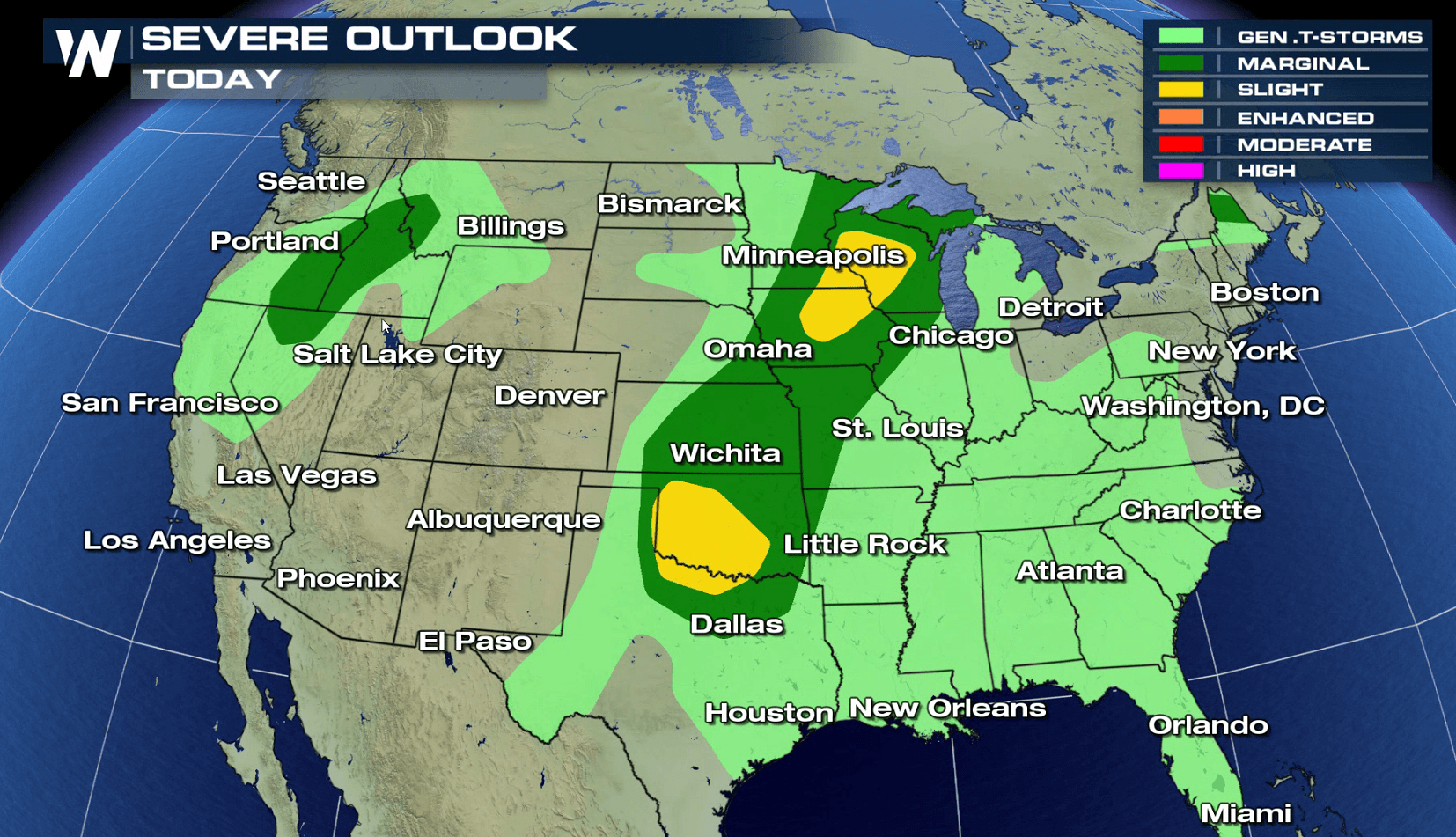
As we head into Memorial Day weekend, there is the threat for severe thunderstorms in the middle sections of the country. A slight risk for severe thunderstorms stretches from the western Great Lakes to the Red River of the South. With limited wind shear, the tornado risk is low. Strong, gusty winds and large hail are the primary severe weather threats.
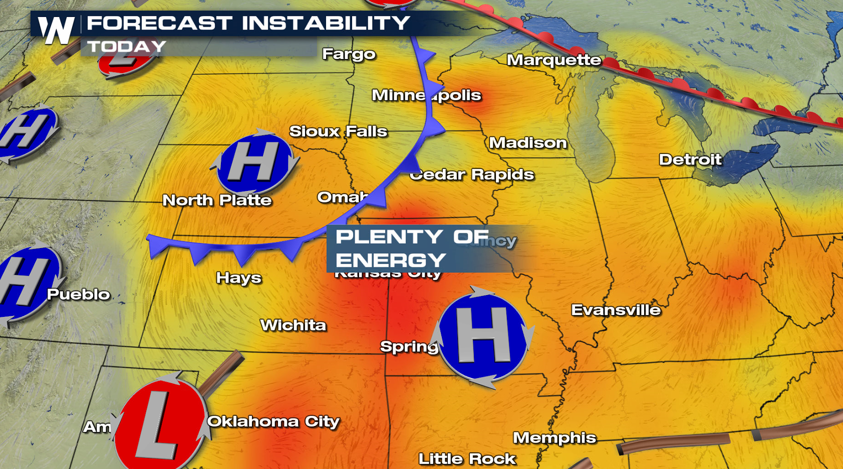
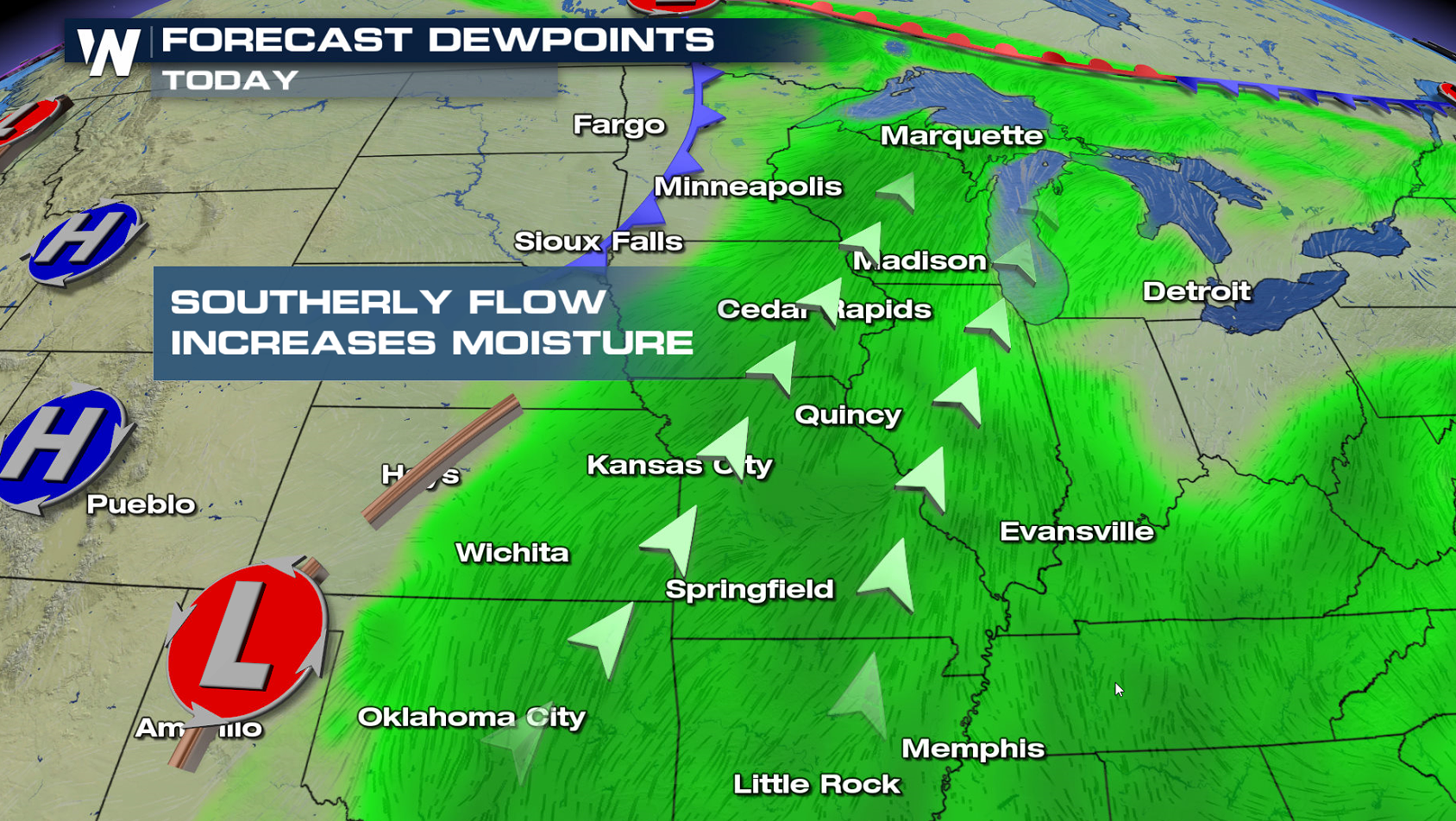
 Humidity continues to climb with heat building ahead of a low pressure center and cold front in the Northern Plains. With high instability, this will help to create severe thunderstorms in the late afternoon and evening hours.
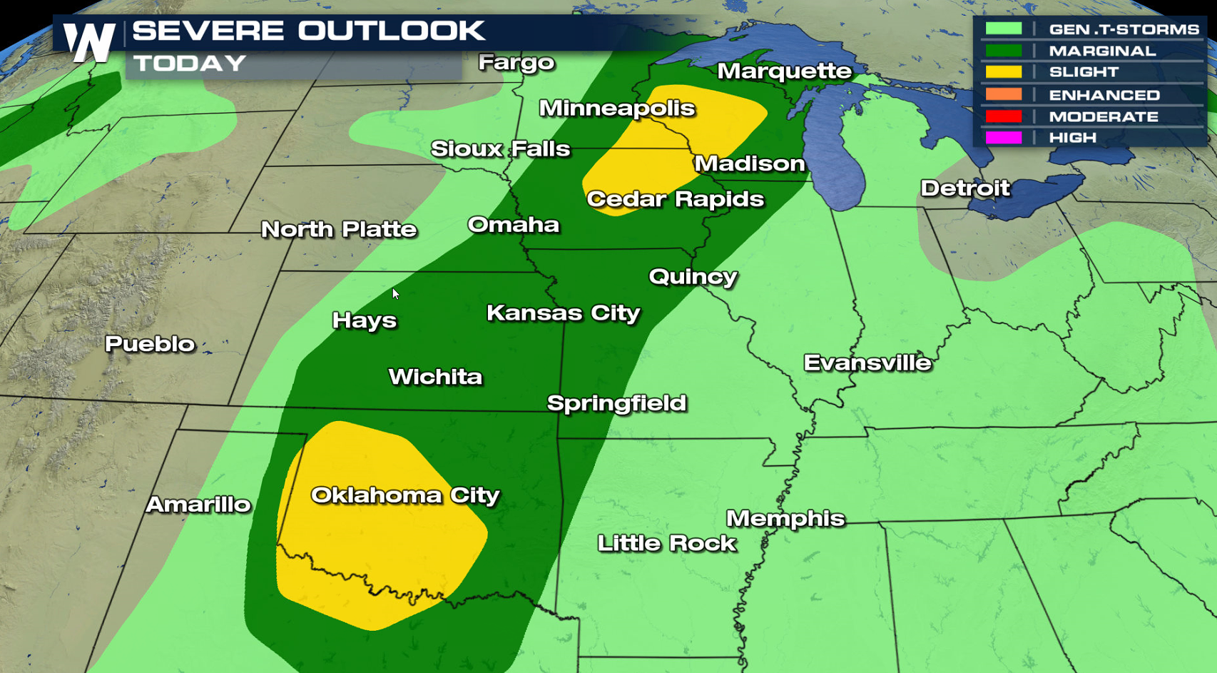
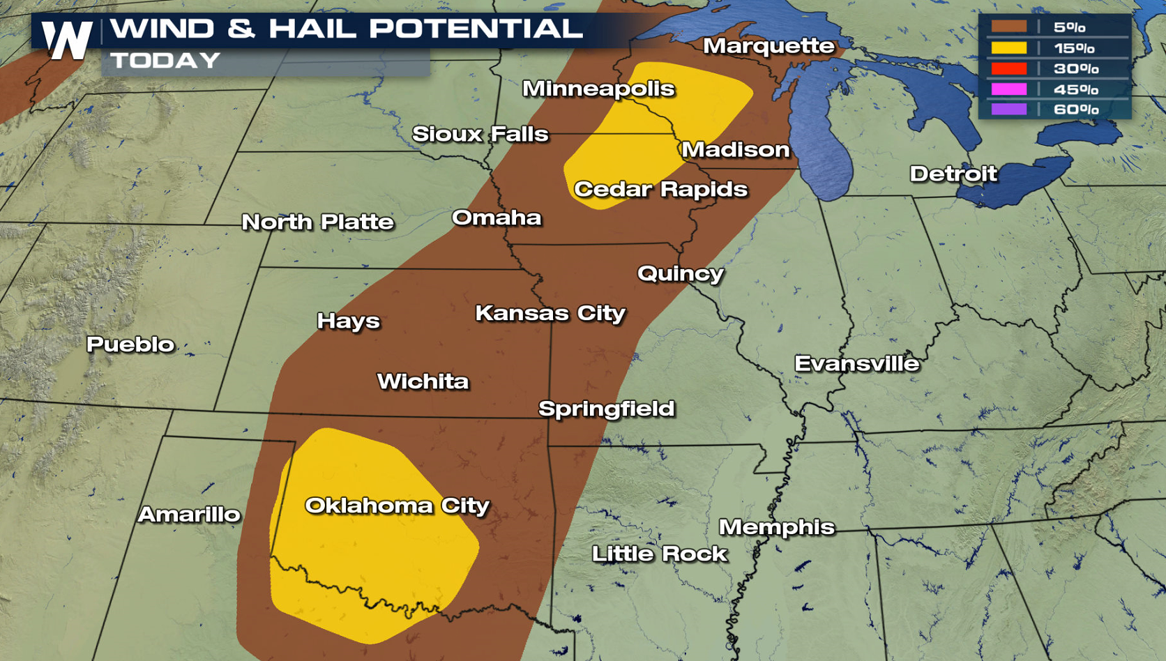
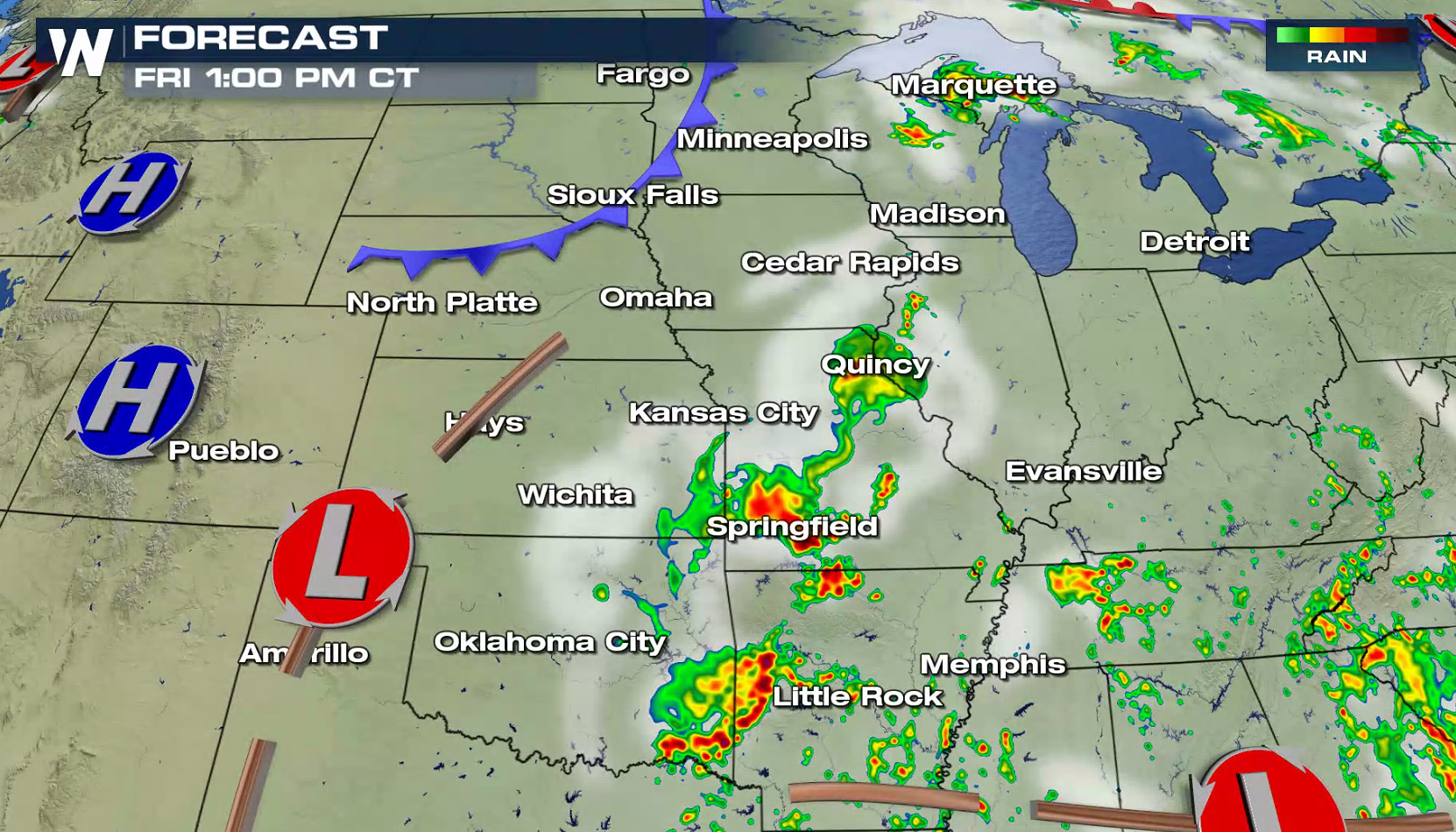
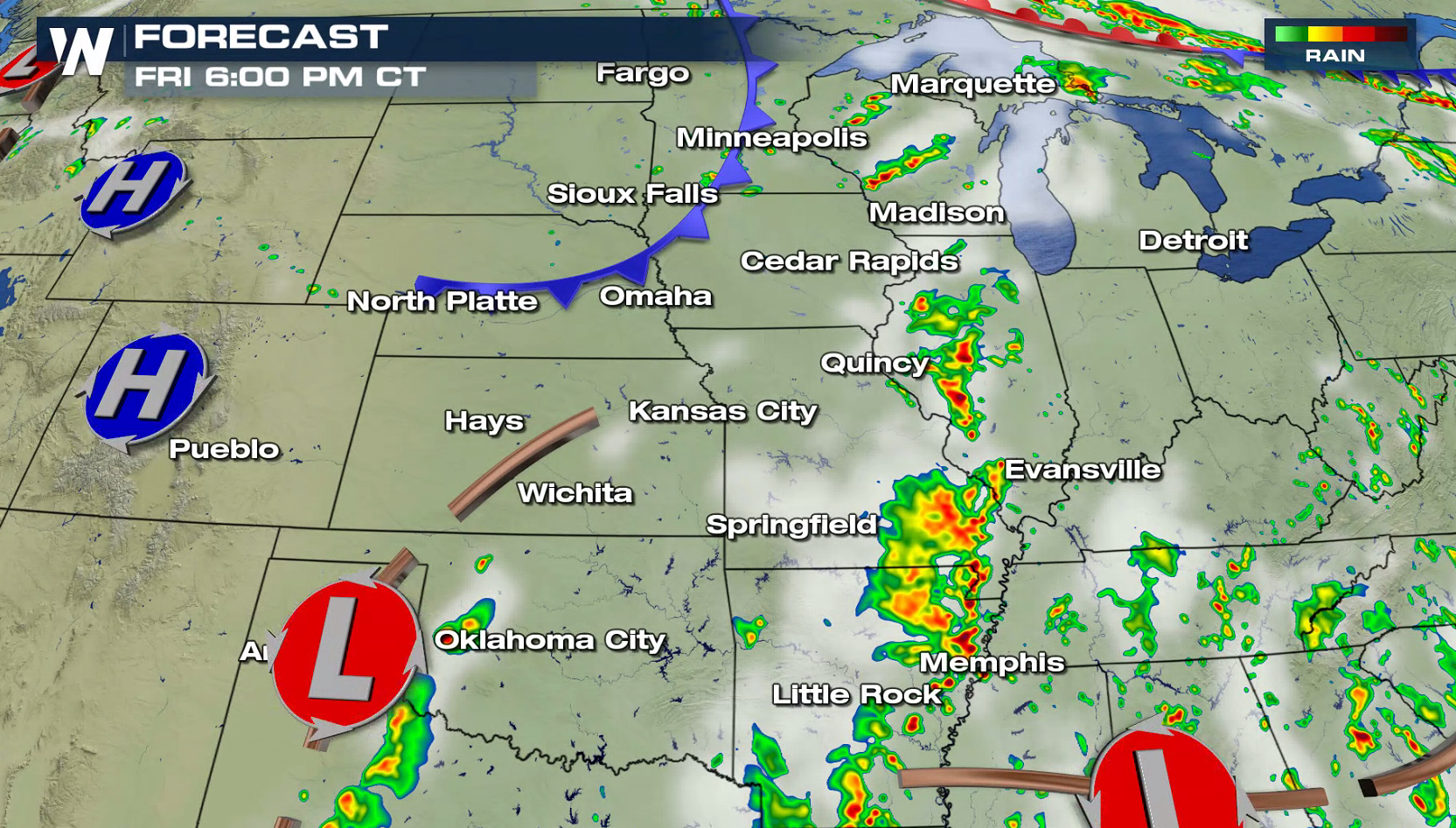
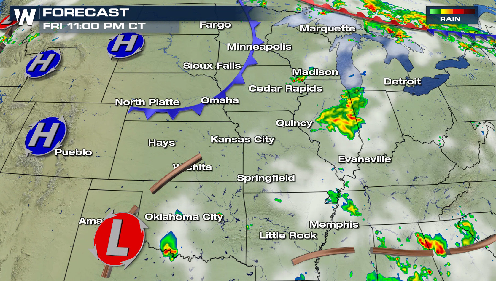
 Overall thunderstorm coverage will be limited, but a few severe cells are likely to form later today (Friday). Wind gusts greater than 60 mph and hail larger than the size of a quarter are the biggest risks. Storms will weaken into the overnight.
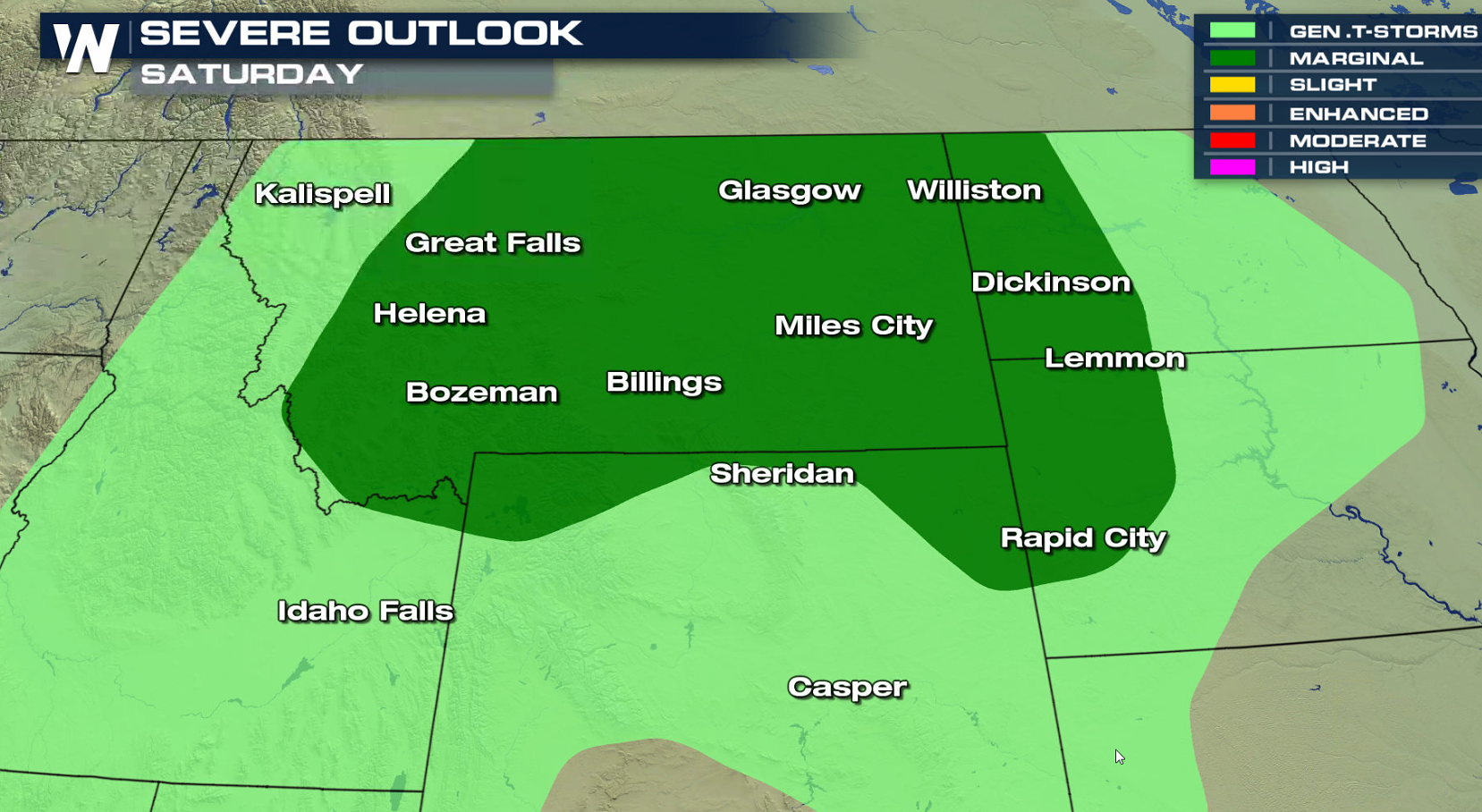
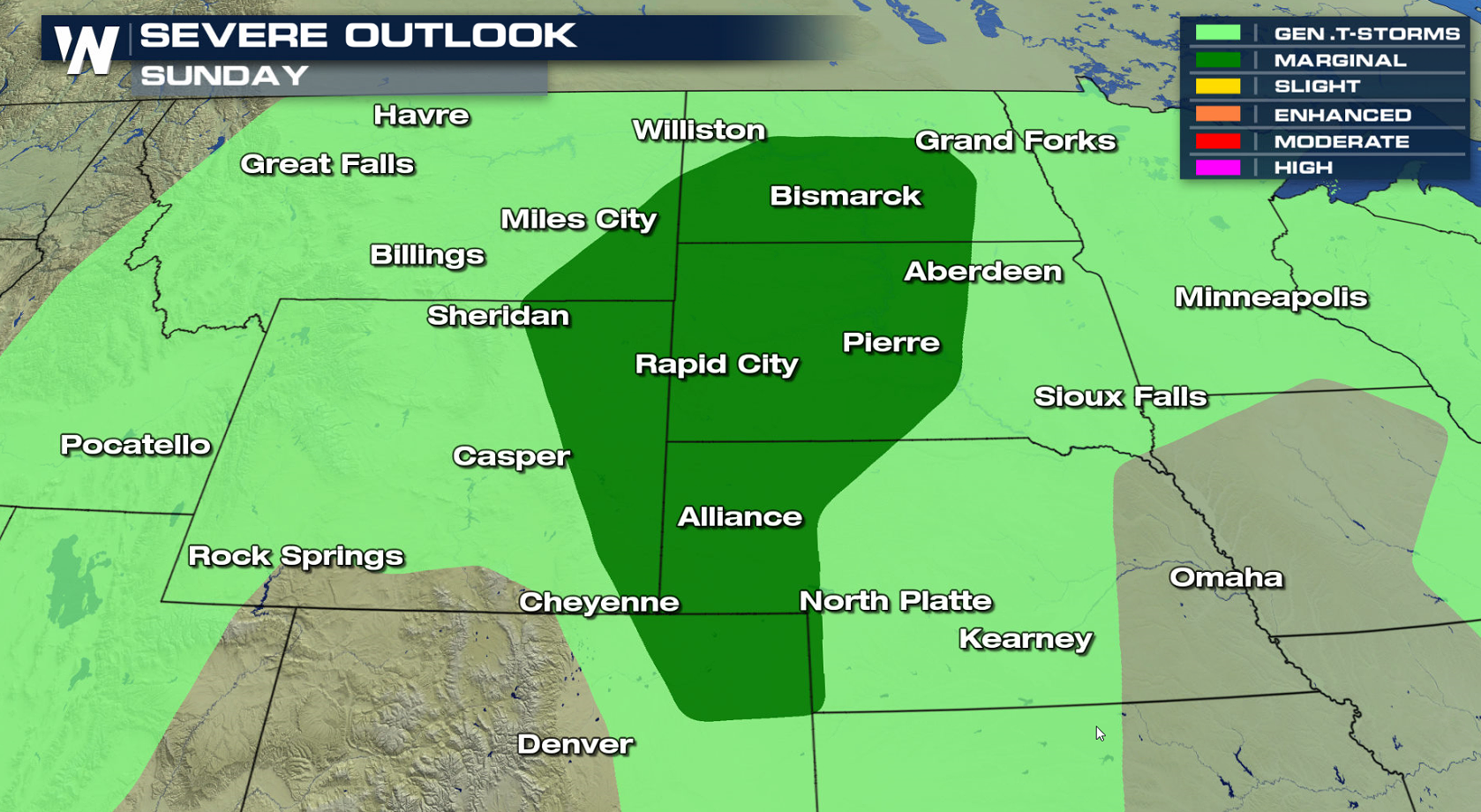
 The threat for severe weather is lower this weekend, with a marginal severe weather risk in the High Plains and along the Gulf of Mexico coastline with Subtropical Storm Alberto.
 For WeatherNation: Meteorologist Mace Michaels
Humidity continues to climb with heat building ahead of a low pressure center and cold front in the Northern Plains. With high instability, this will help to create severe thunderstorms in the late afternoon and evening hours.
Overall thunderstorm coverage will be limited, but a few severe cells are likely to form later today (Friday). Wind gusts greater than 60 mph and hail larger than the size of a quarter are the biggest risks. Storms will weaken into the overnight.
The threat for severe weather is lower this weekend, with a marginal severe weather risk in the High Plains and along the Gulf of Mexico coastline with Subtropical Storm Alberto.
For WeatherNation: Meteorologist Mace MichaelsAll Weather News
More
Flooding Risk Increases as Heavy Rain Targets the Tri-State Area
Tuesday, heavy rainfall moved across the Nort
30 Jul 2026 12:25 AM


Genevieve Down to a Category 2 Hurricane
PacificFausto is now a post-tropical cyclone.
30 Jul 2026 12:00 AM

Severe Weather: Energy From the Midwest Now in the Southeast
UPPER MIDWEST - Through Monday, dangerous tor
29 Jul 2026 10:30 PM


Southeast Flood Risk Lingers Near Stalled Front
A stalled boundary over the Southeast will ke
25 Jul 2026 10:55 AM

Another Round of Storms Targets the Northeast
Tuesday brought severe weather again across p
23 Jul 2026 1:15 AM