Severe Weather Risk Continues in Florida Sunday

Special Stories
11 Apr 2021 2:01 PM
Strong thunderstorms are expected to continue across the Florida Peninsula through this Sunday. We are expecting storms to intensify in a line-segment bringing in primarily a strong wind threat and possible damaging downdraft winds.
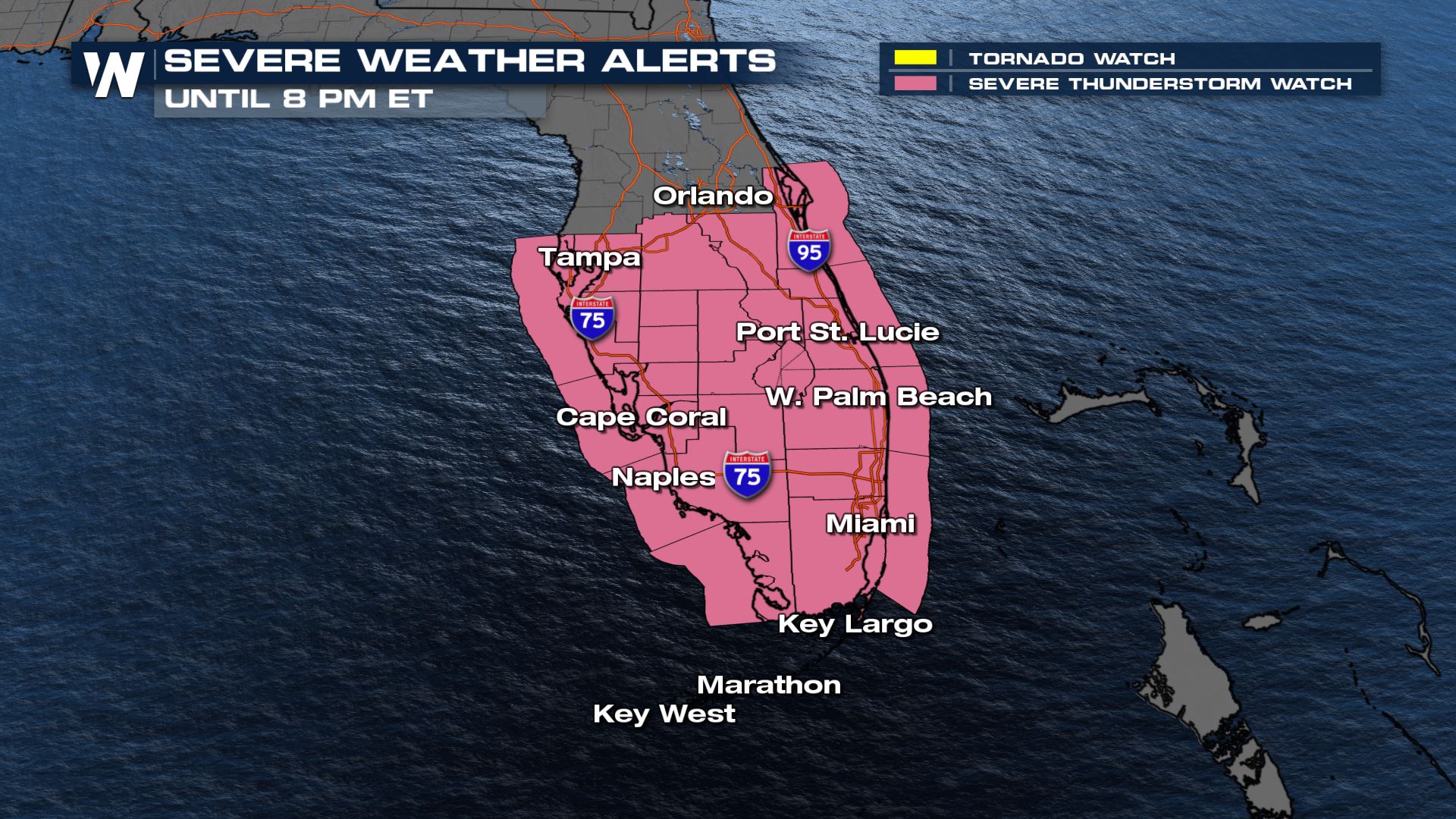
A severe thunderstorm watch has been issued until 8 PM ET for South Florida for winds up to 70 mph, isolated large hail up to 1" and a tornado or two possible.
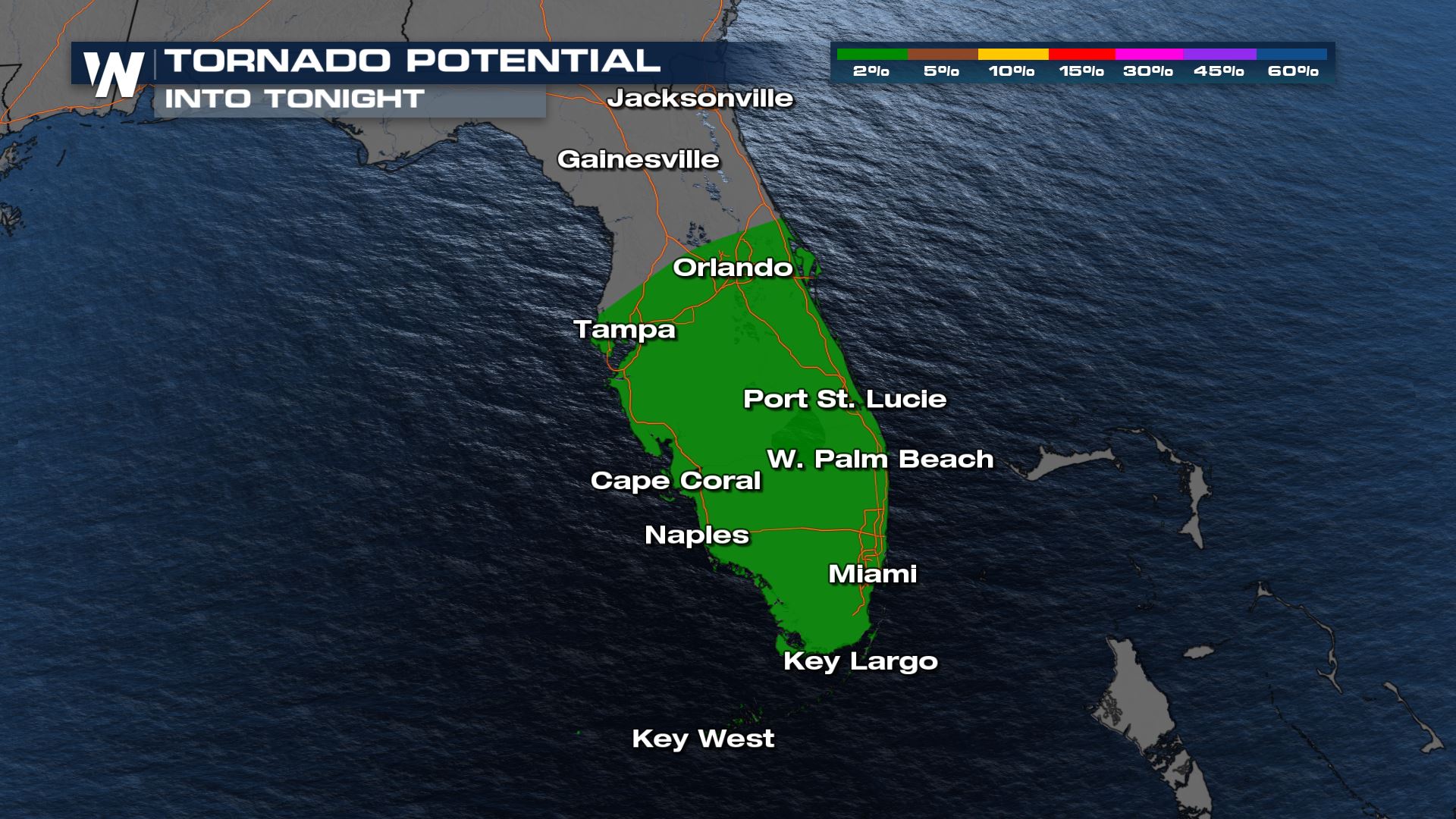
 As storms organize today, the primary threat will be strong winds will be the primary threat but we can't rule out the tornado potential.
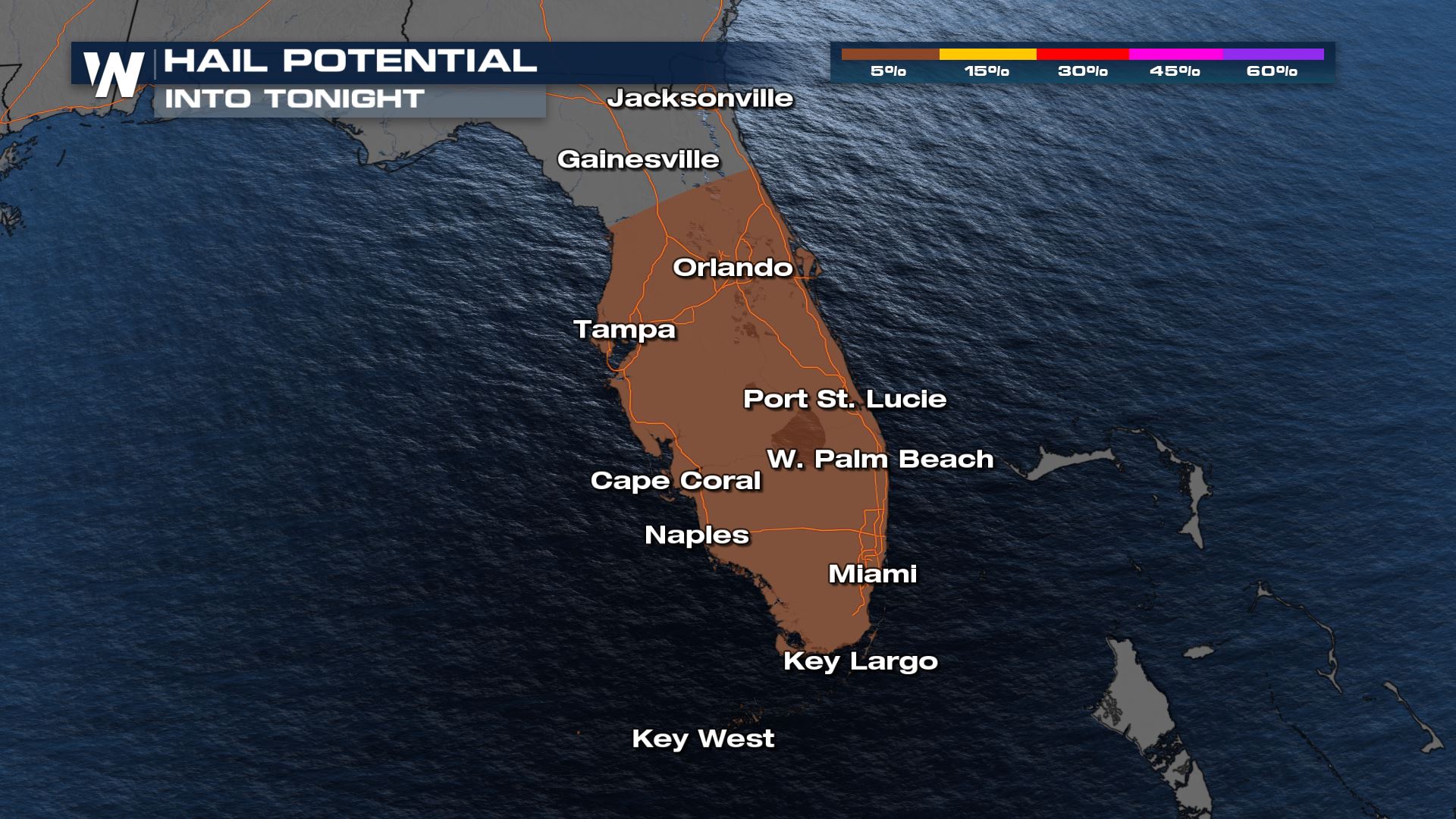
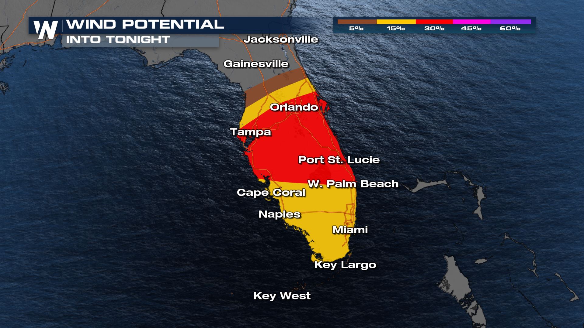 A bit unusual for Florida, but there is also a small risk for damaging hail as well.
 By tonight, storms could also affect the Keys that are also under the risk for severe storms too.
 Your east regional forecast, including Florida, airs at :10 after the hour on WeatherNation.
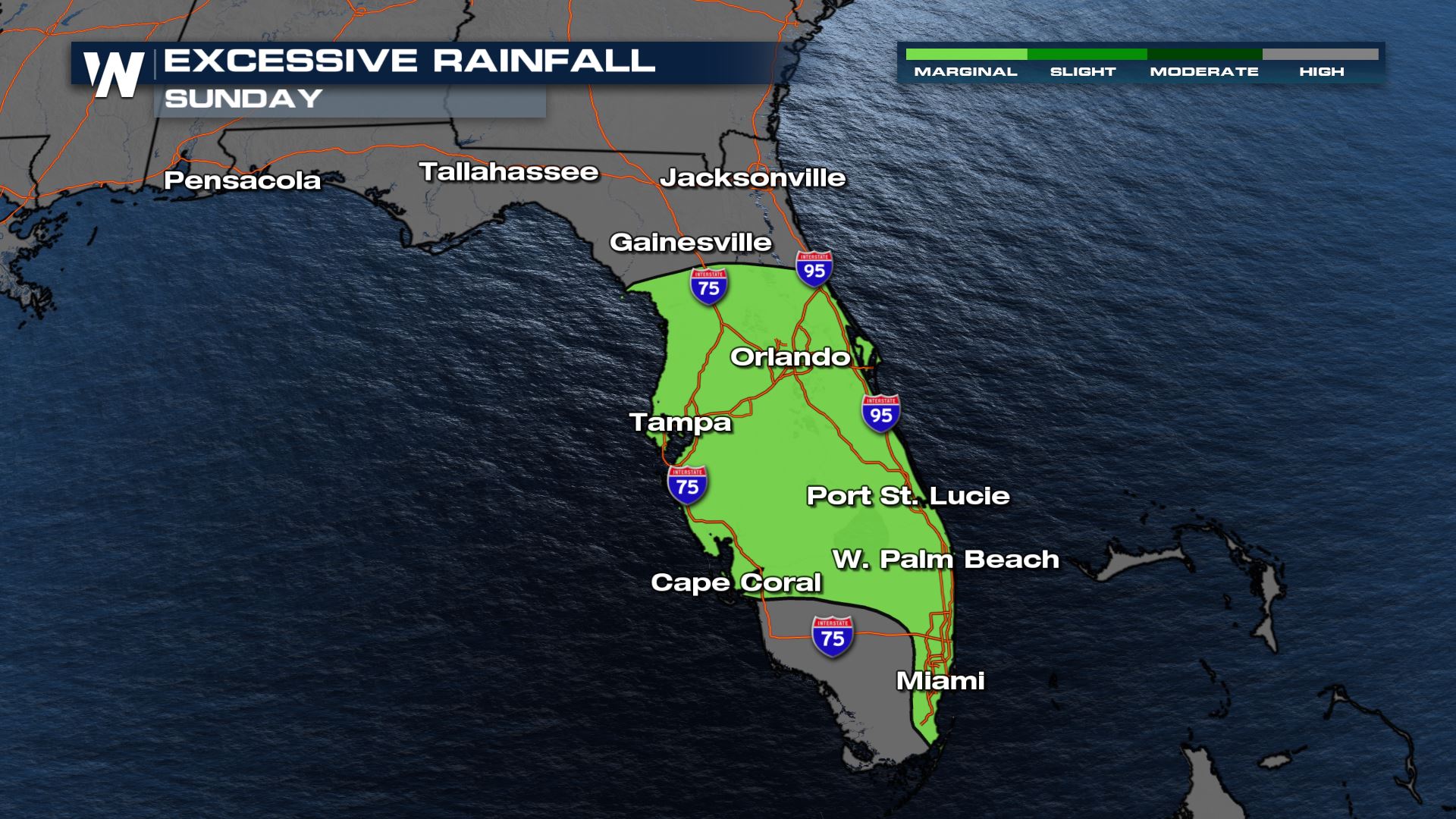
Storm Outlook
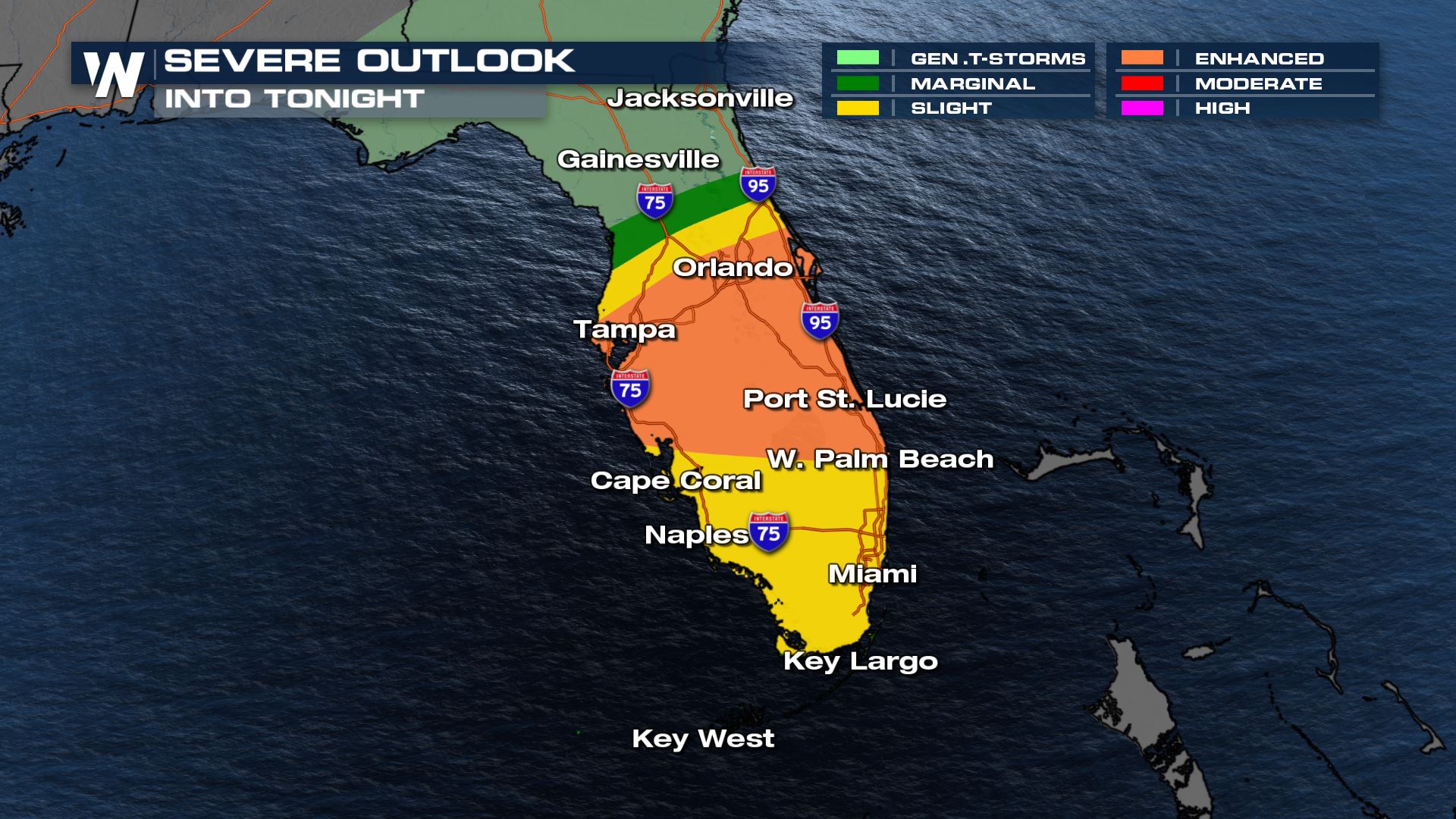
The Storm Prediction Center has issued an 'enhanced' (level 3, on a scale of 1 to 5) risk for strong storms for Florida into Sunday night. As storms organized in a line the threat for damaging wind gusts and possible downdraft winds will enhance throughout the day.
As storms organize today, the primary threat will be strong winds will be the primary threat but we can't rule out the tornado potential.
A bit unusual for Florida, but there is also a small risk for damaging hail as well.
FORECAST
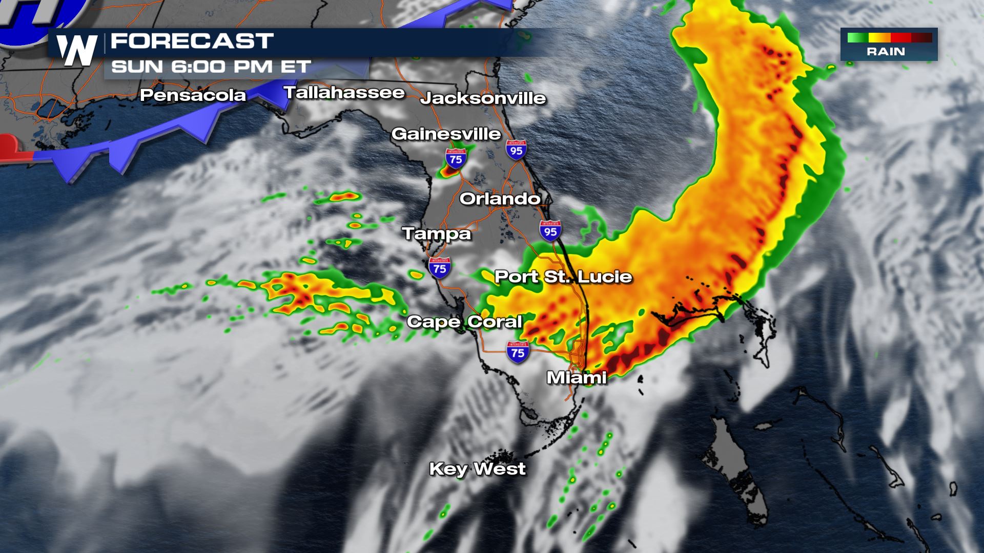
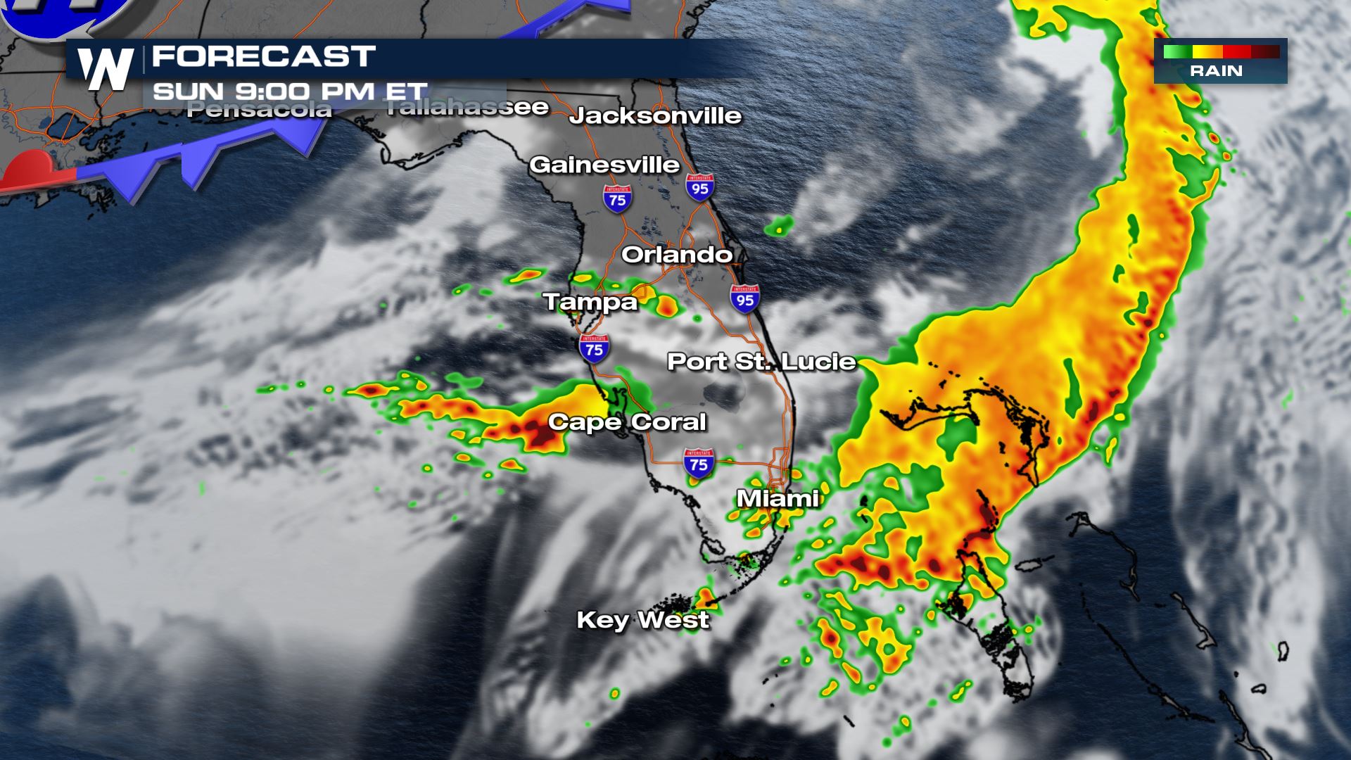
Thunderstorms continue to make their way through Florida with strong winds and large hail reports. By this evening, the line should make its way to Miami and Naples.
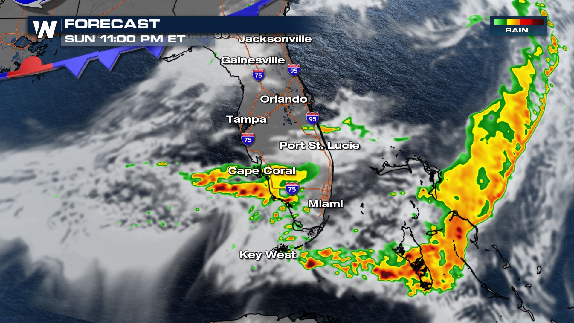
By tonight, storms could also affect the Keys that are also under the risk for severe storms too.
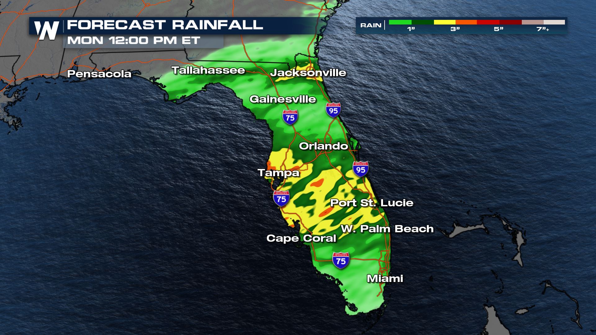
Forecast Rainfall
With thunderstorms and rain in the forecast for most of today, some areas may pick up on some heavy rainfall. Minor flooding may be possible for those with 2-3" of rain in the forecast. Here's a look at our in-house forecast models through today.
Your east regional forecast, including Florida, airs at :10 after the hour on WeatherNation.All Weather News
More
Repeated Rain Raising the Flood Threat
An unsettled weather pattern will continue to
26 May 2026 10:00 AM

Severe Threat For Portions of Texas To Start The Week
WHAT TO EXPECTA trough will combine with inst
26 May 2026 10:00 AM

Severe Storms Target The Upper Midwest
RECAPWe've had quite the last 72 hours across
26 May 2026 9:55 AM

Severe Storms, Heavy Rain Target the Southeast
WHAT TO EXPECTHeavy rain has already hit nume
24 May 2026 8:00 PM

NOAA Predicts Below Normal 2026 Hurricane Season
NOAA has released their predictions for the 2
24 May 2026 4:00 PM

NOAA Releases Summer Outlook, Above Average Temperatures Expected
The National Oceanic and Atmospheric Administ
24 May 2026 3:00 PM

Severe Storms Persist in the Southern Plains, Gulf Coast
Several rounds of storms have been swinging t
23 May 2026 6:45 PM