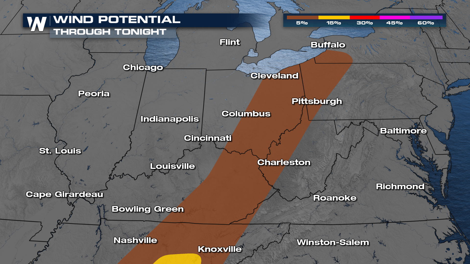
Severe Weather Threat Gradually Decreases for the Ohio Valley Tonight

After a record-warm day, the Storm Prediction Center continues to highlight the risk of strong storms through the Ohio Valley and eastern Great Lakes through tonight (ABOVE).
There is the potential for hail and an isolated tornado throughout the night but our primary threat will be damaging winds.
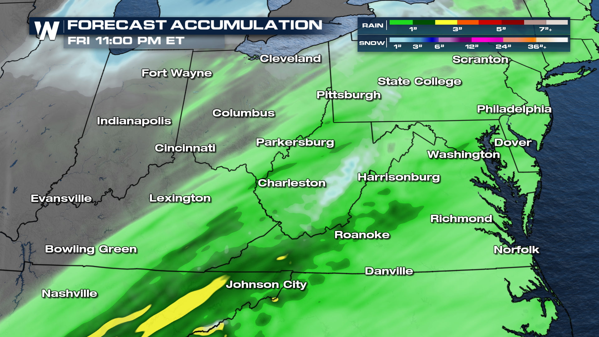
 The area of low pressure and cold front continue to push north and east overnight, creating a heavy rain threat through Central and Southern Appalachia. On the backside of the low pressure system we will see cold air mix in and create the potential for a few snow showers.
Heavy rain will also be a factor that could lead to localized flooding. Light snowfall accumulations are also possible.
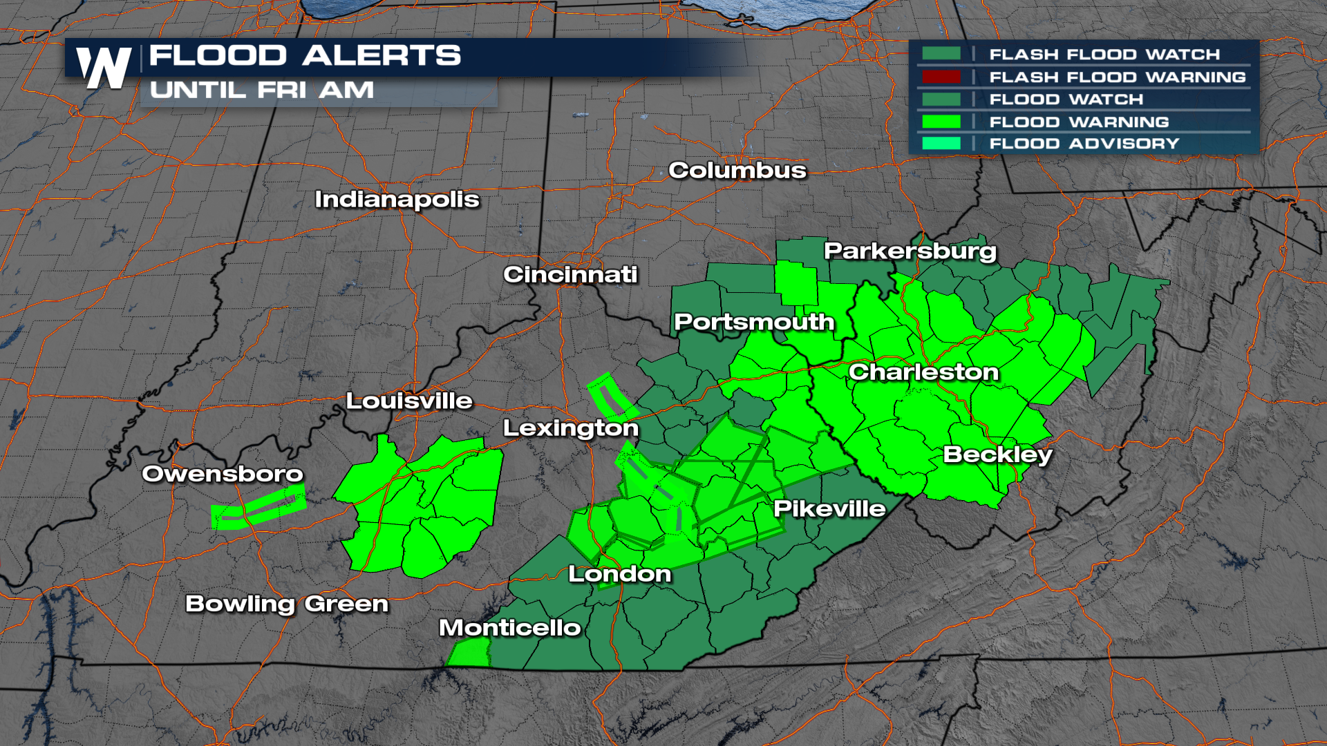
 Flood alerts are in effect for parts of Kentucky, Ohio, and West Virginia into early Friday morning. There have been numerous high water rescues from vehicles, so remember "Turn Around, Don't Drown!"
 For more on the severe weather and flood threat, join WeatherNation, always streaming 24/7.


