Severe Weather Threat in the High Plains and Southeast
Special Stories
28 Jun 2018 11:54 AM
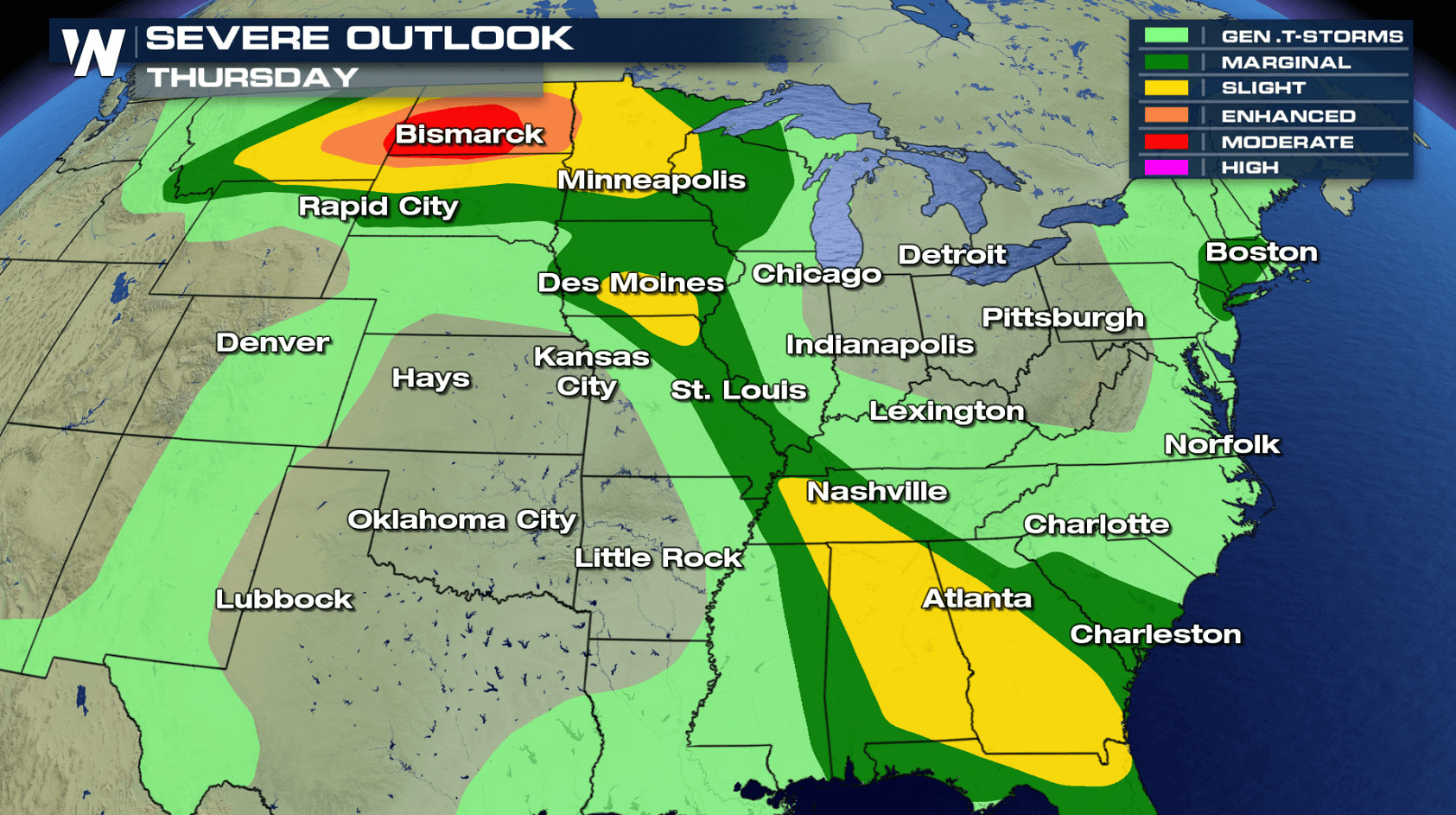
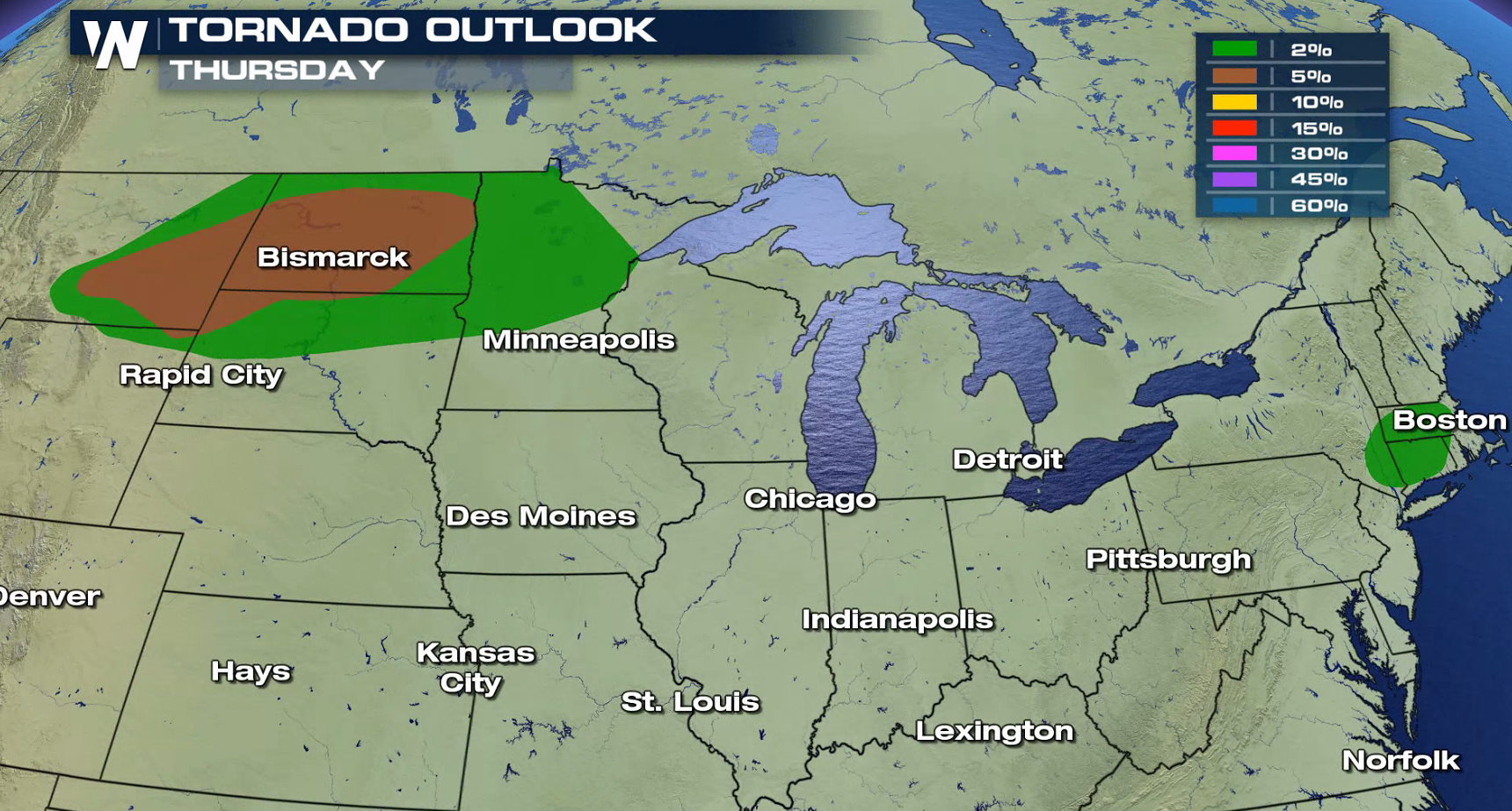
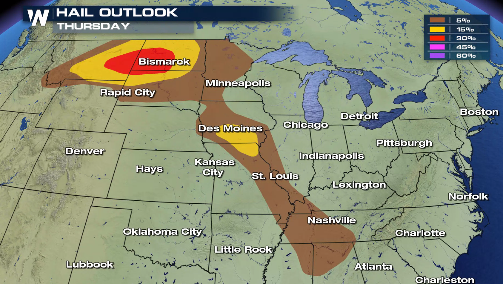
A series of fronts stretched from the High Plains to the Southeast into the Northeast will be the focus for severe weather today (Thursday). Severe weather looks likely in North Dakota, where a moderate risk for severe storms has been posted from the Storm Prediction Center. Some storms have already been producing large hail this morning west of Bismarck. Tornadoes are possible later this afternoon and evening (Thursday). A wave of thunderstorms will develop late tonight into Friday morning across the Northern Plains with a threat for damaging wind gusts.
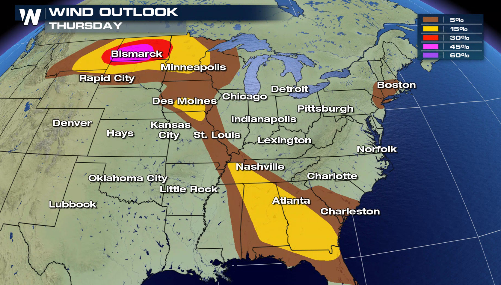
 There is also a severe weather risk in the Southeast, where strong winds are possible. You can read more about the severe weather threat in the Northeast at this link. WeatherNation will have updates on-air and online all day with the latest watches and warnings, along with live updates from in the field.
For WeatherNation: Meteorologist Mace Michaels
There is also a severe weather risk in the Southeast, where strong winds are possible. You can read more about the severe weather threat in the Northeast at this link. WeatherNation will have updates on-air and online all day with the latest watches and warnings, along with live updates from in the field.
For WeatherNation: Meteorologist Mace MichaelsAll Weather News
More

Tropics: Fausto Heads towards Hawaii; Genevieve a Major Hurricane
PacificTropical Storm Fausto continues to tra
28 Jul 2026 11:30 PM

Flooding Risk Increases as Heavy Rain Targets the Tri-State Area
TRI-STATE AREA - Along with the threat of sev
28 Jul 2026 11:20 PM


Southeast Flood Risk Lingers Near Stalled Front
A stalled boundary over the Southeast will ke
25 Jul 2026 10:55 AM

Another Round of Storms Targets the Northeast
Tuesday brought severe weather again across p
23 Jul 2026 1:15 AM