Severe Weather Threat in the High Plains Thursday
Special Stories
23 Aug 2018 7:45 AM
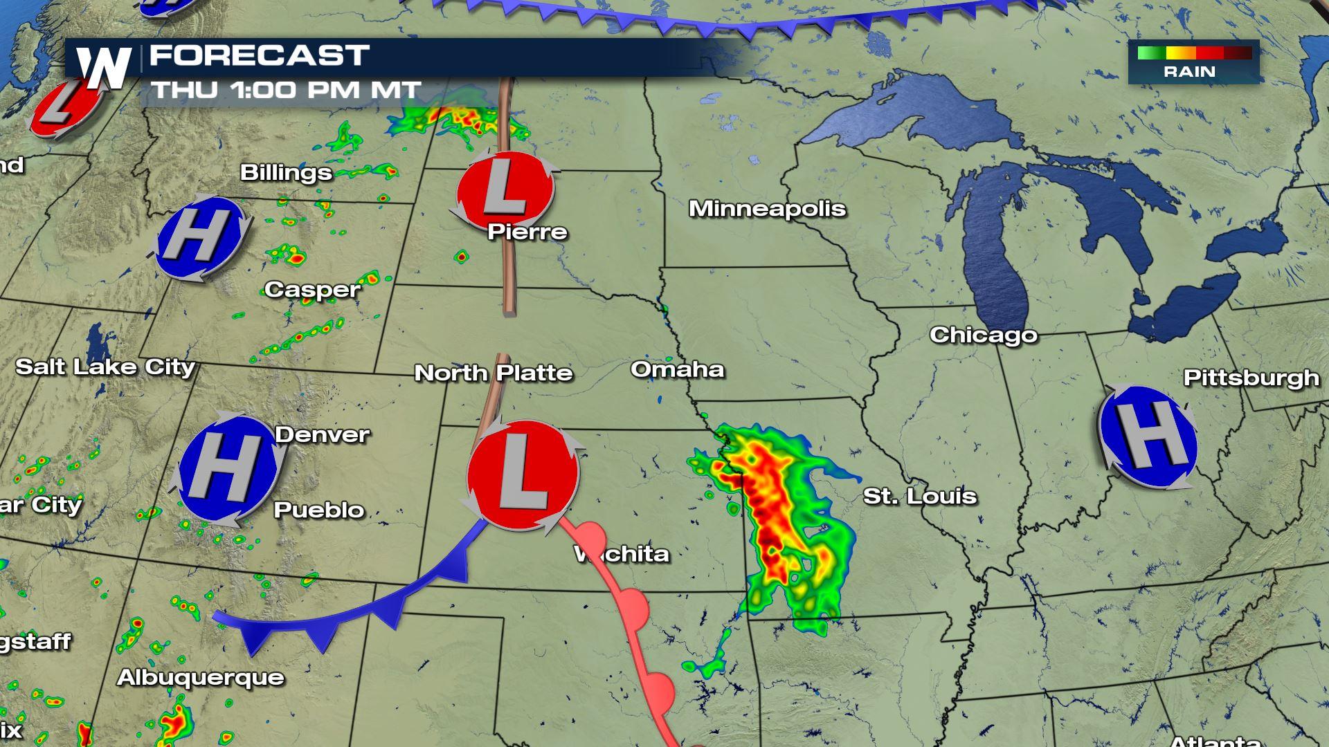
Strong storms are expected to fire up along a trough of low pressure Thursday afternoon. This area of low pressure extends from the Dakotas into Kansas and will be the focus of the storm threat Thursday afternoon and evening.
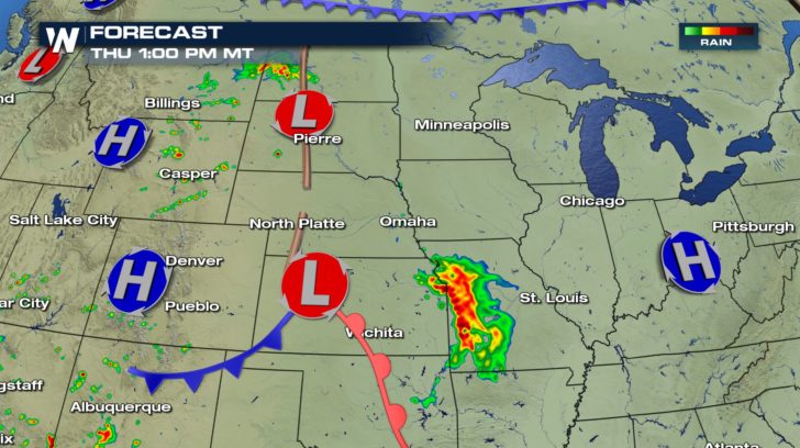
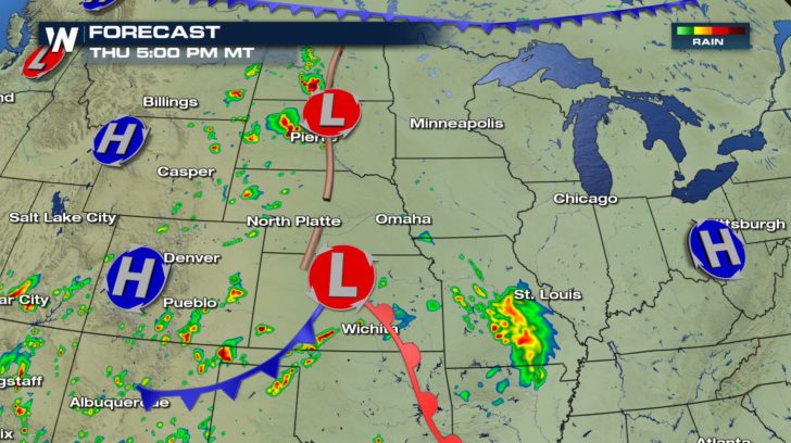 Storms that form along this boundary have the chance to become strong, even severe. A marginal and slight risk for severe weather is anticipated for the highlighted areas with hail and winds being most likely.
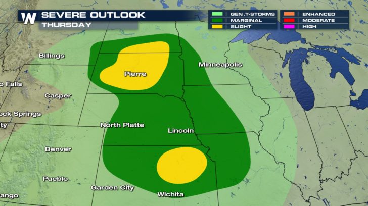
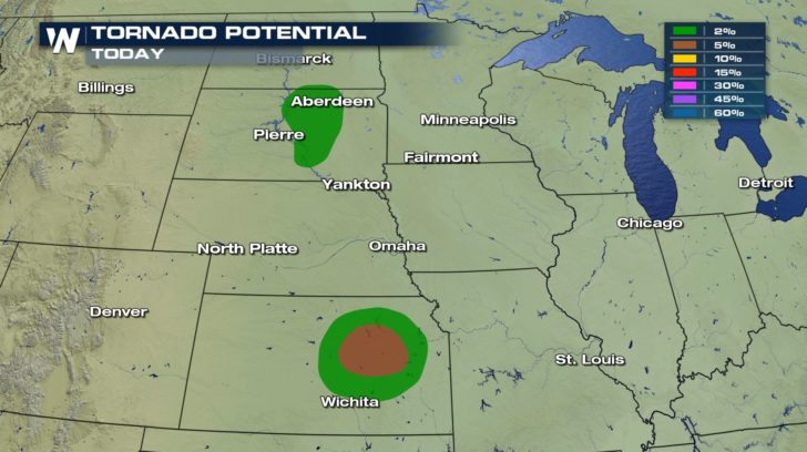
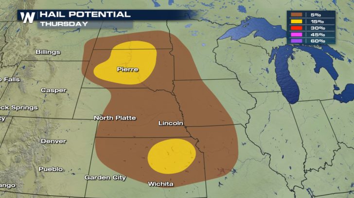 There could even be a few isolated tornadoes, particularly for South Dakota and Kansas. Stay weather aware.
 This low pressure system continues to push east heading into Friday and our severe storm risk follows it.
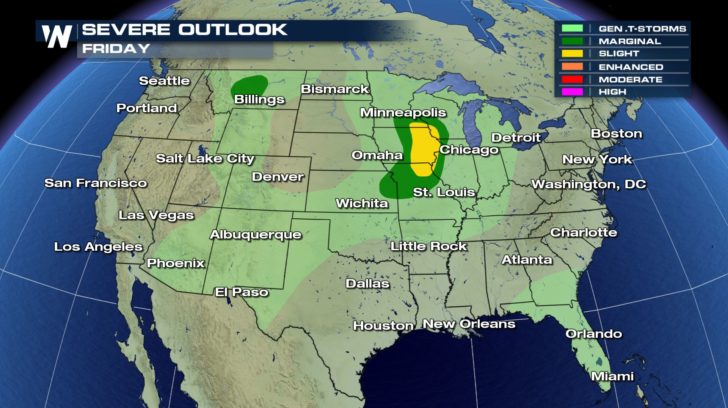 Friday's severe weather threats will be greatest over southern Minnesota, southwest Wisconsin, eastern Iowa and Northern Missouri.
For WeatherNation: Meteorologist Emily Roehler
Friday's severe weather threats will be greatest over southern Minnesota, southwest Wisconsin, eastern Iowa and Northern Missouri.
For WeatherNation: Meteorologist Emily Roehler
Storms that form along this boundary have the chance to become strong, even severe. A marginal and slight risk for severe weather is anticipated for the highlighted areas with hail and winds being most likely.
There could even be a few isolated tornadoes, particularly for South Dakota and Kansas. Stay weather aware.
This low pressure system continues to push east heading into Friday and our severe storm risk follows it.
Friday's severe weather threats will be greatest over southern Minnesota, southwest Wisconsin, eastern Iowa and Northern Missouri.
For WeatherNation: Meteorologist Emily RoehlerAll Weather News
More
Fourth of July Storms Could Interrupt Holiday Celebrations Across the Northeast
An active weather pattern is expected to unfo
4 Jul 2026 9:14 PM

Persistent Heat Dome to Keep Much of the Eastern U.S. Sweltering Through the Holiday Weekend
An expansive ridge of high pressure will cont
4 Jul 2026 9:10 PM

Rounds of Severe Storms Target the Plains for the 4th of July
Strong storms rocked the Midwest and Plains a
4 Jul 2026 9:00 PM

Massive Fires Burn in the Four Corners
The Aspen Acres fire burning in Southern Colo
4 Jul 2026 9:00 PM


Slow-Moving Front No Longer Expected to Develop Tropically, Monitoring Eastern Pacific
Early in the season, we watch closer to the c
1 Jul 2026 12:15 AM

'MCS' Season Brings Severe and Flooding Threats Across the Southeast
As Summer settles in across the Central U.S.,
28 Jun 2026 2:10 AM