Severe Weather Threat in the Plains
Special Stories
16 Aug 2018 9:34 AM
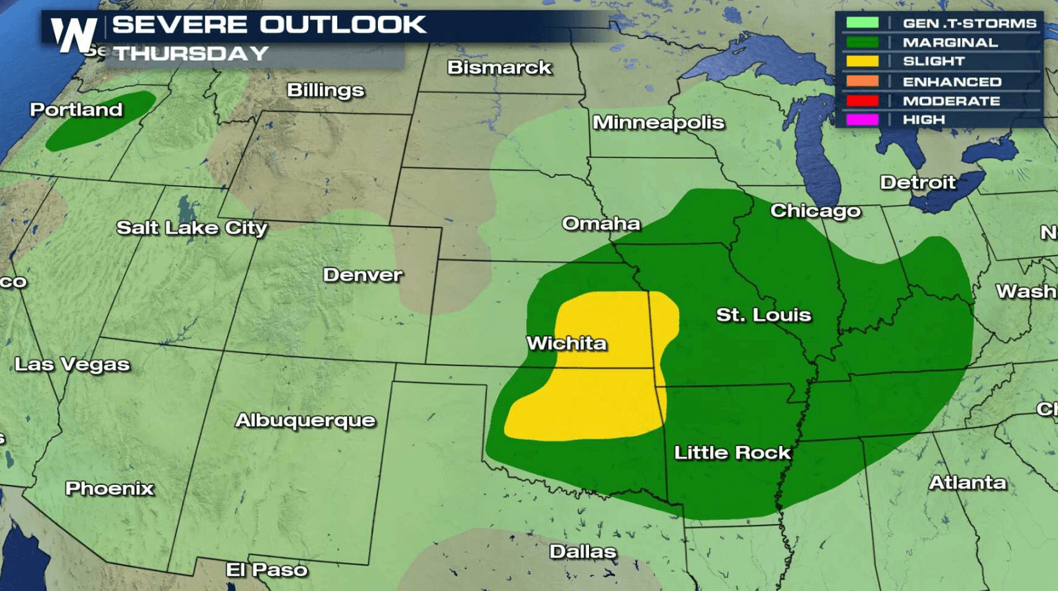
A storm system moving across the central Plains today (Thursday) will bring a chance for severe thunderstorms in the late afternoon and early evening. Strong wind gusts greater than 60 mph and hail larger than a quarter are the biggest threats, along with a low tornado risk.
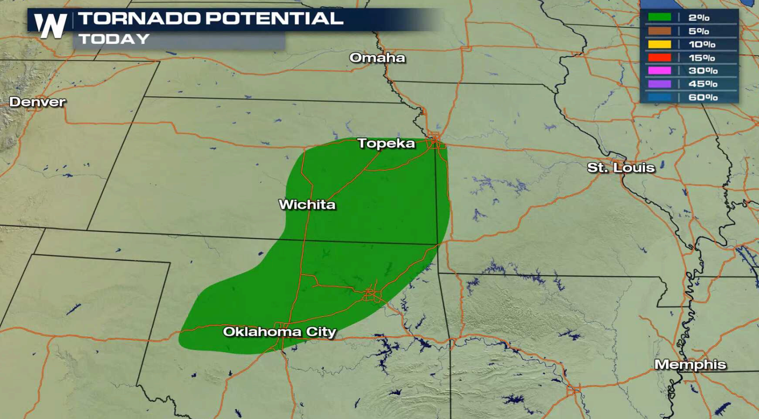
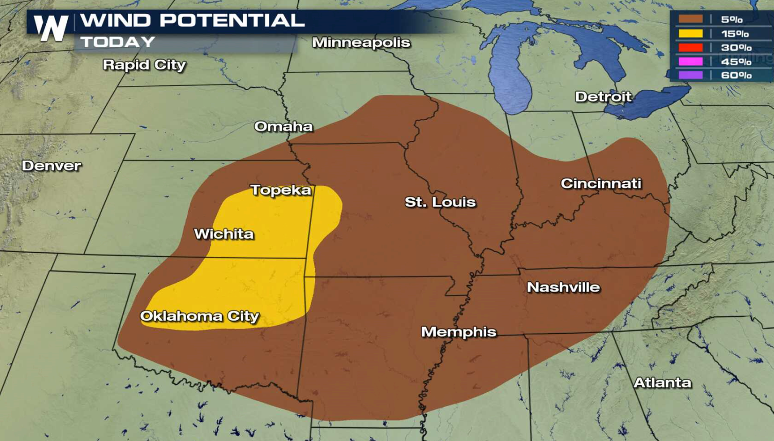
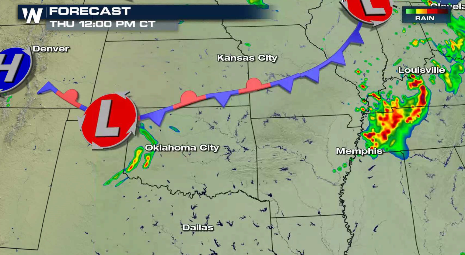
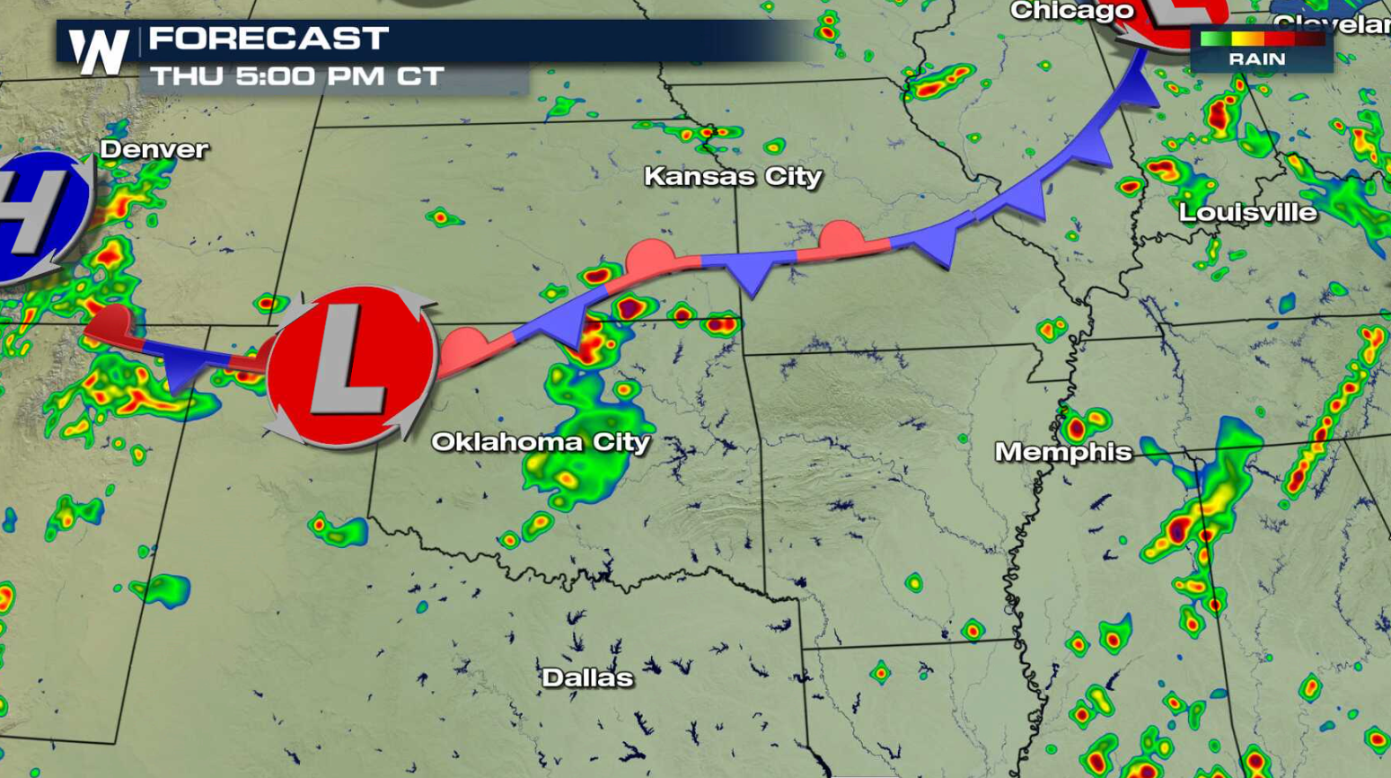
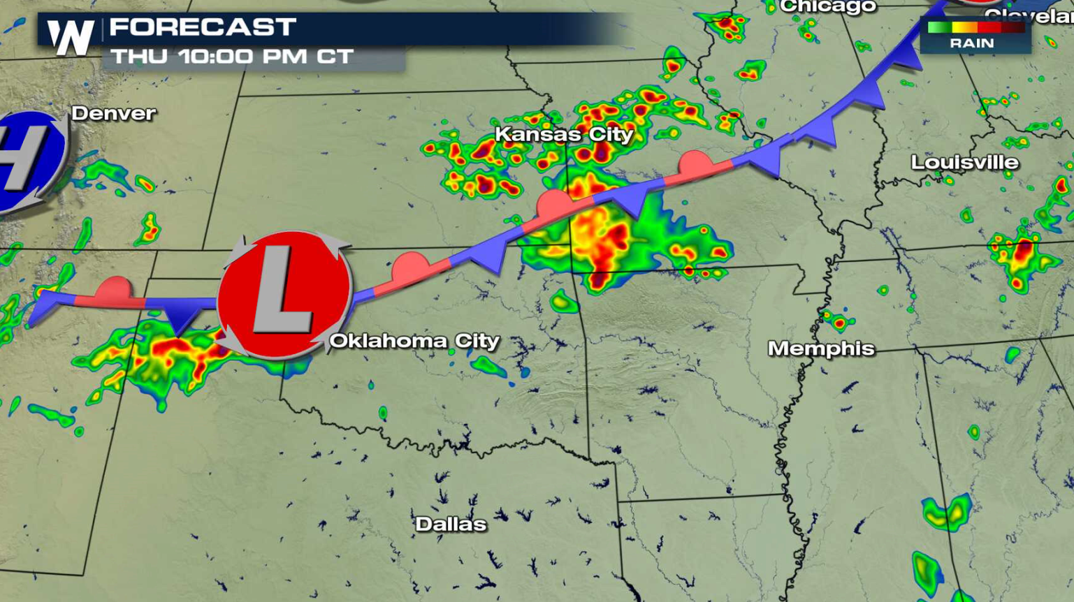
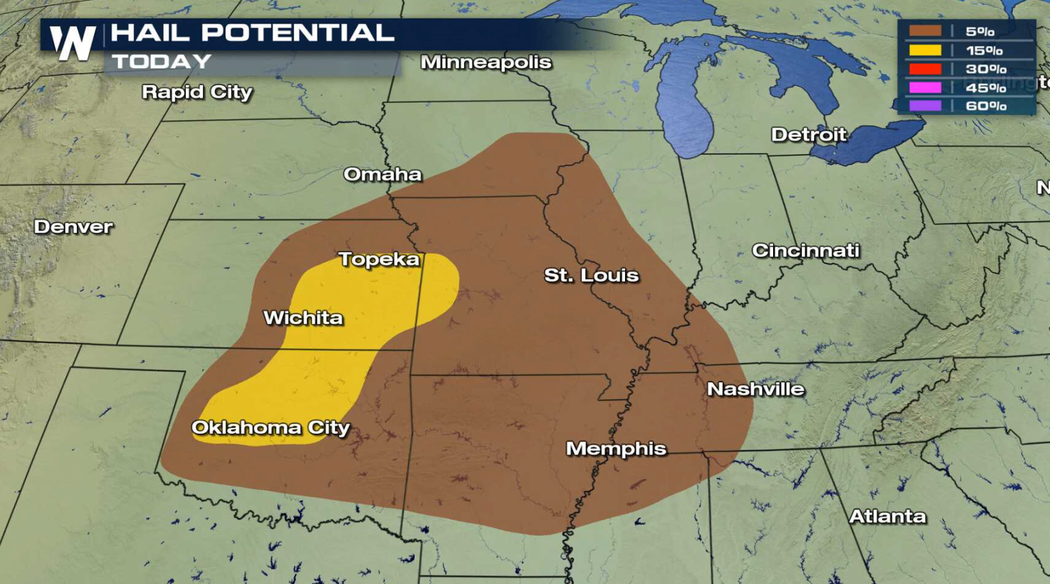 A hot and humid air mass is located along a slow moving cold front and low pressure center. Storms will develop along the front into this evening, with some likely to become severe. Areas from near Oklahoma City to Kansas City may see intense storms.
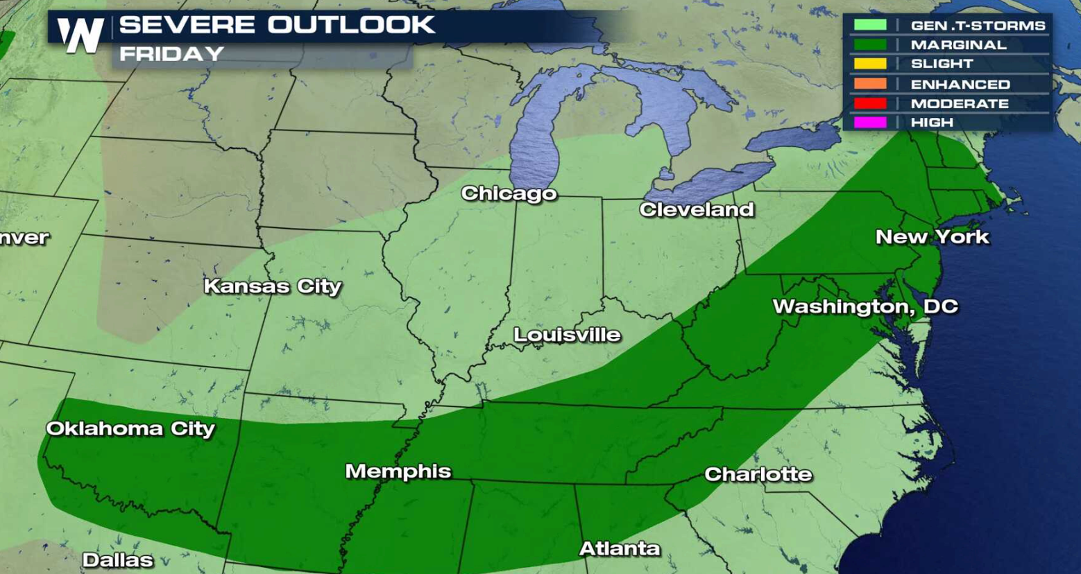
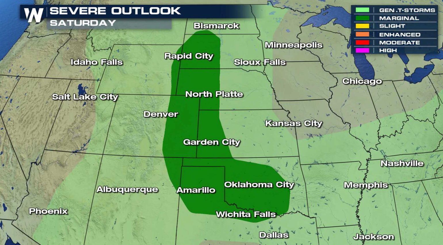
 There is a marginal risk for severe thunderstorms for Friday and Saturday from the Atlantic Ocean to the Plains.
 For WeatherNation: Meteorologist Mace Michaels
A hot and humid air mass is located along a slow moving cold front and low pressure center. Storms will develop along the front into this evening, with some likely to become severe. Areas from near Oklahoma City to Kansas City may see intense storms.
There is a marginal risk for severe thunderstorms for Friday and Saturday from the Atlantic Ocean to the Plains.
For WeatherNation: Meteorologist Mace MichaelsAll Weather News
More
Strong July Trough Shakes Up Temperatures
"Enough of this heat, already" - everybodyIn
14 Jul 2025 8:00 PM

Flash Flooding Threat Continues in Texas
It has been 10 days since the devastating flo
14 Jul 2025 7:05 PM

Invest 93L Develops Off Florida Coast, CSU Updates Seasonal Forecast
Invest 93L has developed off the Florida coas
14 Jul 2025 7:00 PM

Flooding Concern Growing in the Northeast
Storms rumbling through the northeast on Sund
14 Jul 2025 6:55 PM

Dangerous Heat Impacting the Western U.S.
High pressure is moving off the California co
14 Jul 2025 6:10 PM

Heavy Rain, Flooding Threat Returns to Florida
Keep the rain boots handy in Florida - heavy
13 Jul 2025 12:50 PM

Severe Storm Risk Pushes into the Great Lakes, Ohio Valley
Friday was another busy day with severe weath
12 Jul 2025 8:00 PM