Active Across the Plains & Midwest - Severe Storms and Flash Flooding Possible

Flooding Threat
Thunderstorms with heavy rain continue to develop around the periphery of the upper-level "heat dome" and associated frontal boundaries. The risk for flash flooding continues through the weekend. The WPC has issued excessive rainfall outlooks over the next few days. The highlighted areas are at the highest risk for flooding.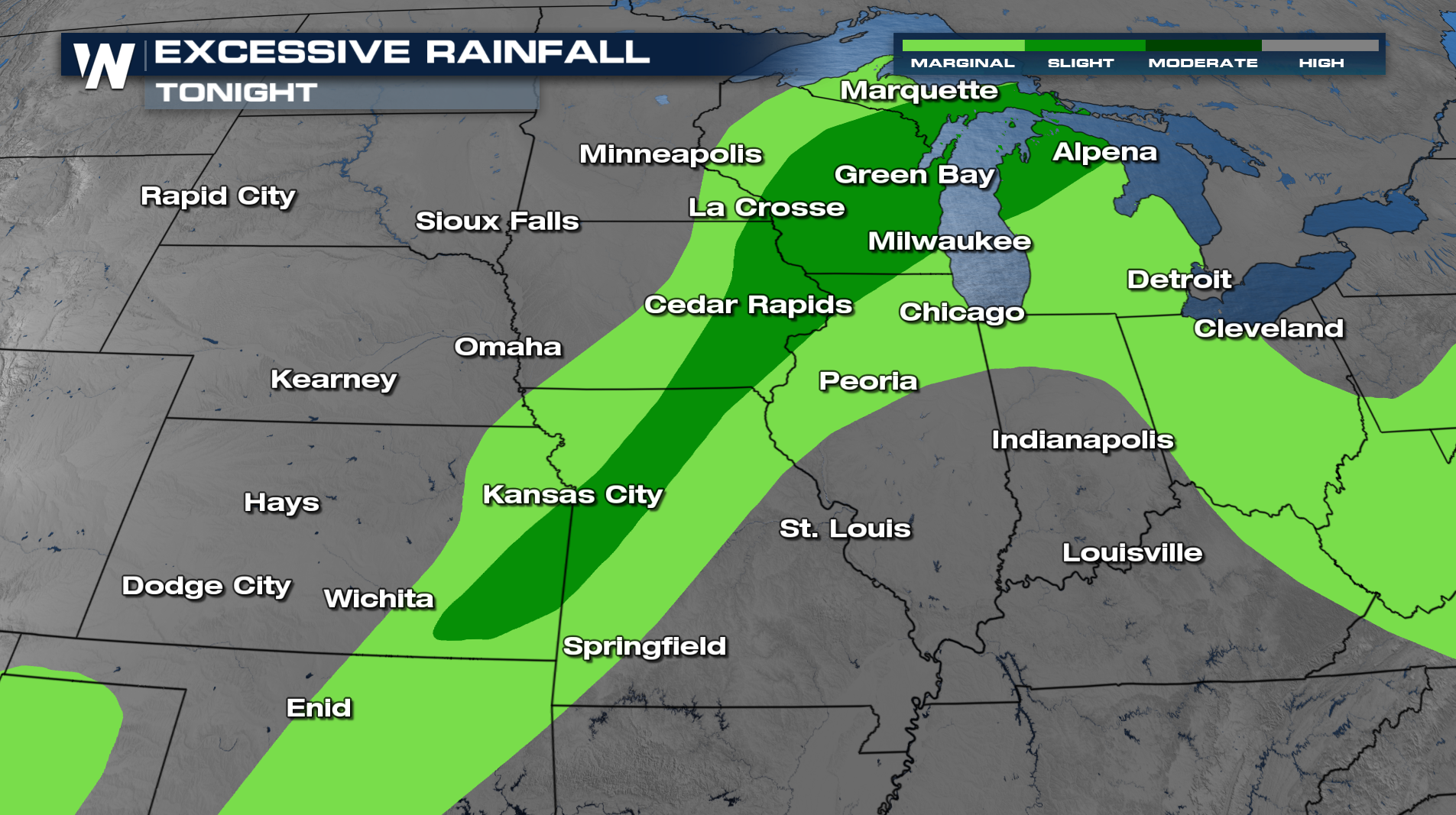
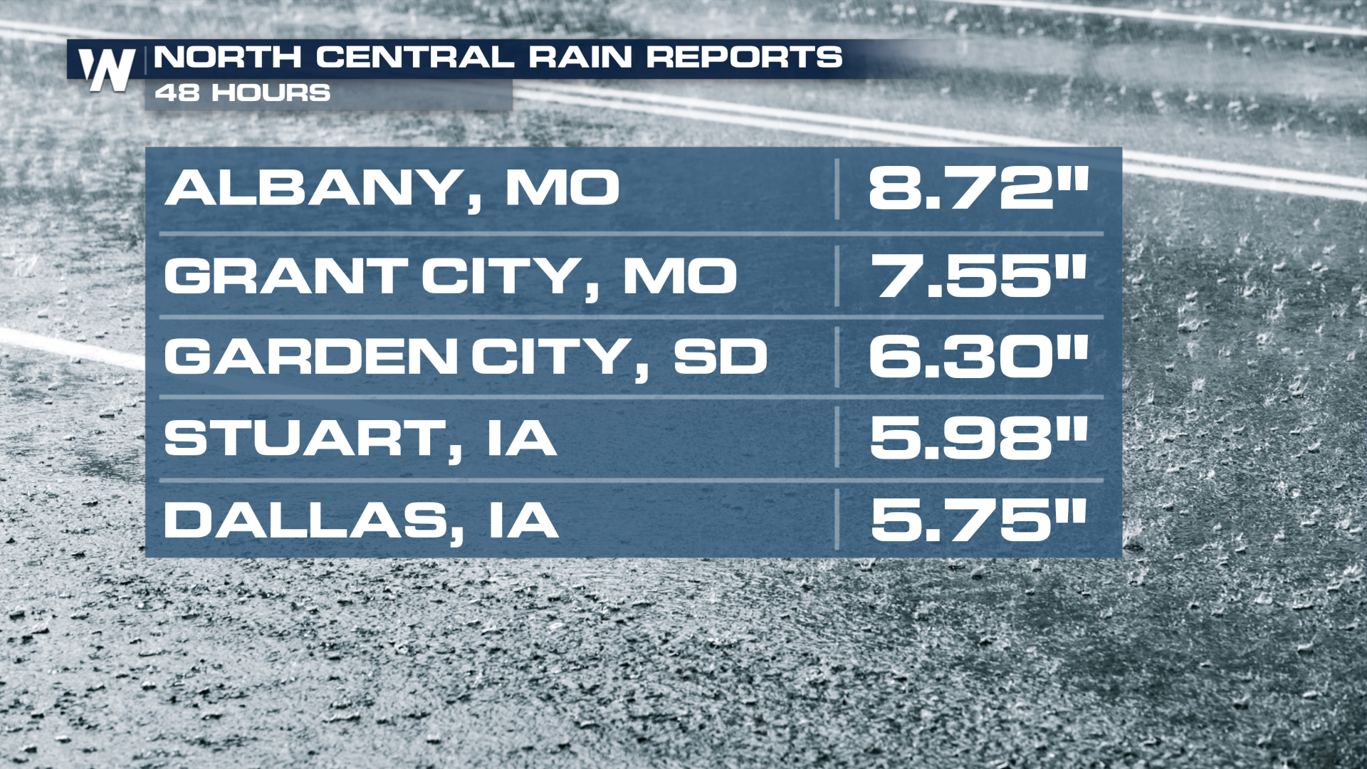
Rain Reports
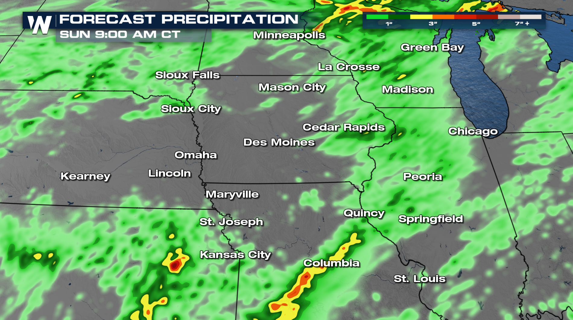
Rain Forecast
Flood alerts have been posted for portions of the Plains and Upper Midwest as thunderstorms continue to develop over the same areas.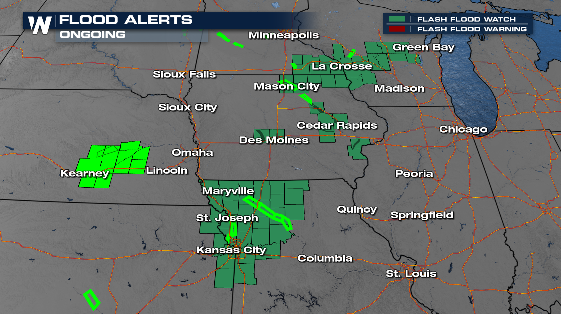
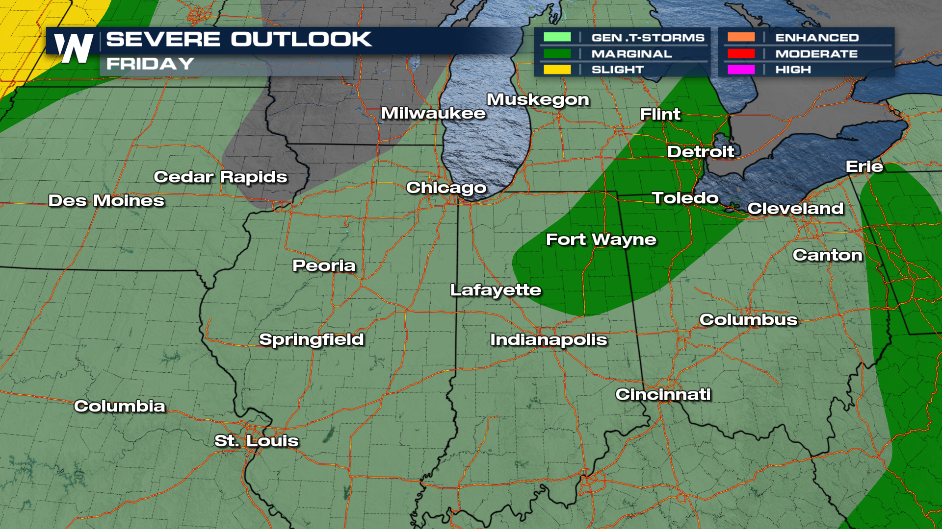
Severe Outlooks
It will remain active for portions of the Great Lakes and Upper Midwest through the rest of the week. As the cooler air to the north pushes up against our hot air mass, additional thunderstorms will occur.
Be sure to have multiple ways to receive severe weather alerts. More details about this will be discussed at :30 past the hour during our Central Regional Forecast on WeatherNation!


