Severe Weather Threat in the Middle Atlantic and Plains
Special Stories
20 Jun 2018 9:09 AM
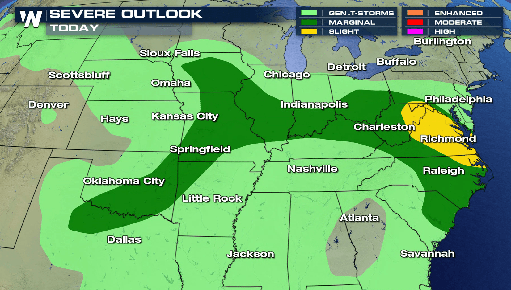
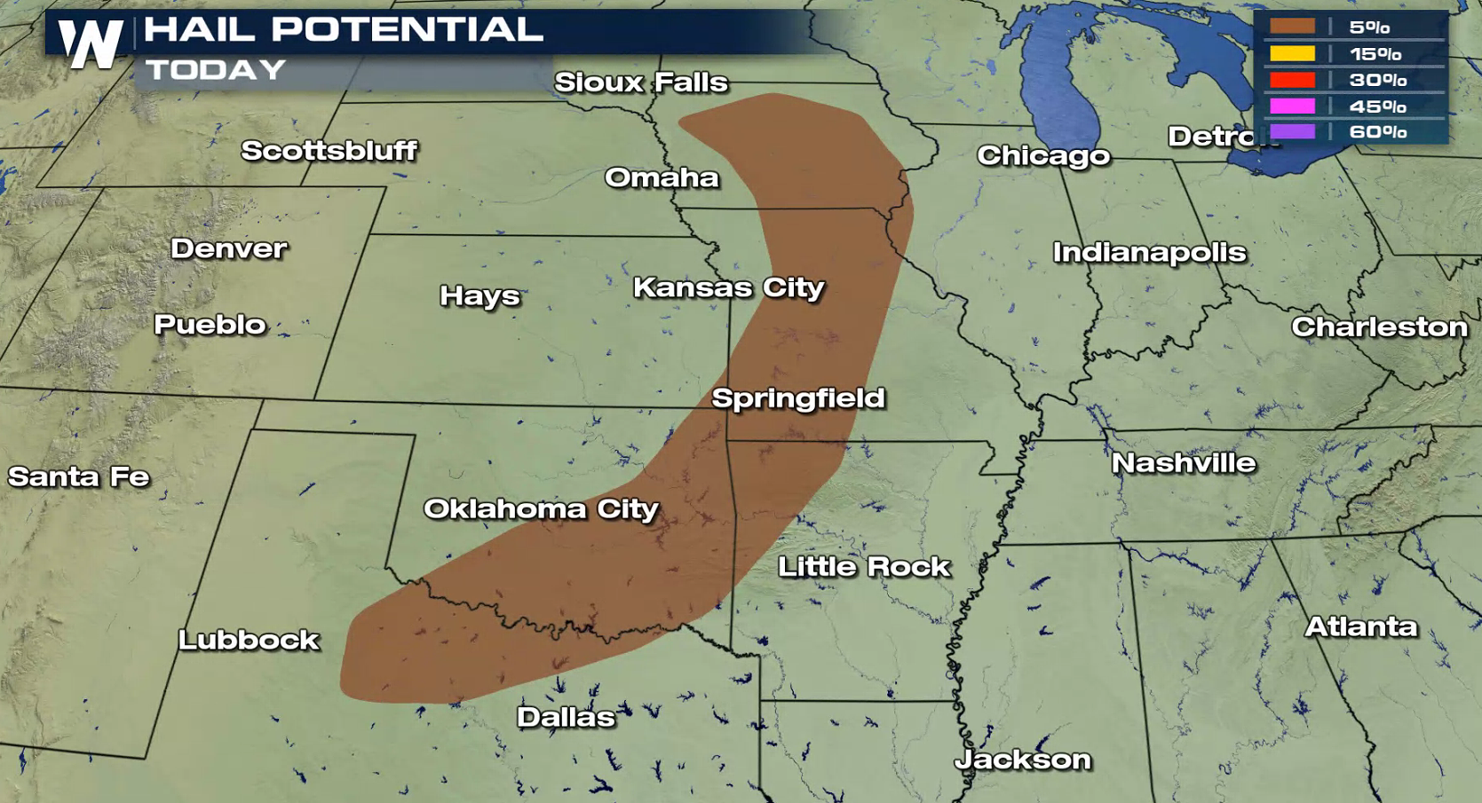
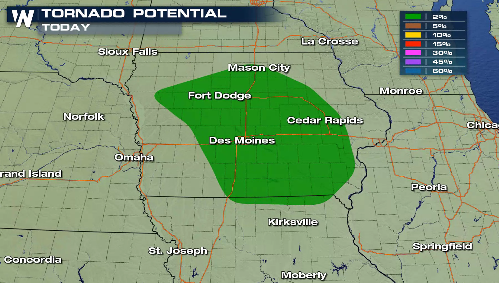
A system swinging into the Middle Atlantic states will likely produce a few severe thunderstorms later this afternoon and evening (Wednesday). Strong wind gusts are the biggest concern, with a more limited hail and tornado threat in the Plains.
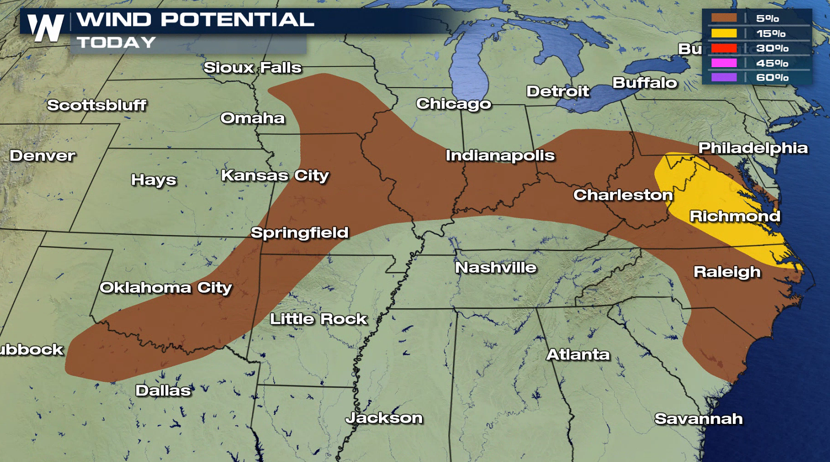
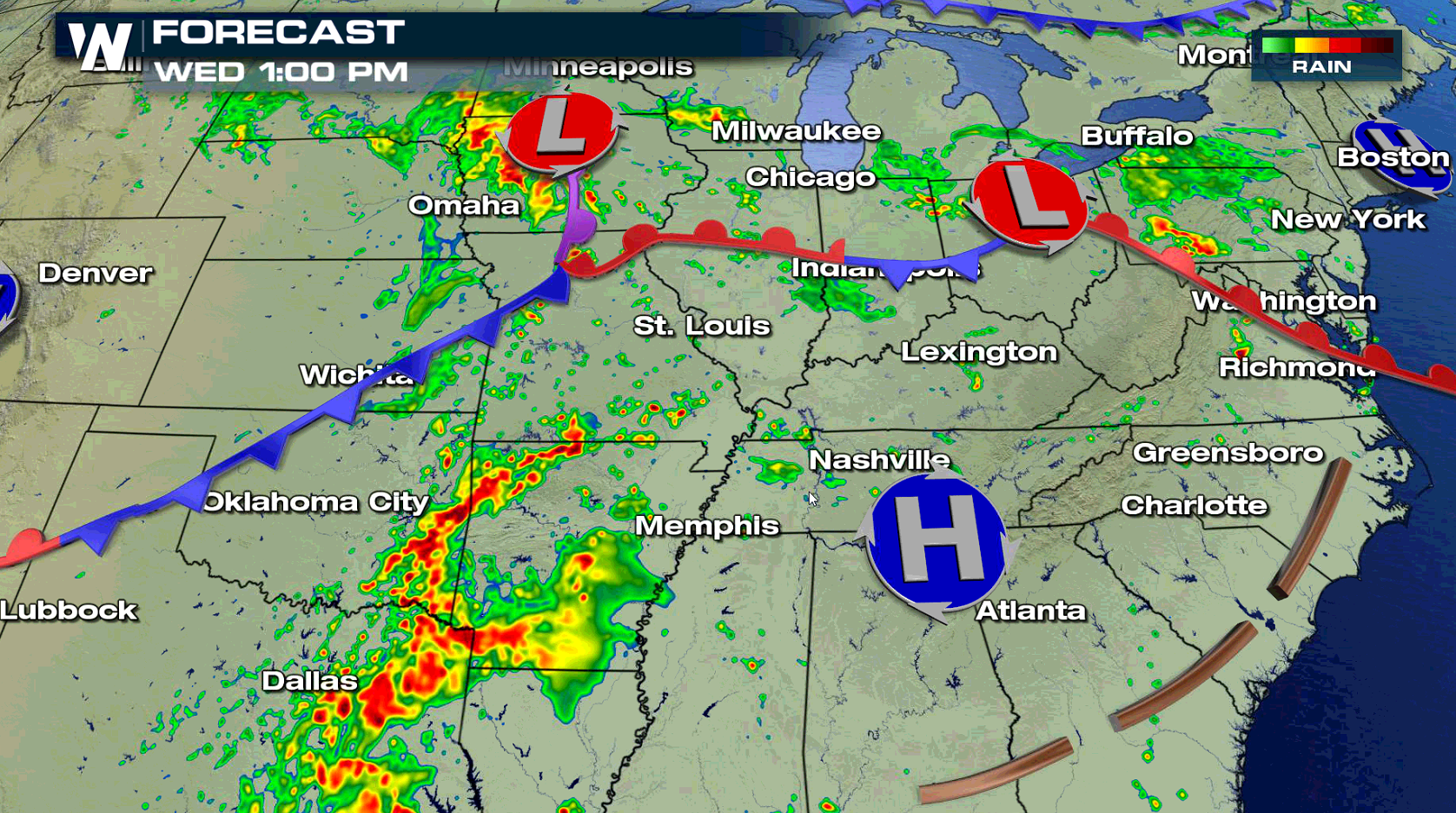
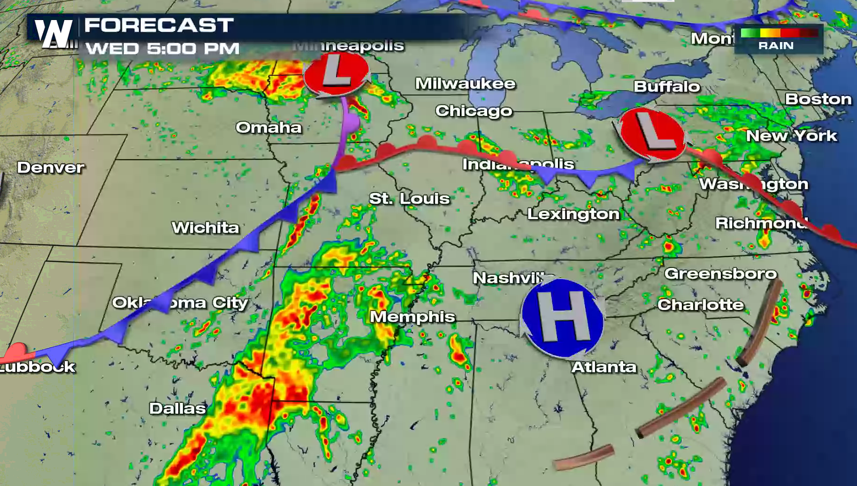
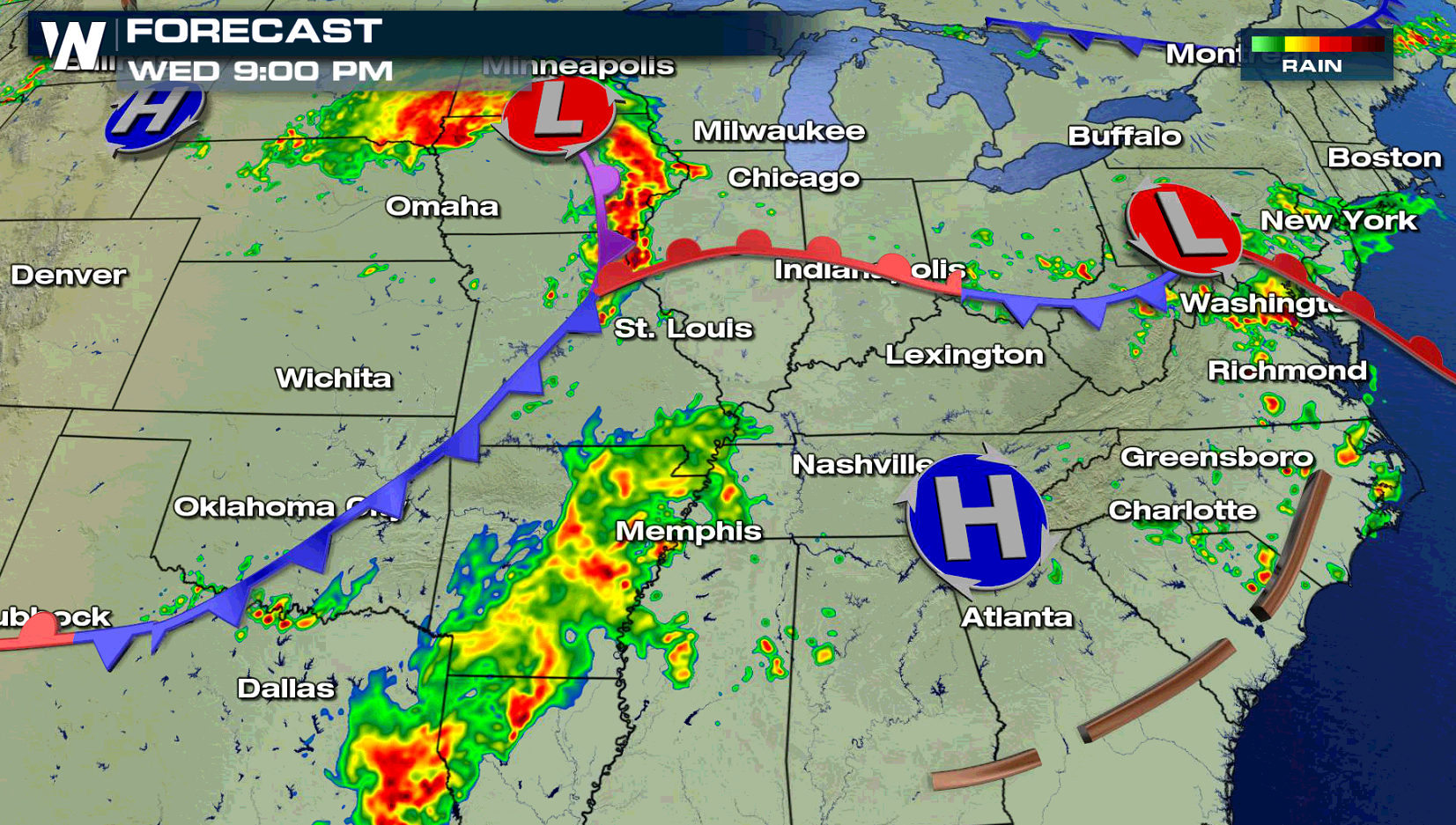
 A low pressure center and warm front swinging through the Mid Atlantic will create a few showers and thunderstorms this afternoon. With strong instability due to high humidity and temperatures in the 90s, severe thunderstorms will likely develop as upper level energy rolls into the region. Further west, isolated severe thunderstorms are possible along a cold front and low pressure center.
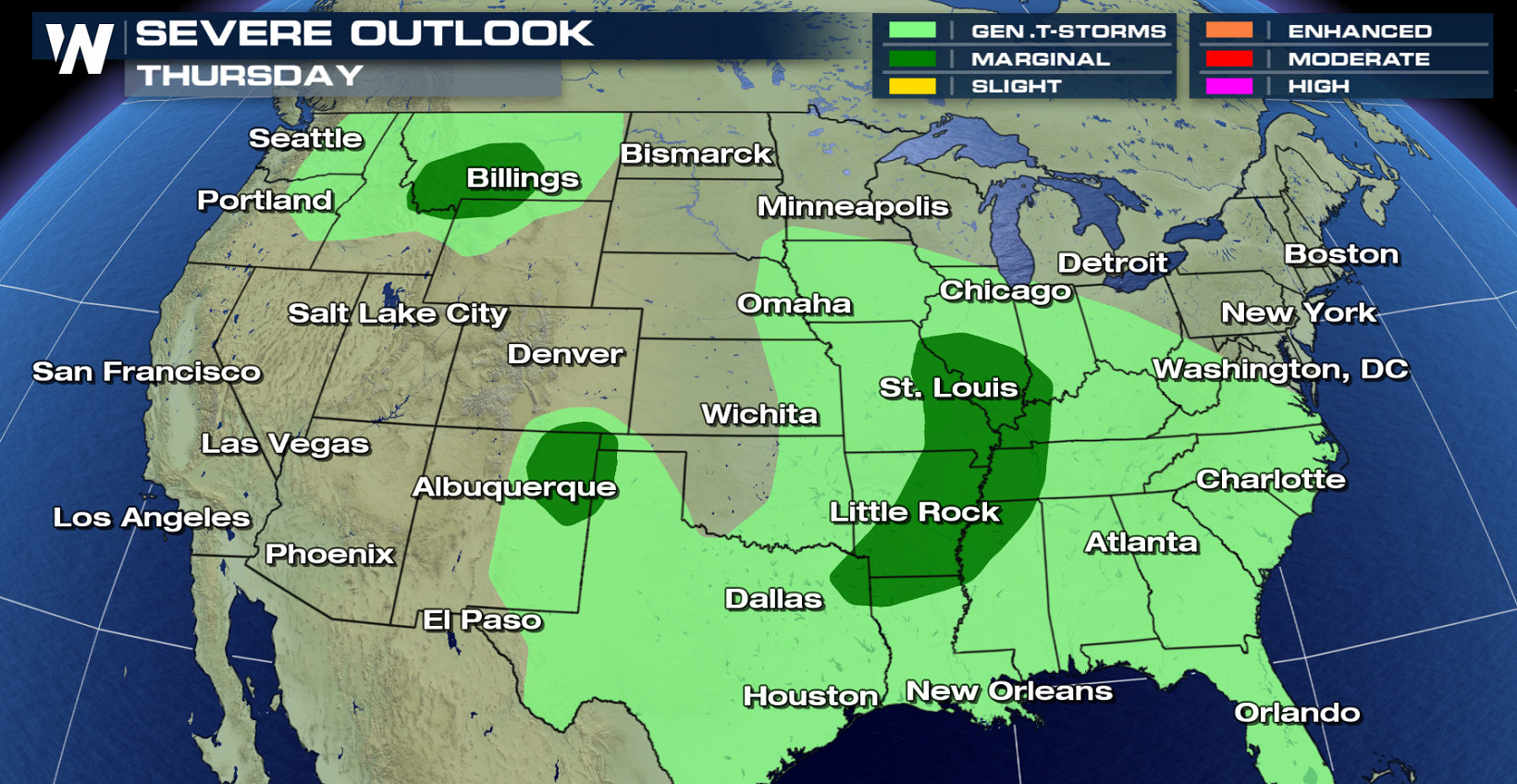
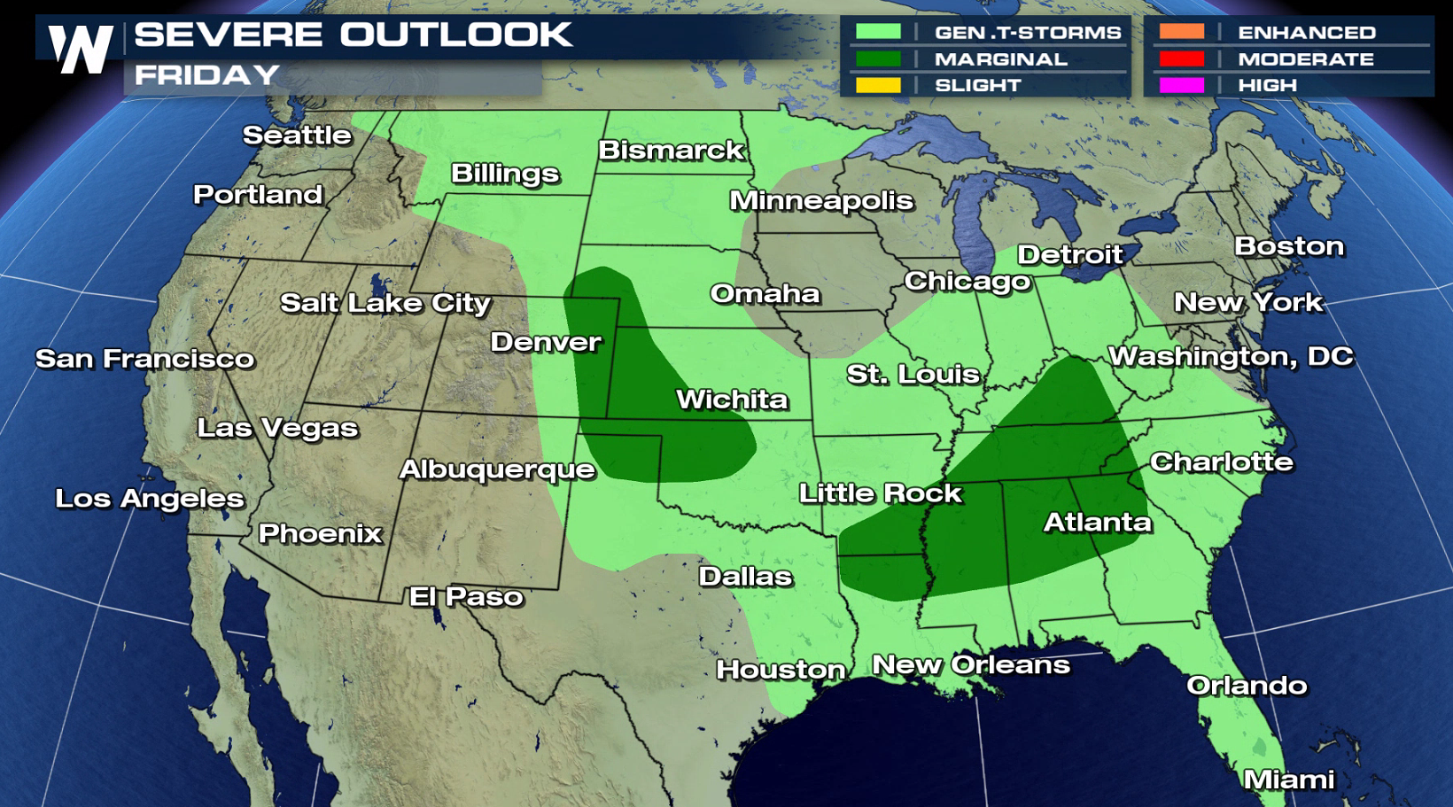
 On Thursday and Friday, there is a marginal severe weather risk from the Southeast to the High Plains.
 For WeatherNation: Meteorologist Mace Michaels
A low pressure center and warm front swinging through the Mid Atlantic will create a few showers and thunderstorms this afternoon. With strong instability due to high humidity and temperatures in the 90s, severe thunderstorms will likely develop as upper level energy rolls into the region. Further west, isolated severe thunderstorms are possible along a cold front and low pressure center.
On Thursday and Friday, there is a marginal severe weather risk from the Southeast to the High Plains.
For WeatherNation: Meteorologist Mace MichaelsAll Weather News
More


More Storms for the East Sunday and Monday
A low-pressure system crashing through the Mi
2 Aug 2026 2:20 AM

After Reaching Category 5, Genevieve Weakens in the Pacific
PacificGenevieve formed on last Friday south
2 Aug 2026 1:30 AM

Flooding, Severe Storms Target the Midwest Again
After an active week of storms across the nor
1 Aug 2026 1:40 AM

Flooding Risk Increases as Heavy Rain Targets the Tri-State Area
Tuesday, heavy rainfall moved across the Nort
30 Jul 2026 12:25 AM

Severe Weather: Energy From the Midwest Now in the Southeast
UPPER MIDWEST - Through Monday, dangerous tor
29 Jul 2026 10:30 PM