Severe Weather Threats Tuesday in the Northeast and Plains
Special Stories
21 Apr 2020 7:30 AM
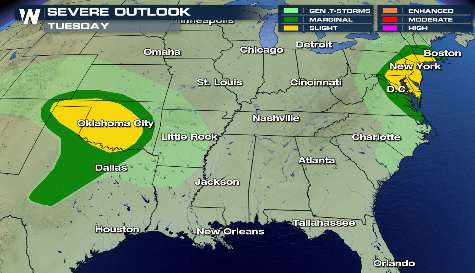
An active severe weather pattern is expected to continue this week. The Southern Plains and Eastern Seaboard are the areas to watch today (Tuesday), with a slight risk posted for both areas from the Storm Prediction Center.
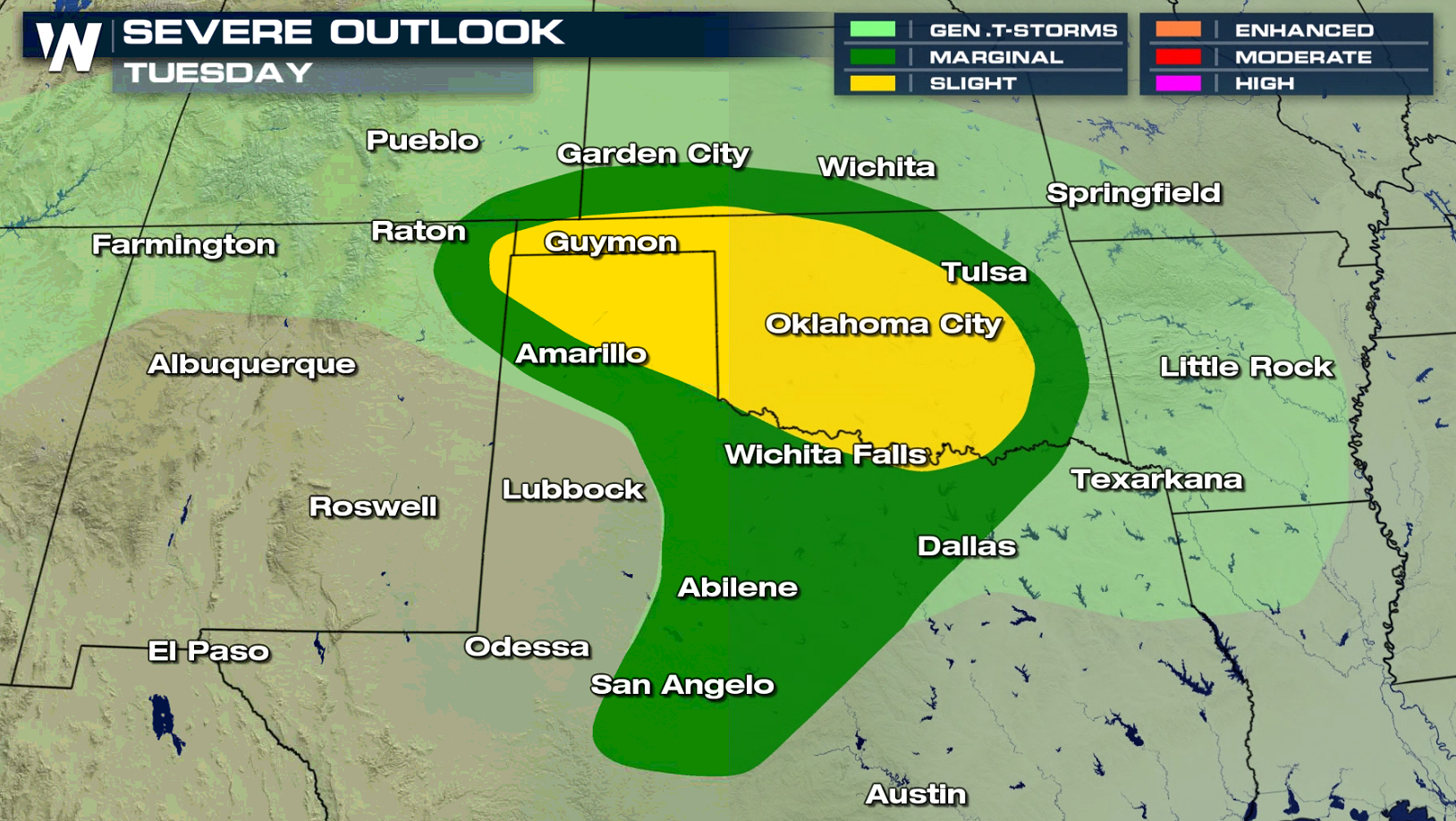
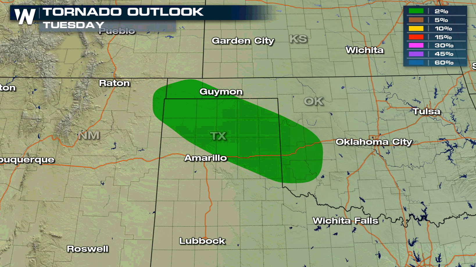
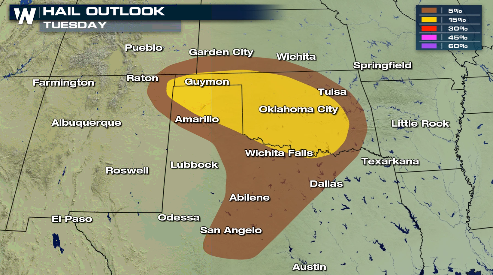 For the afternoon and evening, the panhandles of Texas and Oklahoma have the potential to see severe storms. Large hail is the biggest concern, although isolated tornadoes and damaging wind gusts may also occur.
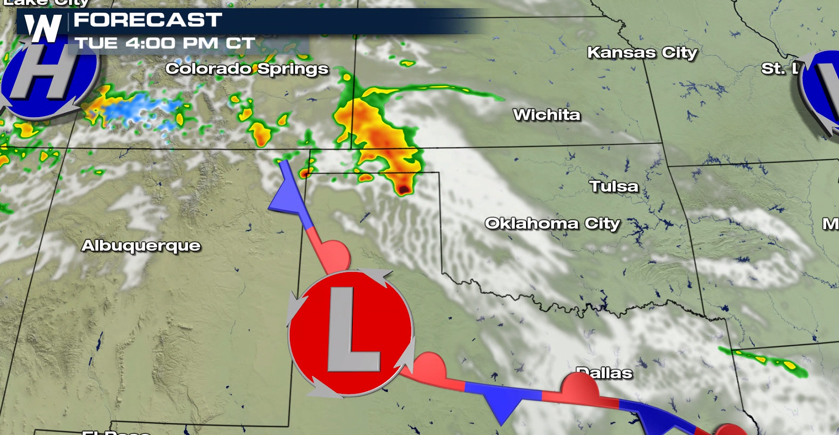
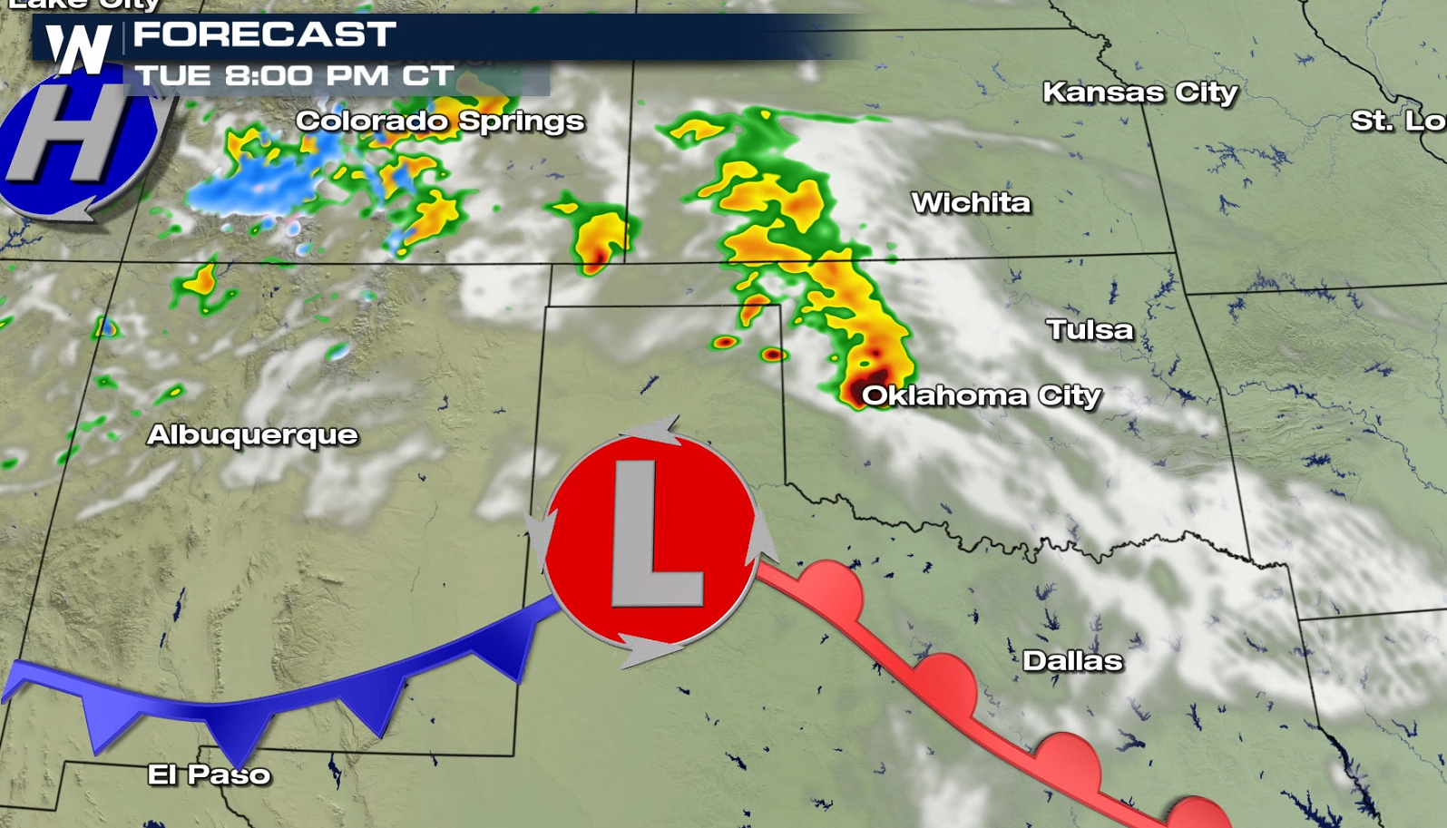
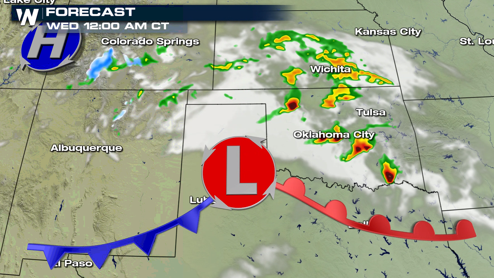
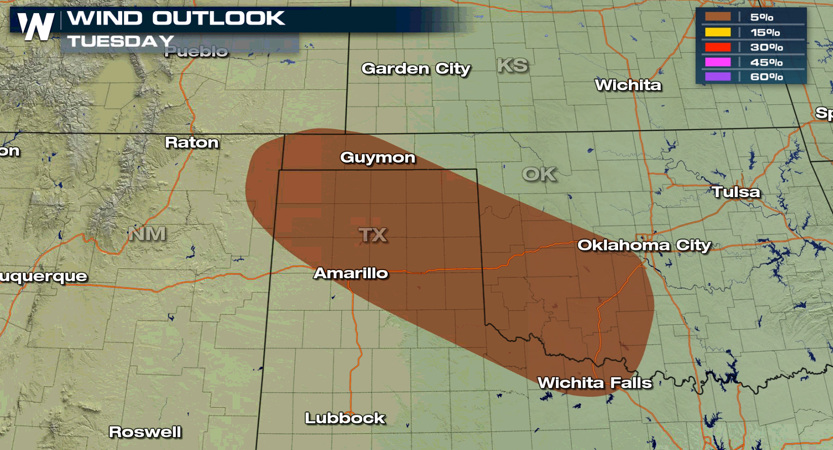 As instability builds in the late afternoon, thunderstorms will increase in coverage and intensity. Severe weather is expected to develop first along a dryline in the panhandle areas. Severe storms may affect areas near Oklahoma City and Tulsa into the evening.
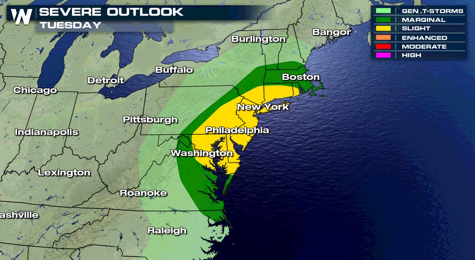
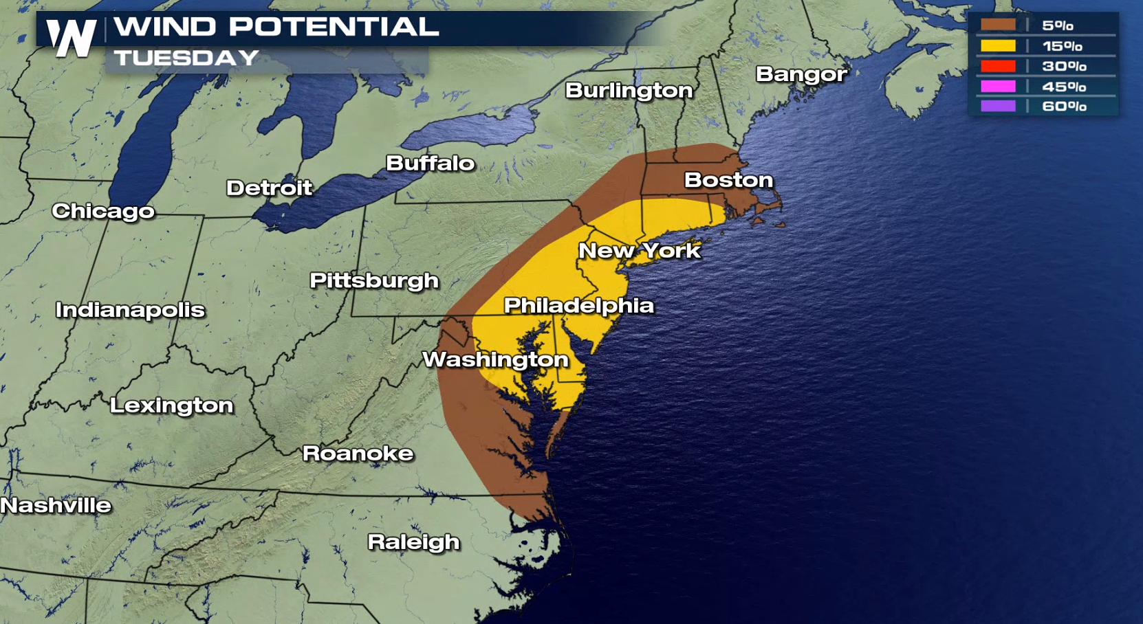
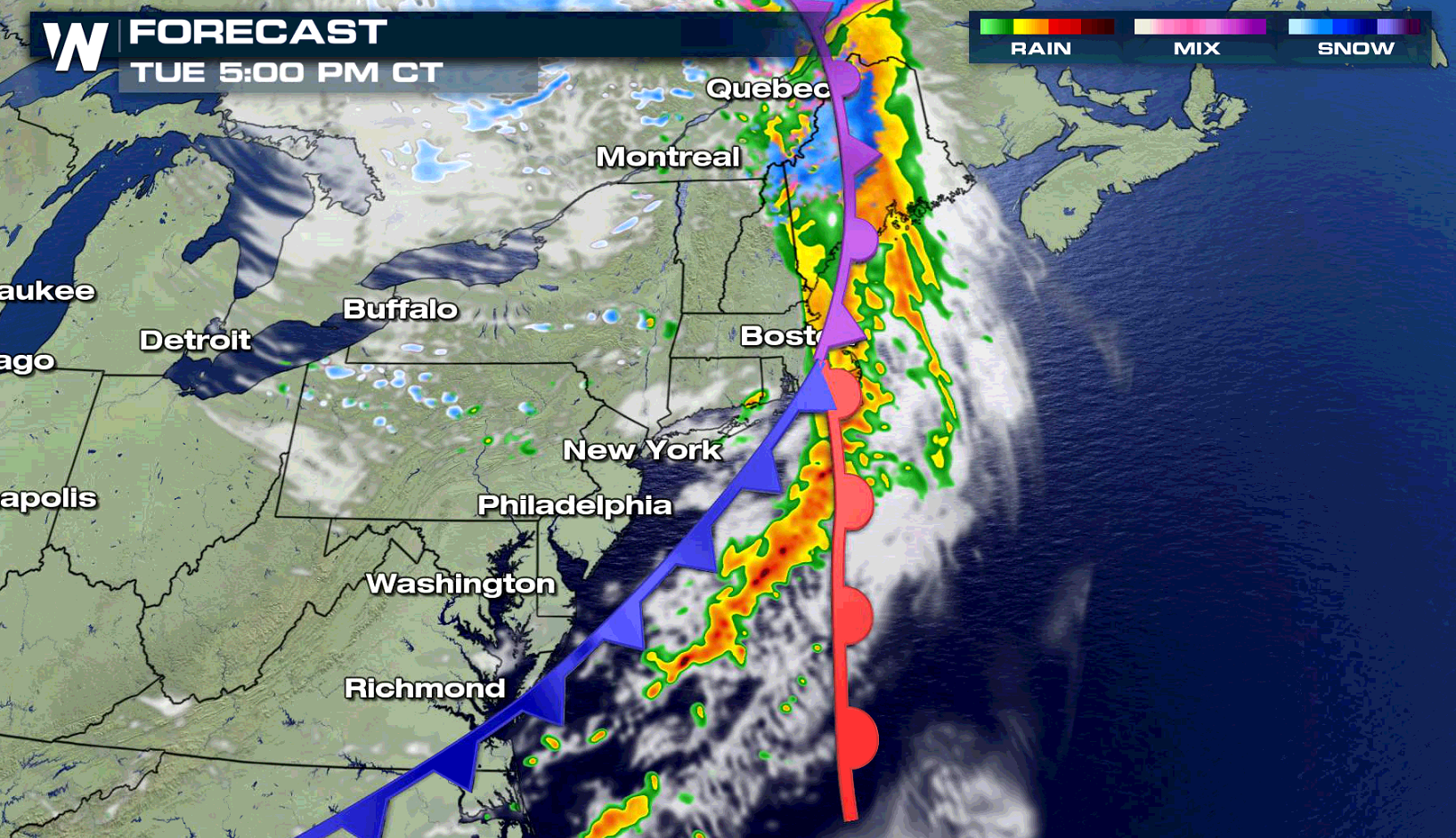
 A cold front approaching the Atlantic Ocean will bring an afternoon severe weather threat from New England to the Middle Atlantic. These storms may bring damaging wind gusts greater than 58 mph.
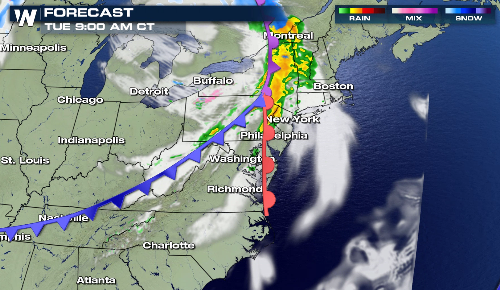
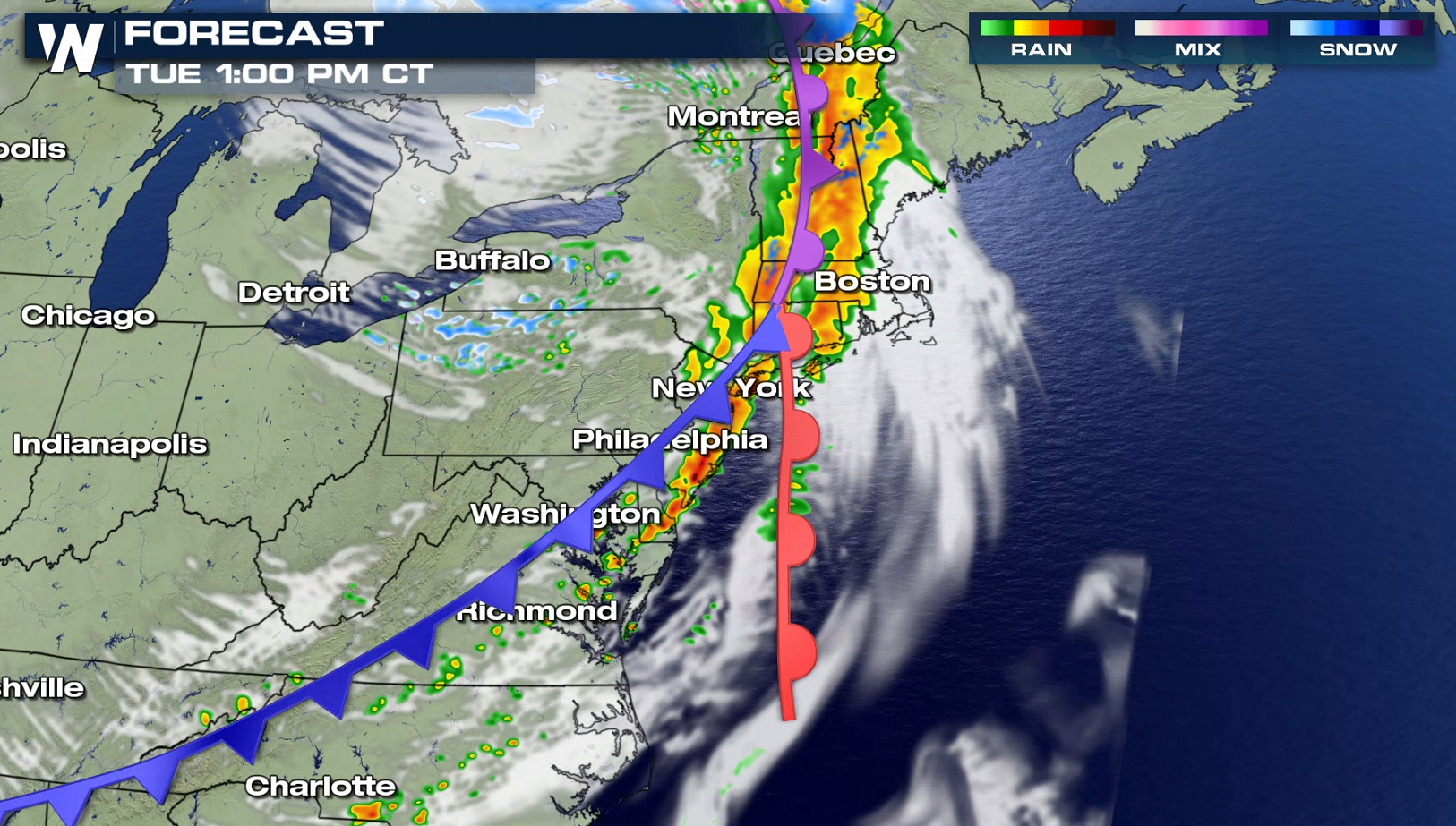
 Storms are ongoing this morning (Tuesday) and will race eastward into the afternoon. As temperature warm, the cold front will arrive, increasing the severe weather threat. The system will push out to sea by evening, bringing an end to the wet weather.
 WeatherNation will keep you updated on the severe weather threat on-air and online. Be sure to check back for updates!
For the afternoon and evening, the panhandles of Texas and Oklahoma have the potential to see severe storms. Large hail is the biggest concern, although isolated tornadoes and damaging wind gusts may also occur.
As instability builds in the late afternoon, thunderstorms will increase in coverage and intensity. Severe weather is expected to develop first along a dryline in the panhandle areas. Severe storms may affect areas near Oklahoma City and Tulsa into the evening.
A cold front approaching the Atlantic Ocean will bring an afternoon severe weather threat from New England to the Middle Atlantic. These storms may bring damaging wind gusts greater than 58 mph.
Storms are ongoing this morning (Tuesday) and will race eastward into the afternoon. As temperature warm, the cold front will arrive, increasing the severe weather threat. The system will push out to sea by evening, bringing an end to the wet weather.
WeatherNation will keep you updated on the severe weather threat on-air and online. Be sure to check back for updates!All Weather News
More
Wildfire Outbreak in the Pacific Northwest
SPOKANE, WA - On Saturday, August 1st, the Ol
2 Aug 2026 7:20 PM

More Storms for the East Through Monday
A low-pressure system that moved through the
2 Aug 2026 7:20 PM


After Reaching Category 5, Genevieve Weakens in the Pacific
PacificGenevieve formed on last Friday south
2 Aug 2026 6:25 PM

Flooding, Severe Storms Target the Midwest Again
After an active week of storms across the nor
1 Aug 2026 1:40 AM

Flooding Risk Increases as Heavy Rain Targets the Tri-State Area
Tuesday, heavy rainfall moved across the Nort
30 Jul 2026 12:25 AM

Severe Weather: Energy From the Midwest Now in the Southeast
UPPER MIDWEST - Through Monday, dangerous tor
29 Jul 2026 10:30 PM