Severe Weather Update for Friday
Top Stories
11 Apr 2018 4:32 AM
Severe storms are looking very likely on Friday for the Mississippi Valley. These areas are already under a slight or enhanced risk of severe weather.
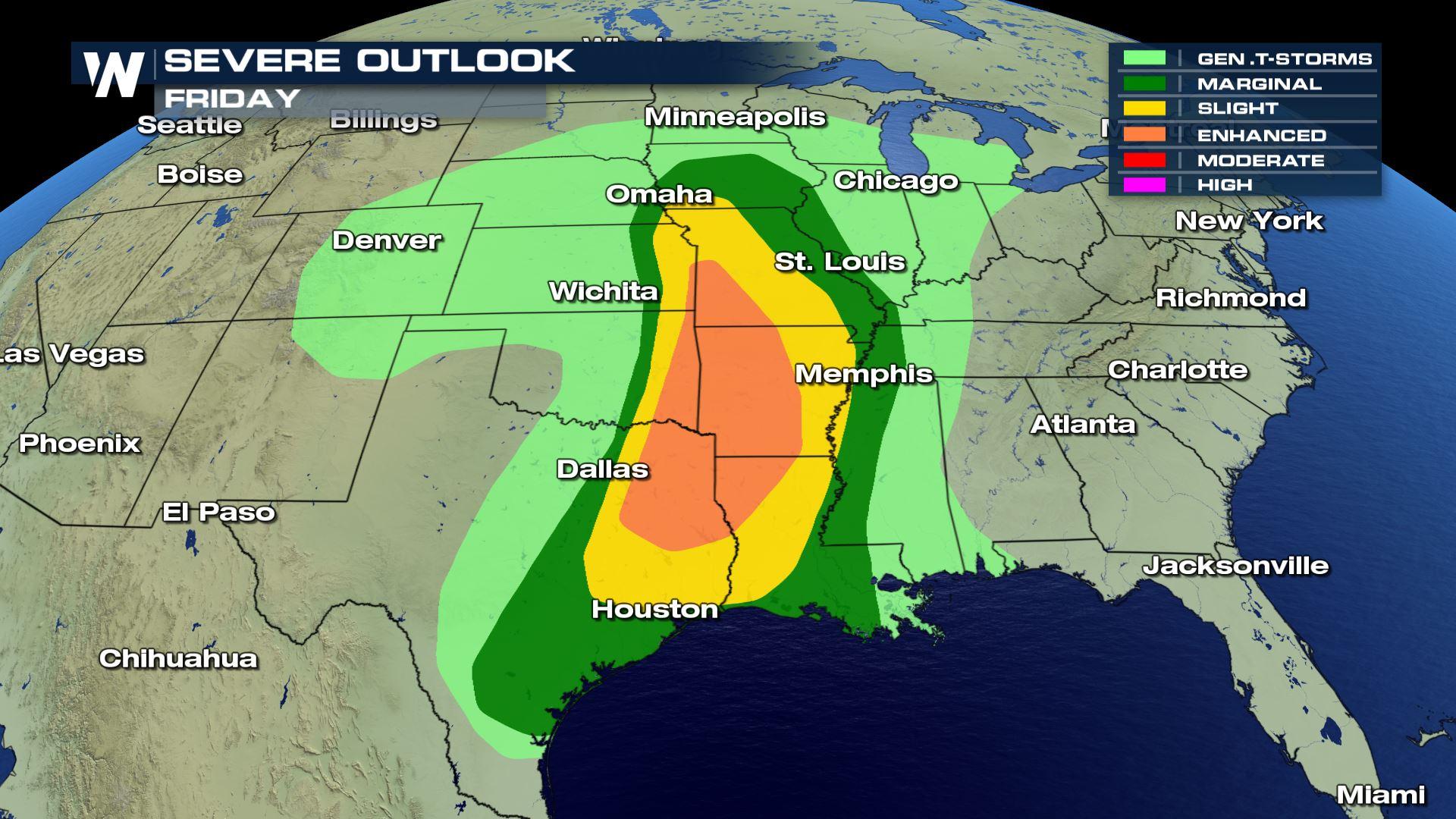
 The enhanced risk of severe weather includes NE Texas, NW Louisiana, E Oklahoma, SW Missouri and western Arkansas. The slight risk sets up from southern Iowa all the way down to the Texas Gulf Coast.
Here is the difference between an Enhanced and a Slight risk of severe weather.
The enhanced risk of severe weather includes NE Texas, NW Louisiana, E Oklahoma, SW Missouri and western Arkansas. The slight risk sets up from southern Iowa all the way down to the Texas Gulf Coast.
Here is the difference between an Enhanced and a Slight risk of severe weather.
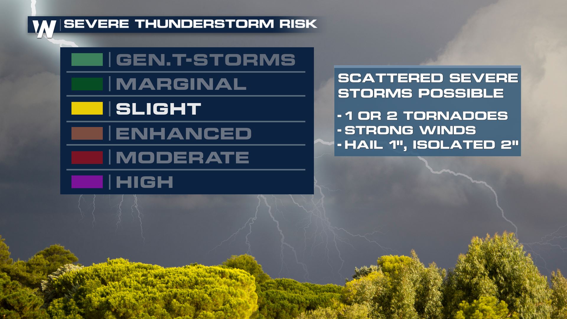
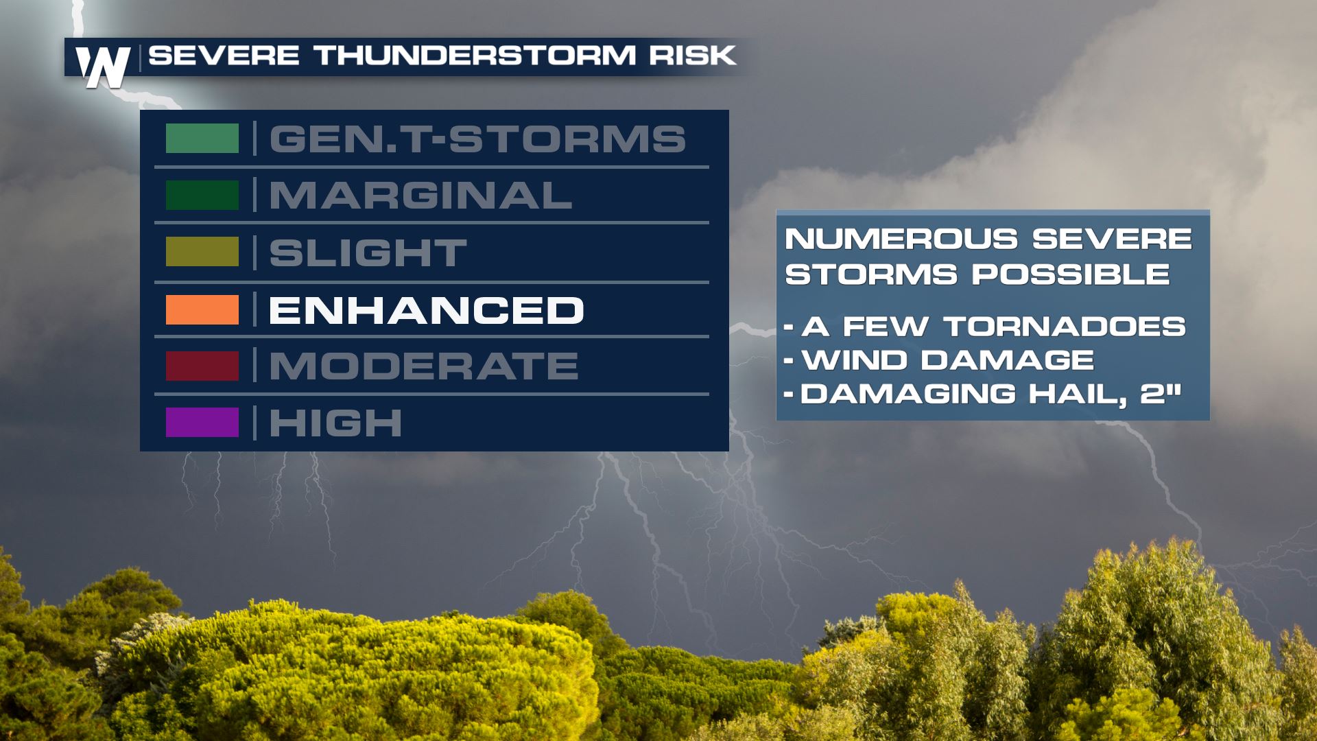 The fact that we are already seeing an enhanced risk of severe weather and we are a few days out shows the confidence in this severe forecast.
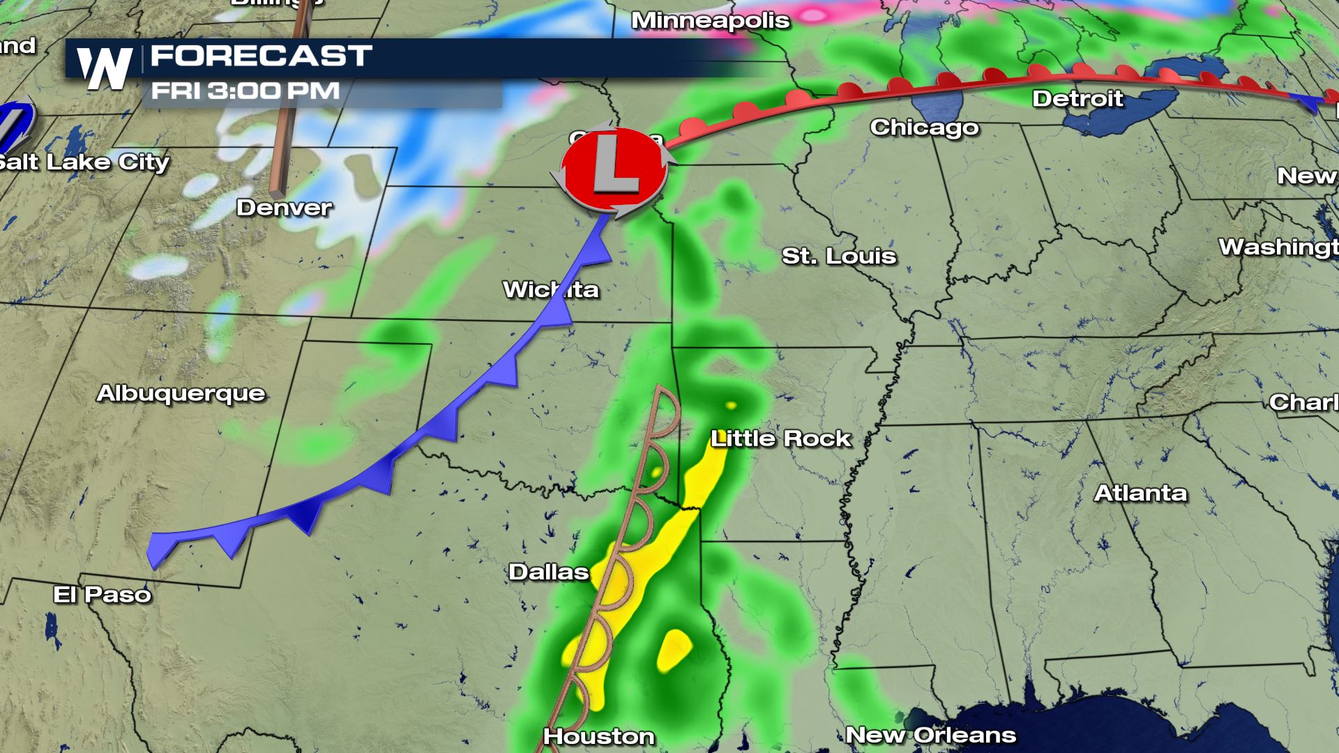
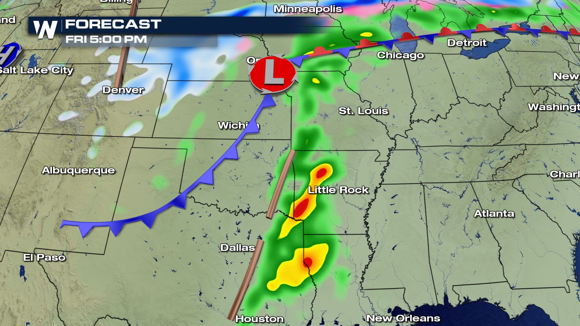
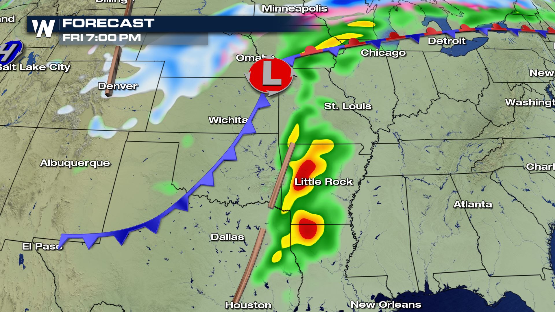
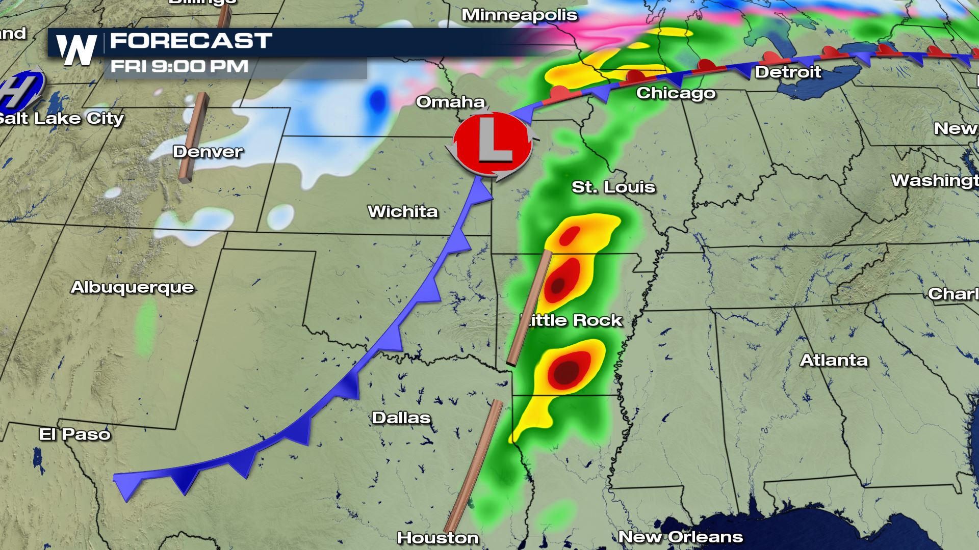 Here is the latest timing of the storms on Friday. Thunderstorm development should start to take shape by Friday afternoon and continue through the evening. Large hail, damaging winds and tornadoes will all be possible.
Keep checking with WeatherNation for more updates on this potential severe weather event.
Meteorologist Patrick Crawford
Here is the latest timing of the storms on Friday. Thunderstorm development should start to take shape by Friday afternoon and continue through the evening. Large hail, damaging winds and tornadoes will all be possible.
Keep checking with WeatherNation for more updates on this potential severe weather event.
Meteorologist Patrick Crawford
Severe Outlook
The enhanced risk of severe weather includes NE Texas, NW Louisiana, E Oklahoma, SW Missouri and western Arkansas. The slight risk sets up from southern Iowa all the way down to the Texas Gulf Coast.
Here is the difference between an Enhanced and a Slight risk of severe weather.
The fact that we are already seeing an enhanced risk of severe weather and we are a few days out shows the confidence in this severe forecast.
Forecast
Here is the latest timing of the storms on Friday. Thunderstorm development should start to take shape by Friday afternoon and continue through the evening. Large hail, damaging winds and tornadoes will all be possible.
Keep checking with WeatherNation for more updates on this potential severe weather event.
Meteorologist Patrick Crawford
All Weather News
More
Tropics: Fausto Heads to Hawaii; Genevieve Rapidly Intensifying
Atlantic BasinBertha has dissipated after mov
27 Jul 2026 10:35 AM


Severe Storms Target the Midwest to the Northeast This Week
Extreme heat will be a big story this week ac
27 Jul 2026 9:50 AM

Southeast Flood Risk Lingers Near Stalled Front
A stalled boundary over the Southeast will ke
25 Jul 2026 10:55 AM

Another Round of Storms Targets the Northeast
Tuesday brought severe weather again across p
23 Jul 2026 1:15 AM

Another Round of Severe Weather for the Upper Midwest and Great Lakes
The upper-level low train continues to keep t
21 Jul 2026 1:45 AM