Severe Weather Watches Posted Across Northeast
Top Stories
2 Oct 2018 4:12 PM
A low pressure system has been firing off severe storms starting in the late afternoon across the Northeast. This has prompted Tornado Watches and Severe Thunderstorm Watches to be issued across portions of Ohio, West Virginia, Pennsylvania, New Jersey, New York, and Connecticut until late Tuesday night.
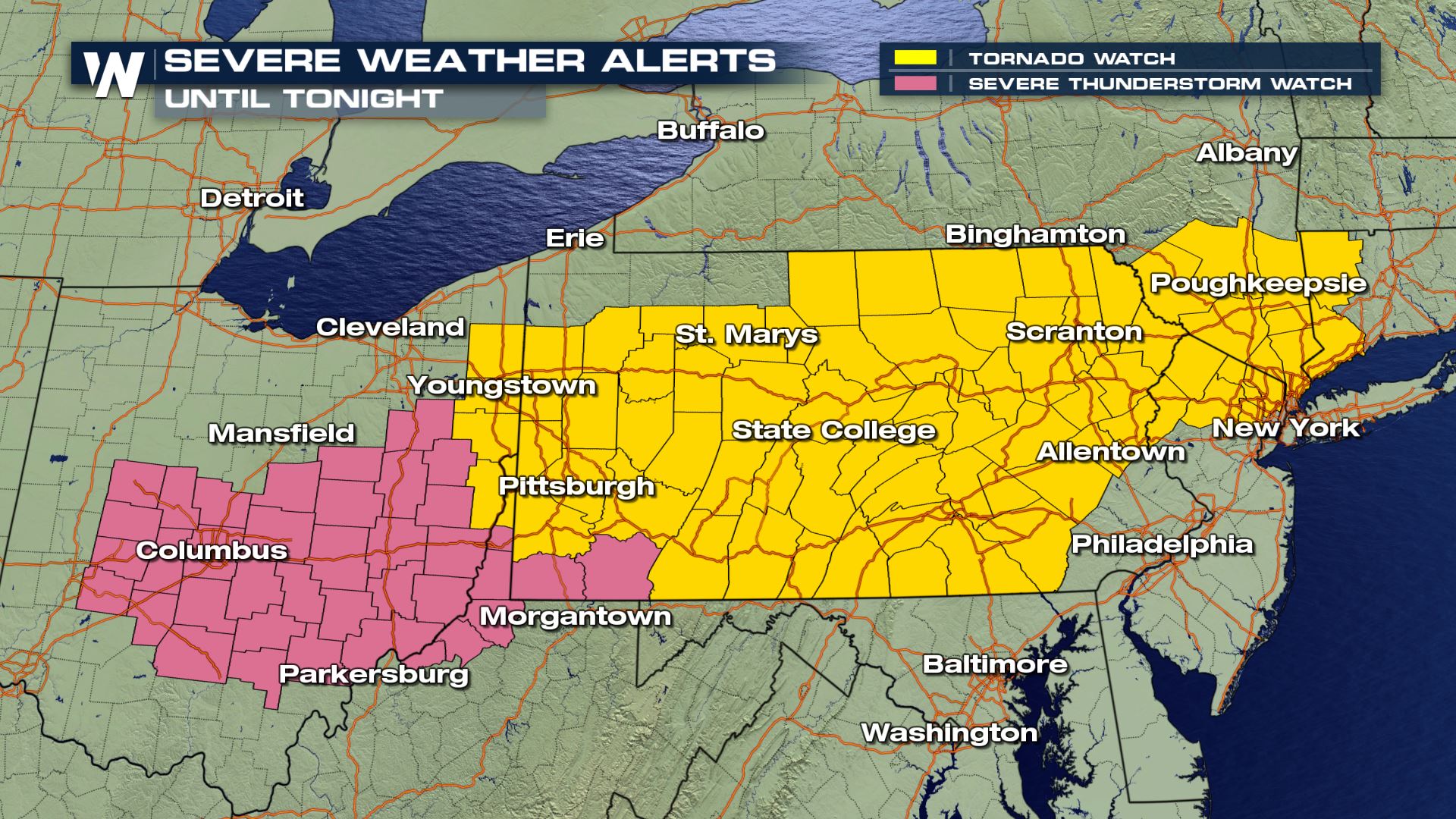 We have already seen many Tornado Warning, especially across Pennsylvania. Some of these tornadoes have been spotted. Even some reports of damage to an outhouse at a nursing home in Pennsylvania.
https://twitter.com/NWSCLE/status/1047198380017909760
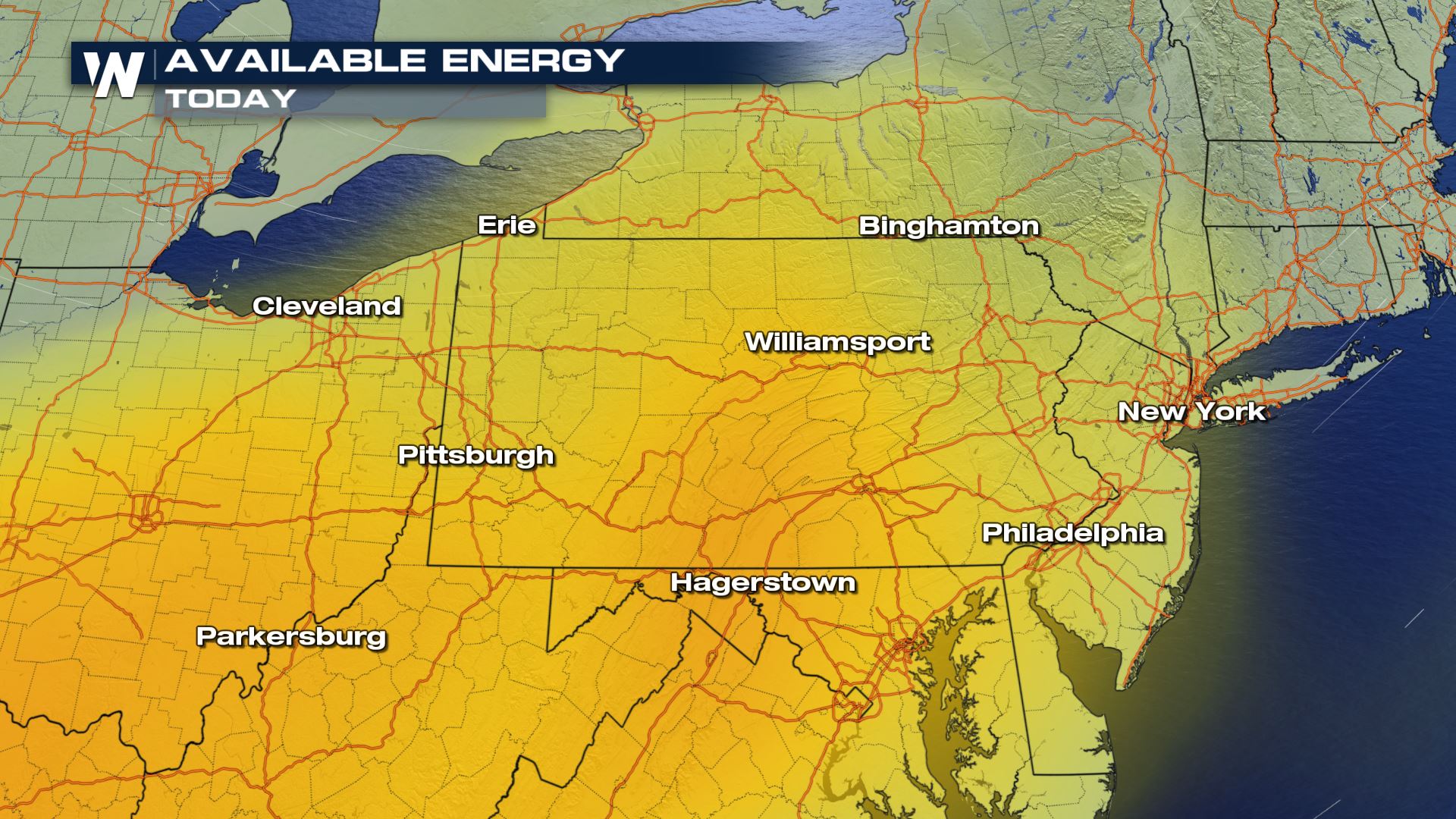
So why is this such an active evening across the northeast? Well, we have all of those dynamics in place for this storms to form. Once they do form, they have plenty of available energy to work with.
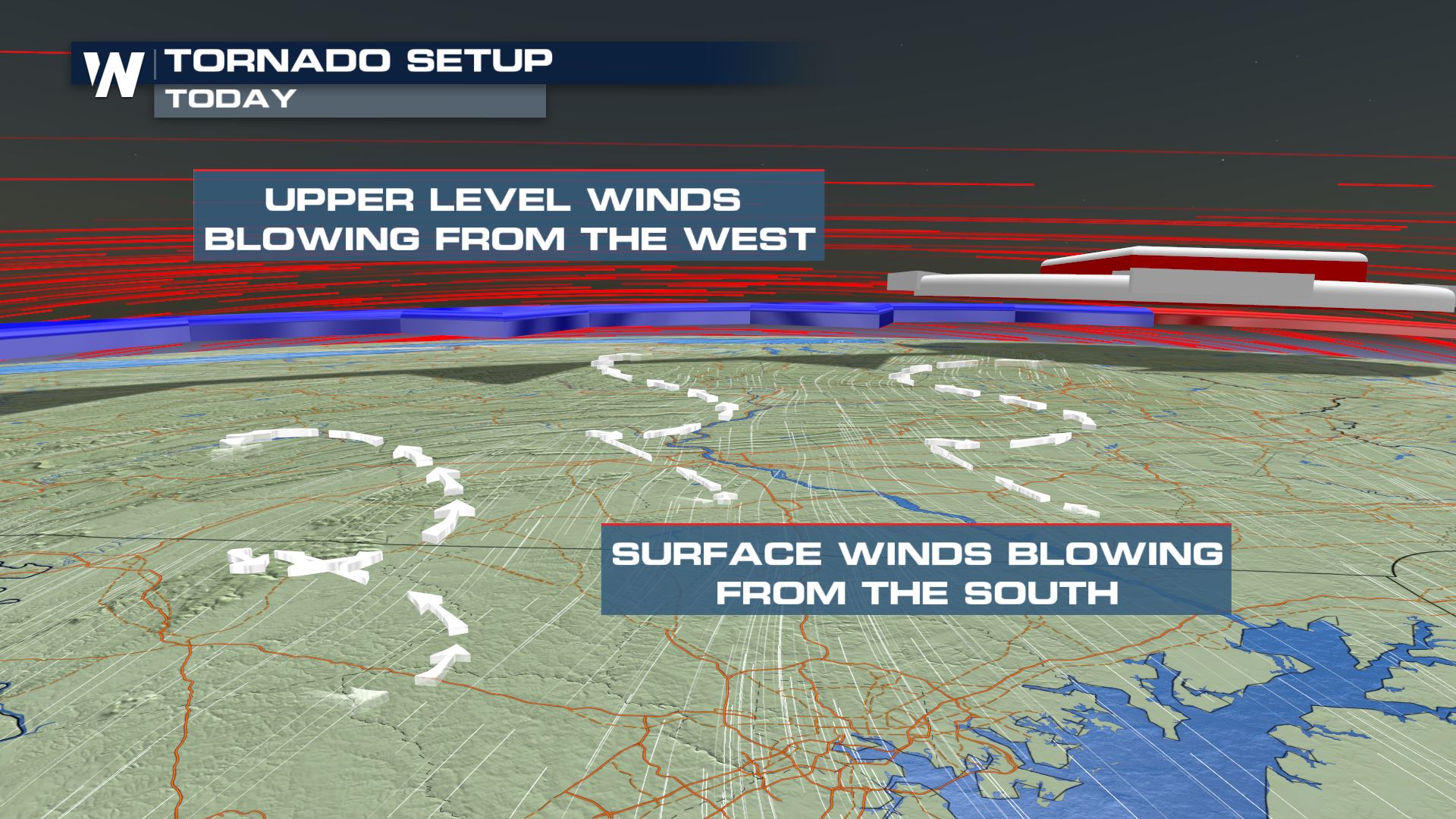
 We are also seeing so many reports of tornadoes because of how the winds are changing direction with height. This is called wind shear. As the winds shift from the south to the west as you rise in the atmosphere, tornadoes are form.
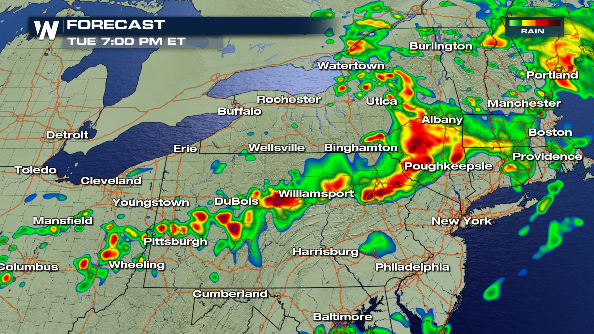
 Storms will continue to move west to east throughout the evening. Luckily, with the setting sun, the amount of energy and instability in the atmosphere will also start to go down. Storms and showers will push off in to the Atlantic Ocean by the early morning hours of Wednesday.
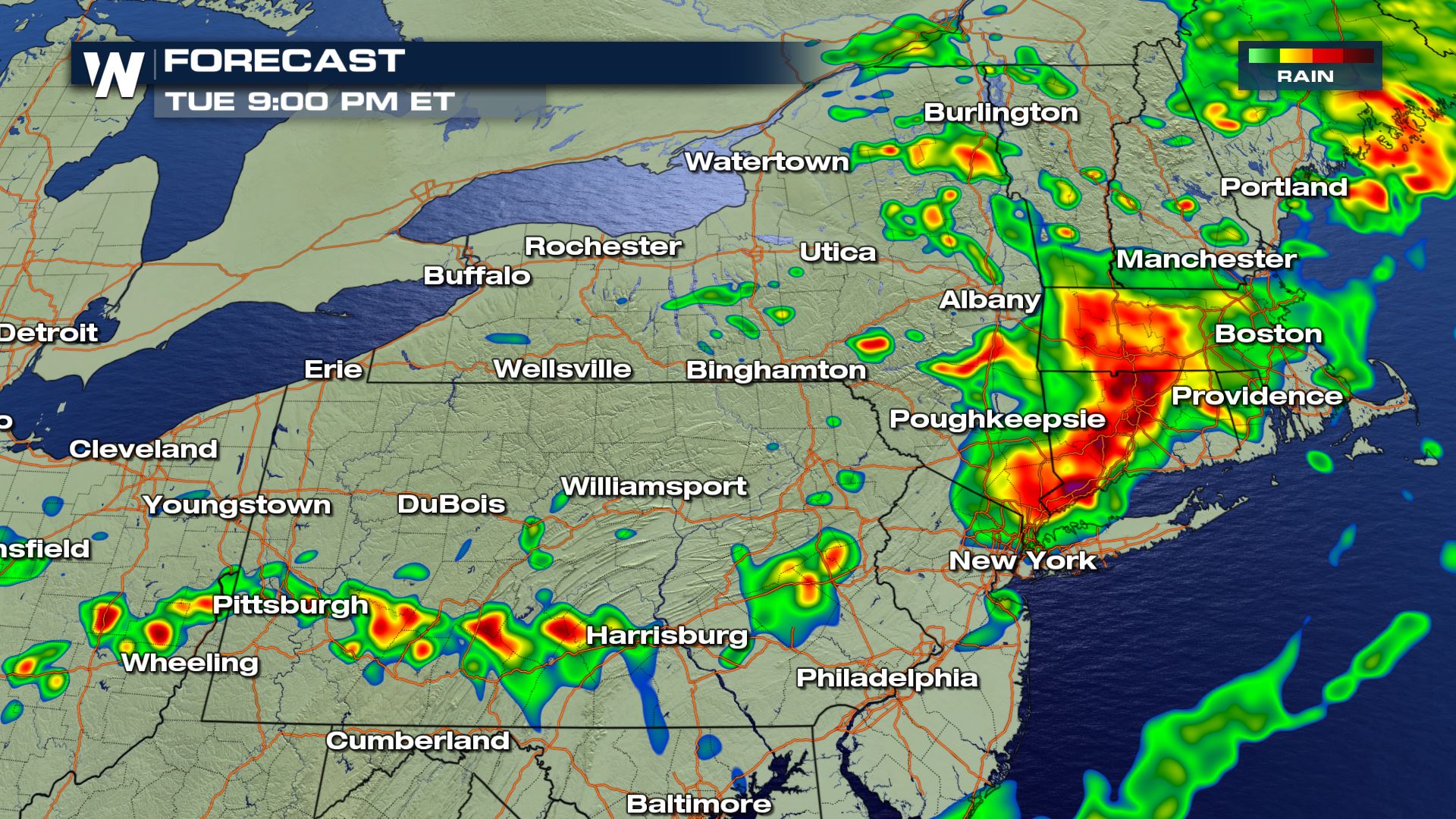 Be sure to stay safe and weather aware. Stay with WeatherNation for the latest as we track out severe storms.
For WeatherNation, Meteorologist Kate Mantych
 We have already seen many Tornado Warning, especially across Pennsylvania. Some of these tornadoes have been spotted. Even some reports of damage to an outhouse at a nursing home in Pennsylvania.
https://twitter.com/NWSCLE/status/1047198380017909760
So why is this such an active evening across the northeast? Well, we have all of those dynamics in place for this storms to form. Once they do form, they have plenty of available energy to work with.
 We are also seeing so many reports of tornadoes because of how the winds are changing direction with height. This is called wind shear. As the winds shift from the south to the west as you rise in the atmosphere, tornadoes are form.
 Storms will continue to move west to east throughout the evening. Luckily, with the setting sun, the amount of energy and instability in the atmosphere will also start to go down. Storms and showers will push off in to the Atlantic Ocean by the early morning hours of Wednesday.

 Be sure to stay safe and weather aware. Stay with WeatherNation for the latest as we track out severe storms.
For WeatherNation, Meteorologist Kate Mantych
Be sure to stay safe and weather aware. Stay with WeatherNation for the latest as we track out severe storms.
For WeatherNation, Meteorologist Kate MantychAll Weather News
More