Hurricane Force Winds, 2" Hail in the Midwest Thursday Night
A "significant" severe weather threat is ahead for the High Plains today after numerous tornadoes occurred in Minnesota Wednesday evening. Tornado surveys in the coming days will help to paint a picture of how strong storms were, but even baseball-sized hail were seen in the Upper Midwest!
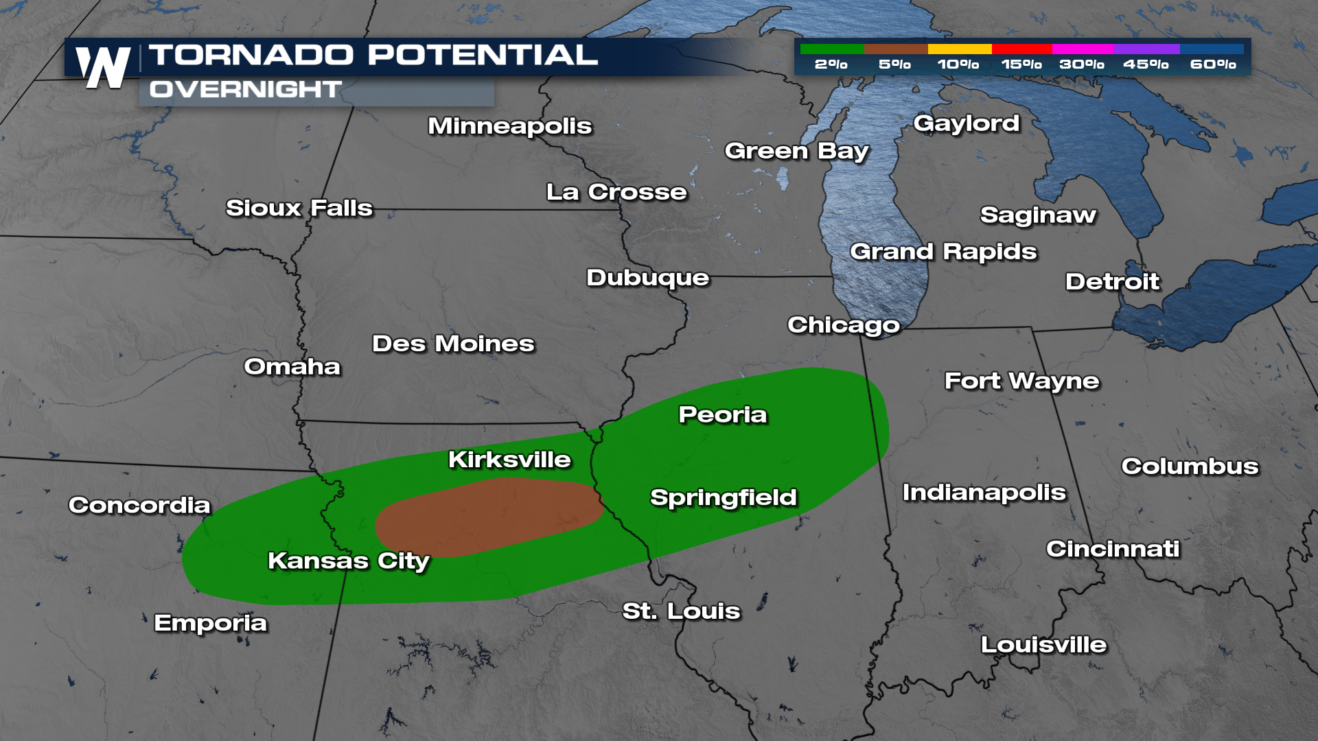
Overnight storms could contain large hail, damaging winds and isolated tornadoes. Residents in these areas need to be prepared for all modes of severe. Including the risk for flooding rain.
 Additional storm development along the cold front in Missouri and Kansas will be the focus tonight. Individual supercells cluster into a line of storms that marches through the central Plains and Midwest overnight. Have multiple ways to get severe weather alerts, especially in a way that can wake you up. For more on Friday's next system with storm chances, visit our sister article here.
The frontal boundary will bring a cool down to the High Plains, trending our temperatures back toward average, especially around the Great Lakes. Temperatures cool by about 5° Friday but still will run above average. Don't be too relieved, more heat is on the way early next week.