More Snow Ahead in the West
Special Stories
10 Jan 2018 5:19 PM
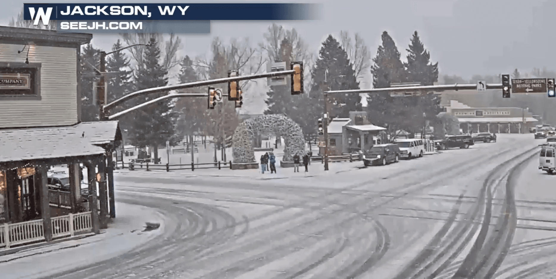
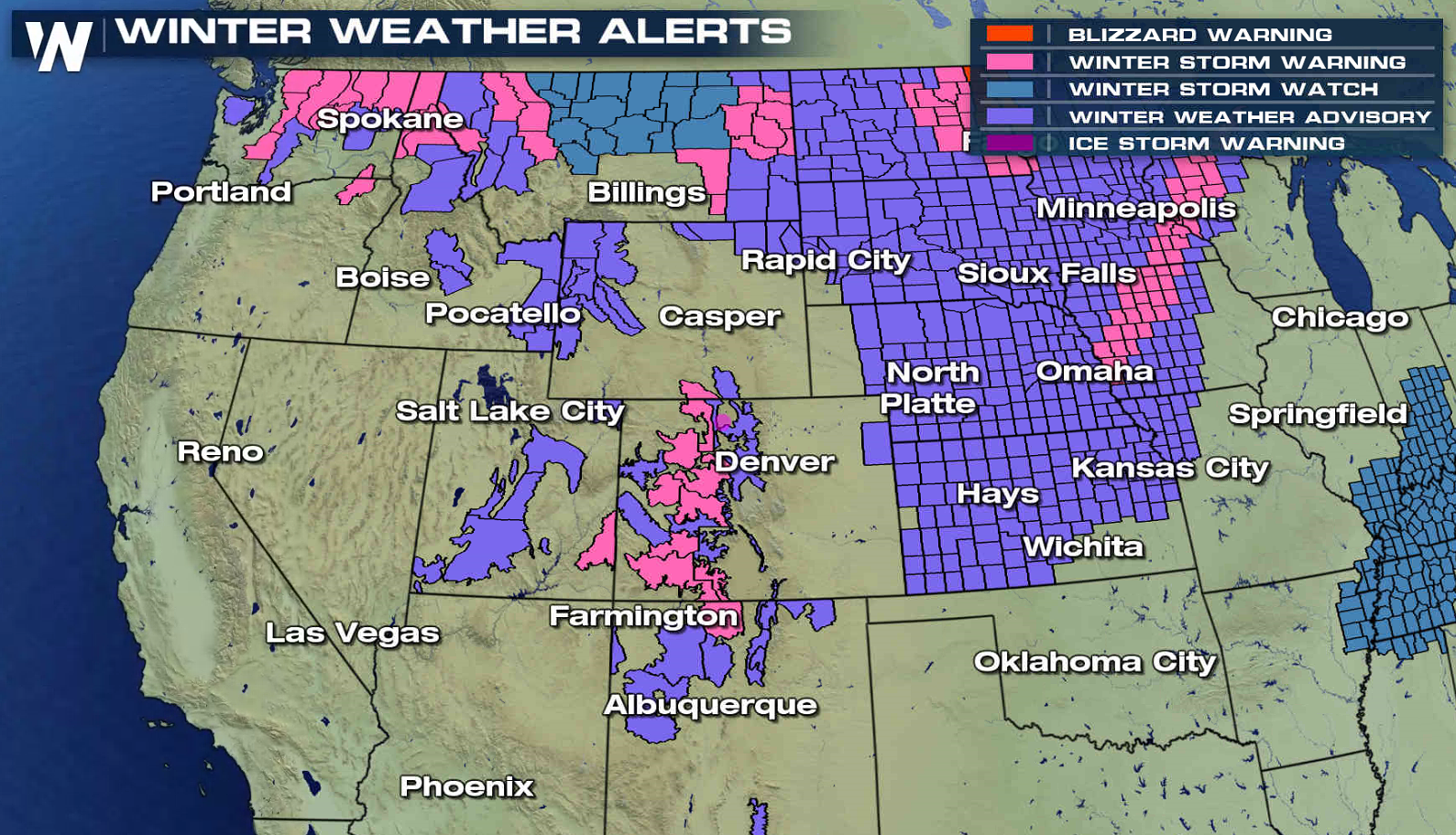
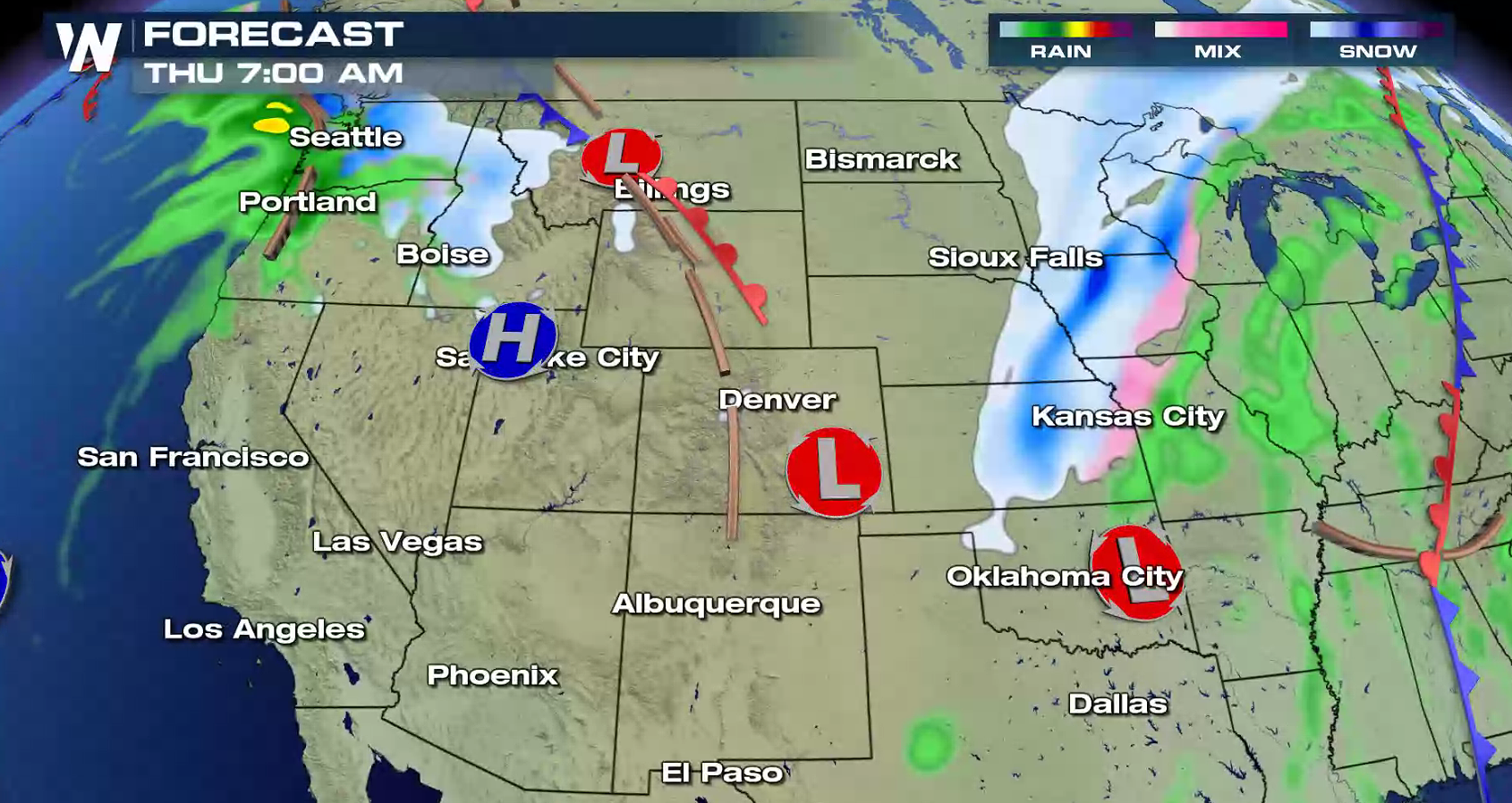
More snow is ahead for the West, as another storm system will follow on the heels of the first low pressure center now moving into the Plains. Winter weather alerts extend from Washington to New Mexico. 1 to 2 feet of new accumulations are possible in the highest elevations, especially near Glacier National Park.
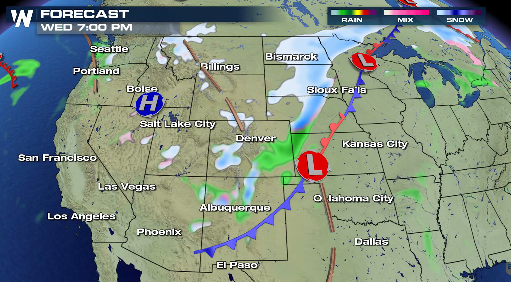
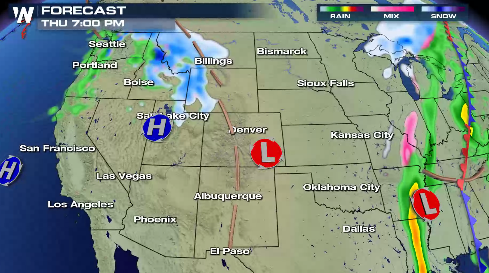
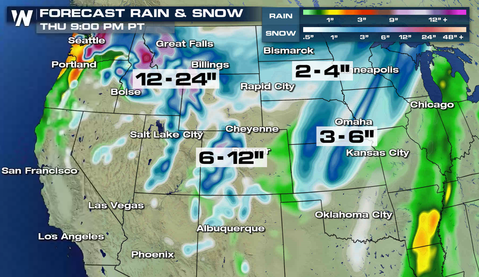 The first low pressure center has moved into the Upper Midwest and snowfall will gradually diminish in the Front Range. The second system will move into the Pacific Northwest Thursday morning, bringing another round of snow into the region. The snow will push from the Cascades eastward to the Tetons throughout Thursday.
 For WeatherNation: Meteorologist Mace Michaels
The first low pressure center has moved into the Upper Midwest and snowfall will gradually diminish in the Front Range. The second system will move into the Pacific Northwest Thursday morning, bringing another round of snow into the region. The snow will push from the Cascades eastward to the Tetons throughout Thursday.
For WeatherNation: Meteorologist Mace MichaelsAll Weather News
More
Hurricane Flossie Now A Major Hurricane
Hurricane FlossieThe National Hurricane Cente
2 Jul 2025 3:00 AM

NHC Monitoring Front in the Southeast Ahead of 4th of July
SOUTHEAST - A frontal boundary moving through
2 Jul 2025 3:00 AM

Where Rain Could Dampen Holiday Travel Plans
AAA is expecting over 70 million travelers to
2 Jul 2025 2:35 AM


Western Heat Continues With Some Relief
A large dome of hot, high pressure remains ac
2 Jul 2025 2:00 AM

Severe Storms For the East Coast Through Tuesday
A cold front moving through a moist airmass h
2 Jul 2025 1:00 AM

Severe Weather Threat Continues in the Midwest
It has been an active, severe season across t
30 Jun 2025 9:00 PM