Active Pattern Continues for the Northeast and Great Lakes

An unsettled and highly active weather pattern is taking hold across the Great Lakes and the Northeast, bringing rounds of snow, gusty winds, and rapidly changing conditions to millions of people. Several waves of low pressure are diving across the East, bringing multiple waves of precipitation over the next few days. A series of fast-moving fronts, fueled by cold air spilling out of Canada, will set the stage for a stretch of winter weather that will last into the coming week. Areas from the Great Lakes down to the Ohio River Valley will have a shot at some rain and snow.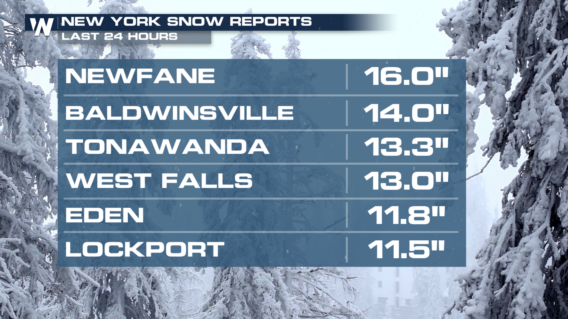
Lake-effect snow has been one of the biggest stories in the region. As cold air moves over the warm waters of the Great Lakes, bands of heavy snow are developing and repeatedly targeting communities downwind of the lakes. Parts of western and northern New York, northern Pennsylvania, and northern Michigan are seeing the greatest impacts, with snowfall totals piling up in localized areas. Some towns could measure accumulations in feet rather than inches, especially in teast and southeast of Lakes Erie and Ontario.
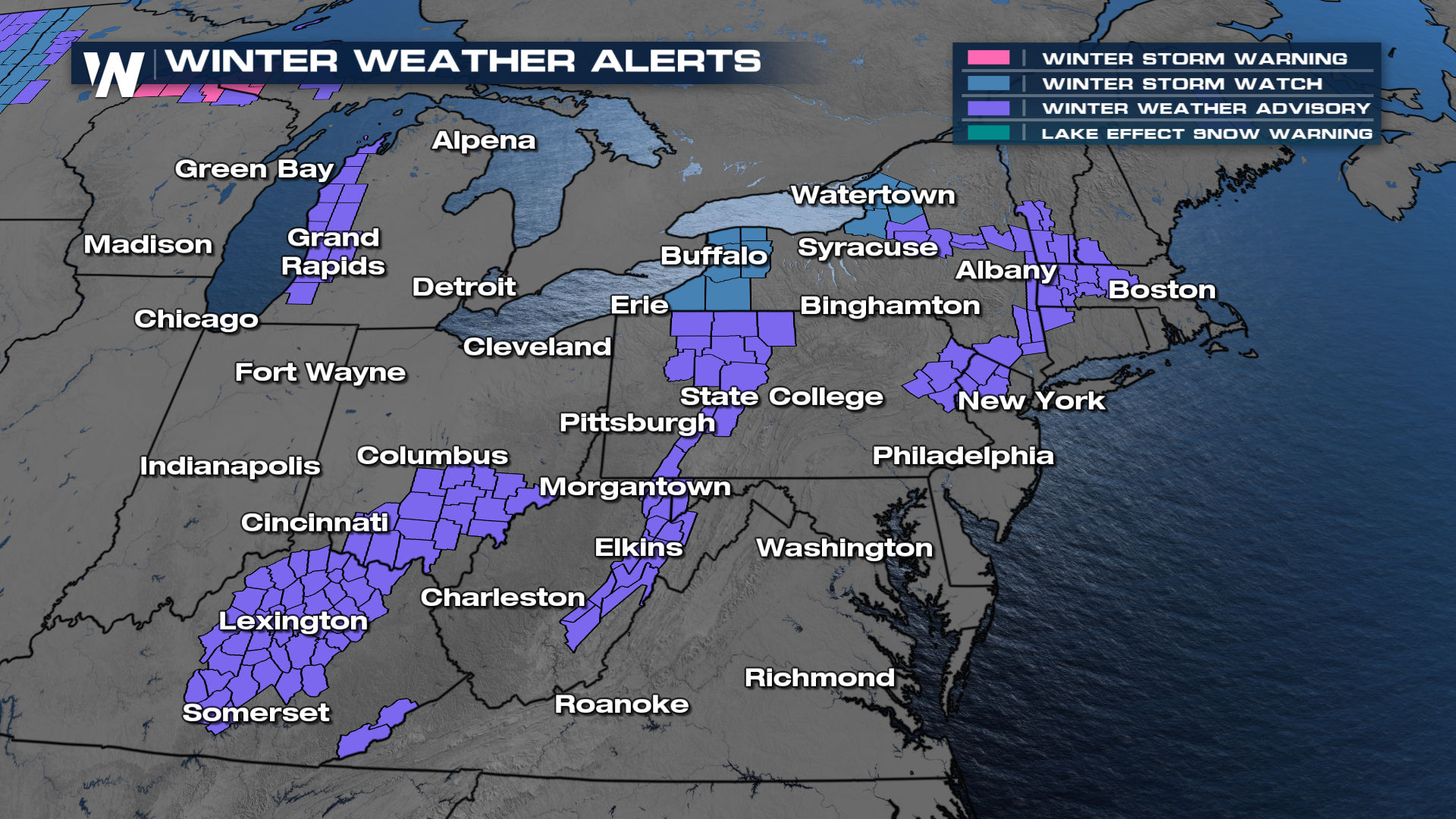
Timing & Alerts
The latest system has been moving across the Great Lakes and the Ohio Valley on Friday. The first front will advance east, with the I-95 corridor seeing increased rain and snow chances by dawn. As this front moves out, there will be another storm system by Sunday, as an area of low pressure develops off the coast.In addition to lake-effect snow, several clipper-type systems are tracking through the Midwest and into the Northeast. These compact but potent storms are producing bursts of snow, slick travel conditions, and occasional wintry mixes. While these systems are not major coastal storms, they are arriving frequently enough to keep roads hazardous and snowplows busy.
Forecast Totals
Through the weekend, the heaviest amount of snow will be found across parts of the Great Lakes with totals over a foot. Totals could add up quickly in New England, too, particularly in the higher elevations of western Massachusetts. In addition, major cities along the I-95 corridor have a shot of accumulating snow through tomorrow morning and again on Sunday. As always, take it slow on the roadways!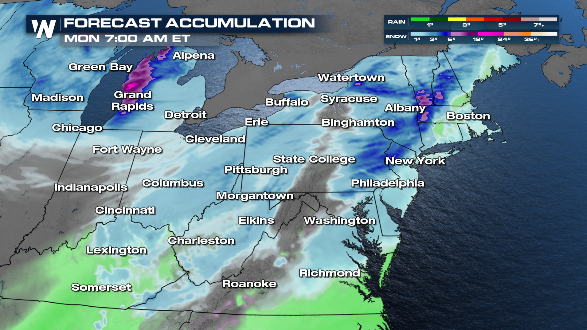
Tune into WeatherNation :10 past the hour for the latest updates on this forecast.


