Snow Chances Continue for the Midwest and Northeast

A pair of low-pressure systems will keep the country's northern tier under the threat of snow, wind, and cold temperatures. Areas across the Upper Midwest and Northern New England are expecting light to moderate snow, though some models have been trending toward a few areas of heavy snow and the potential of freezing rain for the windy city.
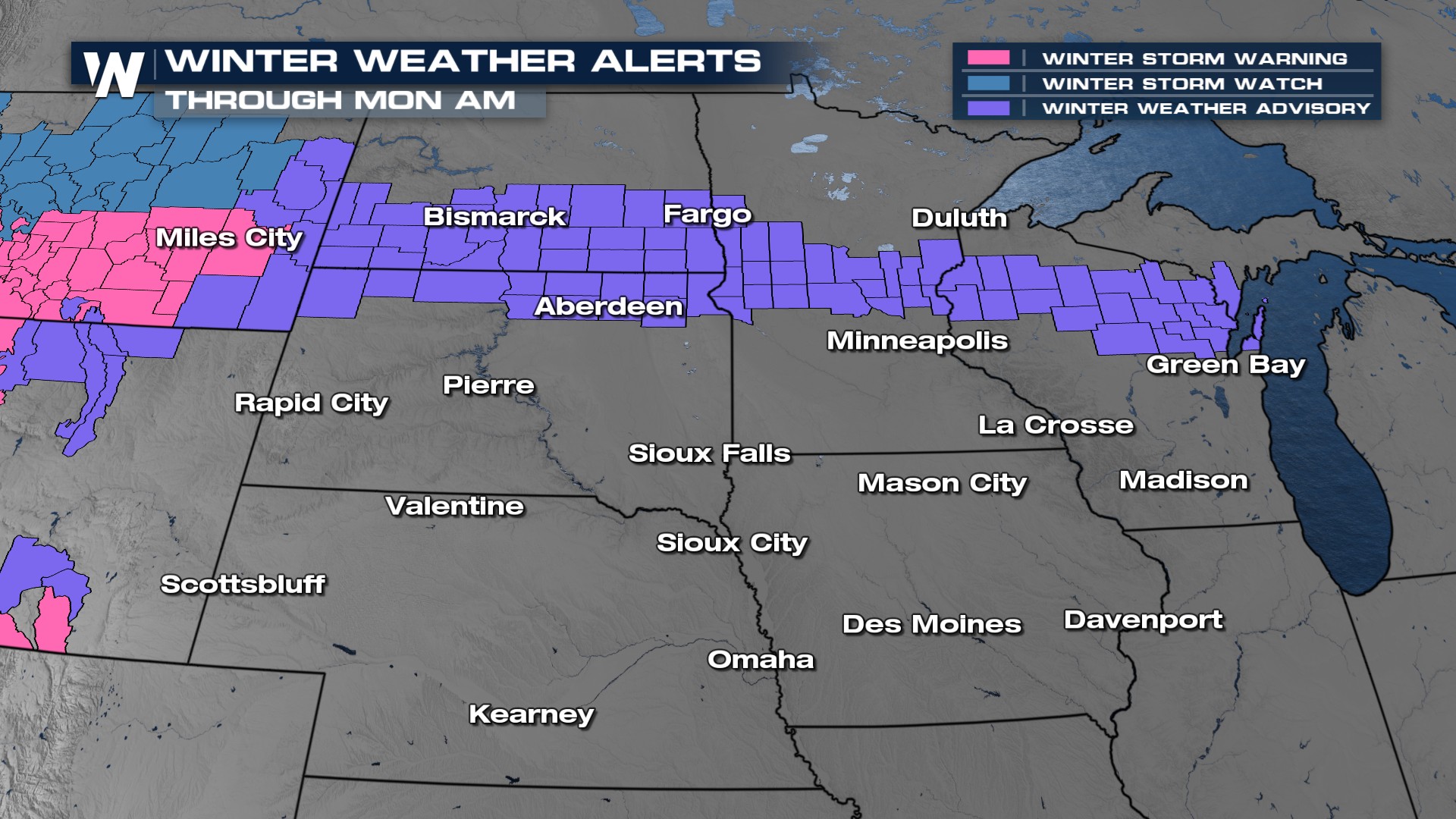
Alerts and Timing
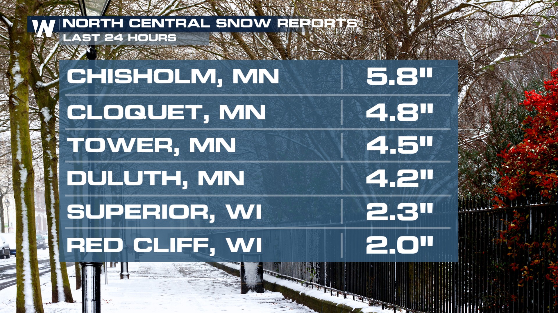
Snow reports are coming in nearly 6" for spots in northeastern Minnesota.
Winter alerts have been issued around western Lake Superior through Sunday for heavy snow and gusty winds. Issues across Minnesota and Wisconsin will remain in place through midday Sunday, and South Dakota's winter Weather Advisory is for the second system that will bring impacts later today.
Snow will come in two waves - along the warm front and with a trailing low-pressure system within a stationary boundary. Areas around the Great Lakes will see snow continue into Sunday morning, where it will gradually clear Michigan by midday. The warm front snow will then track across New York and New England Sunday afternoon and evening.
Round 1:
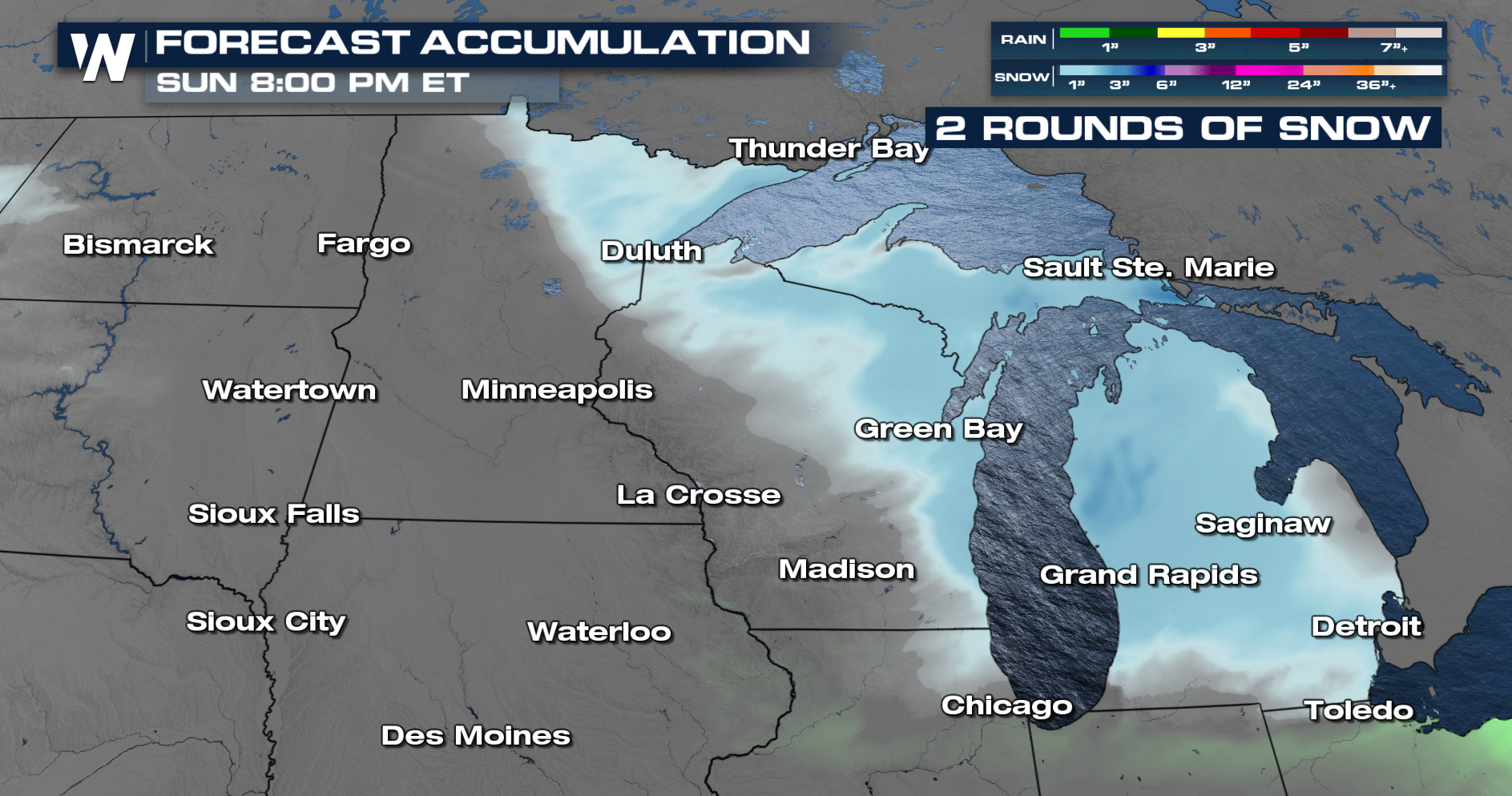
Round 2:
New England will be hit with snow by Sunday evening and they will brace for round two into Monday.
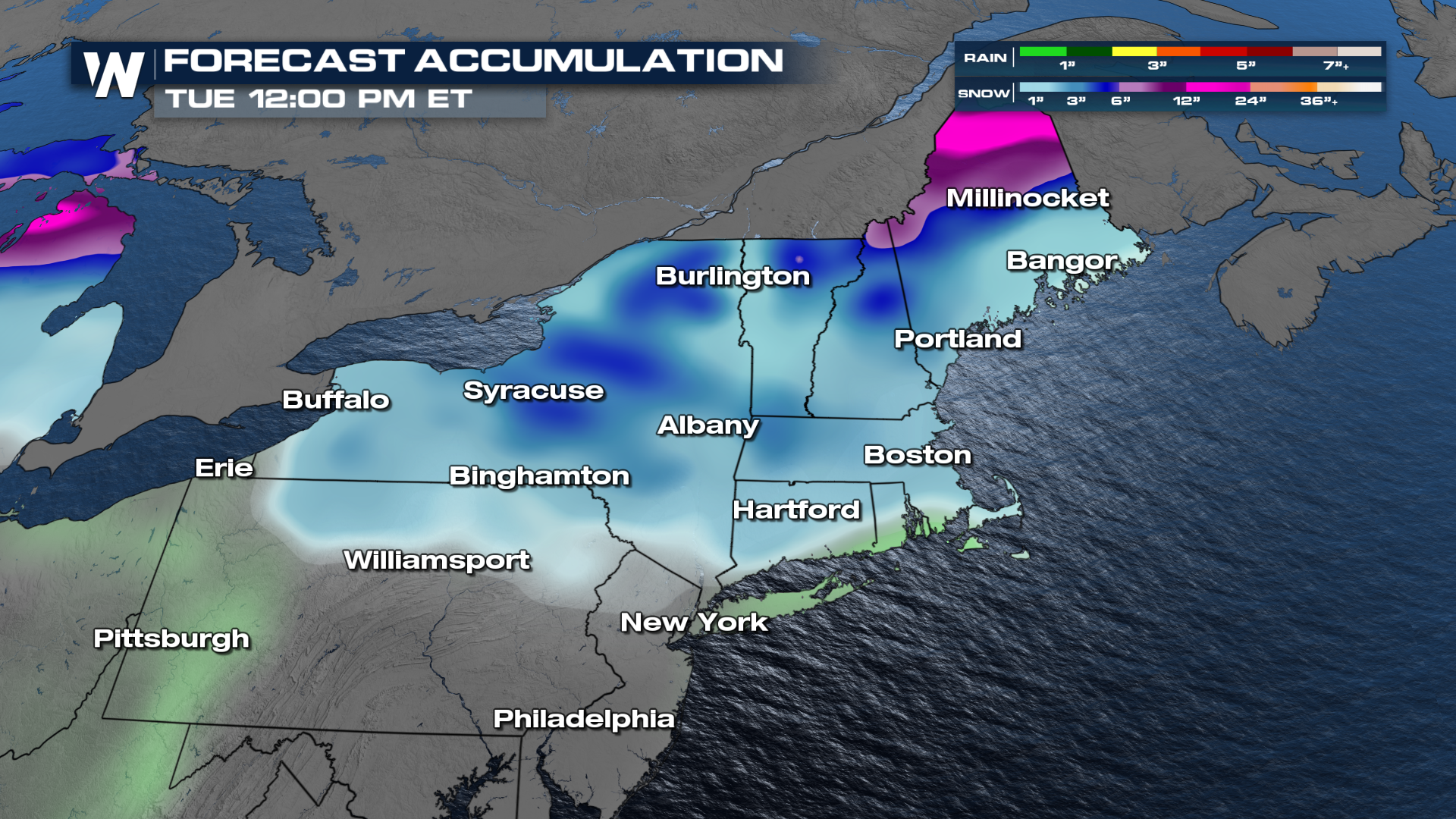
Snow in New York and New England is expected to be lighter, for most, but heavier in the mountains and in northern Maine. Areas east of Lake Ontario into the mountains of northern New York and New England could see 3-6 inches, while areas in northern Maine could surpass a foot.


