Ice Storm In the Great Lakes Through New England

GREAT LAKES to NORTHEAST - As the freezing line hovers the international border, an ice storm continues to bring issues from the Great Lakes through the Northeast. Power outages continue to increase, and roads remain icy and slick across these areas. Pictured above, near Rogers City, Michigan, is an incredibly thick amount of ice that has accumulated on tree branches this morning.
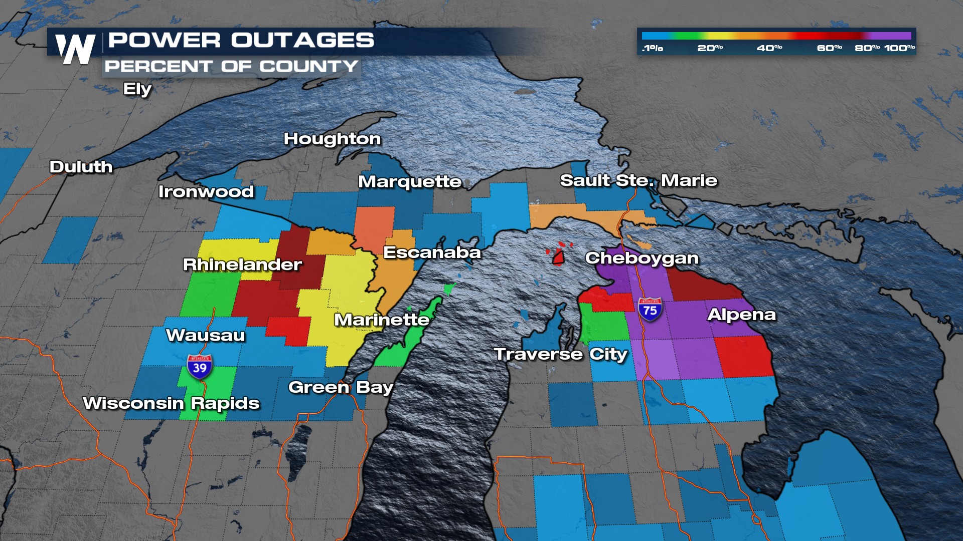
Upper Midwest to Great Lakes
Crippling ice has already accreted in parts of Michigan with another batch on the way. Three-quarters of an inch of ice has led to numerous power outages and slippery roads around the Great Lakes.
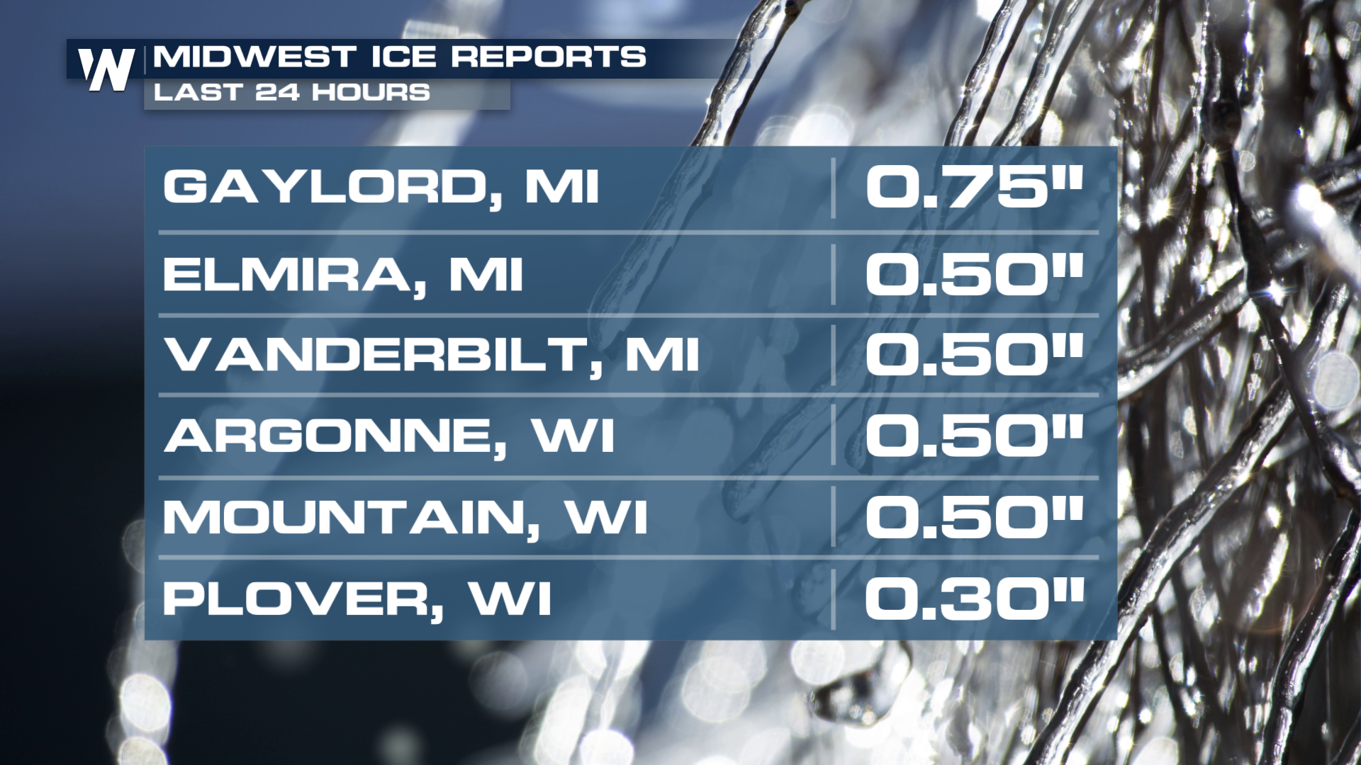
 Gaylord, Michigan has received 0.75" of ice already today!
 Ice storm warnings remain in effect through tonight across portions of Wisconsin and Michigan.
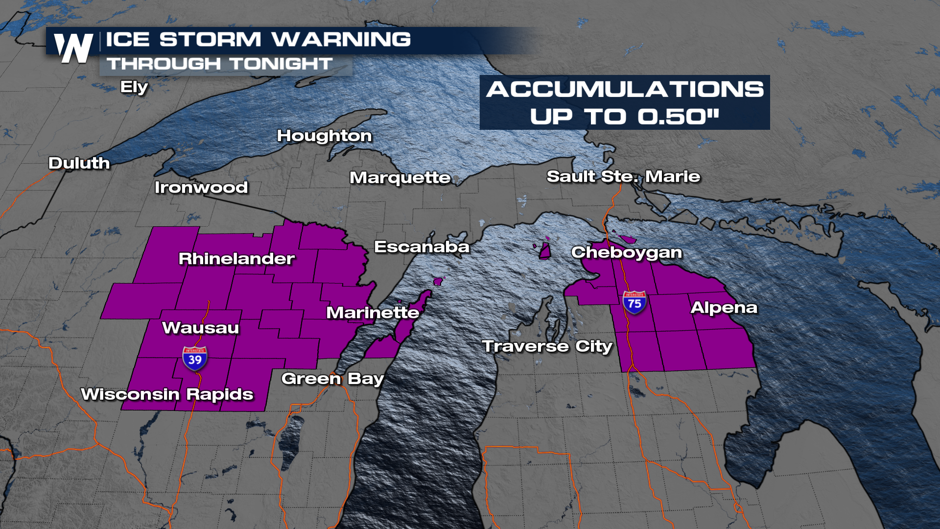 Additional accumulations may still reach up to 0.5", enough to lead to additional power outages and nearly impossible travel. As we time this system out, the surface low will push its way farther north into Canada this evening. As temperatures drop behind this system, ice will transition to snowfall before wrapping up Monday morning. The commute Monday will still be dangerous and slick despite no active precipitation falling.
Stay safe in power outages - always remember to run a generator at least 20 feet from windows and doors to avoid carbon monoxide!
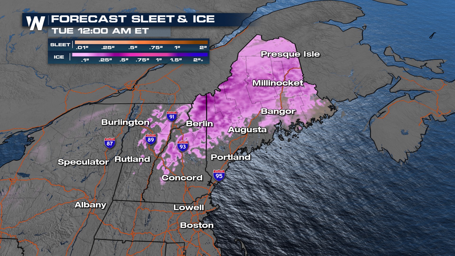
New England
The worst impacts for New England were earlier this Sunday morning as temperatures hovered around freezing. Ice accumulations almost rose to an INCH in some locations. The impacts through Monday remain moderate for New Hampshire and Maine, but the warm front has been lifting the freezing line north of the border, providing room for this icy mess to become more of a rainy mess through Monday.
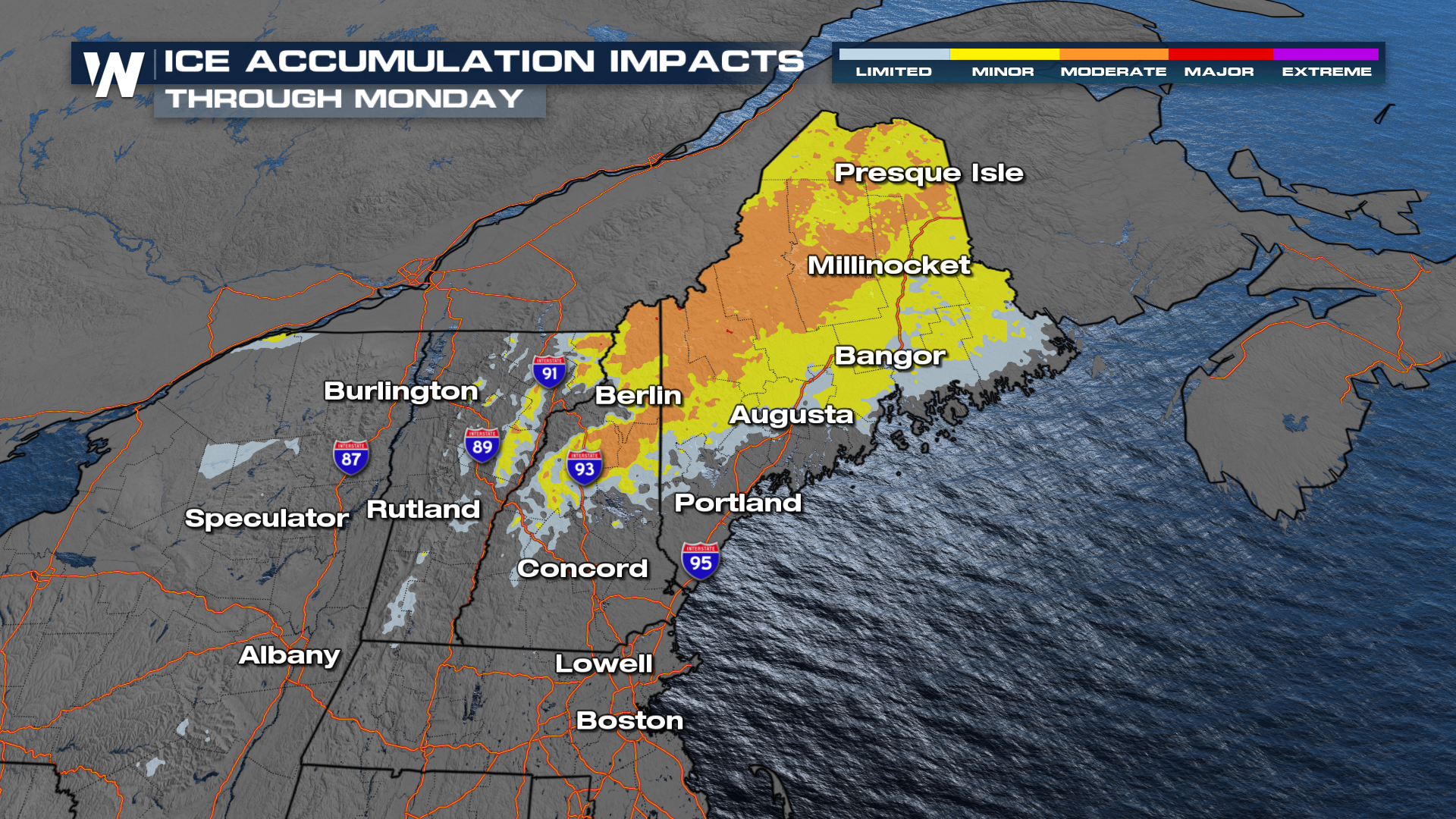
Here's a look at the timing of ice transitioning to mostly rain through Monday. The main cold front arrives Monday as well.
A few inches of snow could fall where the air is even cooler, mainly across northern portions of New England.
 For more details on the rest of your weekly forecast, be sure to join us at :30 minutes past the hour if you live in the Upper Midwest or Great Lakes and :10 minutes past the hour if you live in the northeast.


