Snow & Ice Threaten the South This Weekend

The snow that fell in the south has barely melted and we're already moving onto the next chance? You're probably already seeing people on social media posting about the threat, so let's talk about it.
SETUP
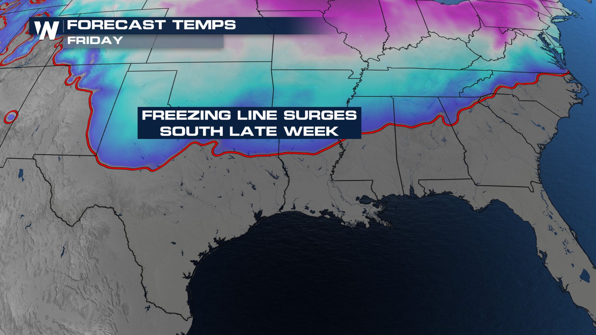
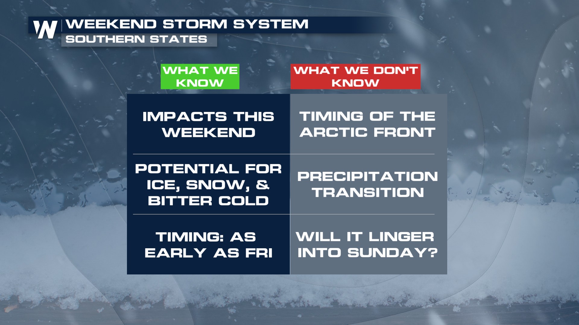
Air that's normally locked up around the poles looks to break off from the region. From there, it will slide southward, invading the southern states. Sub-freezing temperatures will settle in behind this Arctic front, potentially as early as Friday. At the same time, a disturbance will roll onshore from Baja California, providing the lift and moisture needed to cause problems.
TIMING
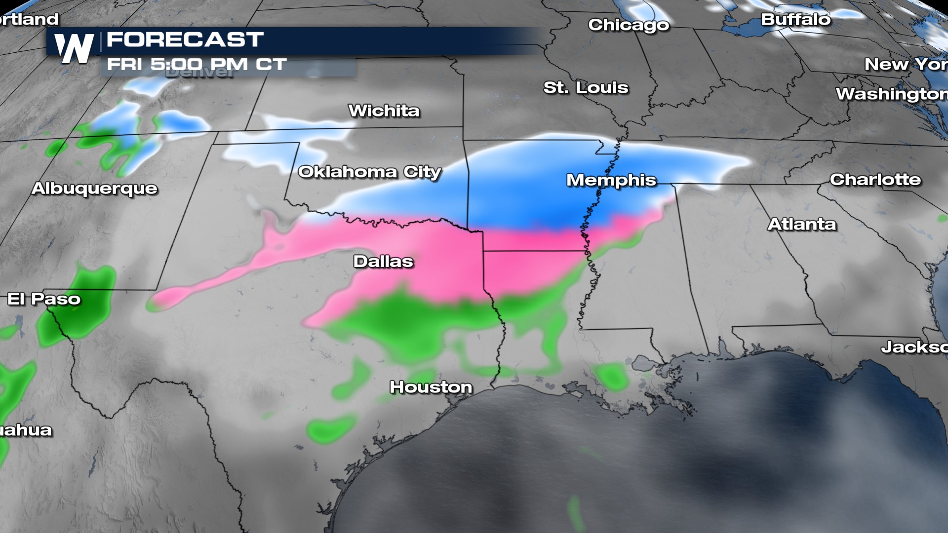
This is where we could see the trickiest part of the forecast, not named precipitation type. Models have been a little all over the place pushing the cold air in, with some as early as Friday afternoon. If that pans out, the Friday evening's commute could be in some trouble. Saturday feels like a safer bet to see trouble, especially in the morning.
UNCERTAINTY
There's a lot riding on when the front moves in. The overall picture of what looks to be shaping up is fairly consistent. Rain turning into freezing rain before becoming sleet and snow seems to make the most sense, given how the setup looks.
WHAT YOU SHOULD DO
With this likely not moving in until at least Friday afternoon, there's plenty of time to prepare. Know what your plans are on Friday and if they're negotiable. This far out, we still only look at forecast trends, before honing in on specific totals.


