Snow Totals from the Weekend Snow that Targeted I-95 From Virginia through New England

MONDAY AM UPDATE: WInter Weather advisories are still in effect for several counties through midday.
Snow Totals:
Plymouth, MA - 6.5"
Greenwich, RI - 6.0"
Durham, NH - 5.0"
Dover, MA 4.5"
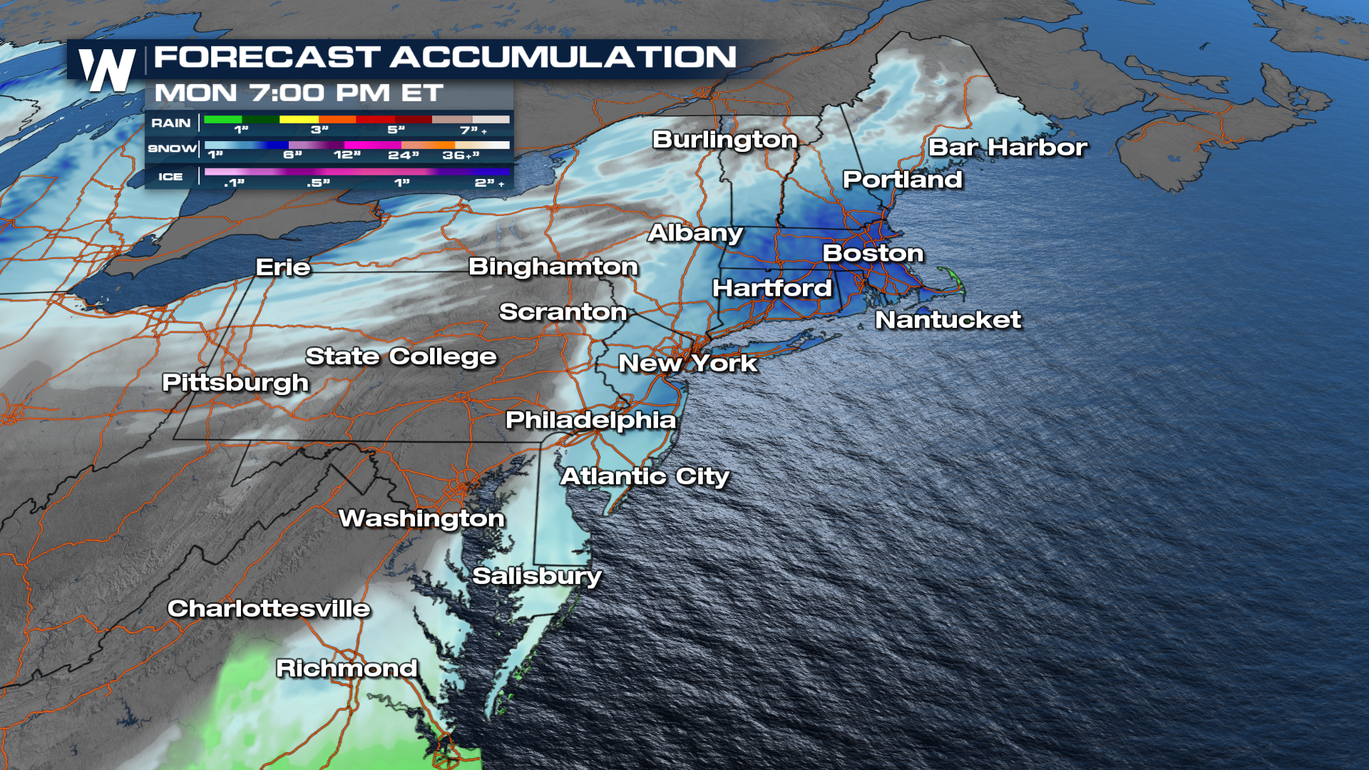
NORTHEAST - The I-95 corridor has seen messy conditions Sunday with rain and snow leading to poor driving. The freeze line has played a role in the type of precipitation we've been seeing. Today, temperatures below freezing led to snow in cities like Boston and New York City. Winter Alerts remain in place through tonight, and for some through Monday morning.
Many areas will taper off through tonight with the snowfall, but some areas across New England will continue to see snow through Monday morning.
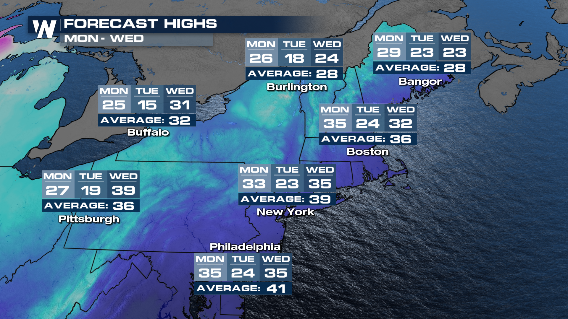
 Temperatures will continue to cool down through the week. Many areas will see the teens and 20s by Tuesday.
Get the latest forecast for the Northeast anytime on the WeatherNation app in the Eastern Regional forecast. The forecast also airs at :10 past every hour.


