Snow for the Midwest and Great Plains through Friday
Several quick rounds of snow will continue to bring impacts to the Plains and Midwest through Friday, as a colder air mass builds in for the weekend. The first round dropped 2-8 inches of snow across the Plains and Upper Midwest Wednesday into Thursday morning. A second low-pressure system has moved through the Plains (top of page) and will track through the Ohio Valley through Friday evening.
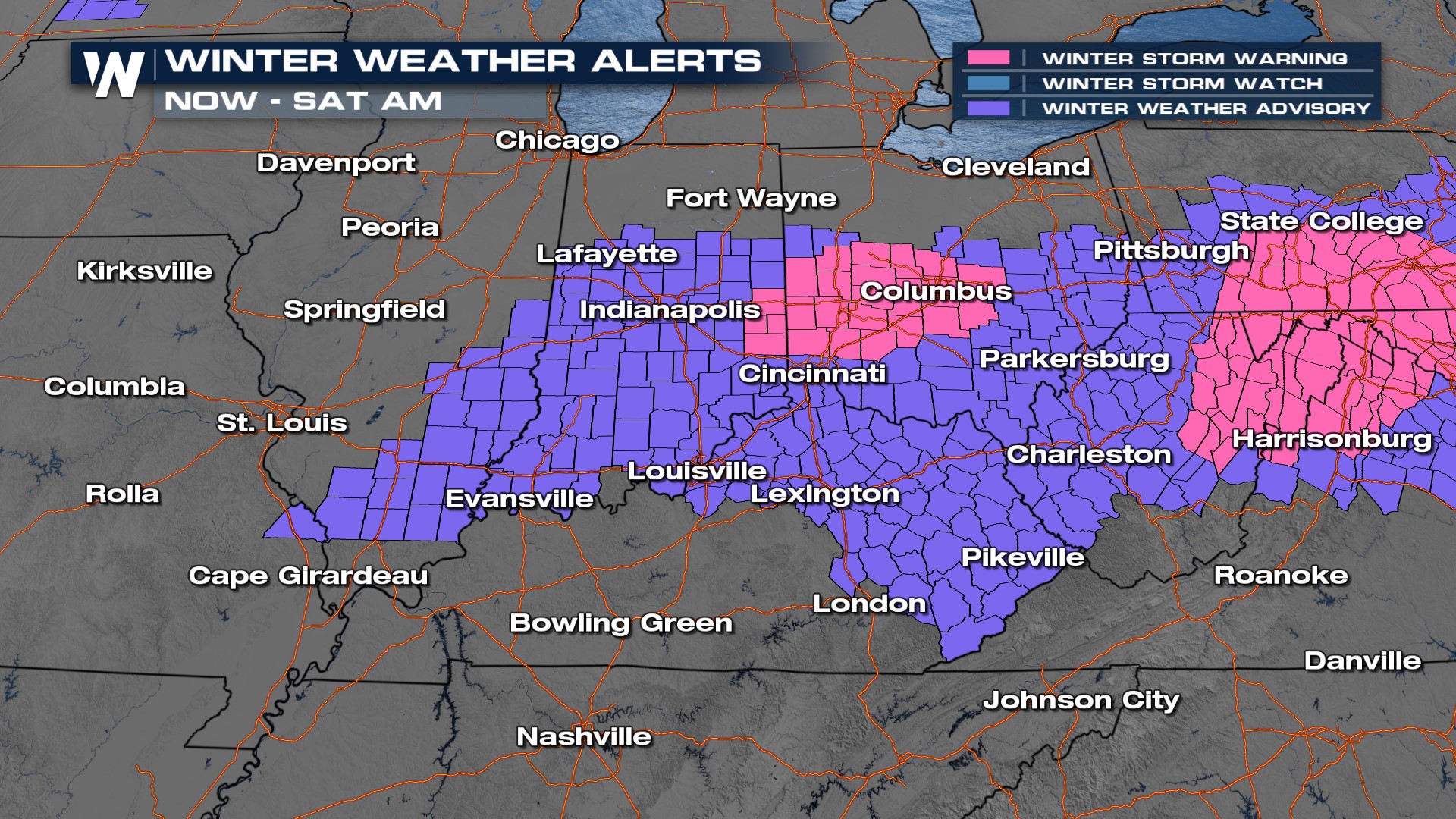
Winter Weather Advisories are in effect from Illinois through eastern Kentucky, and continue into the Mid-Atlantic, where snow is expected through Saturday morning.
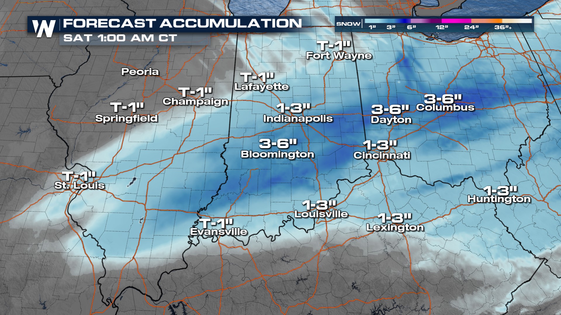
 The atmosphere is cold enough to support widespread snow farther south than our last few systems, even south of the Ohio River. Snowfall totals will be in the range of 1-4" for most, with the most likely area for 5"+ near I-70 in Indiana and Ohio.
Snow will end from west to east Friday night, though snow is expected through the Friday evening commute for many in Indiana, Ohio, and even Kentucky.
