Lingering Lake Effect Snowfall through Sunday Night

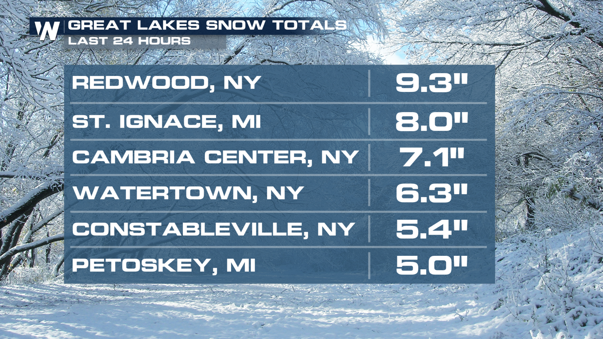
NORTHEAST - We had several snow squalls to begin the weekend on Saturday. What is a snow squall? Great question! It's a brief whiteout of low visibility, heavy snow, quick icing, and gusty winds. It typically only lasts 15-30 minutes but can cause treacherous travel conditions. The clipper system responsible for snow squalls across the northeast is now wrapping around moisture and cool air behind it to produce lake-enhanced snow near the Great Lakes. Totals have already reached 9 inches in some spots.
Forecast
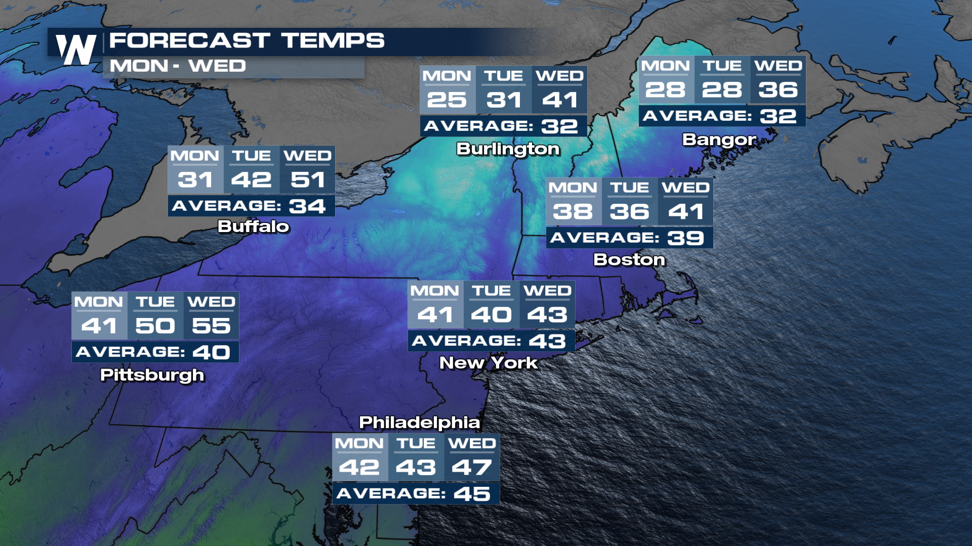
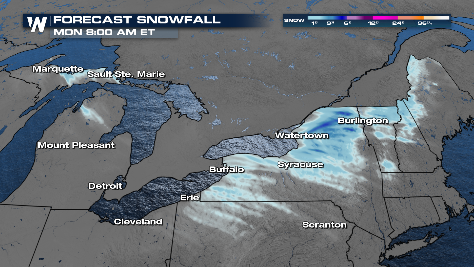
Conditions will remain breezy and chilly for many towns and cities through tonight. Behind an area of low pressure, moisture from the Great Lakes and cooler air behind the front will help to produce additional snowfall, especially across New York State and parts of northern New England. These bands of snowfall are known as lake-enhanced snowfall.
Winter weather alerts remain in effect for parts of western New York for additional lake-enhanced snowfall. Spots that could get locally higher snow totals include Watertown and the Tug Hill Plateau, where Lake Effect Snow Warnings are in place.
 New York state may get the most additional snowfall through the holiday Monday (President's Day) with another 2-4" in localized spots. This would make up to a total of 12-14 inches of snow (including what has already fallen).
 As mentioned above, to get lake-enhanced snow showers, you need to have cold air moving over warm lake waters. The lakes are still mostly unfrozen and cold air coming in from Canada is at or below freezing, setting up the lake-effect snow potential. The next few days will be chilly, but a big warmup will take place toward the end of next week.