Snow Showers Clear Out of the High Plains Later Tonight

Special Stories
13 Apr 2021 4:01 AM
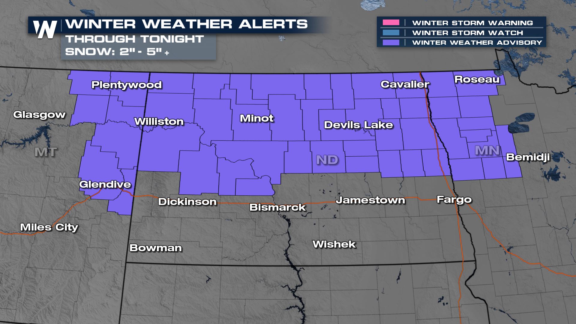
Snow has been impacting the Northern High Plains all morning and with gusty winds in the forecast, the hazardous travel threat will continue through the evening hours. Here is the very latest on the High Plains Snow.

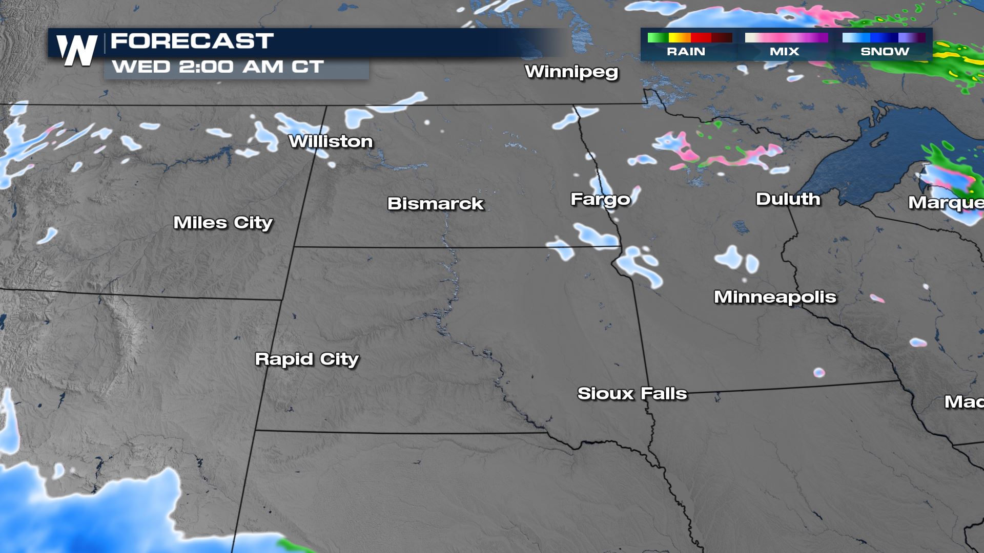
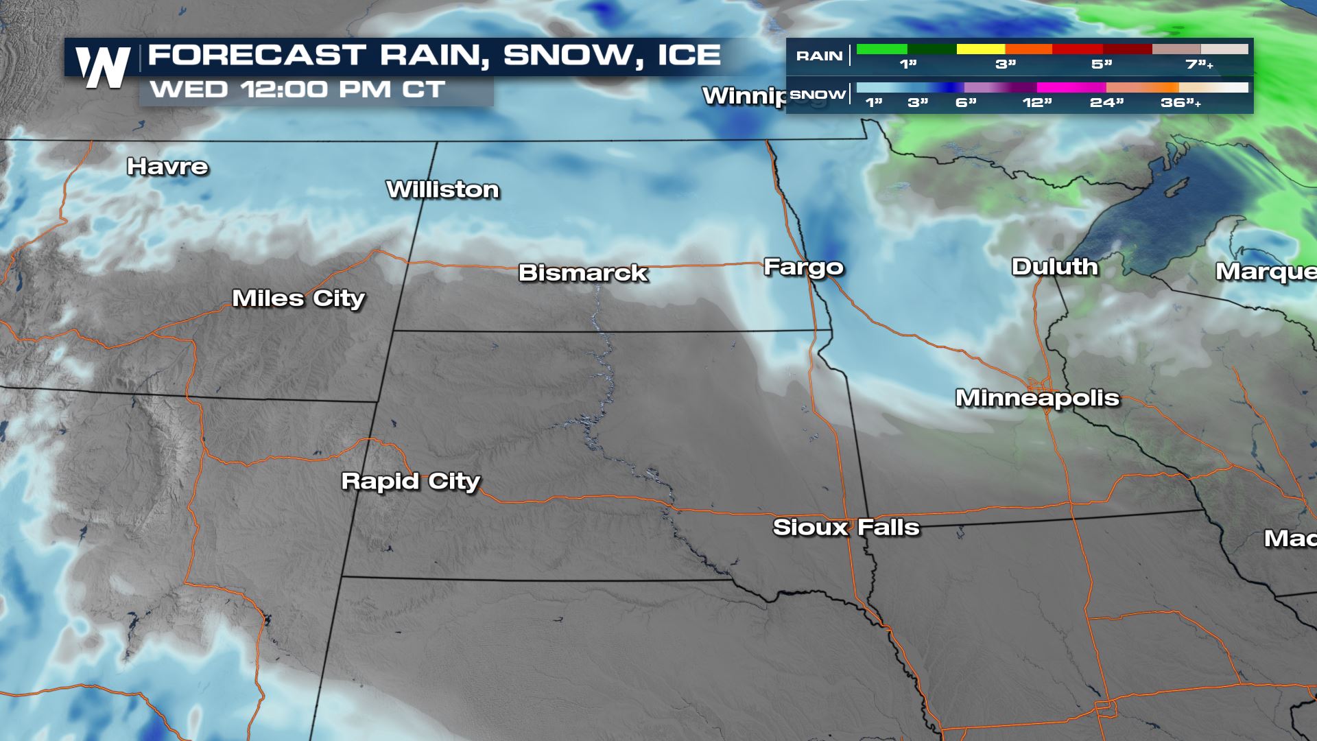
 By Wednesday morning, the bulk of the snow comes to an end from this upper-level trough.
 The blowing and drifting snow could also create some travel impacts for parts of North Dakota.
 For the latest, tune-in to WeatherNation!
Forecast
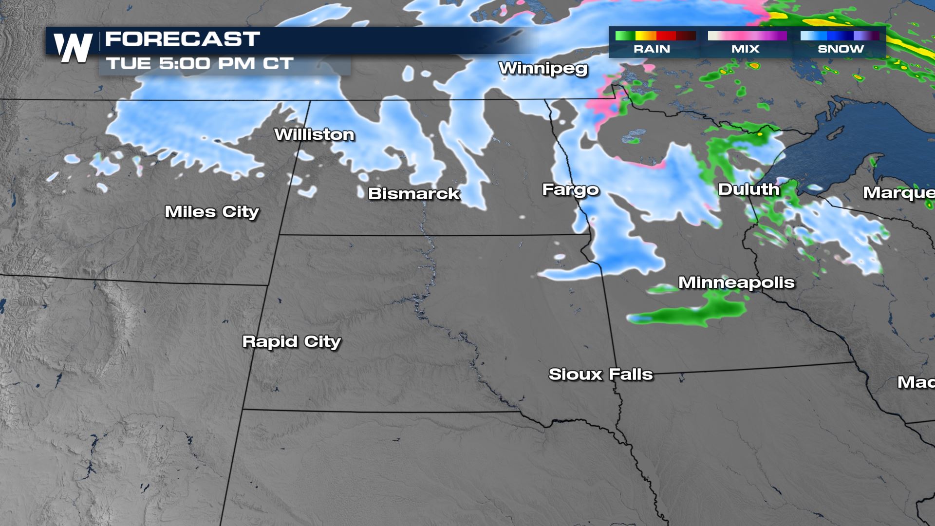
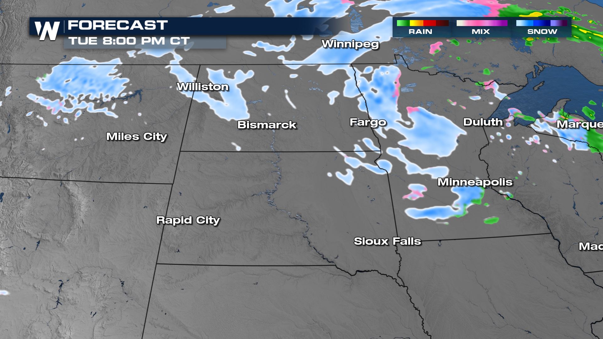
Snow looks to continue into Montana, North Dakota, and northern Minnesota through the day today and possibly some leftover snow showers through the early morning Wednesday.
By Wednesday morning, the bulk of the snow comes to an end from this upper-level trough.
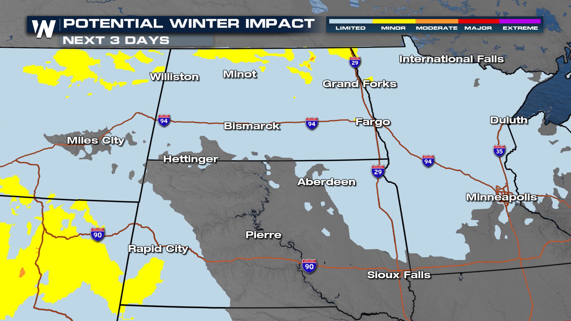
Forecast Accumulation
The heaviest snowfall accumulations will be along the Canadian border through North Dakota where bands of snow will set up in the same spots for a a couple days.
The blowing and drifting snow could also create some travel impacts for parts of North Dakota.
For the latest, tune-in to WeatherNation!All Weather News
More

Flooding, Severe Storms Target the Midwest Again
After an active week of storms across the nor
31 Jul 2026 11:15 PM


After Reaching Category 5, Genevieve Weakens in the Pacific
PacificFausto is now a post-tropical cyclone.
31 Jul 2026 1:30 AM

Flooding Risk Increases as Heavy Rain Targets the Tri-State Area
Tuesday, heavy rainfall moved across the Nort
30 Jul 2026 12:25 AM

Severe Weather: Energy From the Midwest Now in the Southeast
UPPER MIDWEST - Through Monday, dangerous tor
29 Jul 2026 10:30 PM