More Soaking Rain For the East Next Week
Special Stories
16 Feb 2018 5:27 PM
It has been another wet week for many parts of the eastern U.S. In fact, overall, it's been a rather wet winter, with round after round of snow and rain. So it should come as no surprise that the weather set-up for next week will once again, favor more rain.
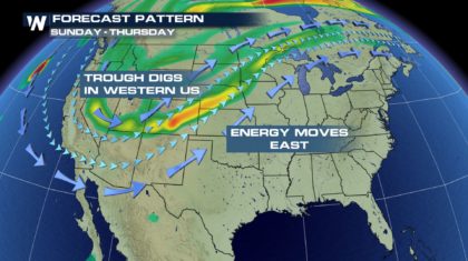
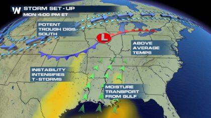
The next storm will begin in the western U.S. as the jetstream digs southward into the four corners region. As the jetstream pulls out of this area to the northeast, the associated energy will shift to to the east.
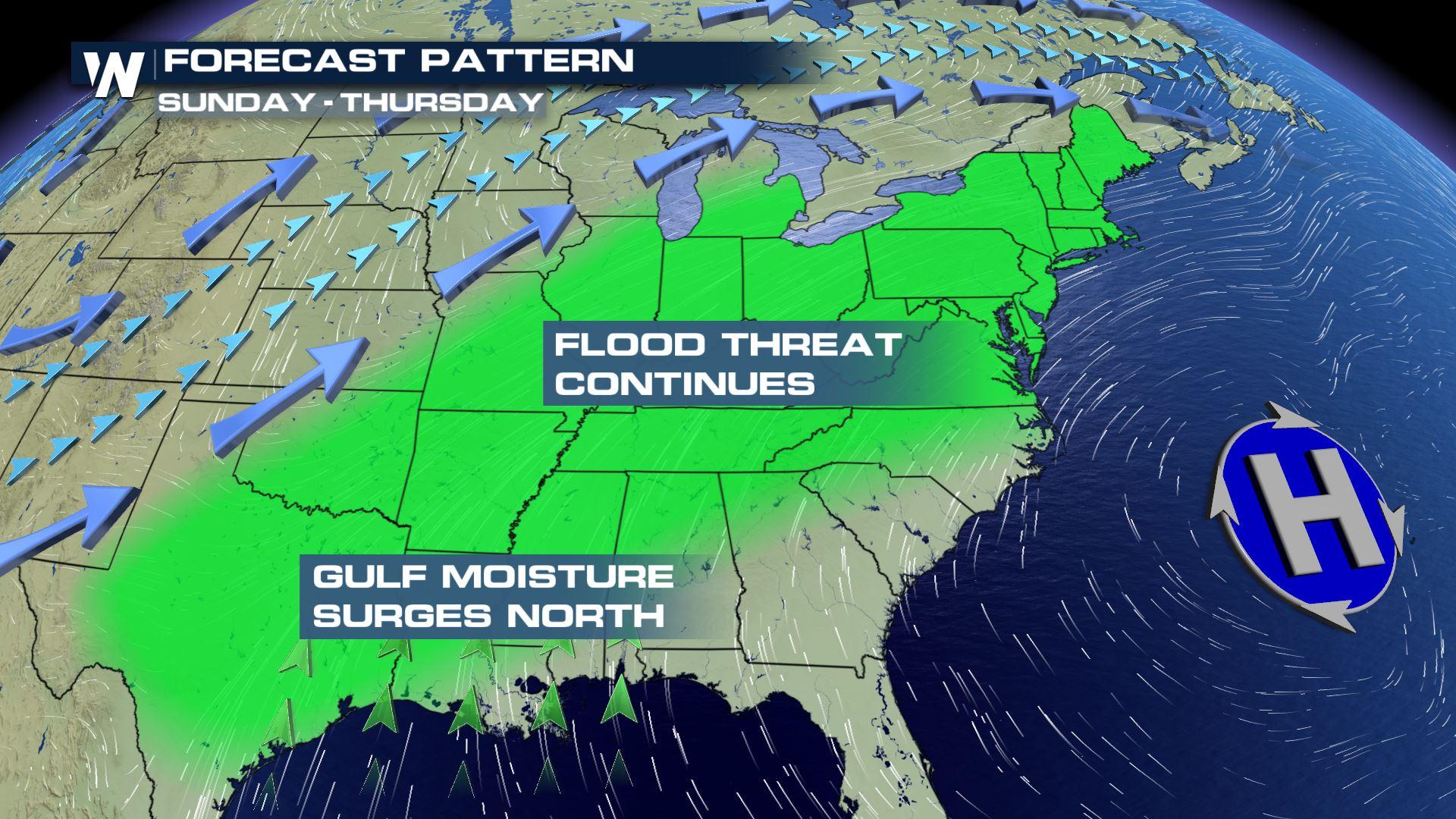
 Gulf moisture will surge northward. Heavy rain will fall in areas that have already received inches of rain over the last couple of weeks. Flood threats will return to the southeast, the Midwest, the Ohio Valley, and the northeast.
 Along with heavy rain, warm air will also be transported from the south to the north. This will create unseasonably warm temps for February. Check out the highs for Monday and Tuesday. 56 degrees in Chicago on Monday. Not bad for February.
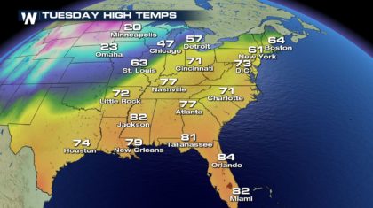
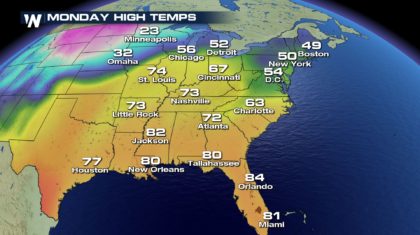 Despite the rain, New Yorkers will enjoy 61 degrees on Tuesday.
 And as the cold front swings through the southeast, strong to severe thunderstorms could develop. Timing and location of these storms will become more defined as we get closer to the event on Monday. The Ark-La-Tex region could be an area of concern for strong storms. But again, right now, it's a little too early to pinpoint locations.
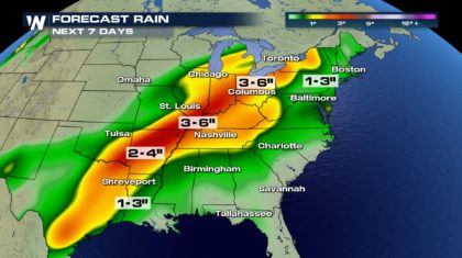
 But the potential rain totals could have the most widespread impacts on the region. Parts of the Midwest and Ohio Valley could see an additional three to six inches of rain. It's another system that we'll be watching very closely at WeatherNation. Stay tuned.
 For WeatherNation: Meteorologist Matt Monroe
Gulf moisture will surge northward. Heavy rain will fall in areas that have already received inches of rain over the last couple of weeks. Flood threats will return to the southeast, the Midwest, the Ohio Valley, and the northeast.
Along with heavy rain, warm air will also be transported from the south to the north. This will create unseasonably warm temps for February. Check out the highs for Monday and Tuesday. 56 degrees in Chicago on Monday. Not bad for February.
Despite the rain, New Yorkers will enjoy 61 degrees on Tuesday.
And as the cold front swings through the southeast, strong to severe thunderstorms could develop. Timing and location of these storms will become more defined as we get closer to the event on Monday. The Ark-La-Tex region could be an area of concern for strong storms. But again, right now, it's a little too early to pinpoint locations.
But the potential rain totals could have the most widespread impacts on the region. Parts of the Midwest and Ohio Valley could see an additional three to six inches of rain. It's another system that we'll be watching very closely at WeatherNation. Stay tuned.
For WeatherNation: Meteorologist Matt MonroeAll Weather News
More
More Storms for the East Through Monday
The threat for flooding rain continues across
3 Aug 2026 6:00 PM


After Reaching Category 5, Genevieve Weakens in the Pacific
PacificGenevieve formed last Friday south of
3 Aug 2026 12:30 AM

Flooding, Severe Storms Target the Midwest Again
After an active week of storms across the nor
1 Aug 2026 1:40 AM

Flooding Risk Increases as Heavy Rain Targets the Tri-State Area
Tuesday, heavy rainfall moved across the Nort
30 Jul 2026 12:25 AM