Southeast Severe Chances

Special Stories
12 May 2019 11:15 AM
SEVERE OUTLOOK
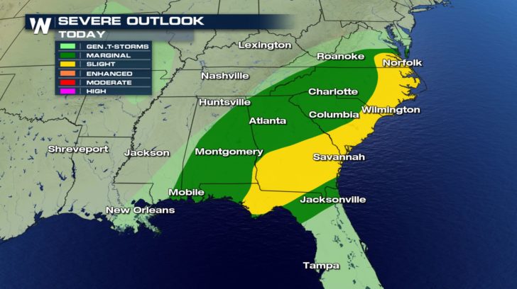
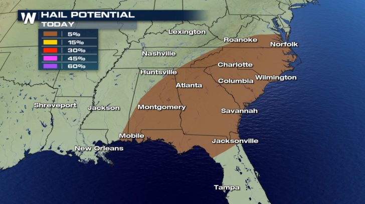
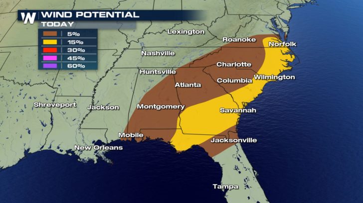
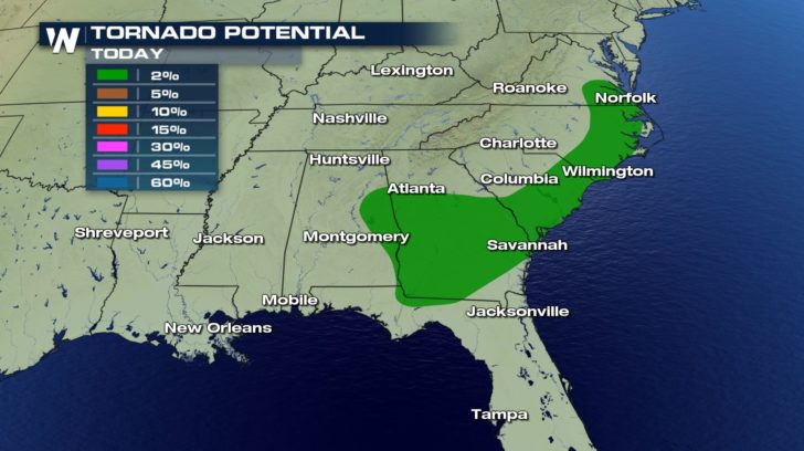 Severe weather continues in the southeast, today. Anything from damaging winds, hail, and tornadoes will all pose a threat.
Hail could reach up to an inch in diameter.
Winds could range anywhere from 58 mph to 70 mph within some of the storms.
FORECAST
Severe weather continues in the southeast, today. Anything from damaging winds, hail, and tornadoes will all pose a threat.
Hail could reach up to an inch in diameter.
Winds could range anywhere from 58 mph to 70 mph within some of the storms.
FORECAST
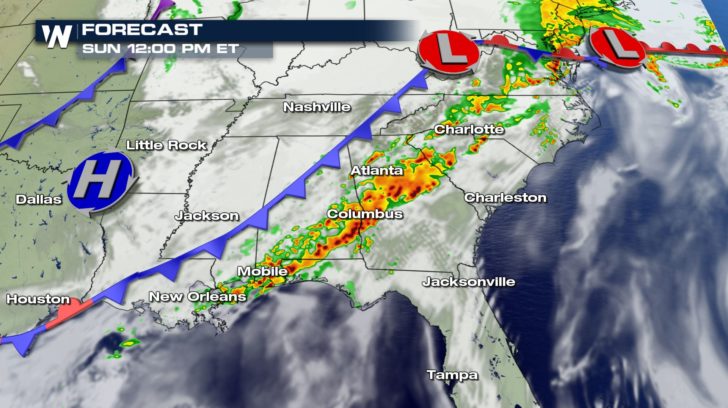
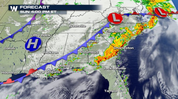 The forecast shows a line of strong storms forming as we head into the afternoon. This band will hold together until around 5 PM this evening.
After, the cold front will slide off the coast and much of the rain will clear out.
Heavy rain showers will hang around the Florida panhandle throughout the night and into Monday morning.
The forecast shows a line of strong storms forming as we head into the afternoon. This band will hold together until around 5 PM this evening.
After, the cold front will slide off the coast and much of the rain will clear out.
Heavy rain showers will hang around the Florida panhandle throughout the night and into Monday morning.
Severe weather continues in the southeast, today. Anything from damaging winds, hail, and tornadoes will all pose a threat.
Hail could reach up to an inch in diameter.
Winds could range anywhere from 58 mph to 70 mph within some of the storms.
FORECAST
The forecast shows a line of strong storms forming as we head into the afternoon. This band will hold together until around 5 PM this evening.
After, the cold front will slide off the coast and much of the rain will clear out.
Heavy rain showers will hang around the Florida panhandle throughout the night and into Monday morning.All Weather News
More
Hurricane Flossie Now A Major Hurricane
Hurricane FlossieThe National Hurricane Cente
2 Jul 2025 3:00 AM

NHC Monitoring Front in the Southeast Ahead of 4th of July
SOUTHEAST - A frontal boundary moving through
2 Jul 2025 3:00 AM

Where Rain Could Dampen Holiday Travel Plans
AAA is expecting over 70 million travelers to
2 Jul 2025 2:35 AM


Western Heat Continues With Some Relief
A large dome of hot, high pressure remains ac
2 Jul 2025 2:00 AM

Severe Storms For the East Coast Through Tuesday
A cold front moving through a moist airmass h
2 Jul 2025 1:00 AM

Severe Weather Threat Continues in the Midwest
It has been an active, severe season across t
30 Jun 2025 9:00 PM