Southeast Severe Threat
Special Stories
29 Dec 2020 11:14 AM
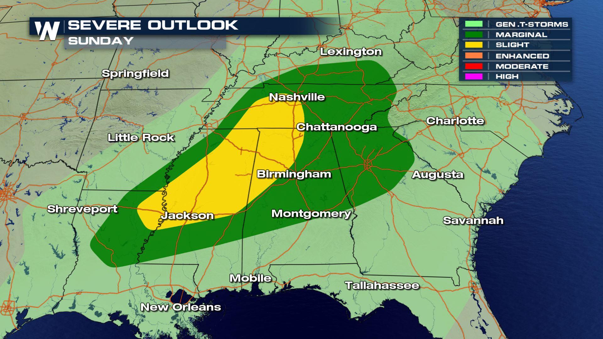
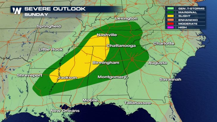
SEVERE OUTLOOK
 Areas in the southeast will have a severe weather threat for today.
The main threats will be the risk for damaging winds and isolated tornadoes.
Winds could reach up to 70 mph within some of these storms.
Areas in the southeast will have a severe weather threat for today.
The main threats will be the risk for damaging winds and isolated tornadoes.
Winds could reach up to 70 mph within some of these storms.
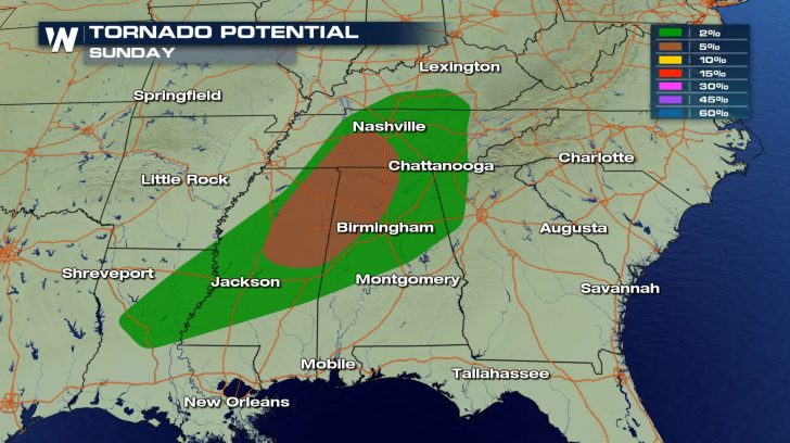
FORECAST
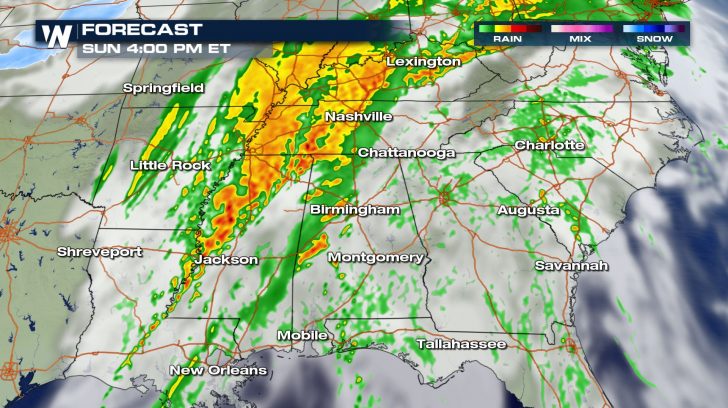
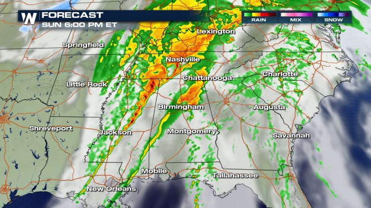
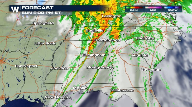 Storms will likely start up around 3 PM and last until 9 PM.
These storms could also come with heavy downpours, so ponding on roads might be possible.
Low visibility could also be possible so drive slowly through these storms.
Storms will likely start up around 3 PM and last until 9 PM.
These storms could also come with heavy downpours, so ponding on roads might be possible.
Low visibility could also be possible so drive slowly through these storms.
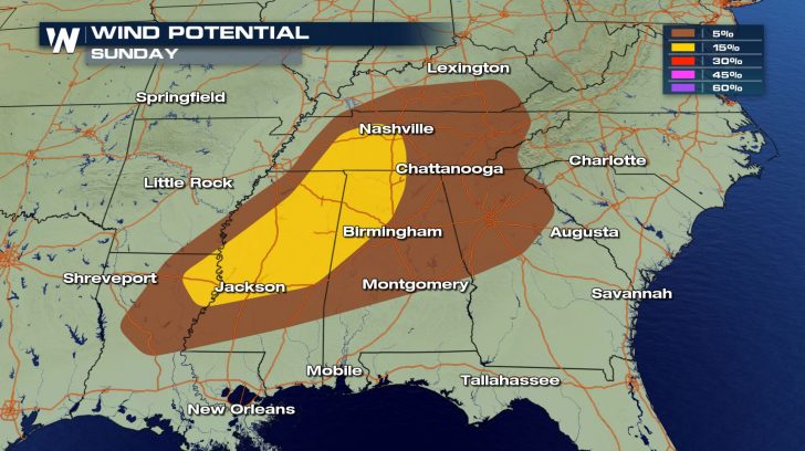
FORECAST RAINFALL
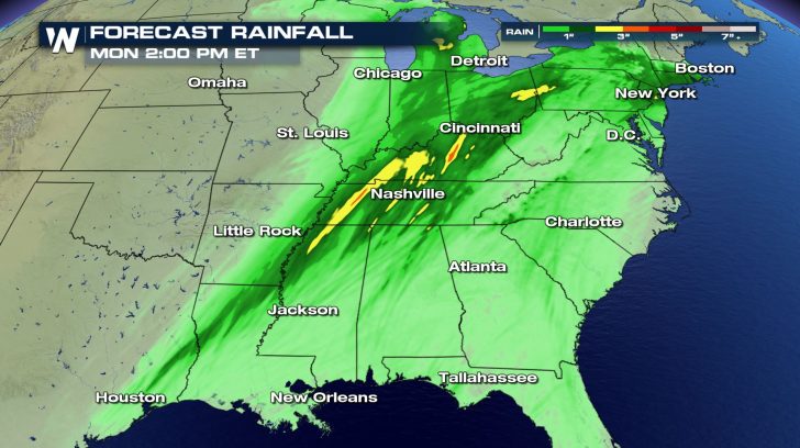 Rainfall totals will not be extremely high but up to 3 inches will be possible, especially through northern Mississippi, Tennessee, and Kentucky.
All Weather News
More
East Gears Up for Stormy, Wet Weekend
A low pressure system crashing through the Mi
1 Aug 2026 6:15 PM


Flooding, Severe Storms Target the Midwest Again
After an active week of storms across the nor
1 Aug 2026 1:40 AM

After Reaching Category 5, Genevieve Weakens in the Pacific
PacificFausto is now a post-tropical cyclone.
31 Jul 2026 1:30 AM

Flooding Risk Increases as Heavy Rain Targets the Tri-State Area
Tuesday, heavy rainfall moved across the Nort
30 Jul 2026 12:25 AM

Severe Weather: Energy From the Midwest Now in the Southeast
UPPER MIDWEST - Through Monday, dangerous tor
29 Jul 2026 10:30 PM