Southern Plains Severe Weather Threat Friday
Special Stories
19 Jun 2020 7:30 AM
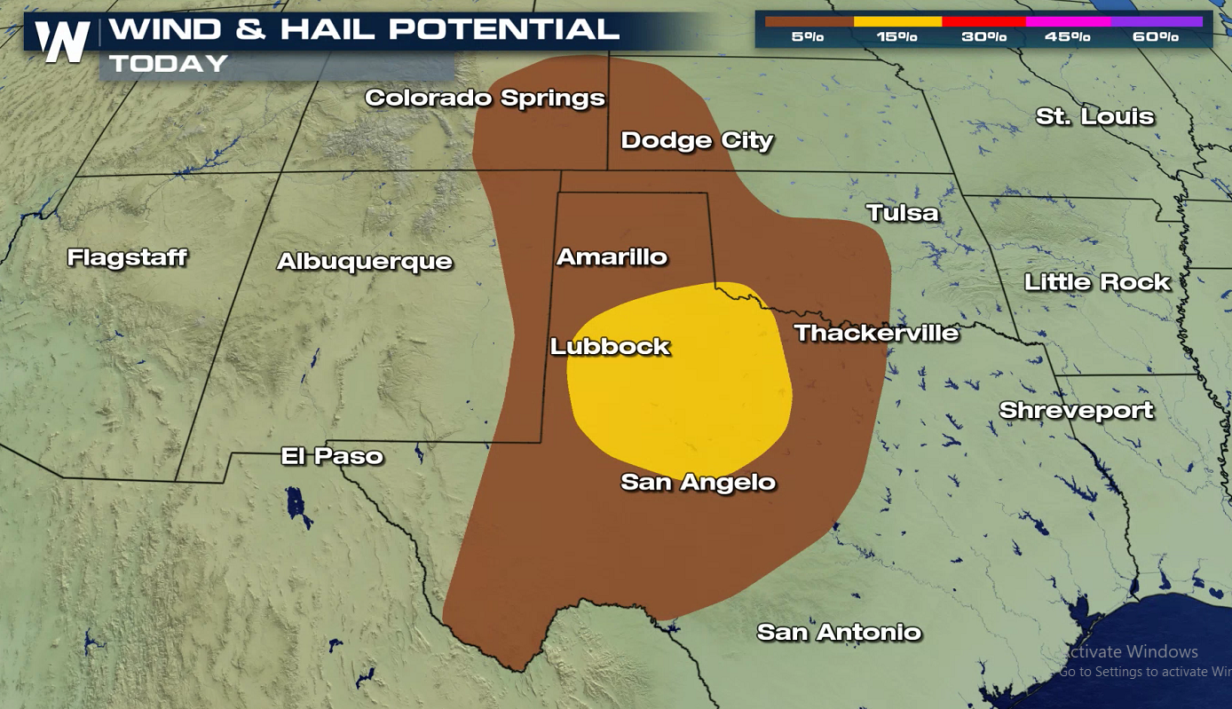
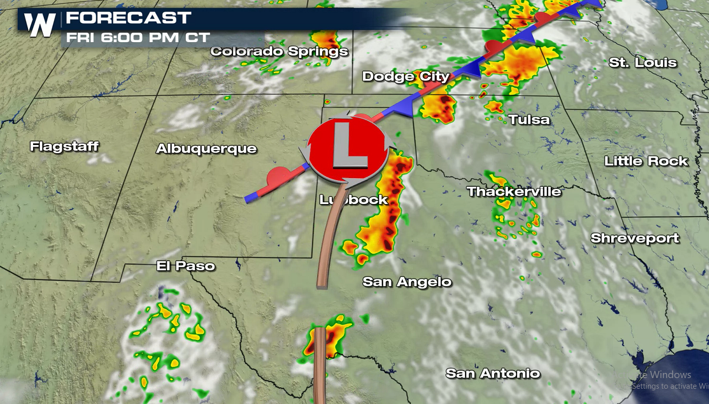
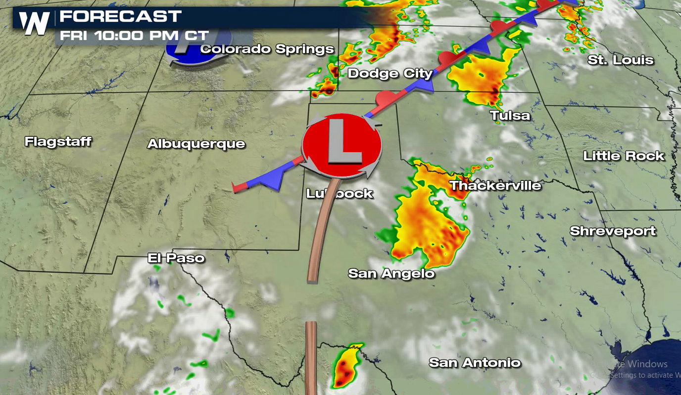
As we approach the weekend, the threat for severe weather exists in the southern Plains today (Friday). The Storm Prediction Center has highlighted areas from the Front Range of Colorado to the Rio Grande in Texas. A slight risk (level 2 on a scale of 1 to 5) has been posted for West Texas, including Amarillo, Lubbock, Midland, and Odessa.
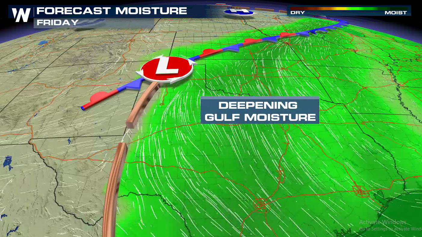
 A well established flow of moisture from the Gulf of Mexico will sweep higher humidity into the region. With highs in the 80s and 90s, there will be ample instability to support severe thunderstorm development.
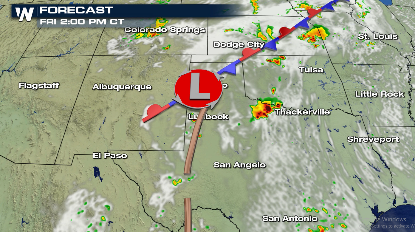
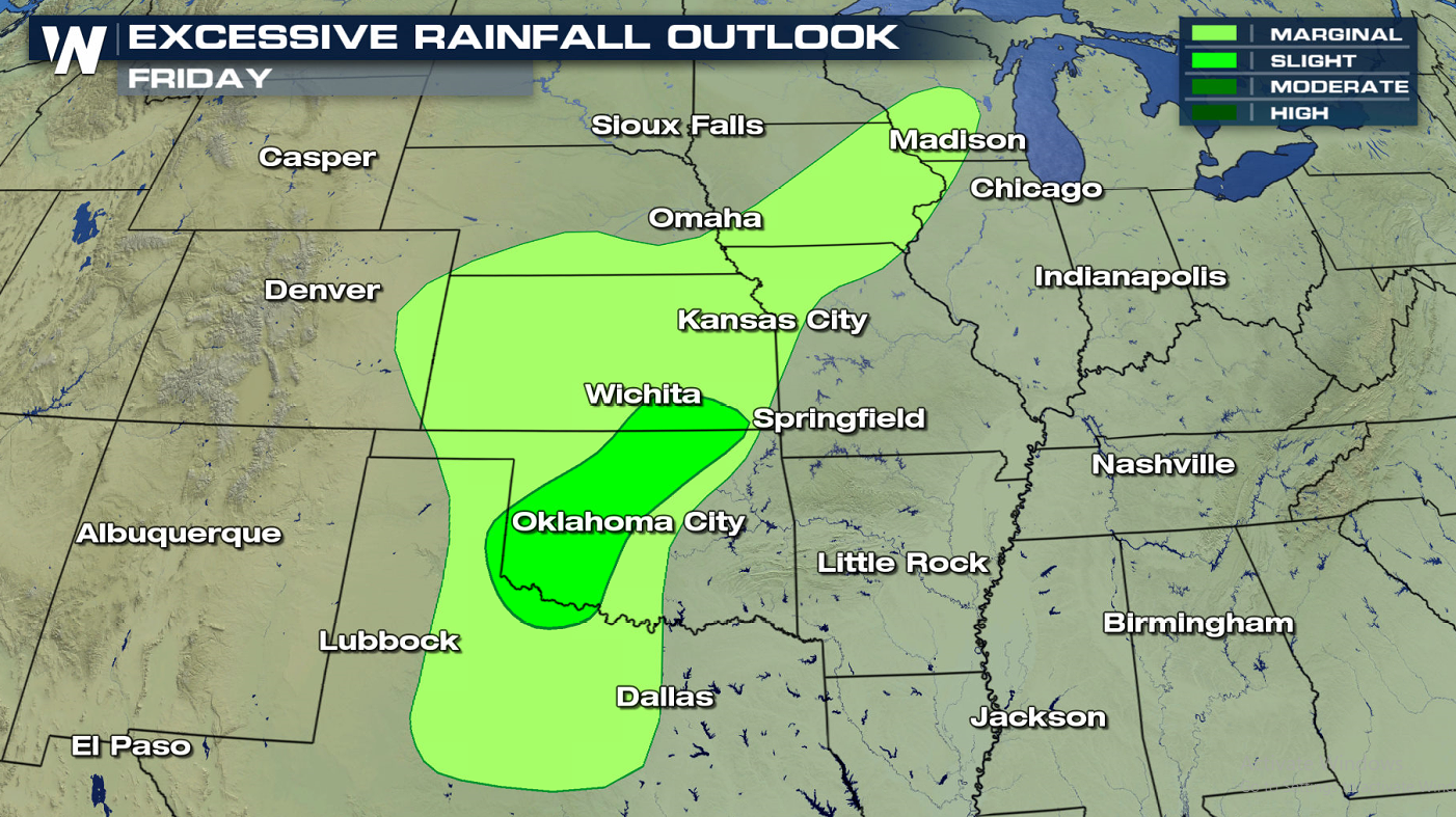 A low pressure center and dryline will be the area of focus for severe thunderstorm development. Large hail and strong wind gusts will be the primary threats. Slow moving thunderstorms will produce very heavy rainfall and the potential for isolated flooding in this moisture rich environment.
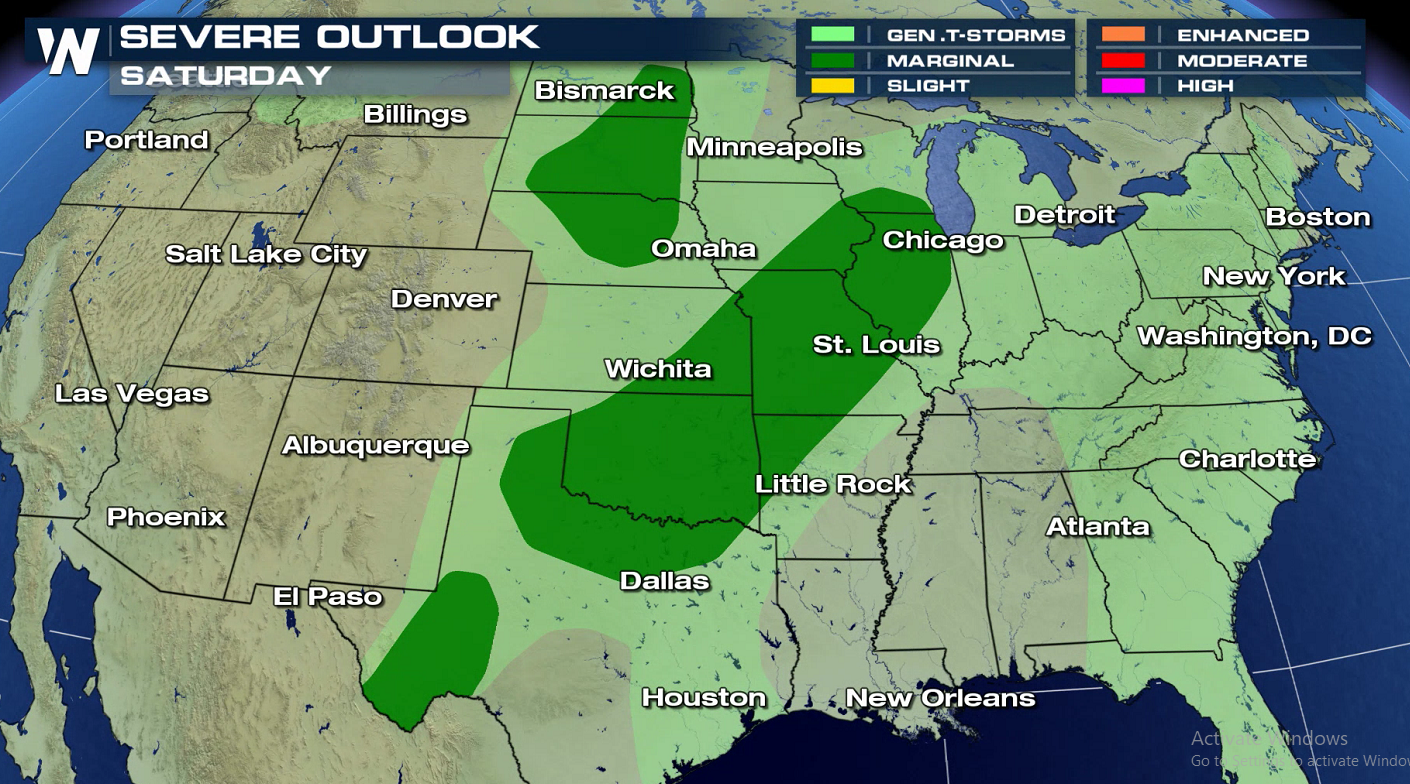
 On Saturday, there is a marginal risk for severe thunderstorms in the across most of the Plains. Higher instability is likely, but weaker dynamics and jet stream energy is shown by forecast models. Check back as the weekend arrives for updates.
 If you are in the risk areas, check back with WeatherNation for the latest forecast and severe weather alerts. We will keep you up-to-date on-air and online.
 A well established flow of moisture from the Gulf of Mexico will sweep higher humidity into the region. With highs in the 80s and 90s, there will be ample instability to support severe thunderstorm development.

 A low pressure center and dryline will be the area of focus for severe thunderstorm development. Large hail and strong wind gusts will be the primary threats. Slow moving thunderstorms will produce very heavy rainfall and the potential for isolated flooding in this moisture rich environment.


 On Saturday, there is a marginal risk for severe thunderstorms in the across most of the Plains. Higher instability is likely, but weaker dynamics and jet stream energy is shown by forecast models. Check back as the weekend arrives for updates.
 If you are in the risk areas, check back with WeatherNation for the latest forecast and severe weather alerts. We will keep you up-to-date on-air and online.
All Weather News
More