Stormy and Slightly Cooler for the Southeast

Heat and humidity have been the topic of conversation for awhile across the southeast. Now, as a cold front moves further to the south, it is bringing some
relief to the hot temperatures. However, this front is also ramping up the storms across the southeast.
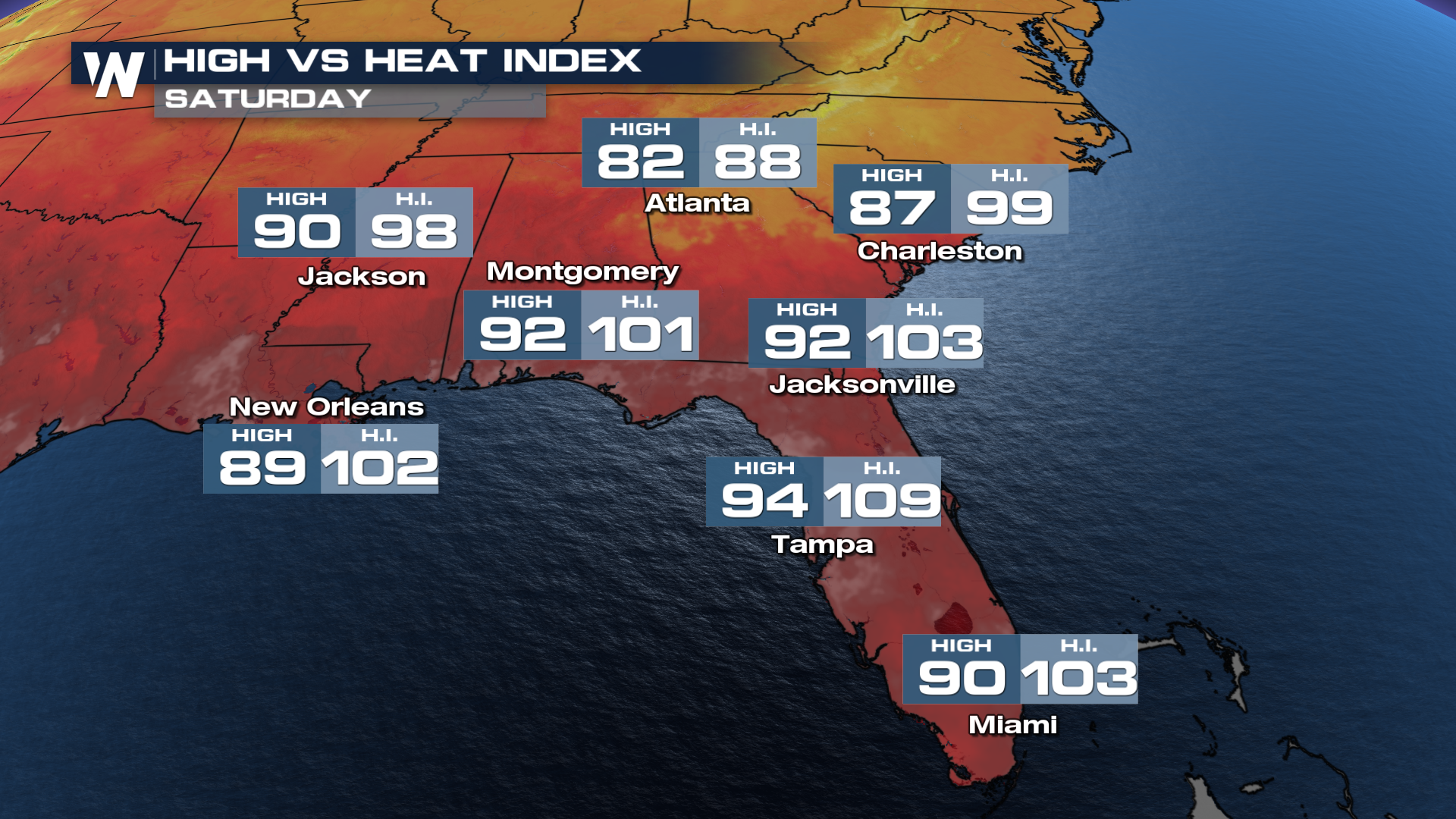
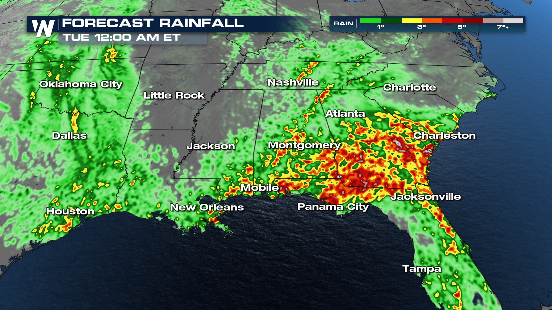
Dewpoints are still in the 70s, so heat indices will nearly reach 103° in Jacksonville, FL to begin the weekend. The moisture will also aid in heavy rainfall across parts of the southeast.
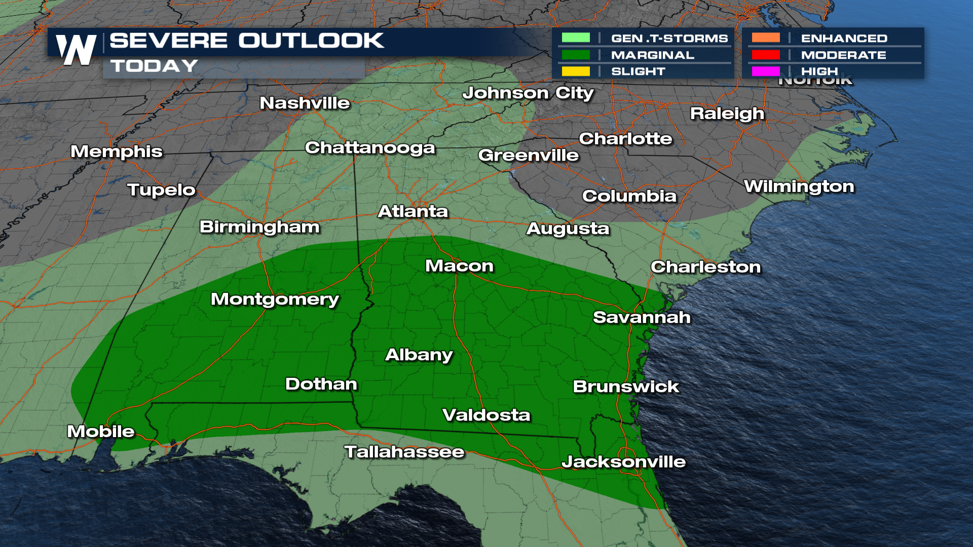
Severe storms will be possible along the stalled front.
FORECAST
The cold front has stalled in the vicinity of the Interstate 10 corridor. With the front acting as a lifting mechanism along with the heat and humidity in place, there is the chance for a few severe thunderstorms overnight and through the weekend.
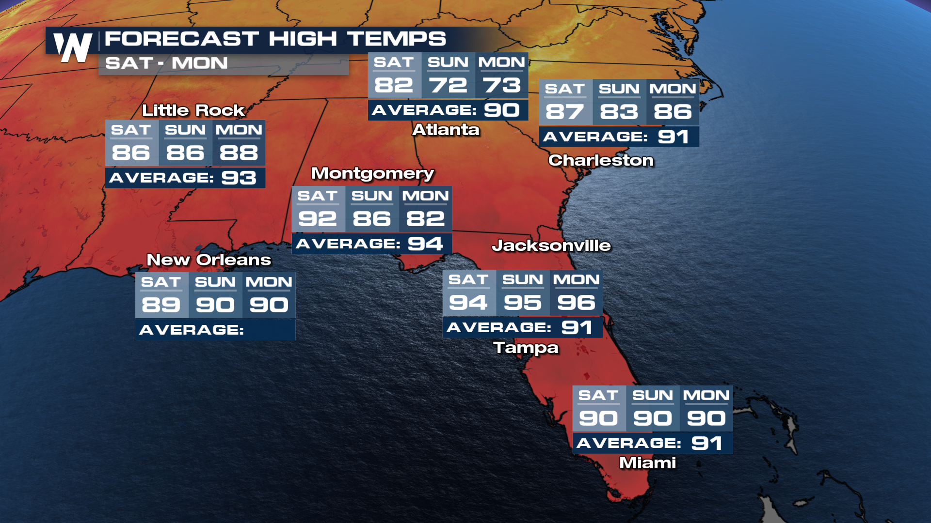
As the cold front lingers, the humidity won't totally go away for parts of the Southeast despite the temperatures going down. The front will stall, and daily thunderstorms will lead to heavy rain for the next few days. By the end of the weekend, cooler temperatures will start to take over the Southeast.
 Tune into the eastern regional forecast :10 past the hour for more details.


